This route is a more refined version of the Moray – Speyside ride that I explored a couple of years back. Reversing the direction to favour the descents made a big difference to the quality of the ride, some additional POIs where also added in
….So forth – ‘The Beast of Badenoch’ was created…
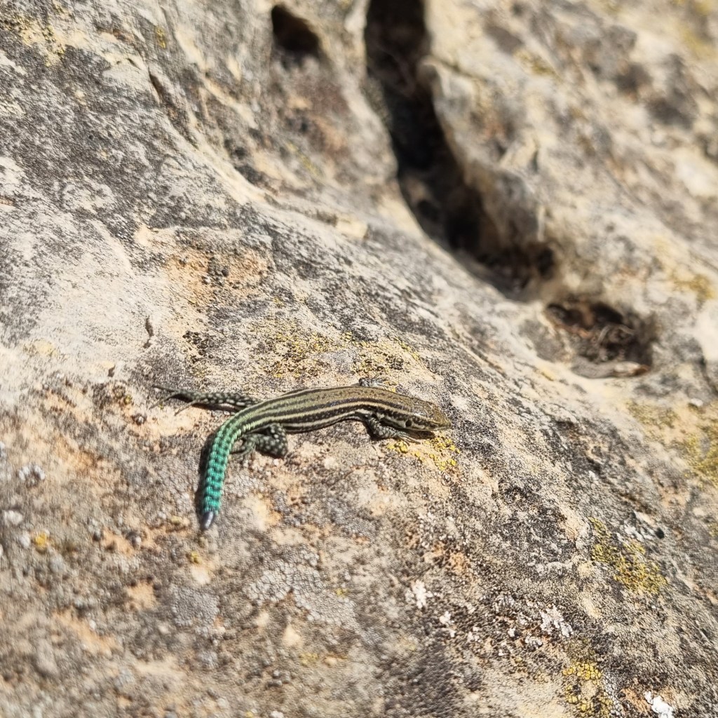
Named after the mythical wolf that roamed and was known to have caused havoc in these areas around 300yrs ago. Leaving the folklore and tales aside, I am a big fan of the Wolf and how it can rebalance nature. Here in the UK the Wolf has been persecuted to extension and this is rather saddening, more so the human perception to its re-introduction, they now re-roam across Europe with proven success. That’s enough about the wolf …however the book ‘The Last Wolf’ by Jim Crumley is a very informing and worthwhile read.
I have been visiting Scotland to undertake long distance Mtb journeys for some 10 years now and I have to say it is a very hard place to beat, obviously and more so now because I am getting older and softer
Getting the ‘weather window’ can make a huge difference to the enjoyment thus… (keeping it more in the ‘type-one’ fun bracket, rather than the ‘type-two’ bracket!)
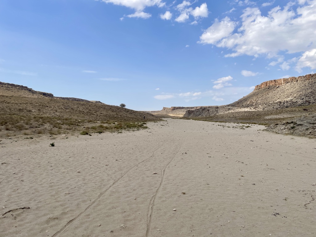
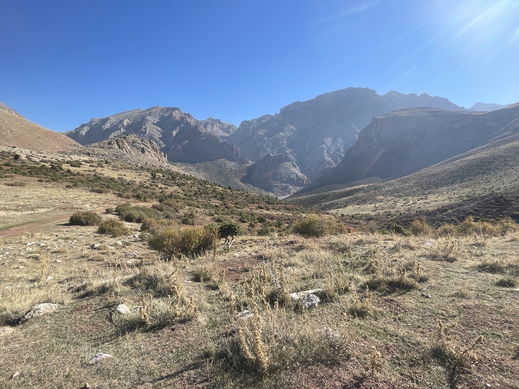
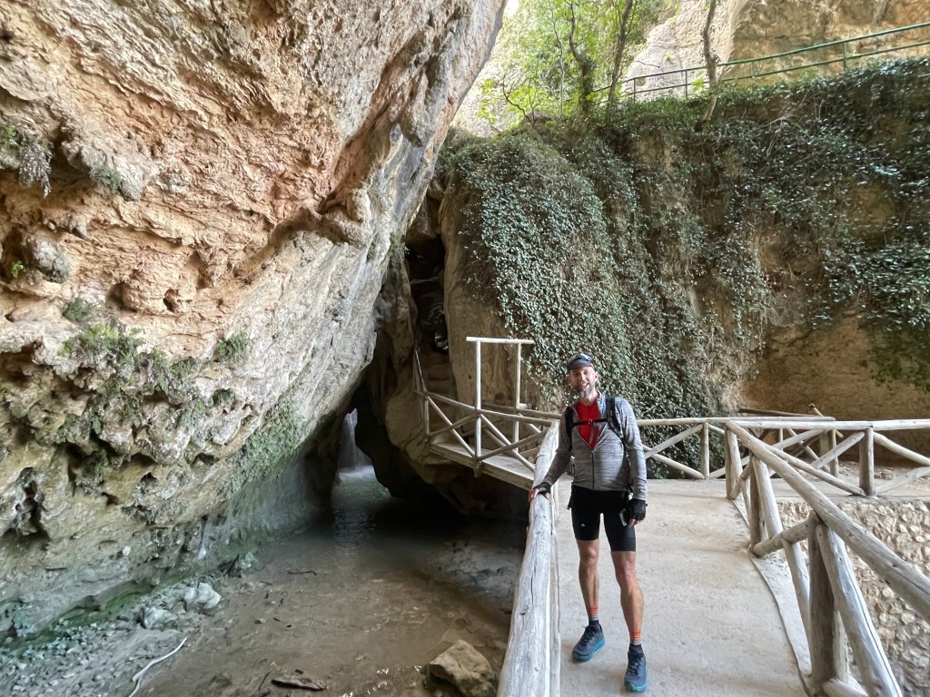
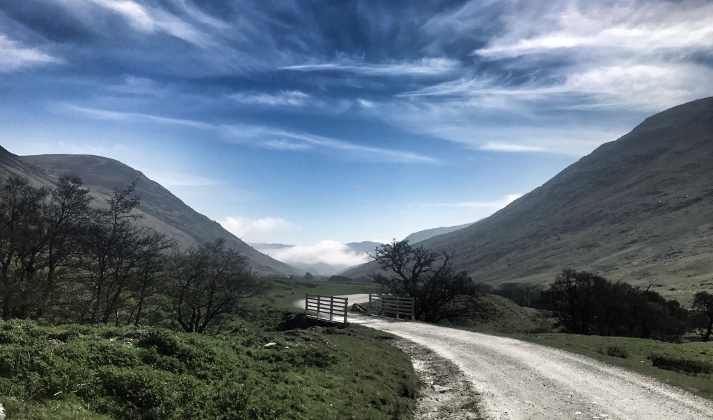
Scotland has a bit of everything and this ride champions it all – it has rich forests, rolling mountains, wild rivers and endless coasts. It also has plenty of resupply and sleep options and is generally pretty accessible and easy to ride, by usual Scottish standards, that is apart from the techie and exposed Findhorn Gorge section (that can easily be avoided, but eaqually shouldn’t be missed!). One of the main benefits of Scotland (vs rest of UK and some European countries) is that it has a very good outdoor access code, allowing most places to be ridden upon and a right to roam and camp – the premise to this is maintaining respect – that’s respect to the environment, respect to land-owners and respect to other users and following the ‘leave-no-trace’ ethos – which I’m pretty sure almost all bike-packers are mindful of (we don’t seem to get much negative press…!).
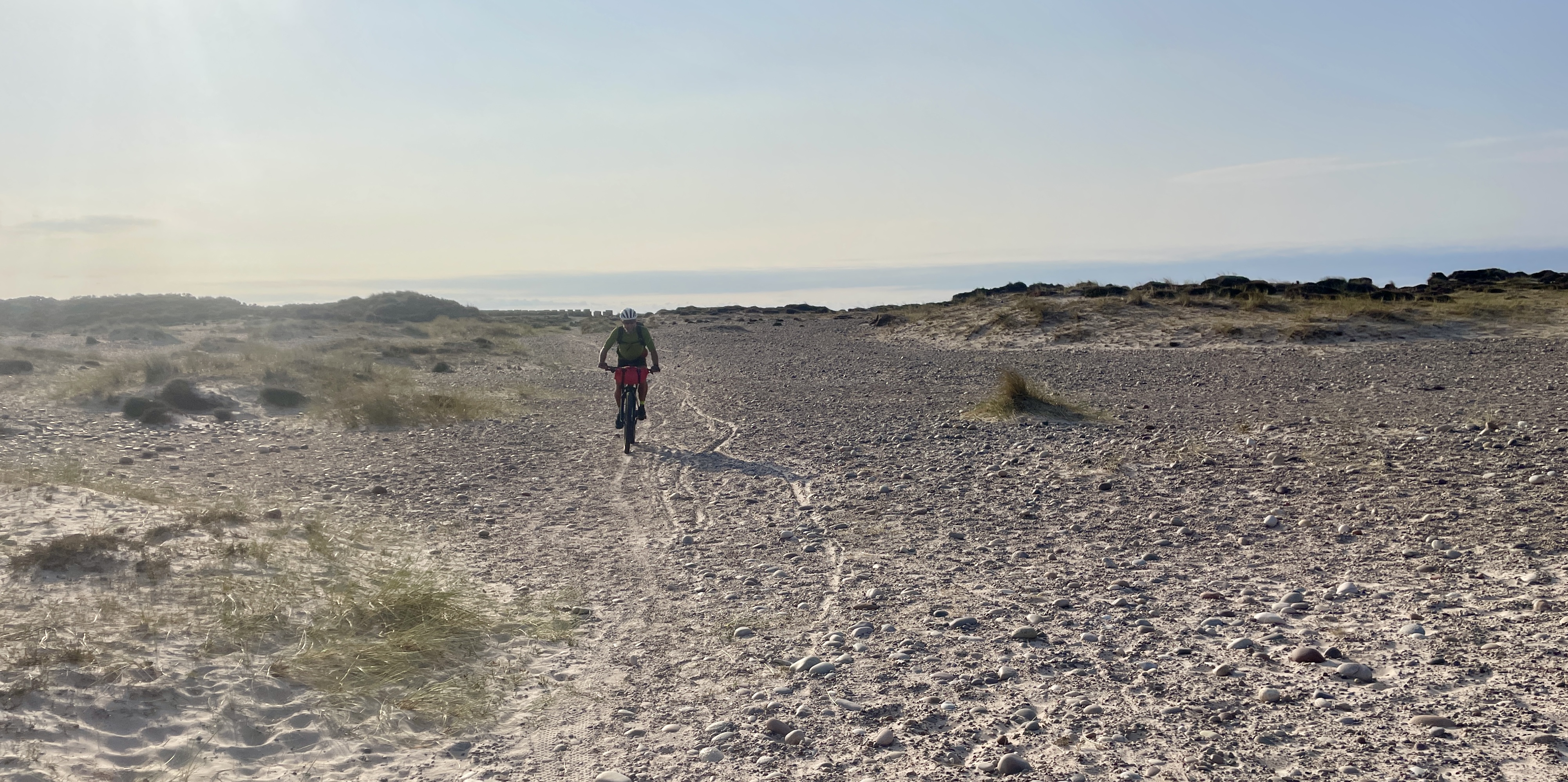
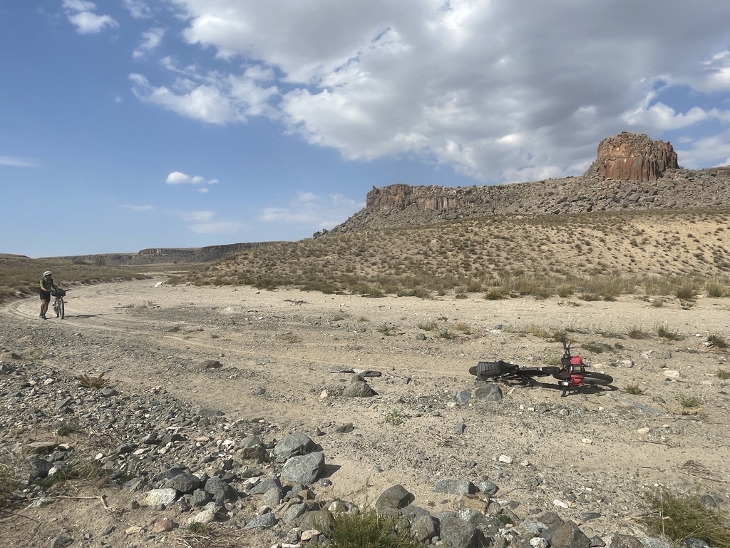
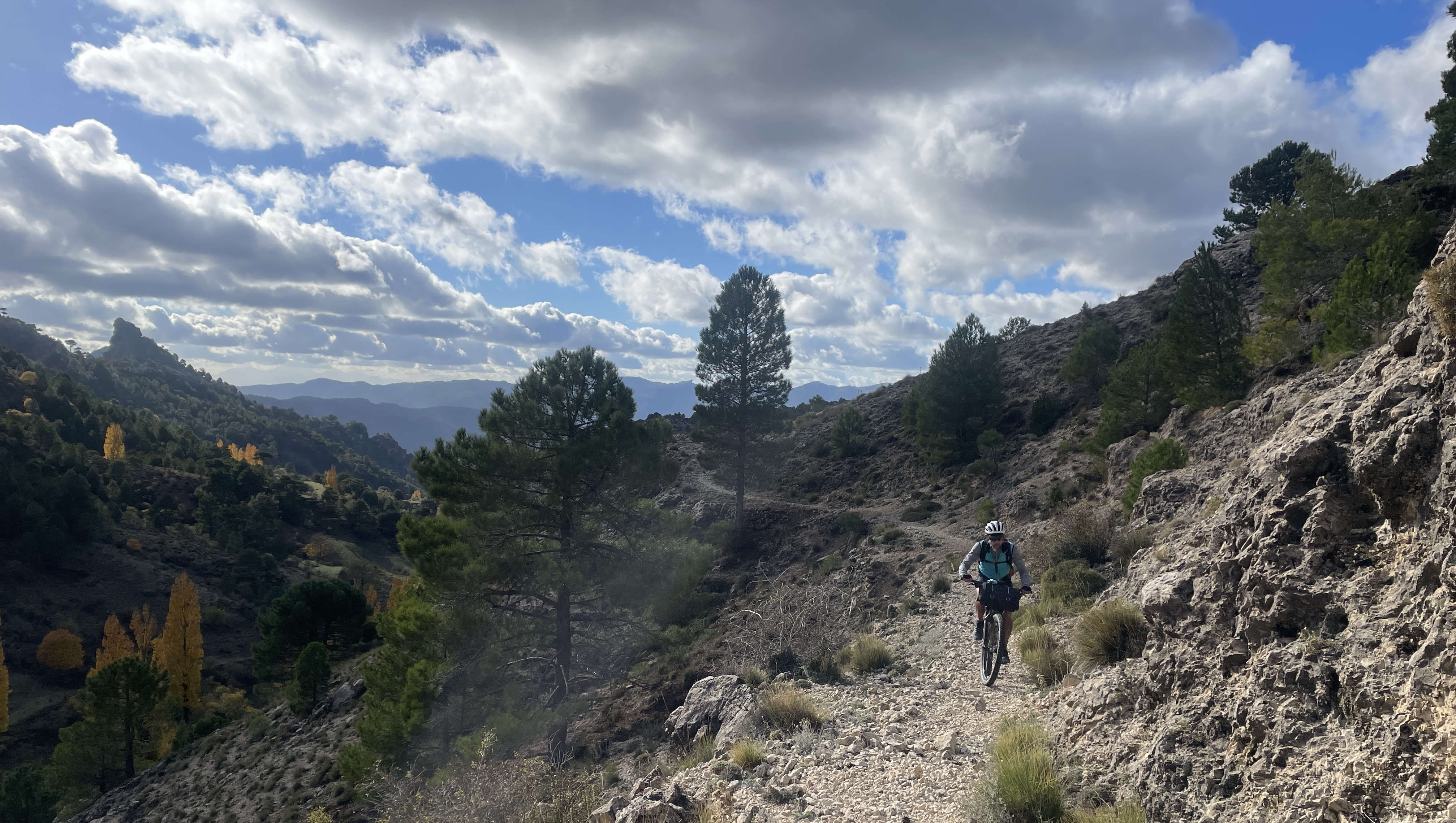
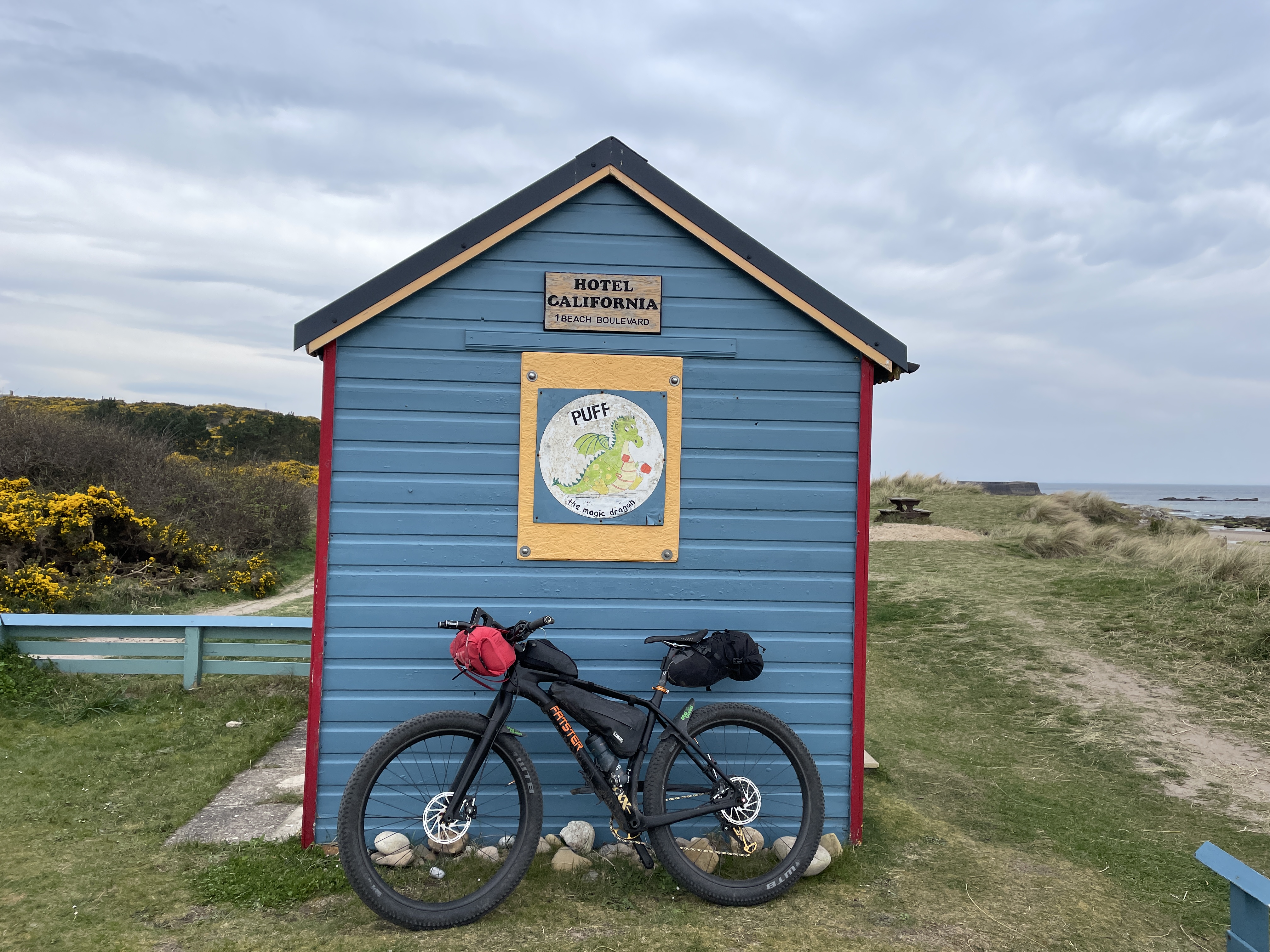
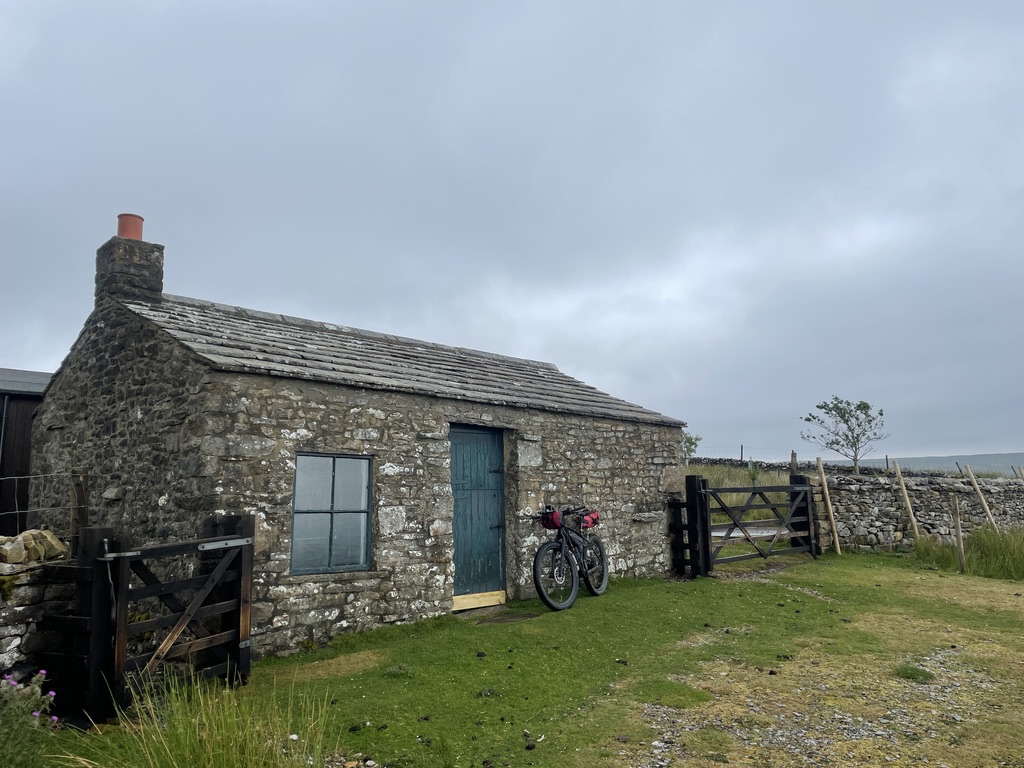
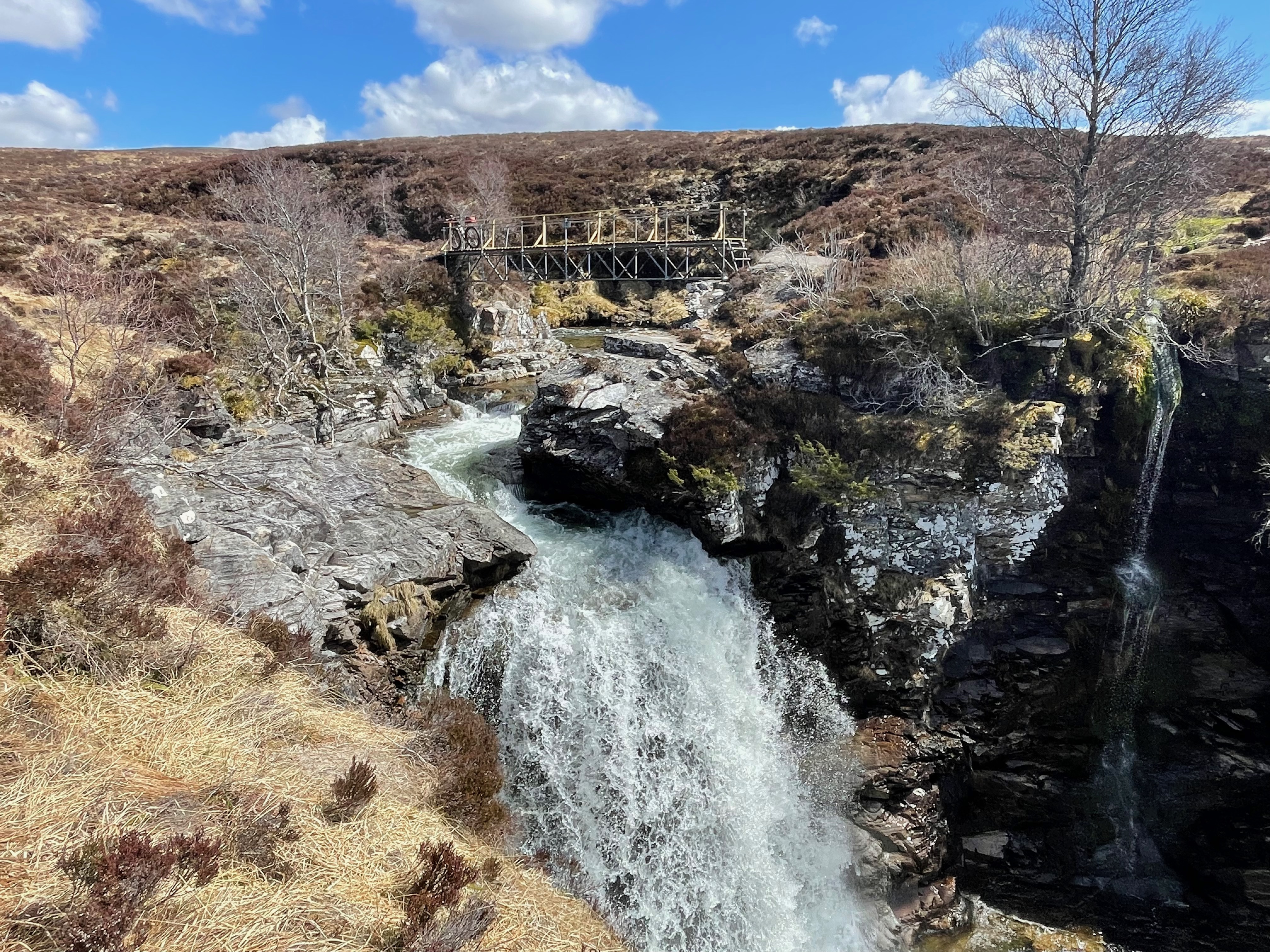
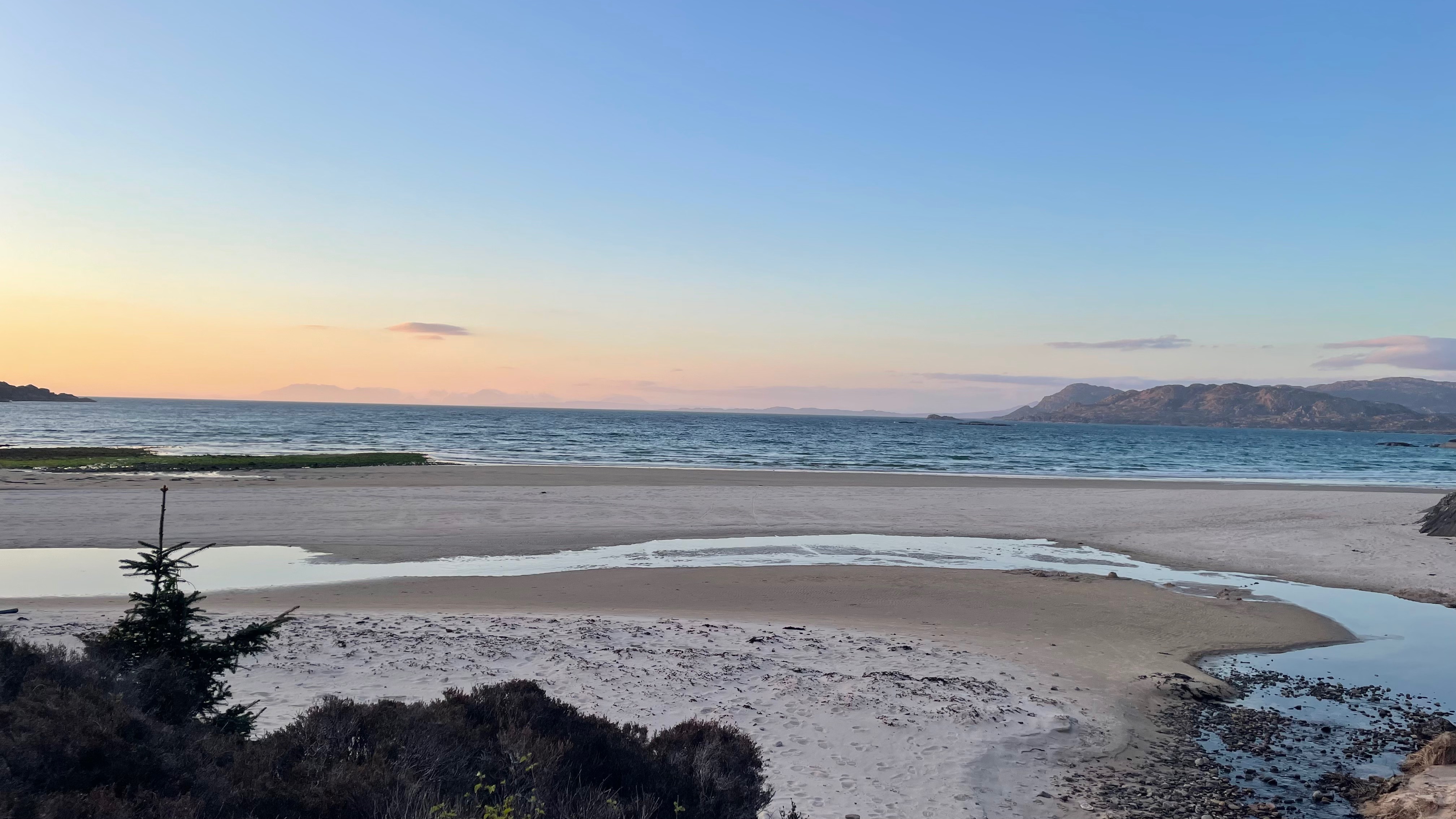
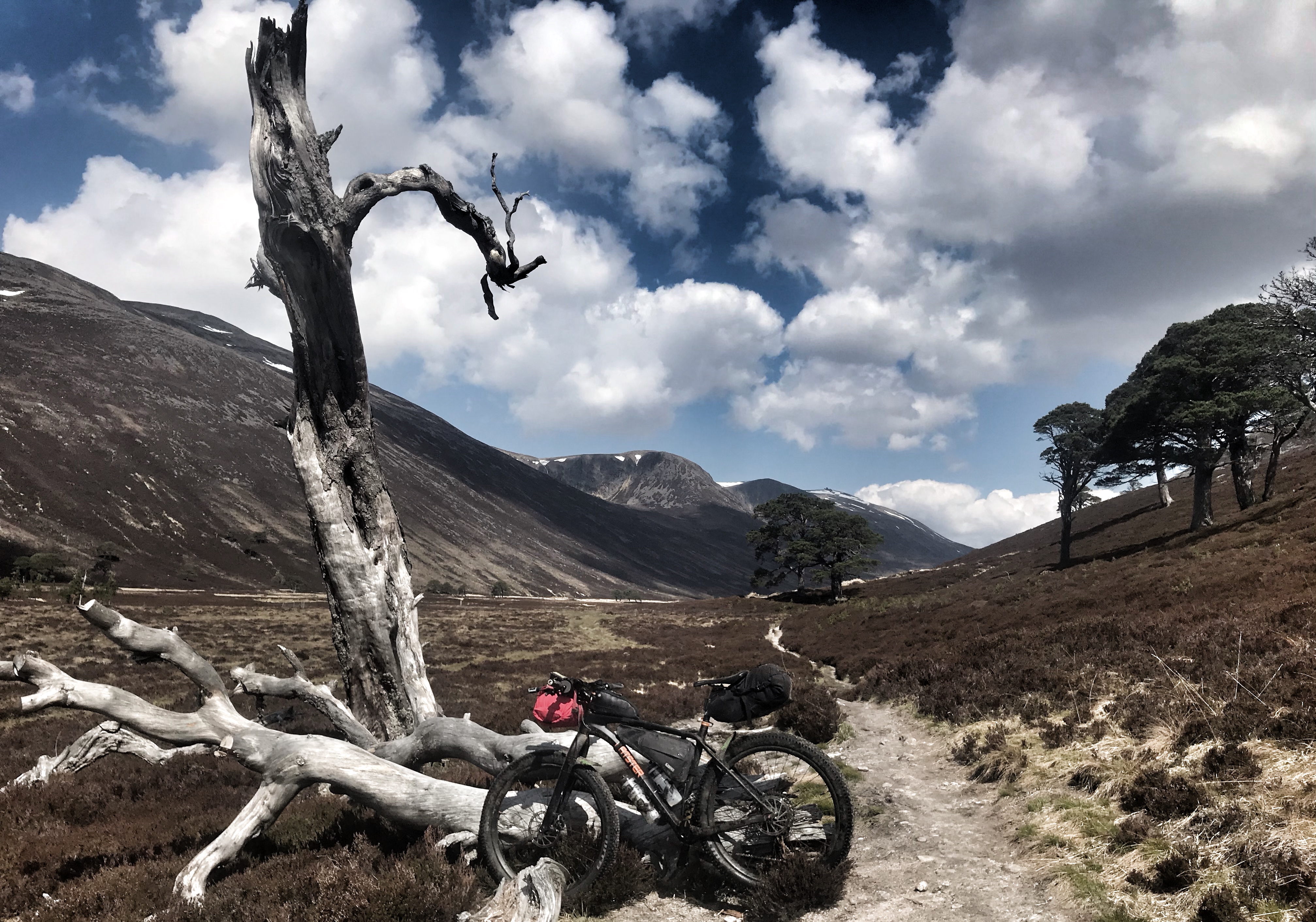
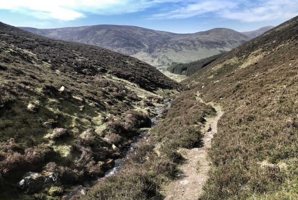
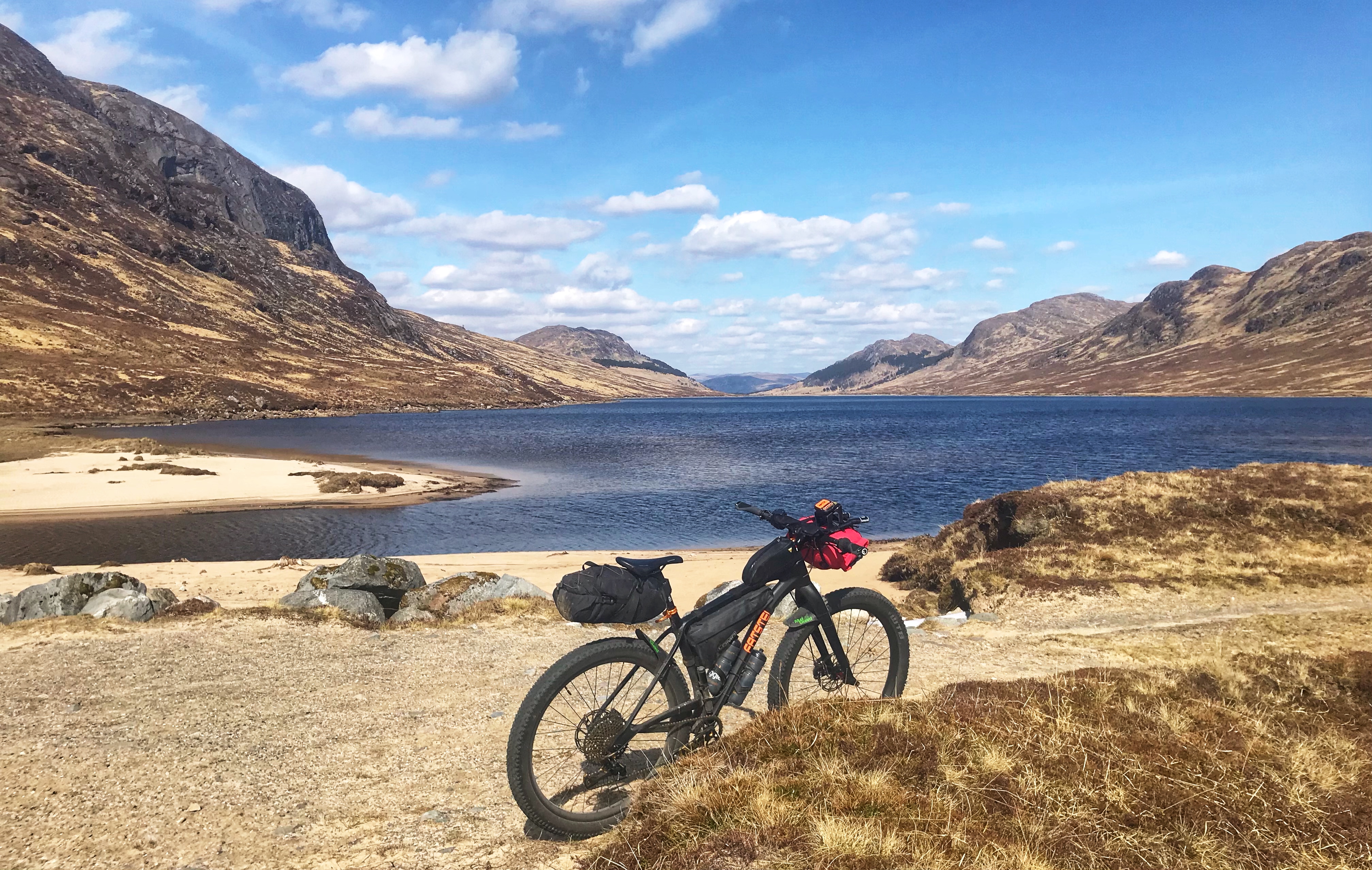
Findhorn & Kinloss into Roseisle Forest – Beautiful and Wild!
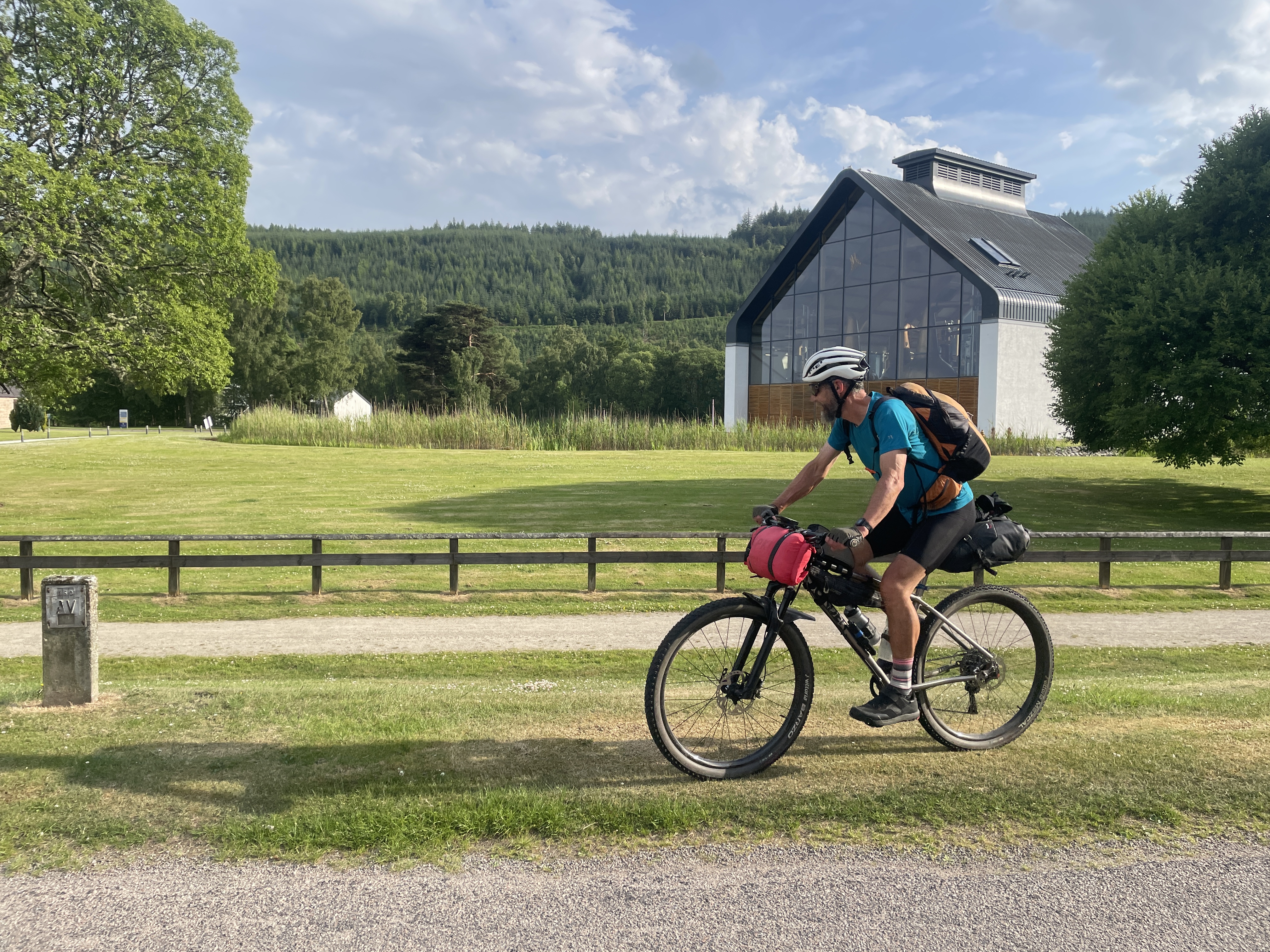
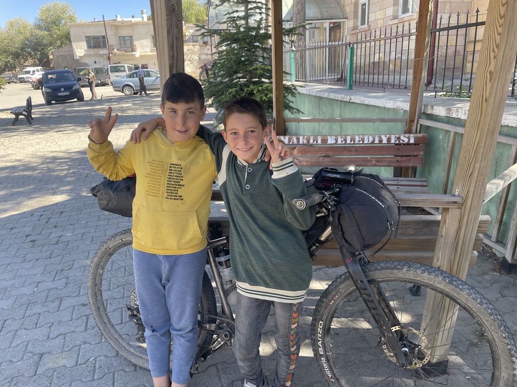
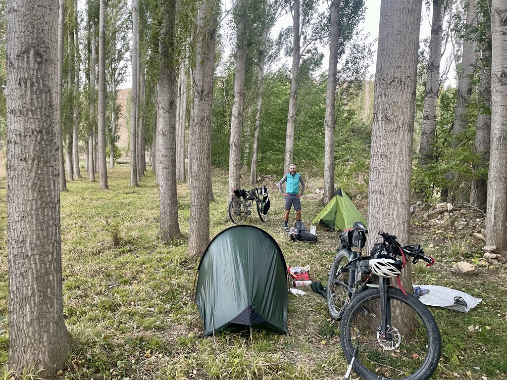
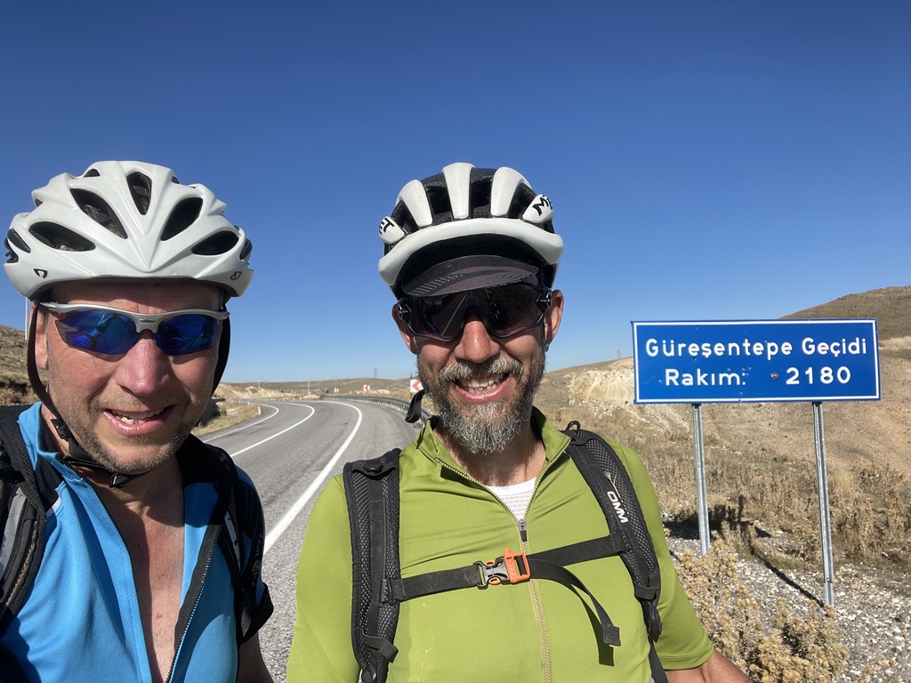
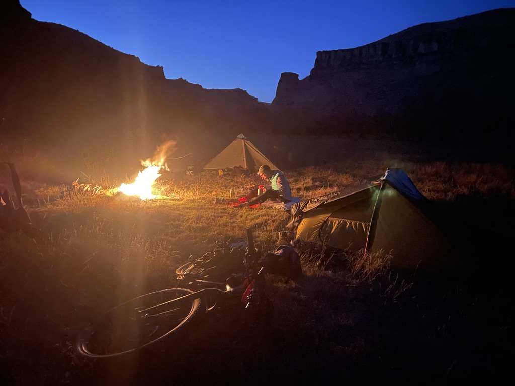
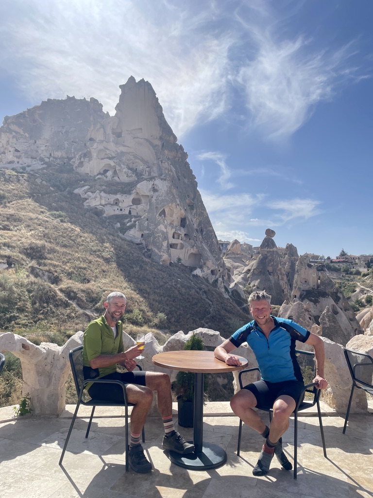
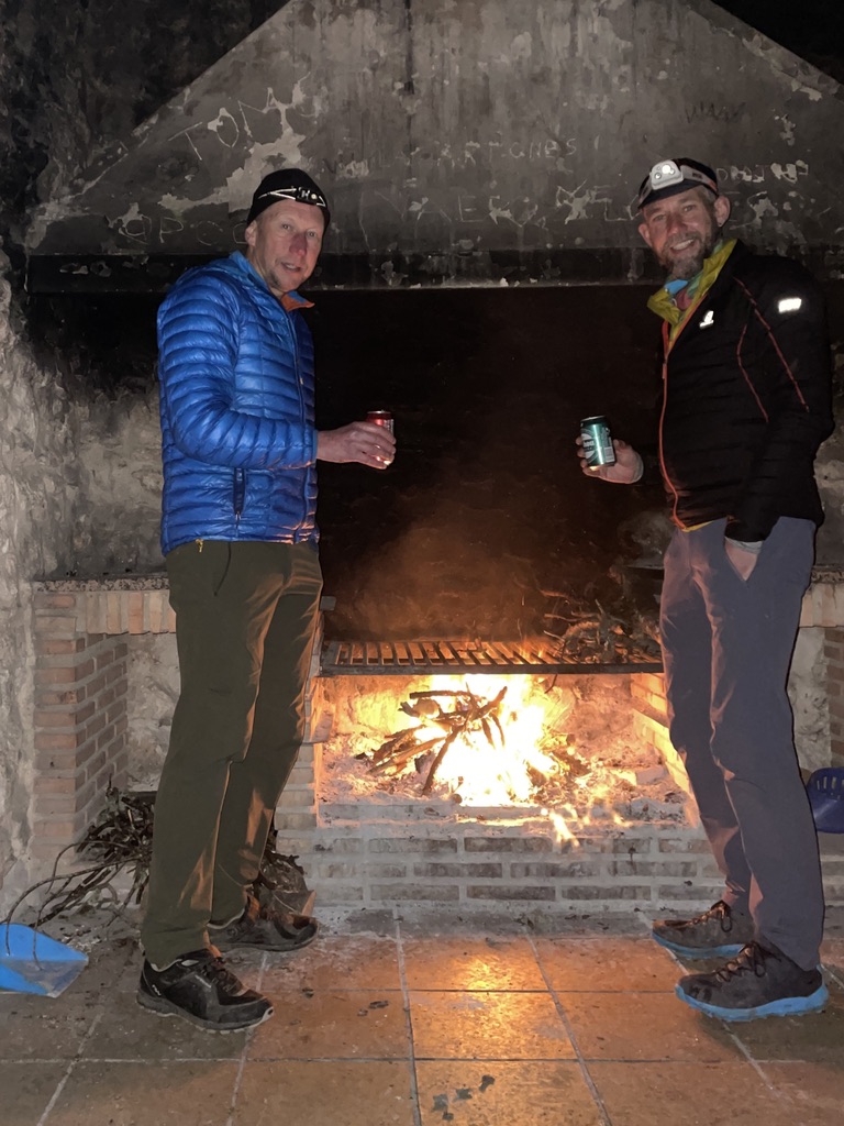
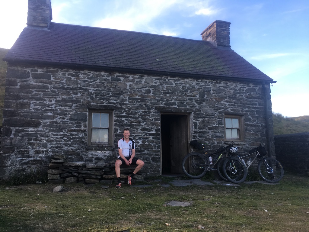
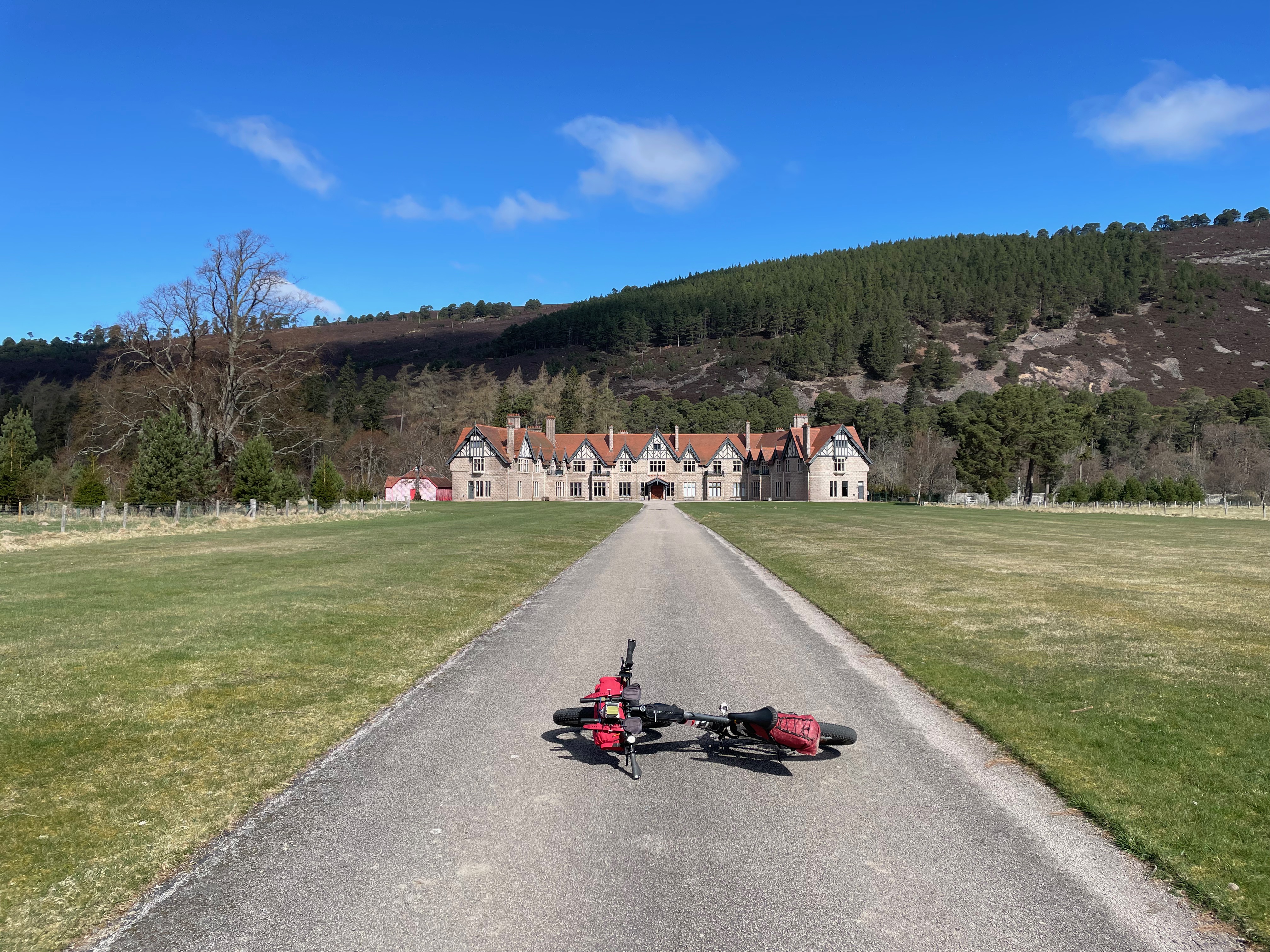
On this outing I had my cycling buddy Mark along, with whom I have been doing long distance riding with for around 8 years. Up until now he had done very little in Scotland, so it was pleasing to introduce him to the Beast of Badenoch (however given his superior fitness to mine, he probably found it quite tame and not such a ‘Beast’!). The small village of ‘Boat of Garten’ was the chosen starting point for us, mainly due to its easy access off the A9, however if coming by rail then either, Carrbridge, Aviemore or Kinguisse could be opted for Boat-oG also had some trusted parking at the community centre, a shop, a pub/hotel, plus a Pizza Restaurant (although we didn’t get to try this).
I don’t intend to provide a detailed route commentary, rather just provide a route map above and tell the story via some of the pictures, which should wet the appetites!
[click pic to enter full size and then scroll thru]
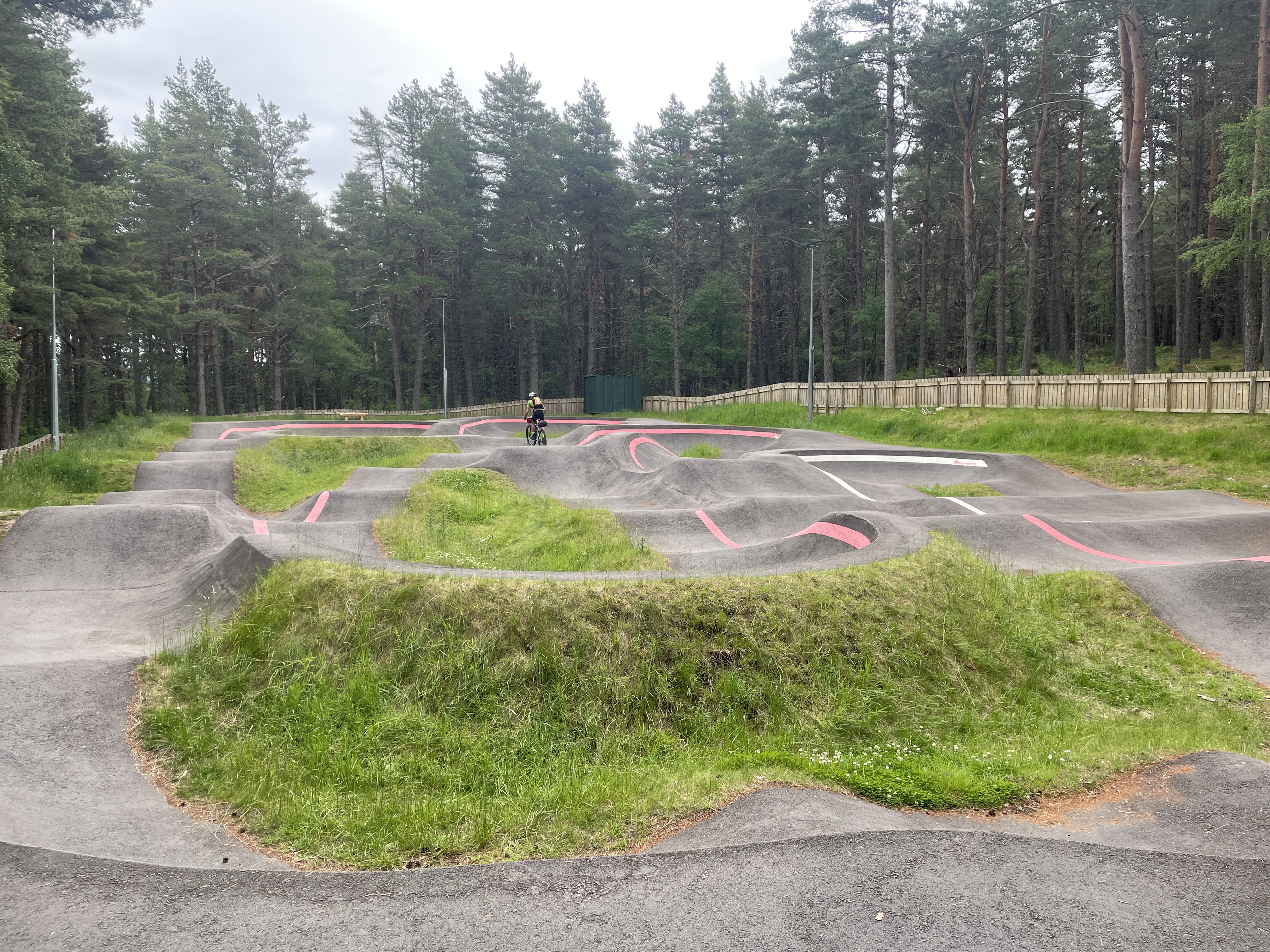
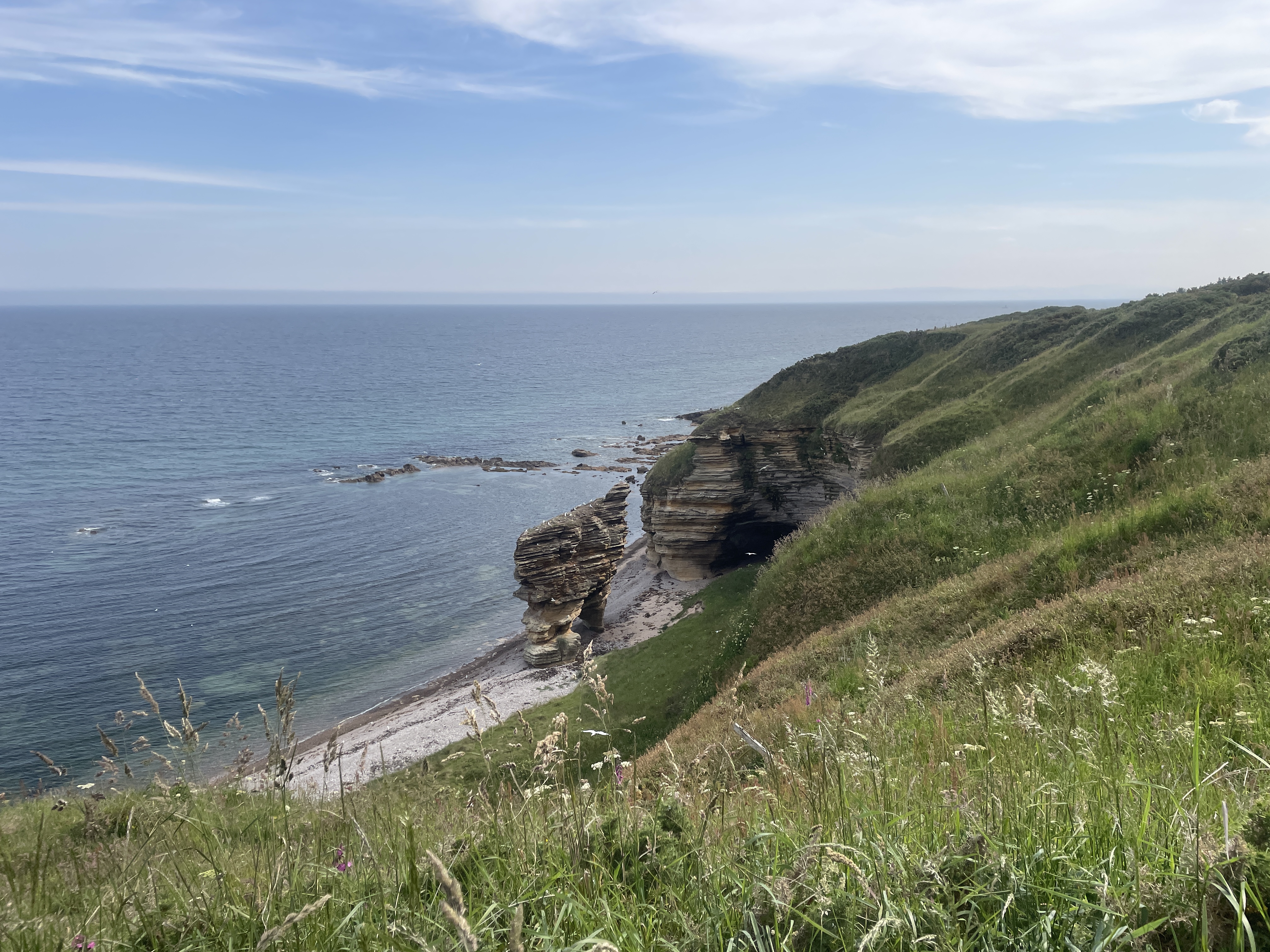
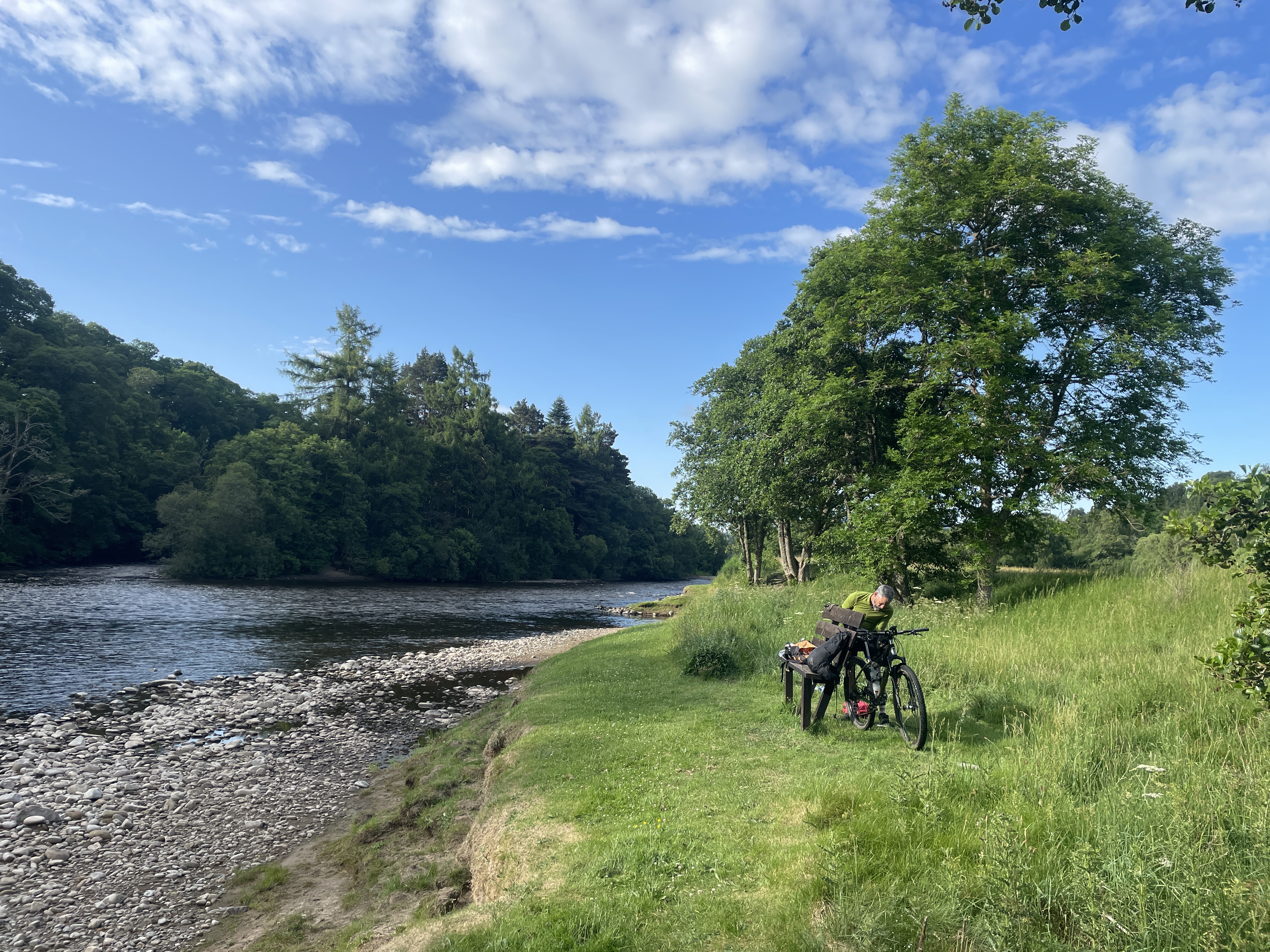
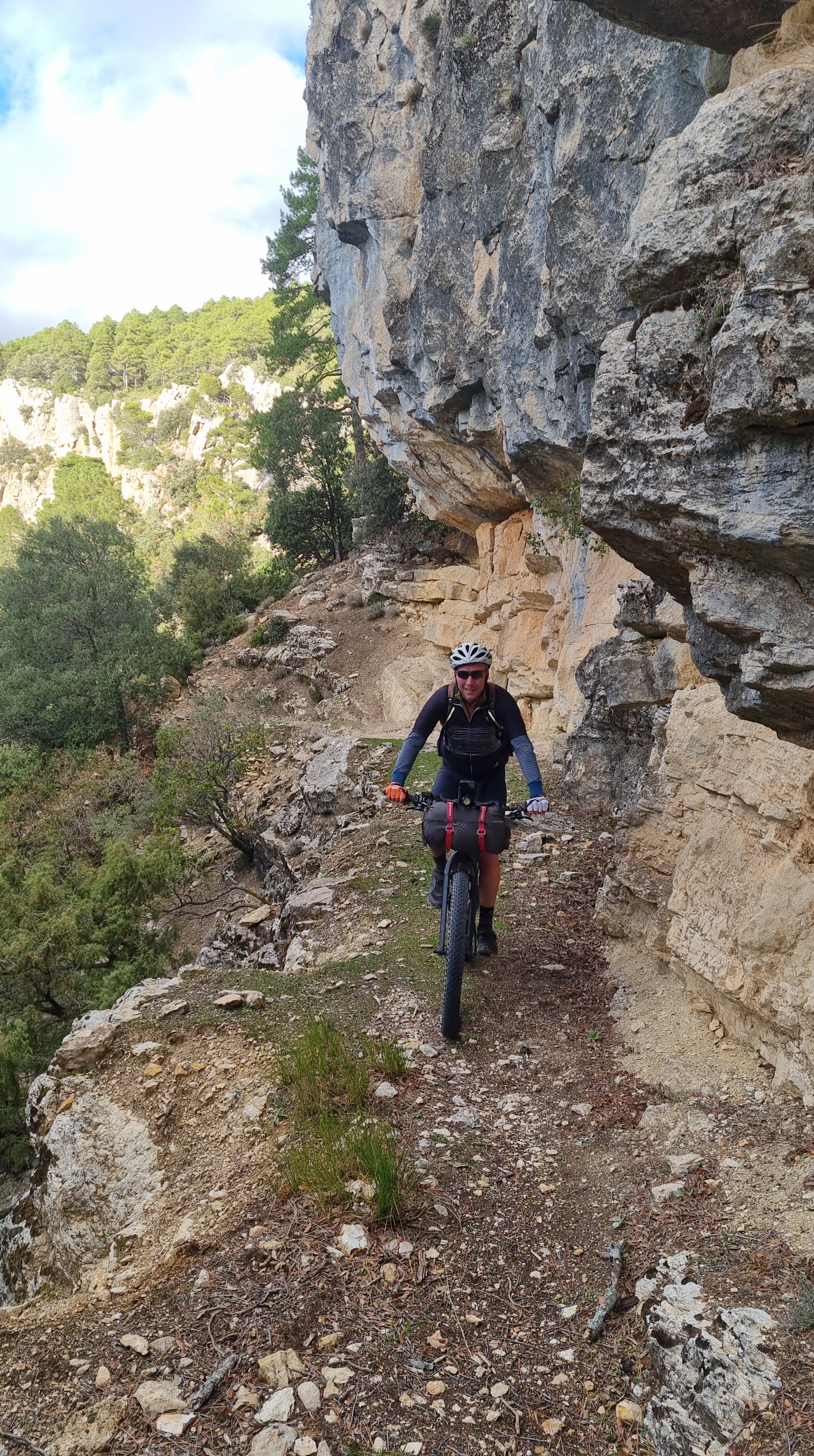
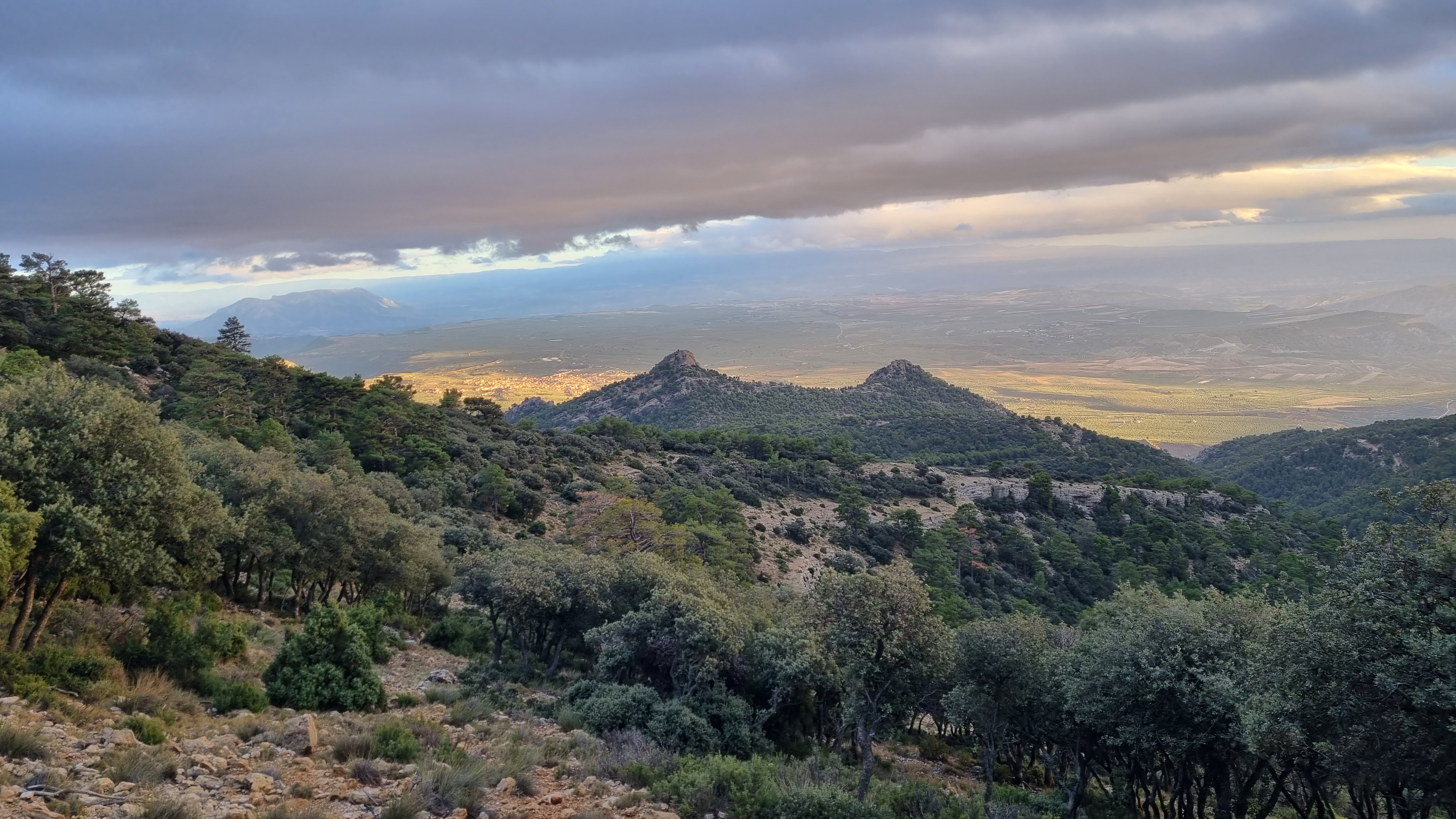
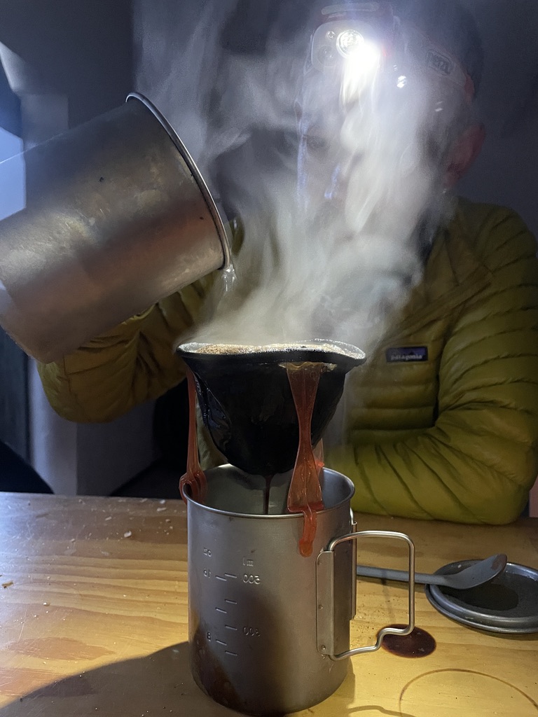
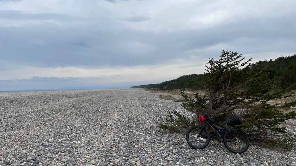
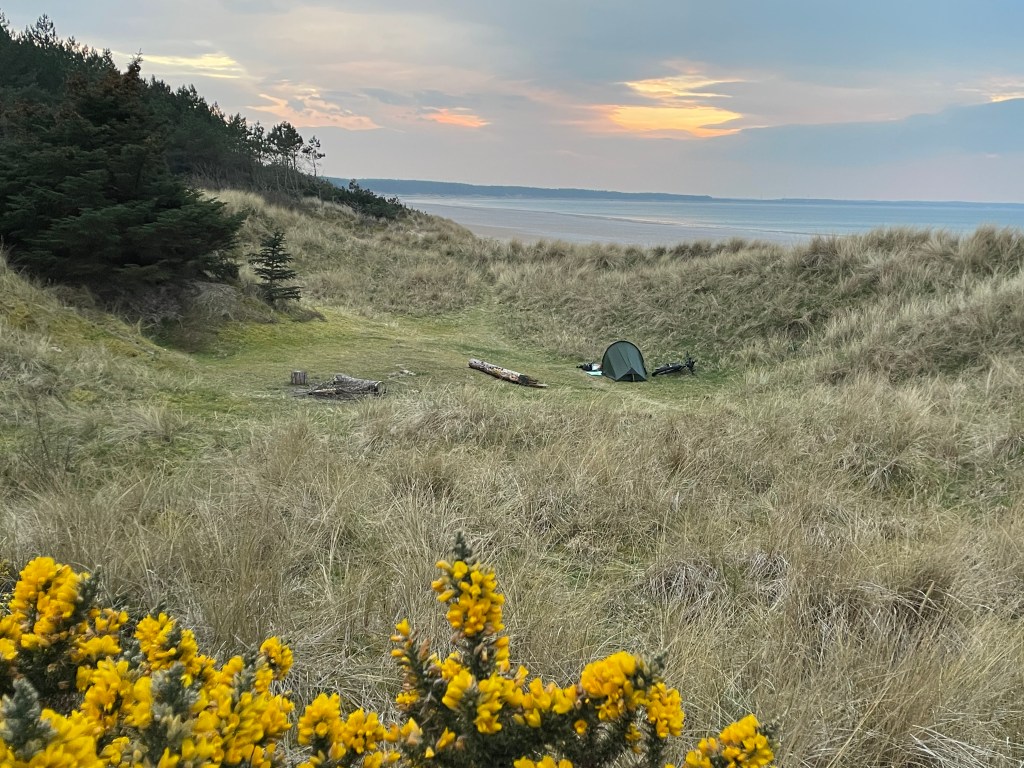
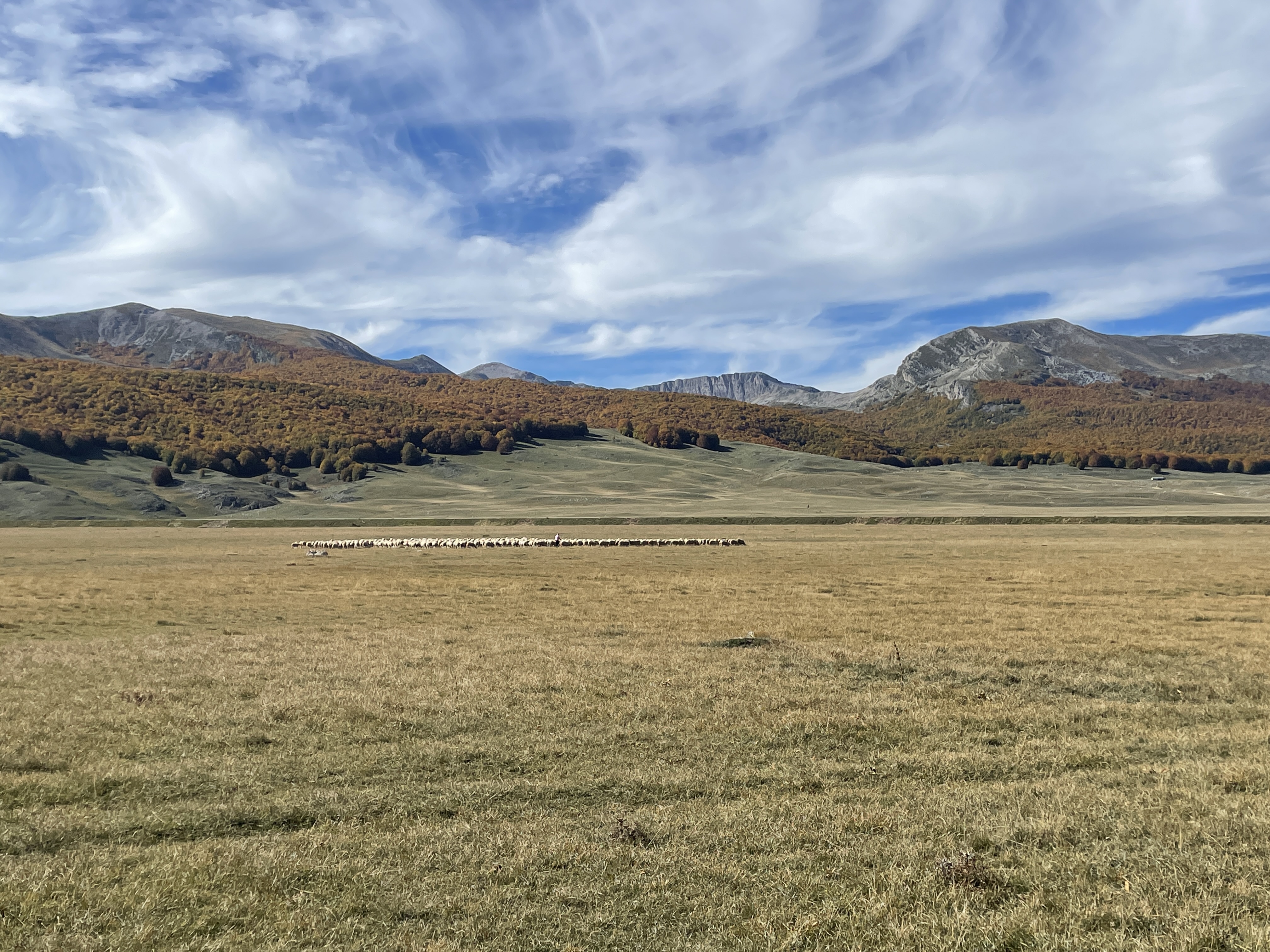
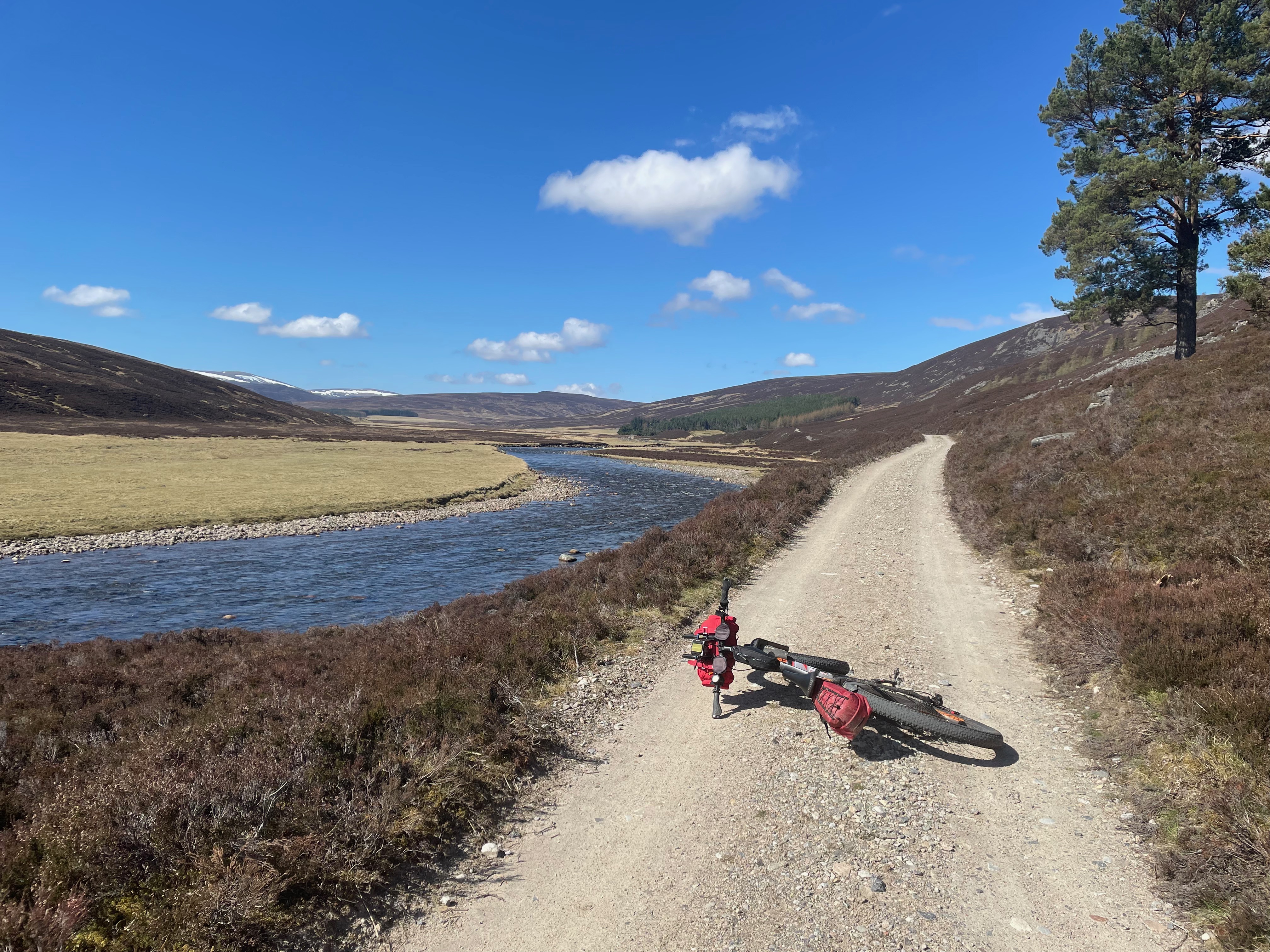
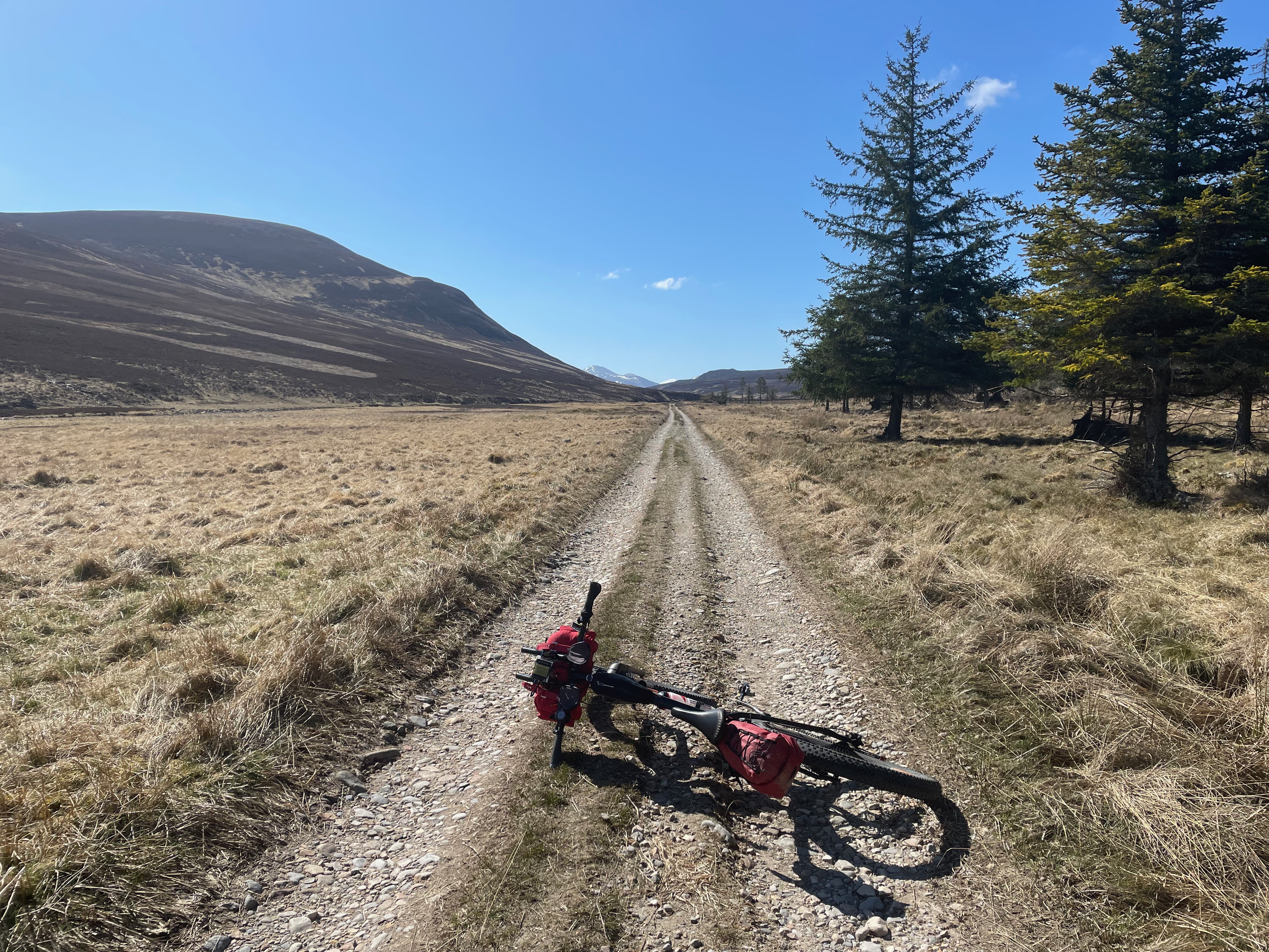
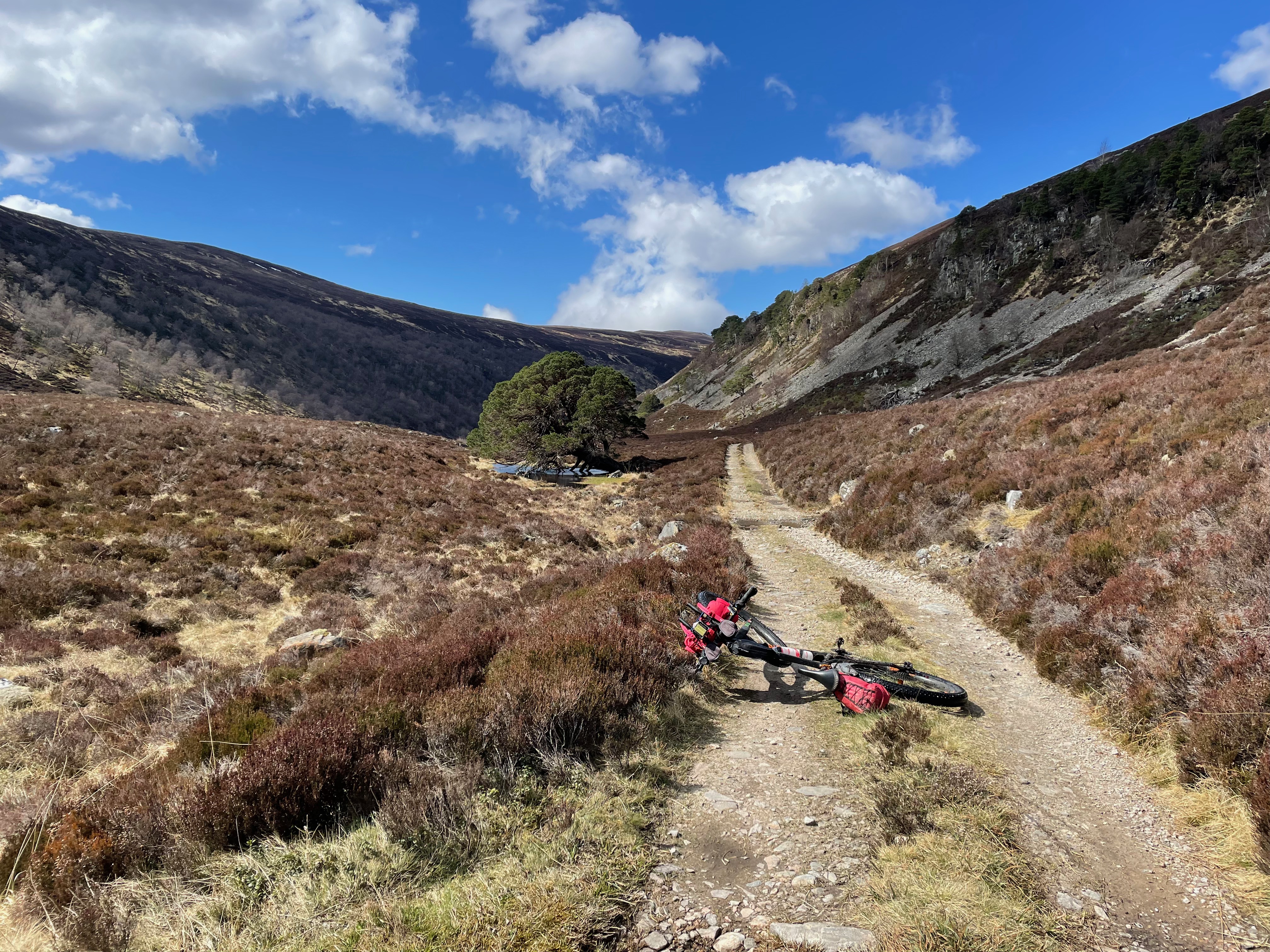
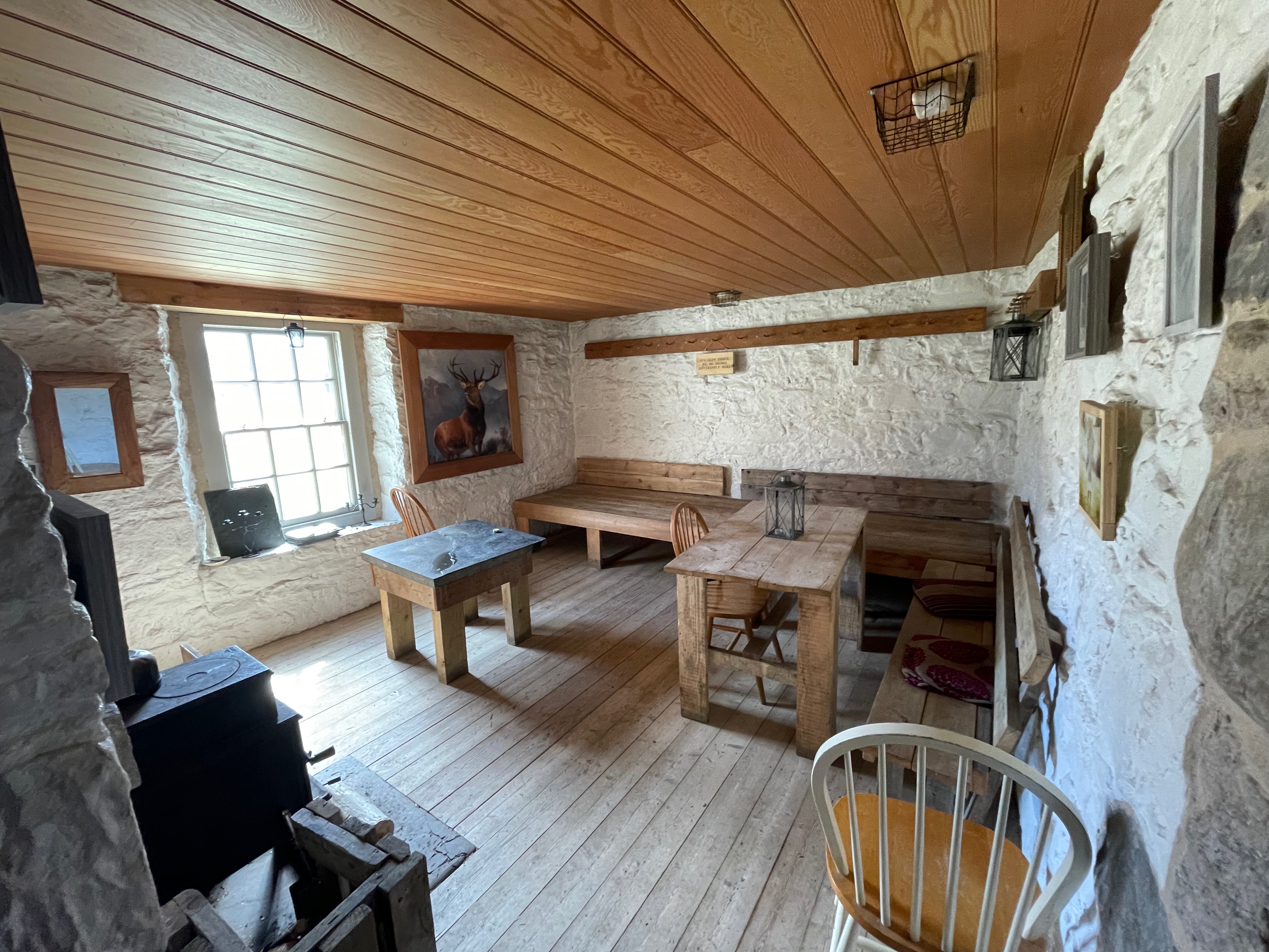
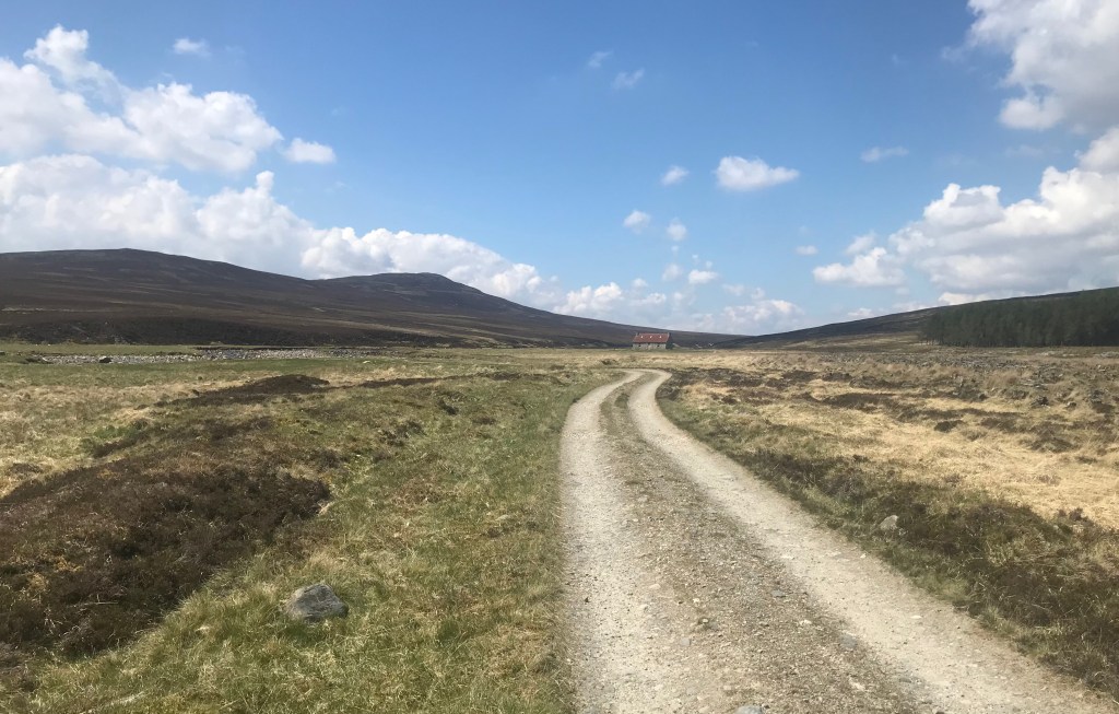
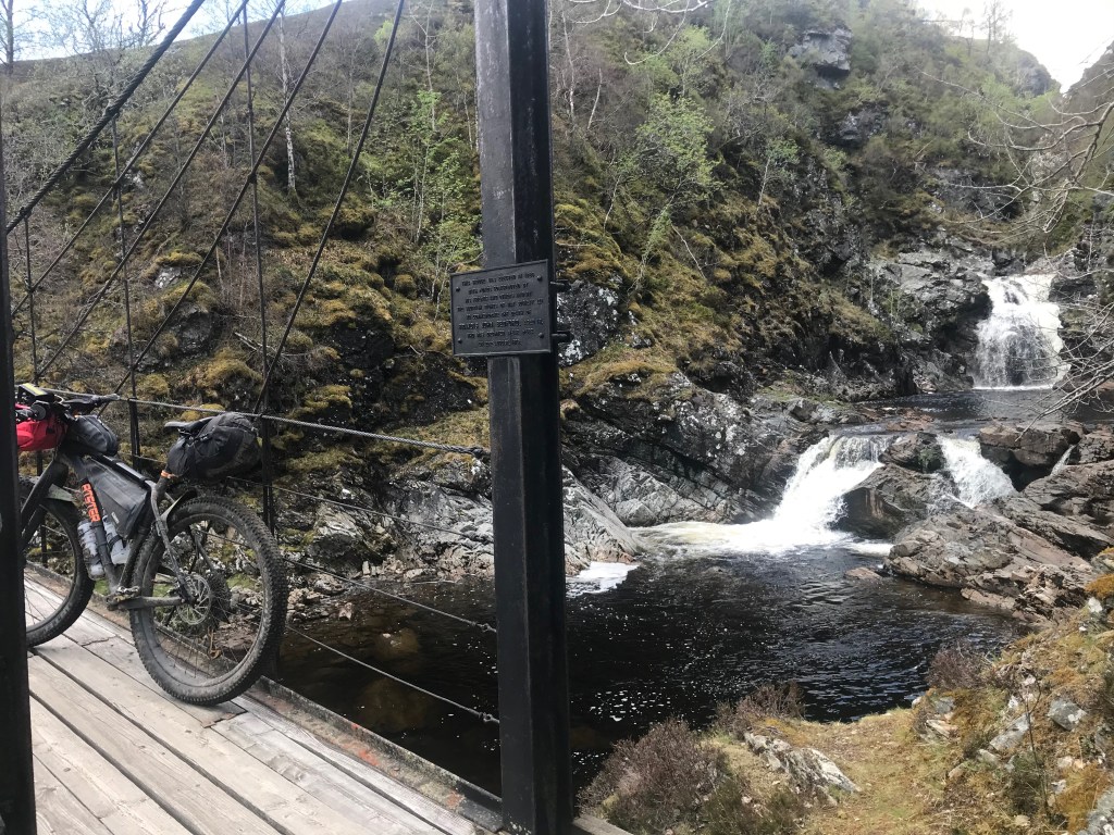
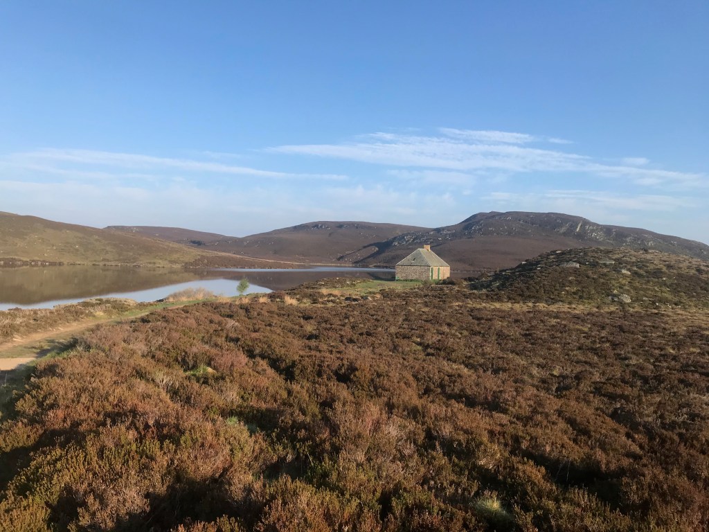
Awesome Pumptrack at Boat of Garten – A Good Warm Up!From Abernethy Forest over the Pass of Ryvoan‘Frank’ Stature Garden at Feshie BridgeRickety Bridge at the Stag HotelHidden Waterfall behind the bothyDurston Xmid-1 TestInside the Bothy, cosy/roaring fire (met my son there too!)Mighty upper reaches of the DulnainRed House in all its splendorCosy insideHeading to CarrbridgeThe Bridge at Carr!On to the Dava Way and quick hello with this fellaDava is a pleasure to ride (providing the wind is behind you!)Swimpools in the Findhorn GorgeImpressive ladder system for the swimmers!The start of many distilleriesThe Coastal section begins…Glorious camp spotMore rugged from Hopeman towards LossiemouthOne of many beach sections (optional)Spey Bay crossingCraigalachie Bridge (more swimming)Riverside camping spot
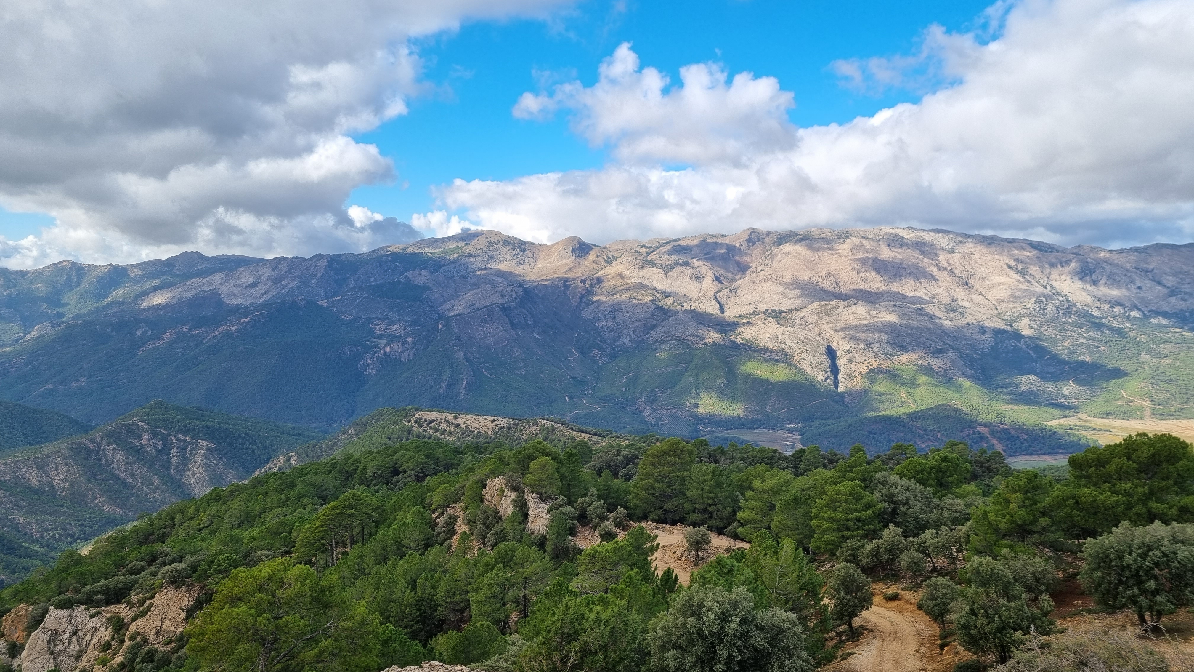
As a wrap – as you can see Scotland is a hard place to beat (however there are a couple of proviso’s – good weather – no midge!). Many other good Mtb routes also exist in the Cairngorm, like the well established and very tough ‘Cairngorms Loop’ – that takes no prisoners!
So get planning your next adventure, happy to share information, so please get in touch with any queries.
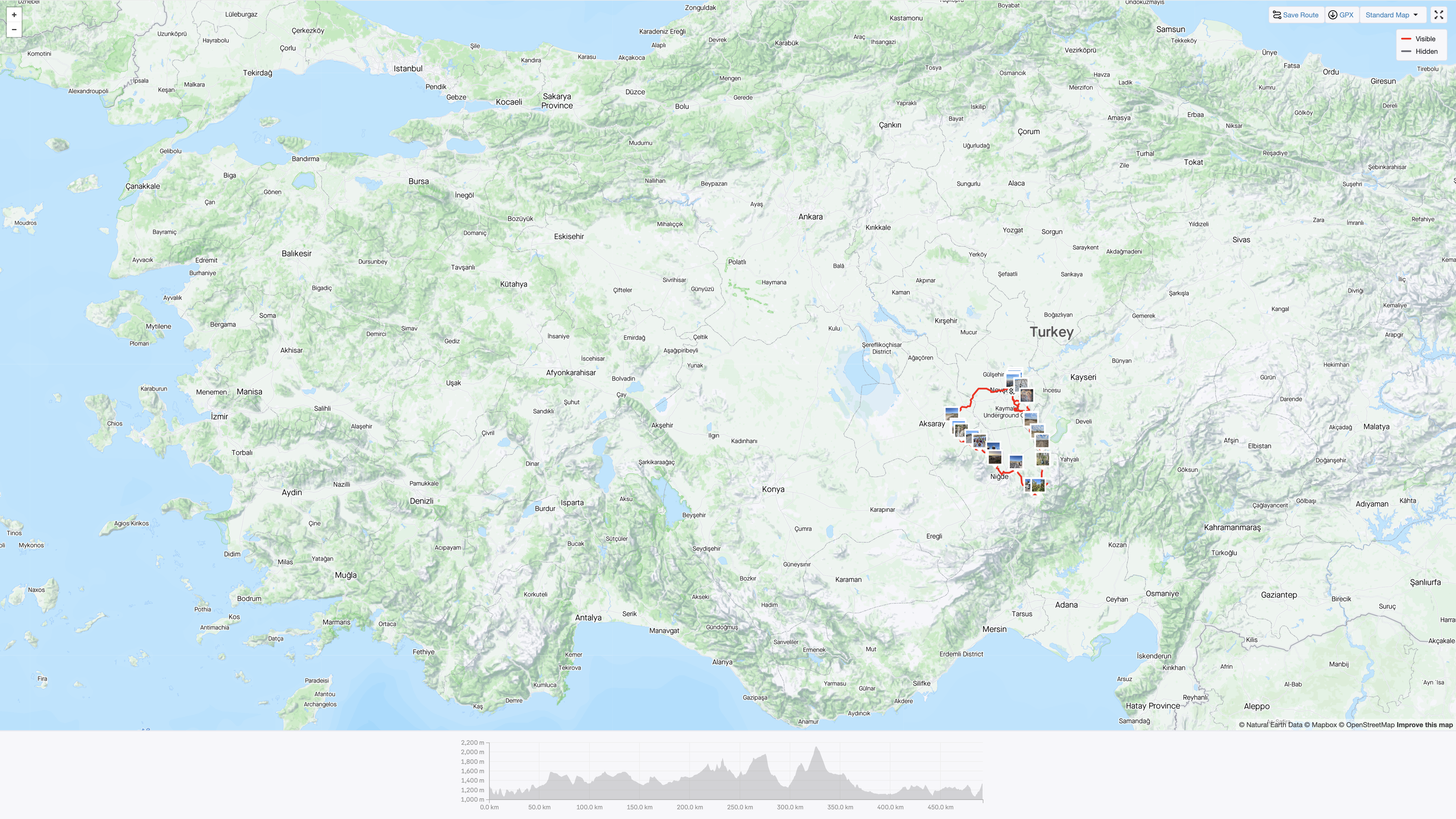
Turkey or Turkiye as it is now known has not really been on my bike-packing radar, nor been a bike-packing place to go. Mark, my bike-packing accomplice and I were attracted to it after reading a recent route posting on bikepacking.com (which is a mecca of a website for information and inspiration on absolutely all things bike-packing). At the planning stage we had shortlisted three route options – Montana Vacias – Spain; Le Vercors – France; Cappadocia – Turkiye. This is my annual ‘once-a-year abroad trip’ and we had planned as usual to go in Autumn, and in the case of this year – October, so all the places listed are suitable locations for this time of year. On further assessment we thought the Vercor could start getting wetter and colder, and we did not fancy that!
Ideally some warmth and sun shine was needed!
The Spanish option was taken off the table as we had ridden in Spain last year, so Cappadocia it was ..and why not!
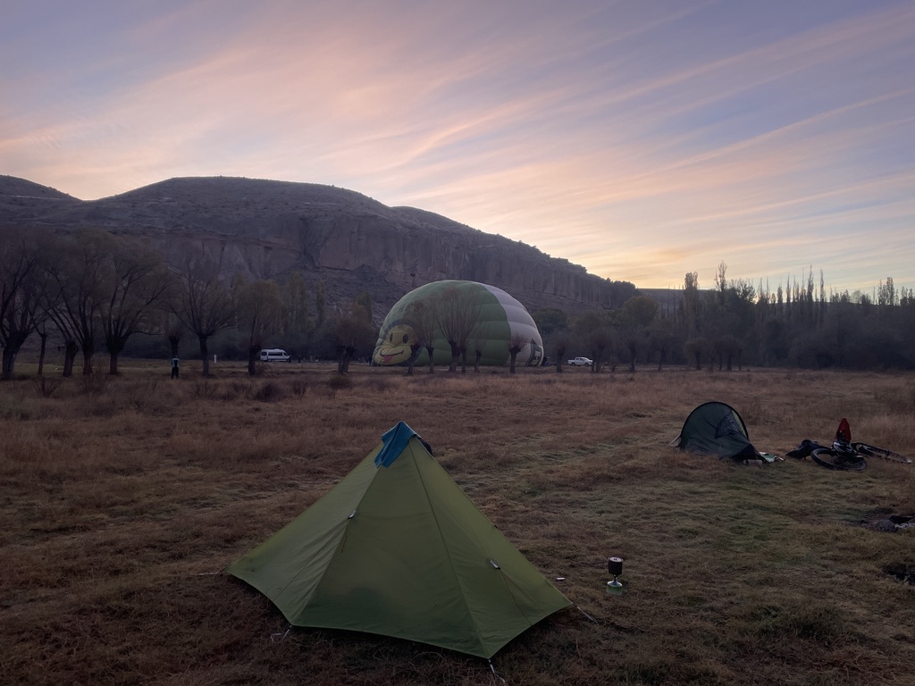
Early morning in Cappadocia country – and this is a typical morning!
Being in central Turkiye, we soon realised that transport logistics would be tricky and there were a few options – fly to Istanbul, then take a train; fly to Kayeseri (the nearest big city); or fly to Antalya on the coast and then rent a car. The latter option was settled upon as both flights and car rentals were easy and relatively cheap.
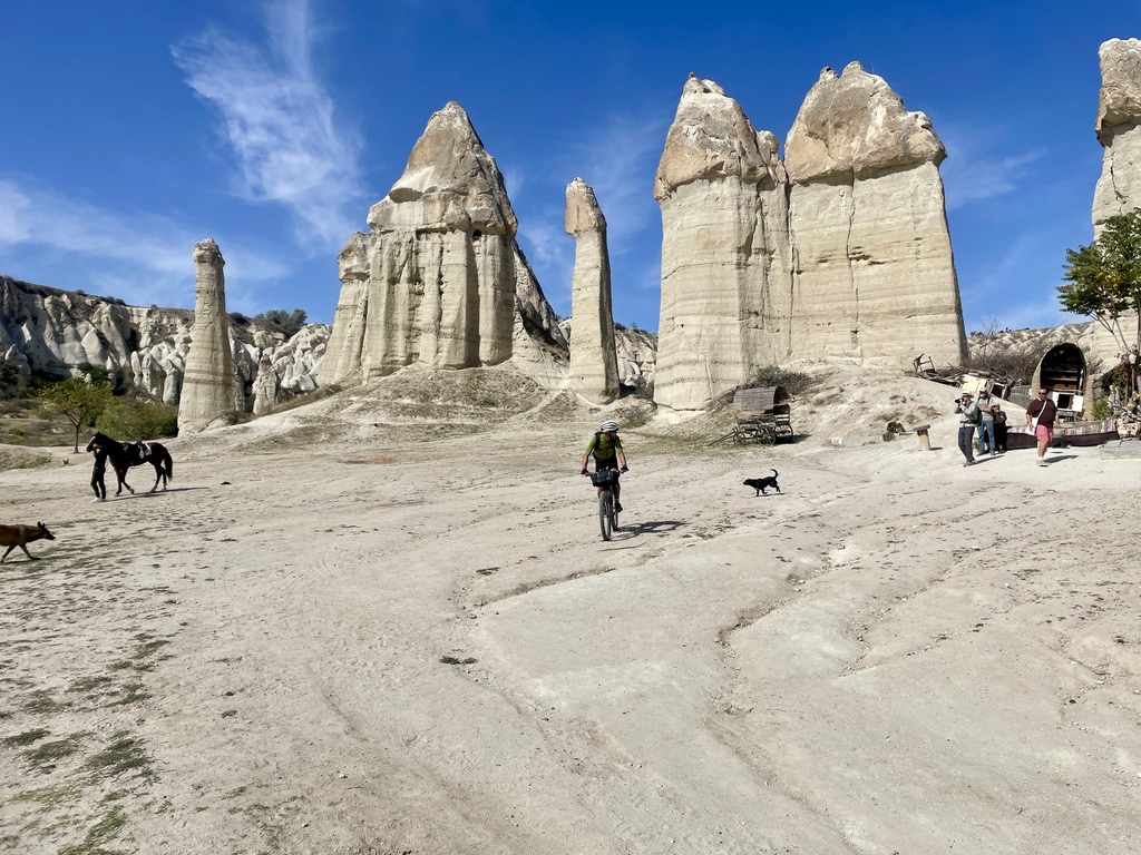
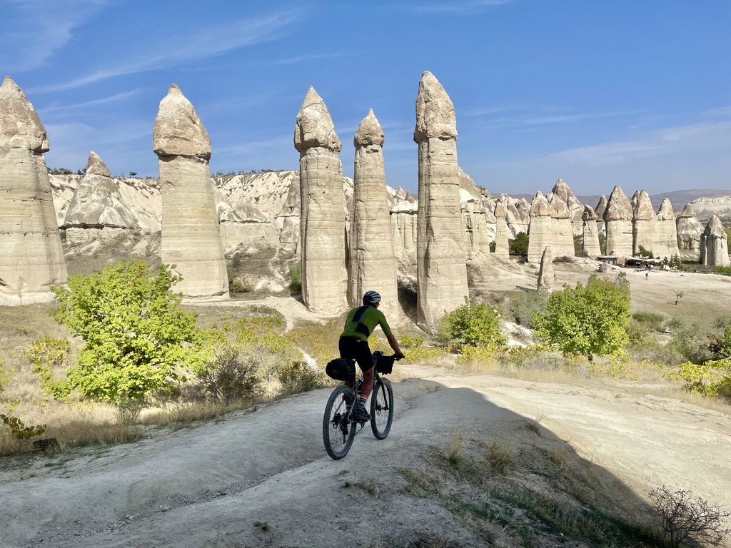
Day 1 and into the Pigeon Valley
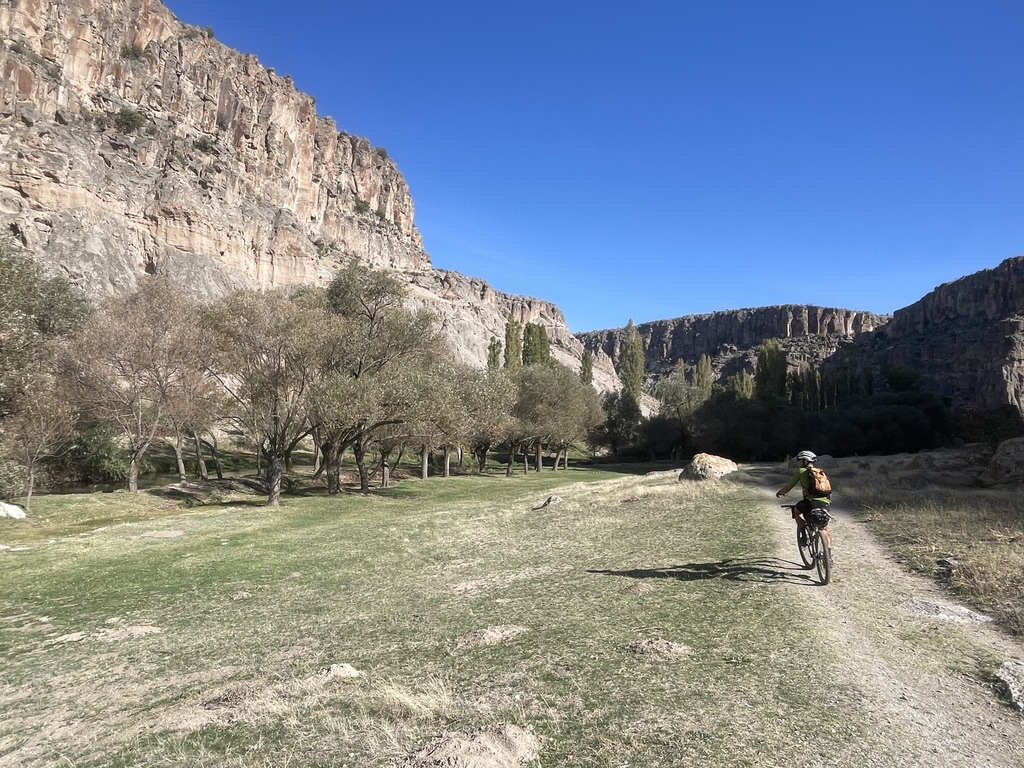
We had planned on 7 days riding, the route (with of our some add-on’s) was around 450km and about 8000m ascent, not too demanding..! …However day 1 for us included all the intricate canyons of Cappadocia, which was slow going – a) because of the technical and hilly terrain (some Hike-a-Bike) and b) it was amazingly and jaw-droppingly scenic, so this meant frequent stops to take it all in.
Day 1 was definitely sensory overload, it was also quite physical and not to mention rather warm – a bit of a baptism of fire you could say; furthermore I had done very little in the way of bike mileage in the year and thought I’d just ‘wing it’..!
There was some saviour in that as it happened that being in a touristy part there were a number of refreshment stops and it was usual to have fresh orange juice or zingy Pomegranate juice, or better still a 50:50 mix of both.
Turkey, A big O’l place – our route didn’t even touch the sides of the countryQ
I’d also had the added specialness to the day as it was my birthday, this meant the need to find a bar for some post ride beer, we had no idea where we would quite end up, we knew that we were out of ‘sync’ with the suggested stops on the route notes, mainly due to starting further along the route and doing a lot of ‘farting around’.
Spectacular Canyons and caves
Just on this we decided on the town of Uchisar as our base for start and finish, it seemed a bit prettier and better placed than Urgup, which is in the B-P.com route notes, either way there are plenty of hotels and at reasonably good prices (albeit slightly inflated due to the touristy location of the place – circa 70-80E B&B for two persons, this looked a mid-range price).
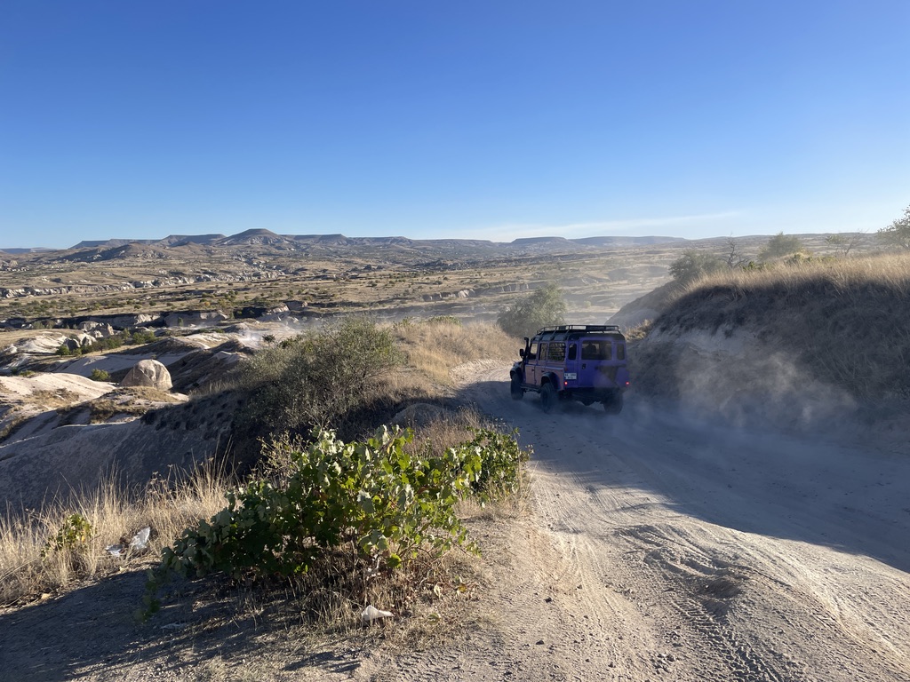
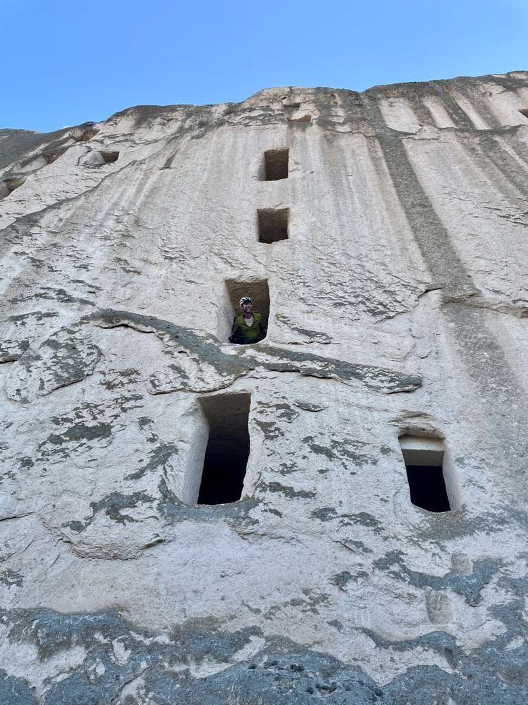
The town of Mustaffapasa sort of marks the end of the Cappadocia landscape of canyons, towers, caves and fairy pinnacles; we then transition into a ‘Steppe’ landscape, some of it rough and quite barren, while other sections farmed – here we saw masses of pumpkin fields and potato fields. Another thing we noted here were the many man-made bunker / caverns, we later found out these were used for storing potatoes and other farming machinery, in some areas they where in huge complexes.
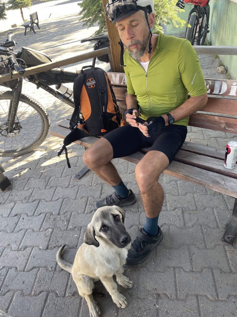
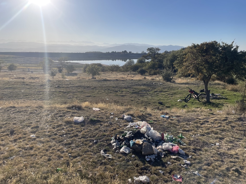
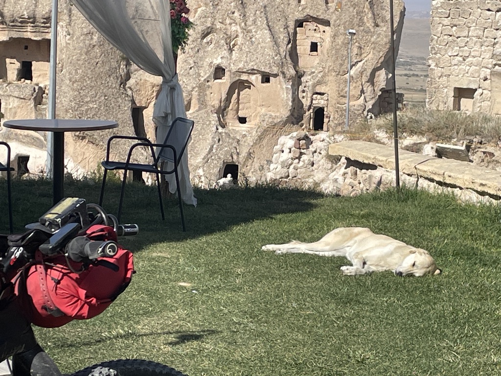
By the third day we had started to notice some patterns forming:- The friendliness of the Turk people The number of roaming dogs (usually friendly, just wanting food and a stroke!) The number of old Renault 12s Good camping spots would generally appear when needed The quiet roads Numerous re-supply shops and tea cafes Where ever you camp the sound of the ‘call to prayer’ is always present The only real negative was the amount of litter and rubbish about the place…
The abundance of litter and rubbish was a sad sight to see
As you cycle south the mountains of the Aladaglar are ever present on the skyline, these lofty peaks almost reach 4000m, the route would just touch their northern fringe. This ‘transit’ section between the two parks, was in fact very interesting, a lovely mix of Steppe and rough farmland, the villages that we passed through were very, very basic, many families just having an old tractor for transport. Then, all of a sudden the route would ‘plunge’ into another valley, rich in Poplar trees and small meadows. The valleys would often narrow and become canyons, and were there are canyons there are more stone houses and caves. One of the best locations to see these is Soganli – it was like the valley of the churches. A reminder of the past and its Christian inhabitants.
The climb out of Soganli is a brute – on a very steep paved road (not recommended straight after lunch and in the heat of the day!) More Steppe riding again, this time taking us the infamous ‘dry river bed’ – basically soft sand winding its way for around 5km.
I loved this section, the 3″ tyres on my bike were just big enough to not dig in, and I was able to cruise down it, anything less and it was impossible to ride and a long push was the only option. I felt sorry for Mark here – he-he-he! It felt very wild here and it is in places like this you often and unexpectedly find yourself low on reserves – in this case water!
Push-push-push!…and my tracks..!
Eventually another village appears and most have a water point, sometimes associated with the mosque. The villages were usually quite frequent, perhaps at most 20km apart. Most had a small shop and a tea cafe or two. Like the villages, camping spots would also be plentiful, and from our experience, it was good to find these before darkness, which in early October came at about 6:30PM. It was pleasing to find most locations were quite bug free, however at some point we did both pick up a few mozzi bites.
Electrified Railway was a surprise to see!The last of Steppe, with the Aladaglar Mountains loomingA Poplar Camp Spot!
Aladaglar was fringed by orchards, here we would find (meaning snaffle), or more often, just be handed apples, we had so many at one point, along with grapes and walnuts as well! We had enough for days. The eye-catching canyon that you cycle through at the start of the NP is quite impressive, though it does not last long and on exit, it feels like you have gone through a portal to the mountains. Wolfs live here, but they were not a problem for us, it was the shepherds dogs, this was the only time we felt properly threatened – three of them approach and barking wildly, fortunately thats all they did and eventually they lose interest.
Poplar lined orchards and more apples
After the Aldaglar excursion, you get chance to restock in quite a large town called Camardi, here we found a lovely Baklava Patisserie and we therefore carb and caffeine loaded our little bodies. We noticed the Turks are partial to sweet things and despite all the sugar they must eat are not in such bad shape, as in not so much obesity about the place – I think the folks here work quite hard for their living, especially in these country regions. This town is also the turning point were the route heads back north and is perhaps our halfway point.
The high point! enroute to Nigde
However, it felt more than halfway for us as we had to do an unplanned re-route back to the town of Nevsehir, near where we started. This added about 80km and was due to loosing all my tyre sealant and not having spare. The problem was the replacement tubes would last about 5 minutes, before picking up a thorn and prickle – they were everywhere and this basically meant tubeless was the only viable way of keeping tyres inflated while in the bush!
This was a late breakfast/lunch
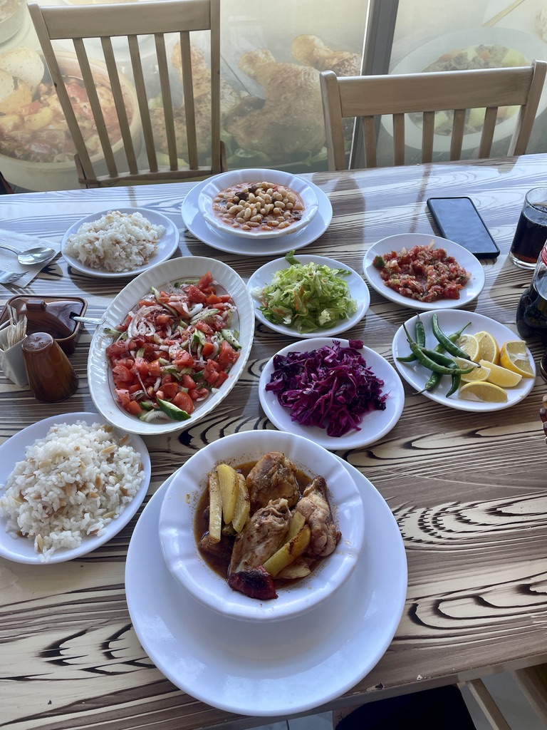
Villages were plentiful, but towns were you could get a meal were a bit more spread out, this meant we were often keen to get a breakfast or lunch somewhere on the route and then cook our evening meal at camp. The food was super, tasty and freshly cooked or made, often cost less than £10 for the two of us.
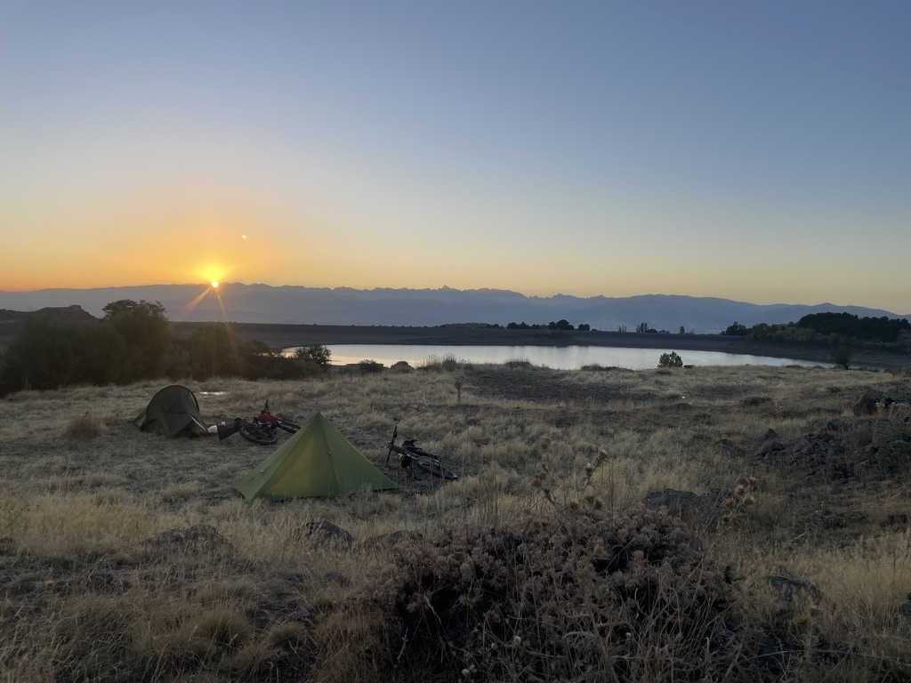
Sunset Camp
After negotiating the suburbs of Nigde – quite a large city, which we were not keen to go into and rather keen to get away from, we would then start climbing towards the Ciftlik plateau, going via ‘on’ road and ‘off’ road trails. Along here the route climbs to around 2100m – the high point of our journey, this was on a mixture of old and new road, and whilst a ‘fast’ road for cars the shoulder was wide and made a good sanctuary for the cyclist, we did notice along this bit that a off-road track looked possible, but decided to stick to the easy and enjoy a meal in Ciftlik.
Typical village day
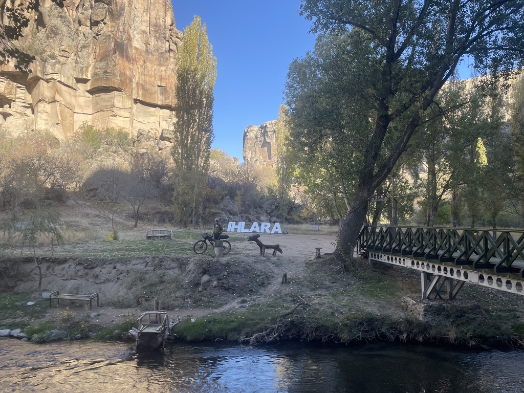
The next ‘highlight’ was soon approaching – The Ilhara Canyon, however we were in not in a particular rush to get there, as the riding across the plateau was very varied and interesting, seeing more of the ‘real Turkiye’ and having those random and entertaining meetings with the locals.
The Ilhara Canyon is another of these places that is quite hard to put into words, or take-in. It starts at the town of the same name and you have ‘actually’ got to pay an entrance fee – and it’s actually quite a lot by Turkish standards of 15E person. However, it is worth the payment and is not at all much really… and it means the historic place is preserved, maintained and kept clean and litter free. Also whilst not entirely suited to bike – due to narrow, steep sections and steps, it is very good fun …and only in Turkiye would they let you proceed on bikes through here! Again trying not to crash while being mesmerised by the sheer beauty would be a challenge…
The Ilhara was just another place beyond words…
The main canyon is probably only 8km, but with stops and detours takers around 2-4hrs. On exiting the main Canyon you are greeted with commercial / tourist overload as it is cafe and restaurant central – having eaten a better meal in the town beforehand, we were very keen to skip through this and get to Ilhara Canyon ‘Pt2’, this is where we would look for our camping spot – and in tradition a good spot came up…
Fallen wood was abundant and there were one or two existing fire pits present, therefore a camp fire* was in order. A camp fire enhances the camp vibe, along with a good feed and a couple of river chilled beers our spirits were high…
– we were loving Central Turkiye!
* Where suitable – as in there was an established fire pit already dug (in fact several – its not just a UK thing!) Typically our approach would follow the bike-packers unwritten code, one of which is to leave no trace (apart from tyre tracks maybe…)
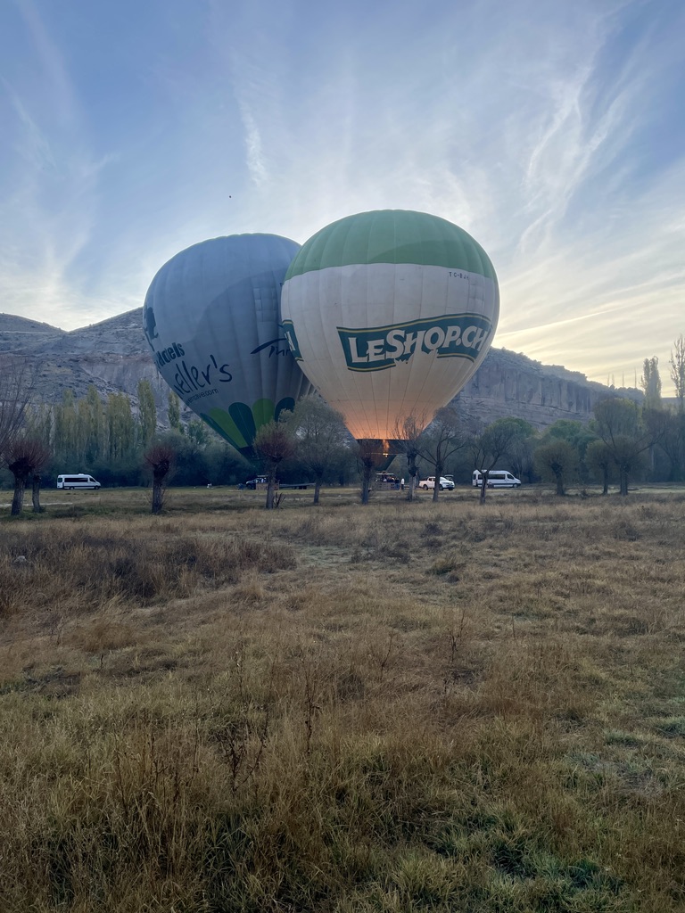
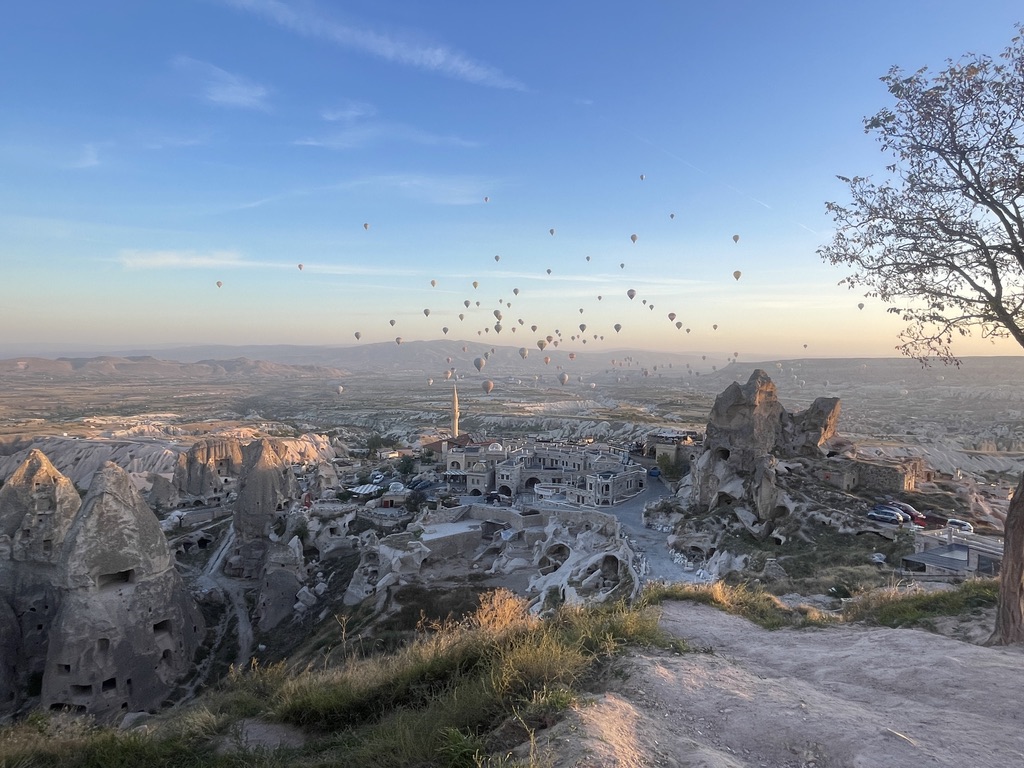
Morning time would yield yet another big surprise… Awoken at around 6:00 to clanking and banging, thinking at first it to be forest work, it was not. Hot air balloon and their crew had arrived. We were soon up and about watch the spectacle of it all!
Little did we know that this would not be the last balloon spectacle! After the excitement of the early start, we decided to have a ‘slow’ start, partly because being camped in the valley and next to the river, everything was very damp – this was the first damp night of the ride. We decided to let the rising sun dry things off a little, while we sipped coffee and savoured the restored peace of the valley.
After setting off down the damp, cool meadows, there was another constriction ahead, as the steep sandstone walls closed in again, this provided some more real estate for cave dwellings, more churches, houses and pigeon holes. We we not tired of this ever-curious and historic landscape always yielding little treats to go and explore and other eye-pleasing surprises. These valleys definitely could not be rushed and many excursions off-bike were had.
This might have been the best section so far – quite wild and peaceful, full of places to stop and linger and kept green and fresh looking with the river.
Pink FlamingoesOld gravesSock bargaining!Google Translate in action!
Several more hours were spent meandering down the Ilhara valley, stopping at the odd cafe, keeping a close eye out for turtles or terrapins that are meant to be found here, until eventually our dictated route exited and then started to head back ‘east’ – with the circle of the ride slowly closing, we had just one camp-night left. First however we had to do some 40-50km of Steppe.
The word “steppe” is derived from the Russian word for “flat grassy plain.”
Another ‘POI’ lay ahead, this time the underground city of Saratli, so here, rather than using a geographic feature like a canyon, this time the Byzantines crated a labyrinth of tunnels and rooms, cleverly connected – to allow ventilation, security, access to water, often spread over many levels. There are between 100-120 of these underground cities in the region, some up to 180ft deep. A very interesting 2 hours was spent at this one, eating lunch, exploring (and getting lost) in the tunnels and then buying some wooly socks from the local stalls – some special hand-made and local gifts to take home.
Chip Butty and our drink of the ride – A Cherry ‘Cappy’ – very zingy and refreshing
Our last night was spent on a high plateau, whilst the terrain was varied and interesting, it was intricately farmed, this meant finding a piece of flat, smooth, non-rocky grass was quite tricky – and the day light was disappearing fast! The last night is always a little sad, as you really want the journey and freedom to continue, and to keep on exploring this charming country. However all things must come to an end, so the final day was to be had and enjoyed to the maximum, but first of all a breakfast was needed. The large town/city of Nevsehir would be ridden through, so far riding in the towns had not really been a problem and this ‘big place’ was no different. We soon found a cafe and had a good feed, before the short hop over the Urchisar about 12km off.
As we had time on our side we took an extended route back, via one last valley and it was by far the best – Love Valley. No place else quite like it!
So Why Not Cappadoccia?
It had delivered and surpassed on every level. The mountain bike was the perfect tool for the job again and bar the punctures, both our machines held up well, and even our bodies too! We thought we may have a problem with drinking from the water points, as we did not really know what the water quality was like in rural Turkiye, but it did not give us a problem and nor did the lovely food.
The end of the ride beer and one or two other random pics of Crazy Cappadocia!
And then when we thought we were all done for surprises , on the last morning we awoke early to go and see if we could spot a hot air balloon…
The balloons just kept on coming – we counted 125 (ish)
There is always a ‘bit more’ after the end of every ride, our journey here from Antalya was all part of the trip and whilst it may not be photographed or journaled here, it was very much all part of the grand adventure. Turkiye left us with a strong desire to return, everything was good, I’d not really mentioned the weather, but it treated us well, and was the treat we needed after the UK’s ever-present rain and dampness, nor was it excessively hot, being autumn time. The trails and riding, whilst maybe not as exciting or technical as those experienced in countries like Spain or Italy, kept us buzzing; all this coupled with an ever unfolding landscape and the history book that we where in was captivating throughout the journey.
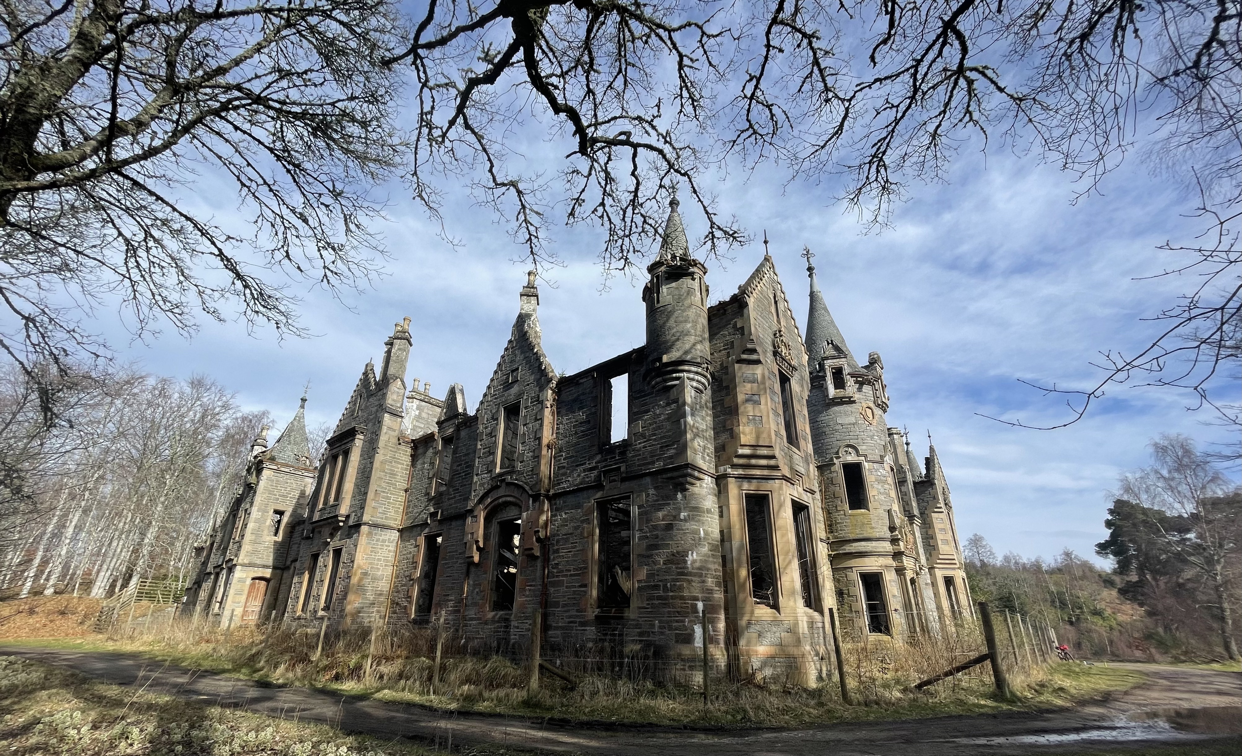
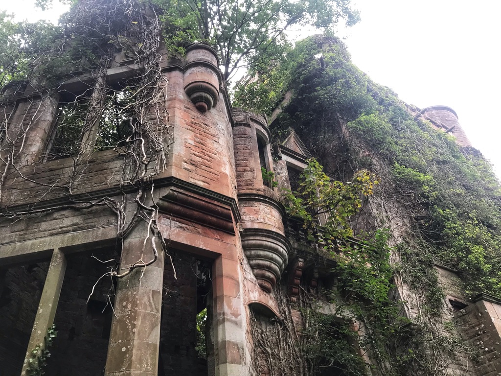
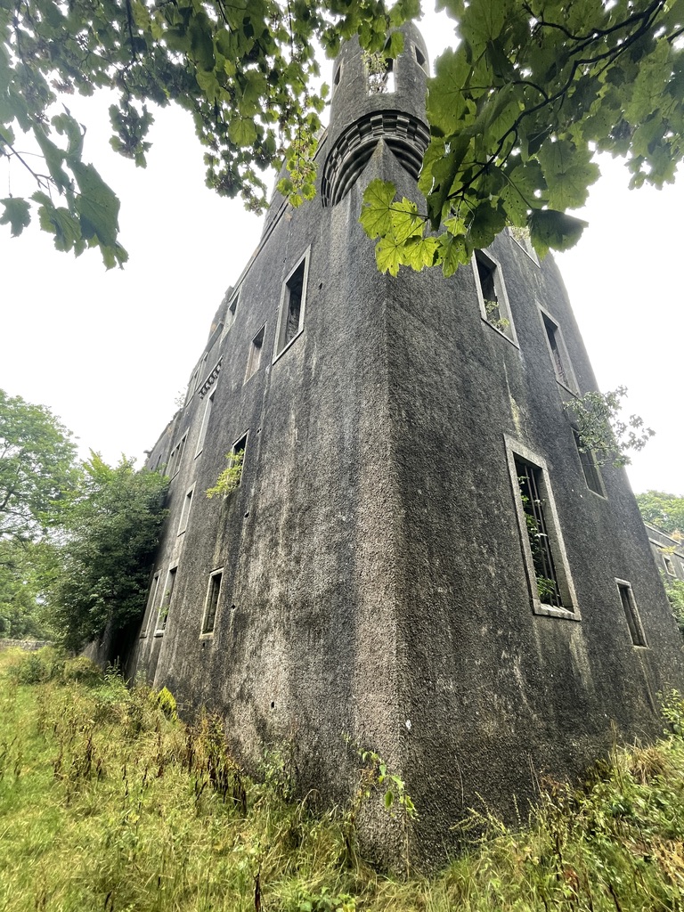
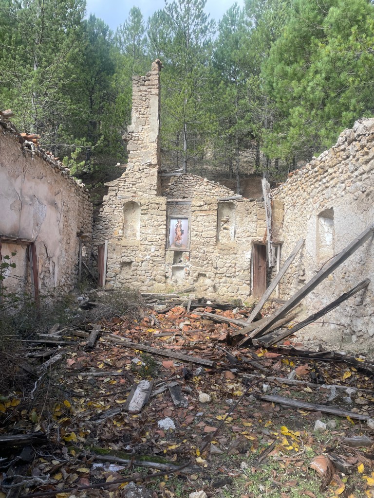
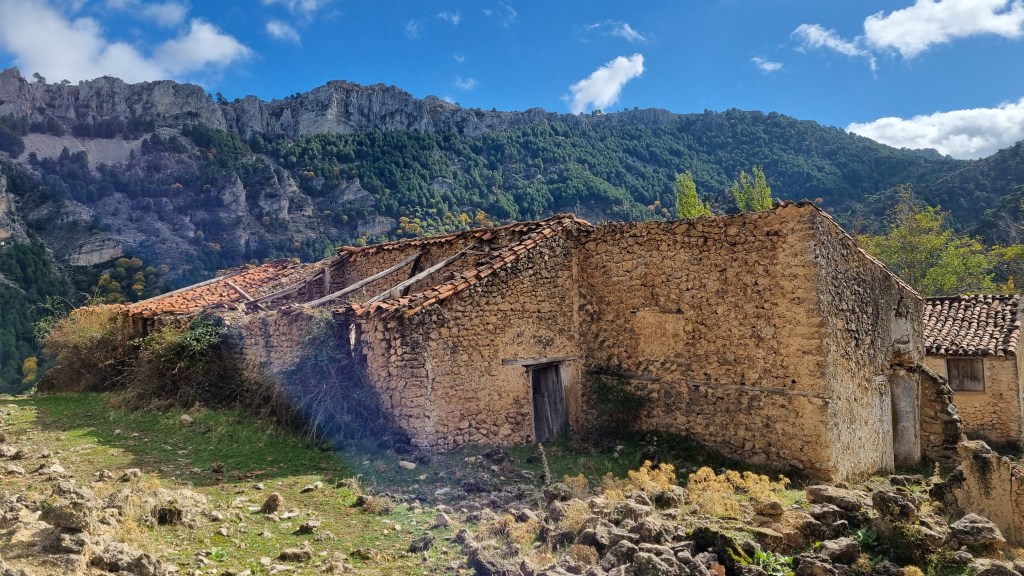
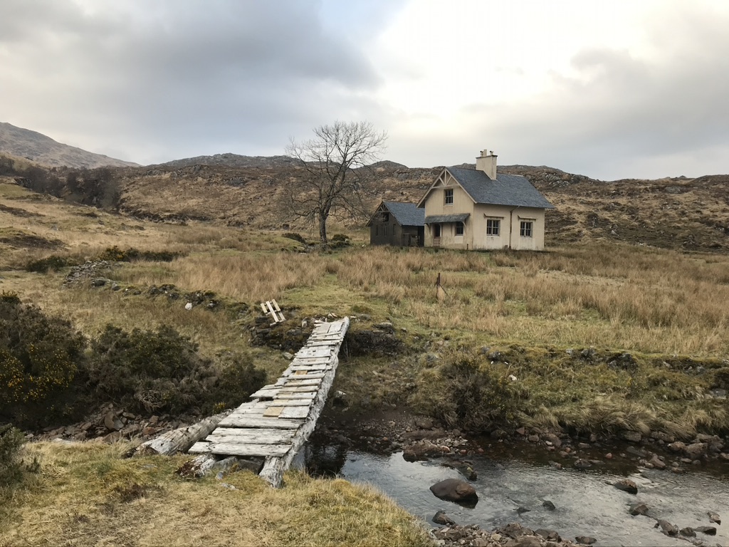
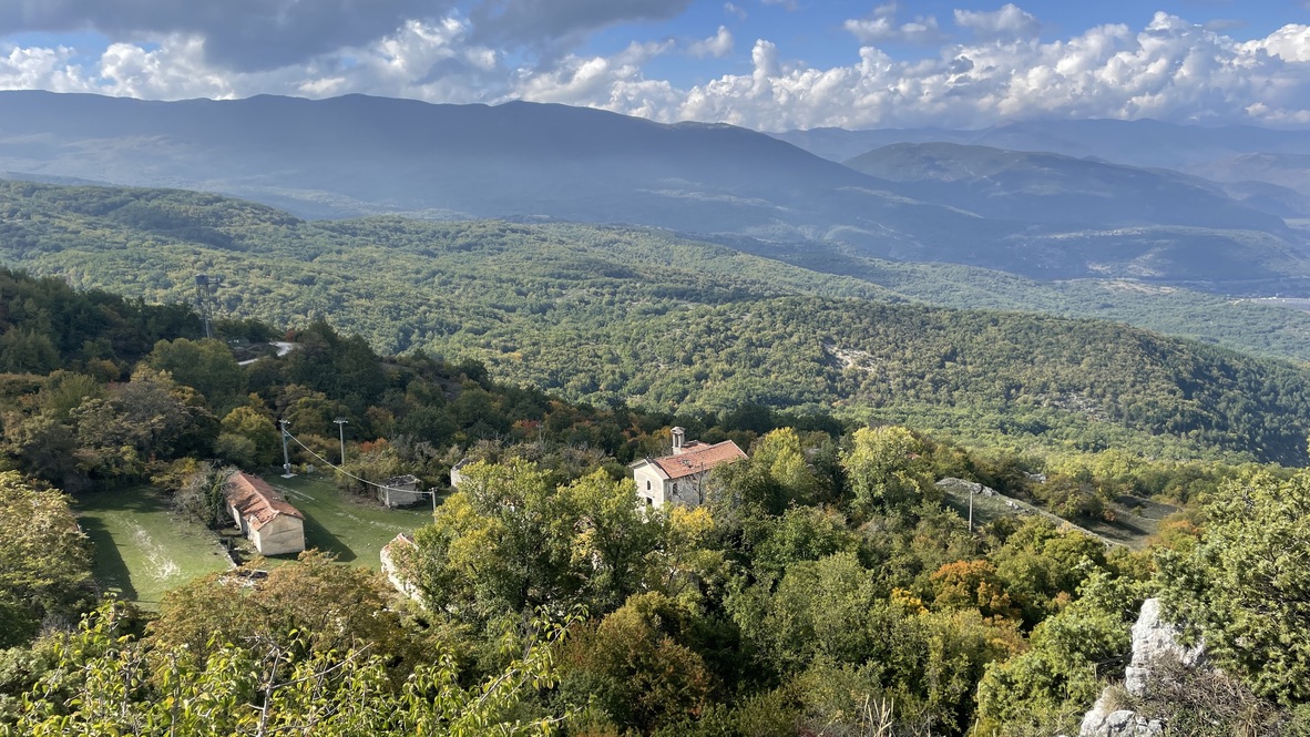
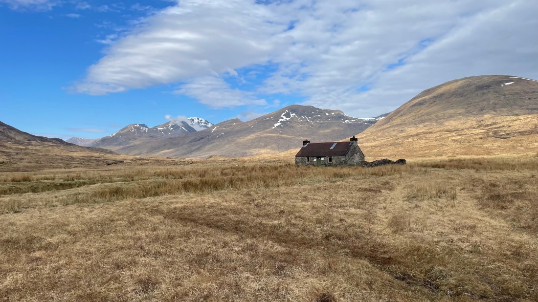
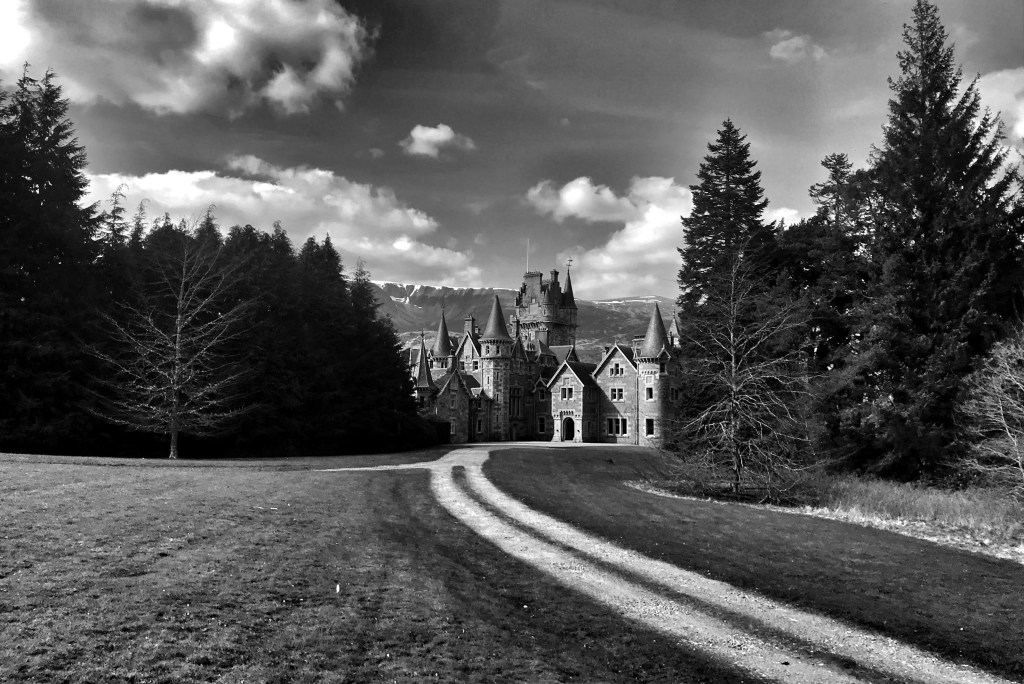
Whilst travelling the trails of Scotland on my bike, I have passed many a ruin. Not just the mighty ancient castles or abbeys that are often prestigious national monuments, but more often than not the more obscure, lost and forgotten houses, estate lodges or small castles that are no longer lived in and are slowly but surely going into a state of ruin …for whatever reason. Its quite sad to see these impressive residences, which were no doubt soaked in rich, regal and sometimes sinister histories, now no longer cared for and steadily been retaken by nature.
The buildings below are just a few of those that I have passed by, they make good ‘Points of Interest’ or POIs on the rides and I usually stop for a coffee and snack whilst admiring or sometimes exploring them. They are displayed in no particular order, with a bit of research (aka googling) their full histories can be found.
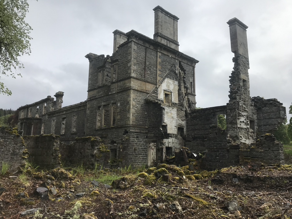
Dunalistair House
Dunalistair House is well hidden and is easy to pass by as it is tucked away near to Kinloch Rannoch. In its previously life it was a stately country house, and at one time owned by Hugh Tennent, the head of brewing company Tennent’s; now it’s an imposing, mesmerising and haunting vision. It is derelict and roofless, but hugely impressive, retaining many original features – conical roofs, turrets, chimneys and a coat of arms above the main door.
Dunalistair House
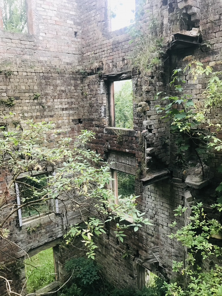
The building below is located down in the south, or what I call the ‘Land In-between’, as its so often ‘passed by’ on ones journey to the Highlands, it is also known as the Scottish Borders and it is located along the beautiful Annadale Way – which is a lovely long distance trail for either hiking or bike-packing. Near to lockerbie a commanding building found in the woods is easily passed by, it is the old Milkbank House and Kennels. Built probably in the late 1800s this impressive mansion in Scots Baronial style lays beside the trail in ruins. There are many of the prominent features such as towered roofs and crumbling corbelling with trees and vegetation taking hold. Inside there are large fireplaces and mosaic floors. The ‘kennels’ are next door to it and lay in a similar level of dilapidation.
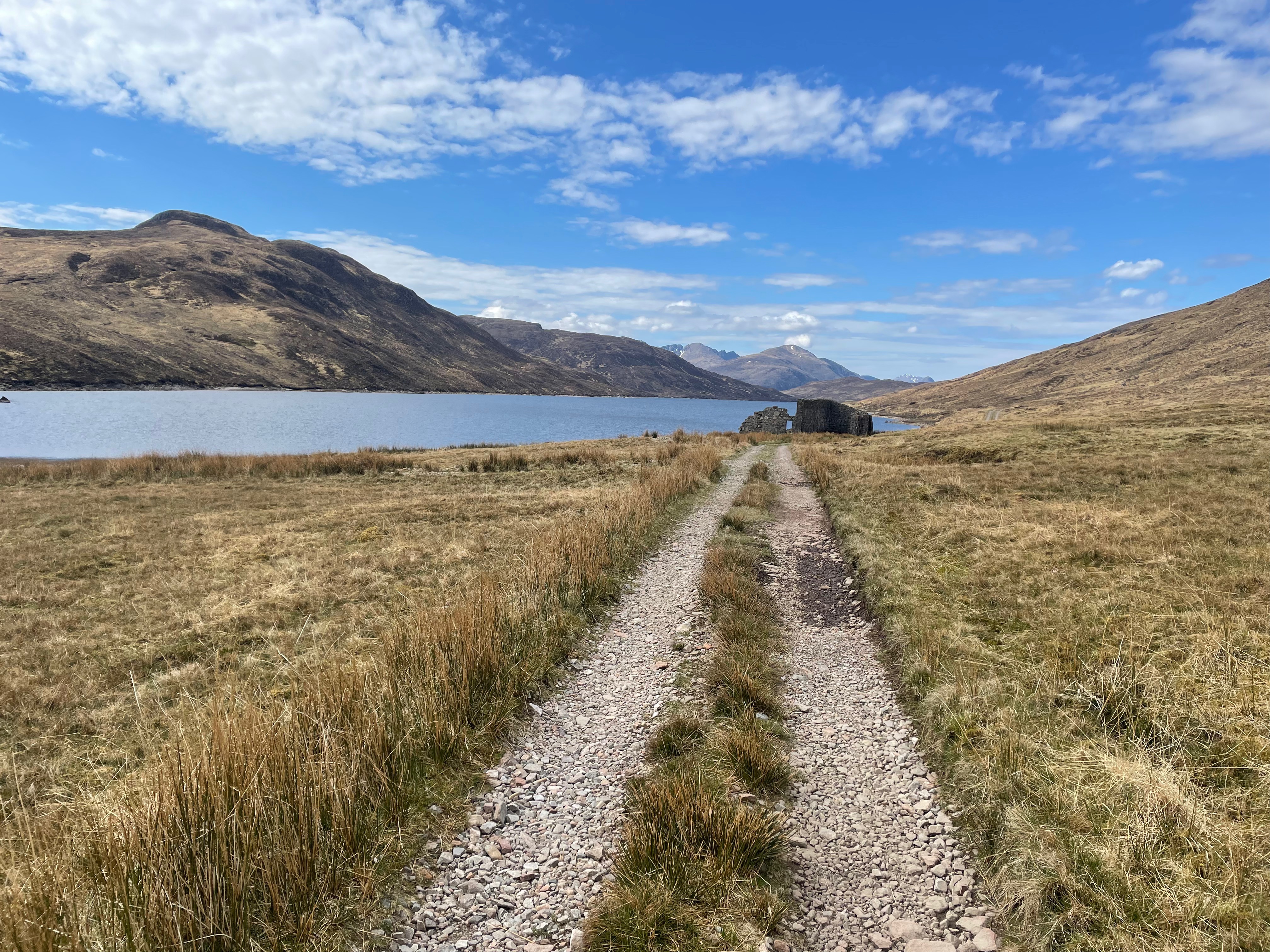
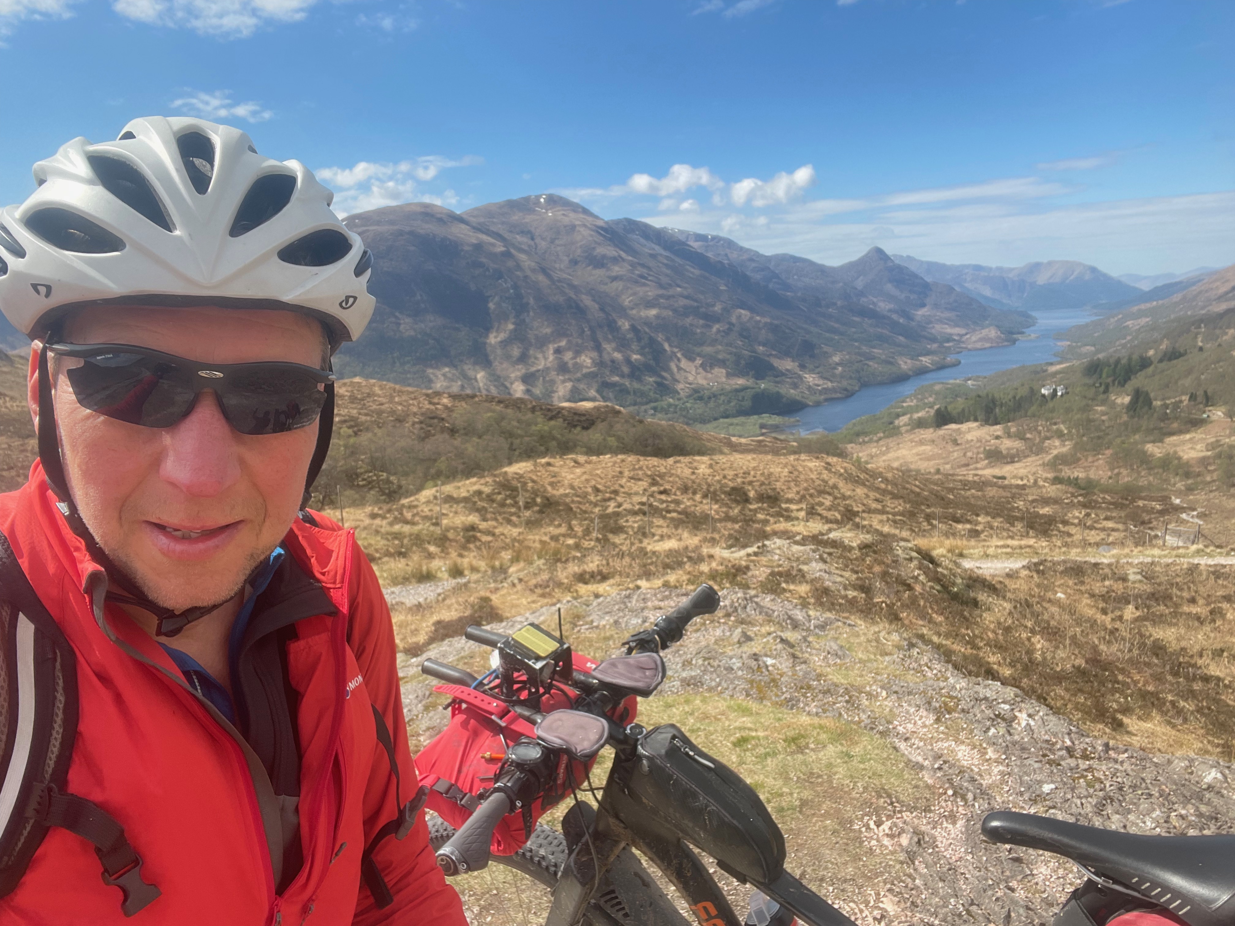
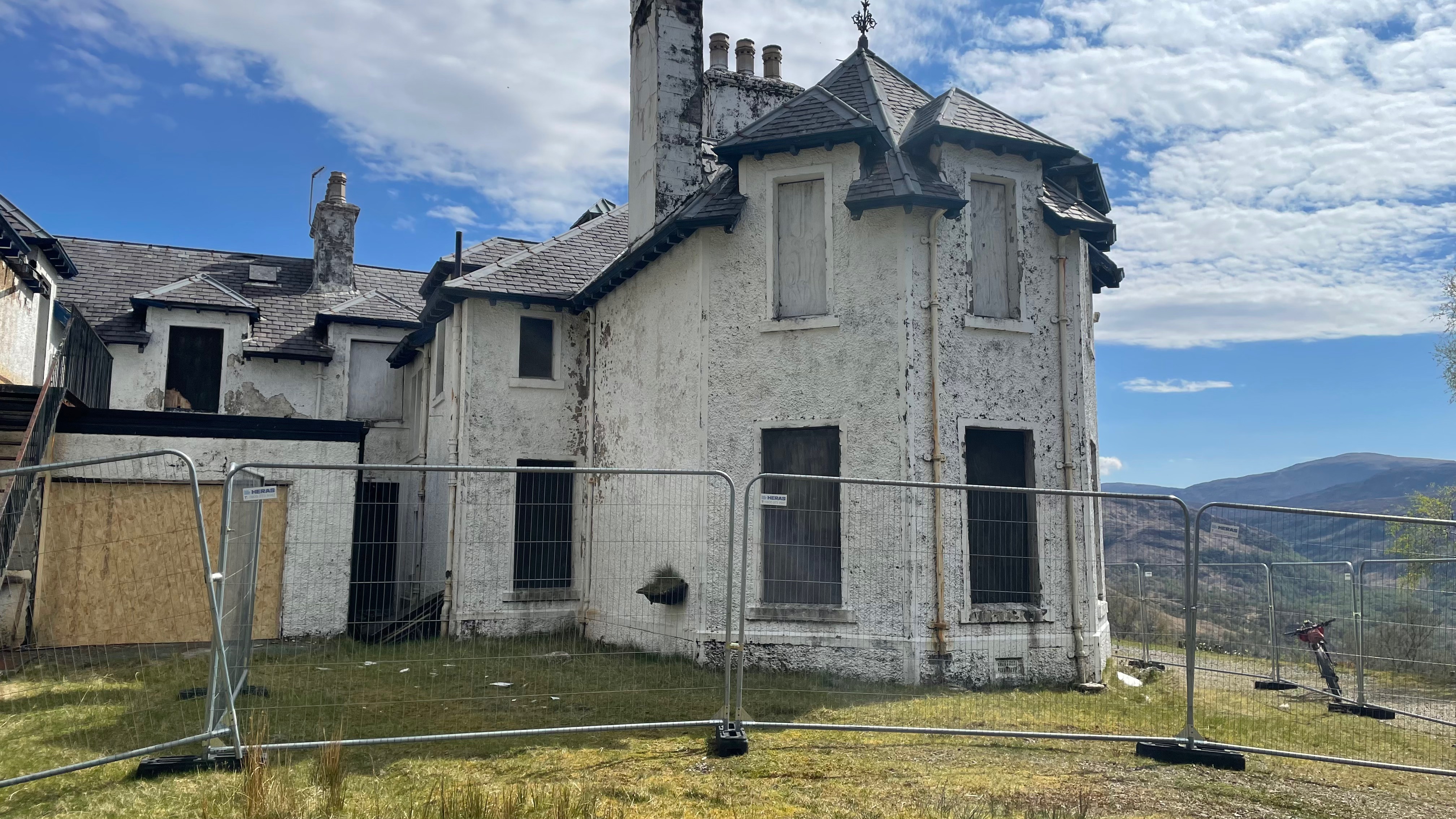
Moving further north, this time in the mighty Highlands near to Kinlochleven on the west coast stands this old lodge nestled in a very lofty position 230m up under the mighty the Mamore Range. Bearing the same name as the mountains, the Lodge was constructed in early 1900s by the Fairfax-Lucy family, who owned land covering 45,000 acres, it has long reaching and spectacular views over Loch Leven. It was built for Captain Frank Bibby and could be the worlds oldest independent shipping company and is still being run by the sixth generation. The lodge became a hotel at some point and entertained many a regal person, with King Edward, Viscount Churchill and Sir Henry Fairfax-Lucy. The building has also been used on film-sets Rob Roy and Brave Heart.
Mamore LodgeMamore Lodge Hotel taken in circa 1910 – Credit Canmore
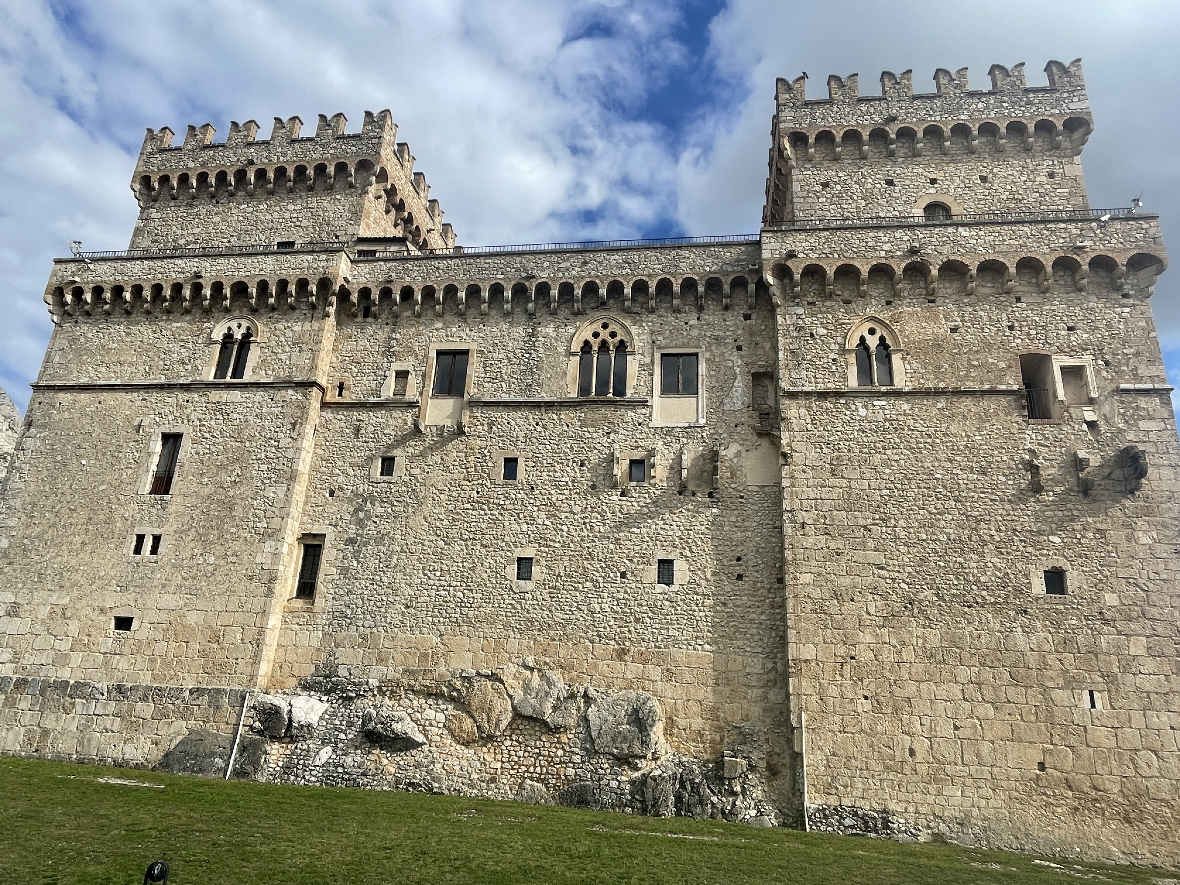
Moving south to Galloway, there is a mighty castle hidden away in the trees near to Loch Ken. Bearing the name of the loch – Kenmure Castle is reached from the road down an abandoned tree lined driveway. The old castle balanced on a natural mound and once defended by the local area and is surrounded by marshy and flooded ground.
The Lords of Galloway were once rulers of a breakaway mini-kingdom in southwest Scotland until the 13th-century. Many families and peerages have passed through this place over the centuries.
What remains now is a ruin that consists of a largely 17th-century building including a 16th-century tower house, three stories high with an attic that was further extended, along with an impressive set of cellars – no doubt used to store vital goods such as wine and ports in one part and in other parts to imprison the un-ruley. The castle was first recorded as a ruin in the late 1700s, but was extensively restored and remodeled in the 1800s, which saw large sections of the courtyard and northeast tower removed.
Kenmure Castle has been derelict since the mid 1900s, after the interior fittings and fixtures and roof were removed in 1958. The ruins were listed in 1971, and since 1998, it has been considered a Scheduled Monument.
The best bit is the castle is said to be haunted by the Headless Piper of Kenmure – I will have to camp one night in the grounds to see if his presence can be found.
Well worth a visit, also the extensive grounds and nearby derelict fish farm buildings are a fascinating peak – like something found off one of those kidnap thriller movie scenes…
Kenmure CastleKenmure CastleKenmure CastleHolmains House
The Annandale Way again! Holmains is between the small villages of Dalton and Hightae, it sits quite high on a ridge at about 180m. The day we passed by it, it had a very sinister feel to it, we did not enter it as we were short on time, maybe on another occasion we’ll explore more. An imposing Oak stands next to the abandoned Holmain House.
The surrounding hill is very rich in ancient history, with forts, burials and mounds aplenty.
Inverailort House
Inverailort House is situated on the east shore of Lochailort to the south of the River Ailort under the lofty Seann Chruach. The house dates from the late 1800s, said to have begun as a farmhouse, the house was rebuilt as a Victorian shooting lodge in 1875, then extended in 1891. During World War II, the house was requisitioned, and was used by the Commandos and the Royal Navy.
The house was occupied until around 2011, and included use as the Lochailort Post Office and sorting office, but it is now in a state of considerable disrepair and suffering badly from the effects of the west coast weather (Wind and rain!).
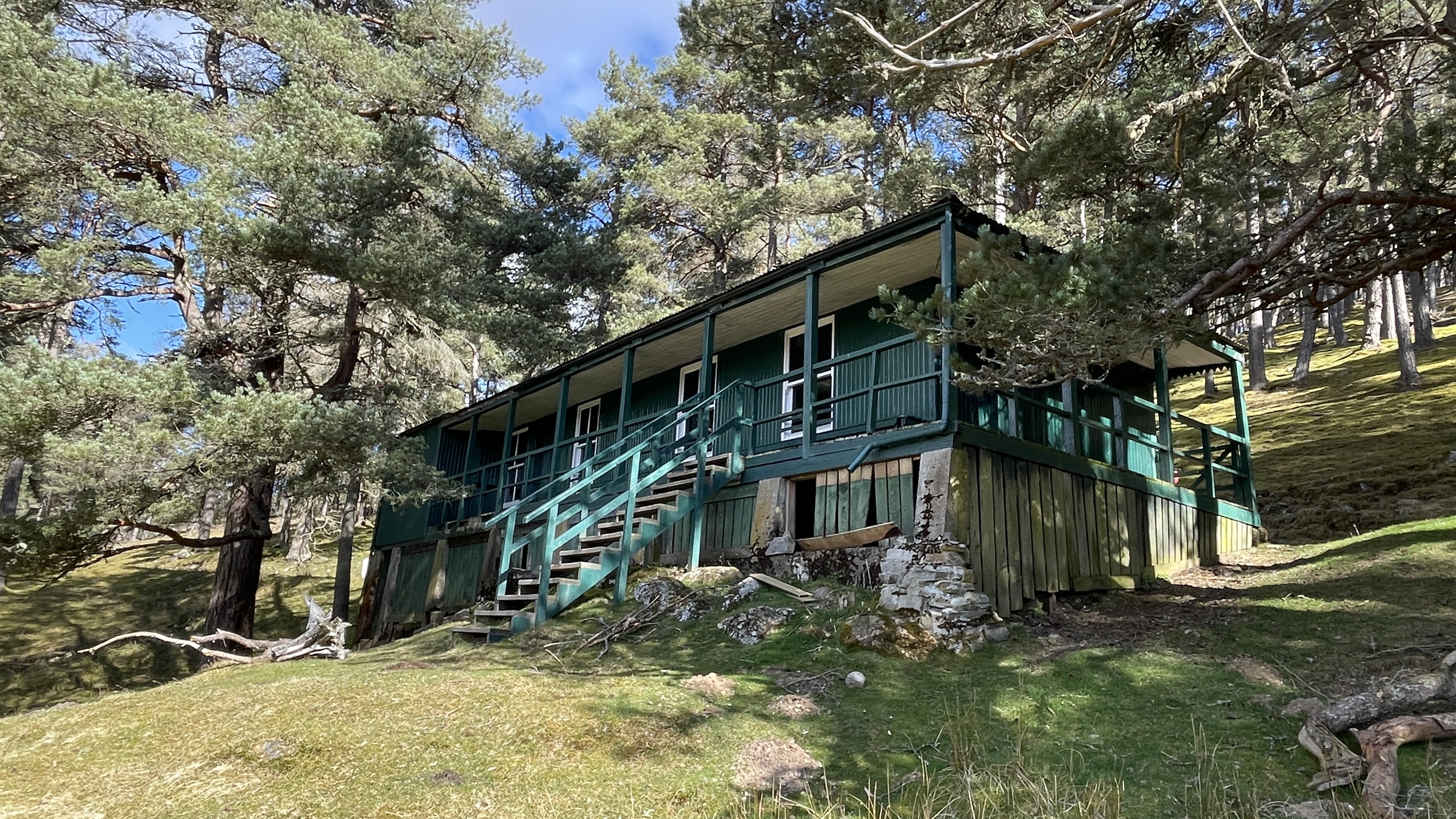
Guisachan House
Hidden deep into the majestic Glen Affric is the ruined remains of Guisachan House, near to the mighty Plodda Falls. Built in the mid 1800s for Lord or Baron Tweedmouth, it was used by the wealthy as a shooting and hunting lodge.
More information can be found here: https://friendsofguisachan.org/main/the-estate/ [the two illustrations below are taken from this link, they give a good indication of the size and the impressive architectural features.
This account will be added too as I discover more buildings of interest. I also need to sift my journey archives as there are numerous other buildings that are worth a mention. One thing for sure is that they do add a lot of interest to the journey, whether it be a back-packing or back-packing trip seeing these places adds some spice and compliments the other more nateral things that you see, hear and smell.
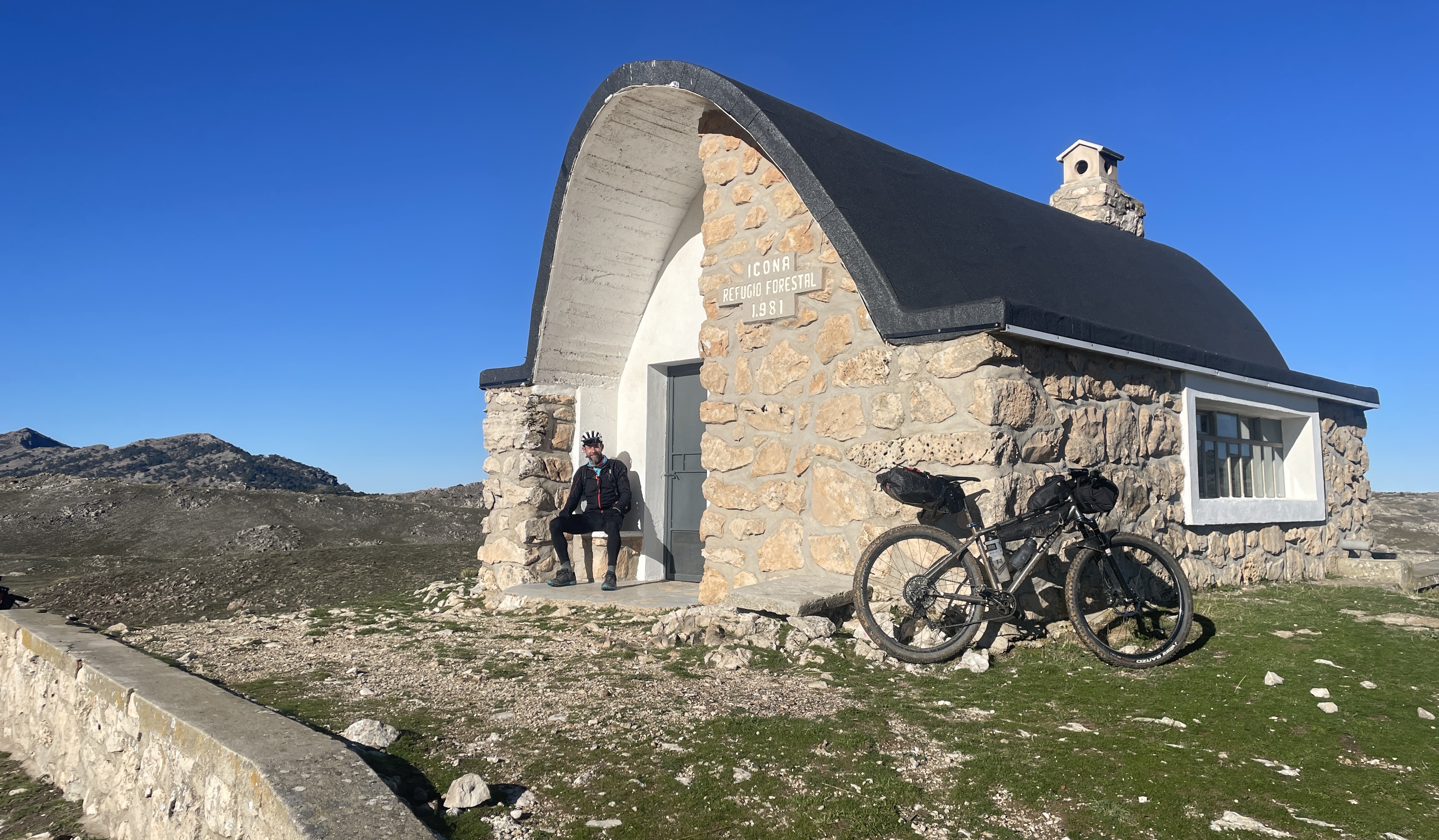
Given the choice and variety of locations that we have available to us in Europe for wilderness bike-packing excursions – Why visit the same location for a third time..?
Well I guess there are a few reasons:
1. I failed to complete the full route on the two previous visits – due to getting mud-bound (these were both in Winter) 2. The dramatic geography, coupled with an abundance of interesting Flora and Fauna 3. The mountain bike riding is some of the best, as in the most off-road and there is a high percentage of single track riding, certainly far more than any other long distance route that I have done 4. The interesting history and number of historic features to explore 5. The local hospitality and number of refugios available 6. This time I was riding with a friend and introducing them to the delights of the region was a great pleasure to share.
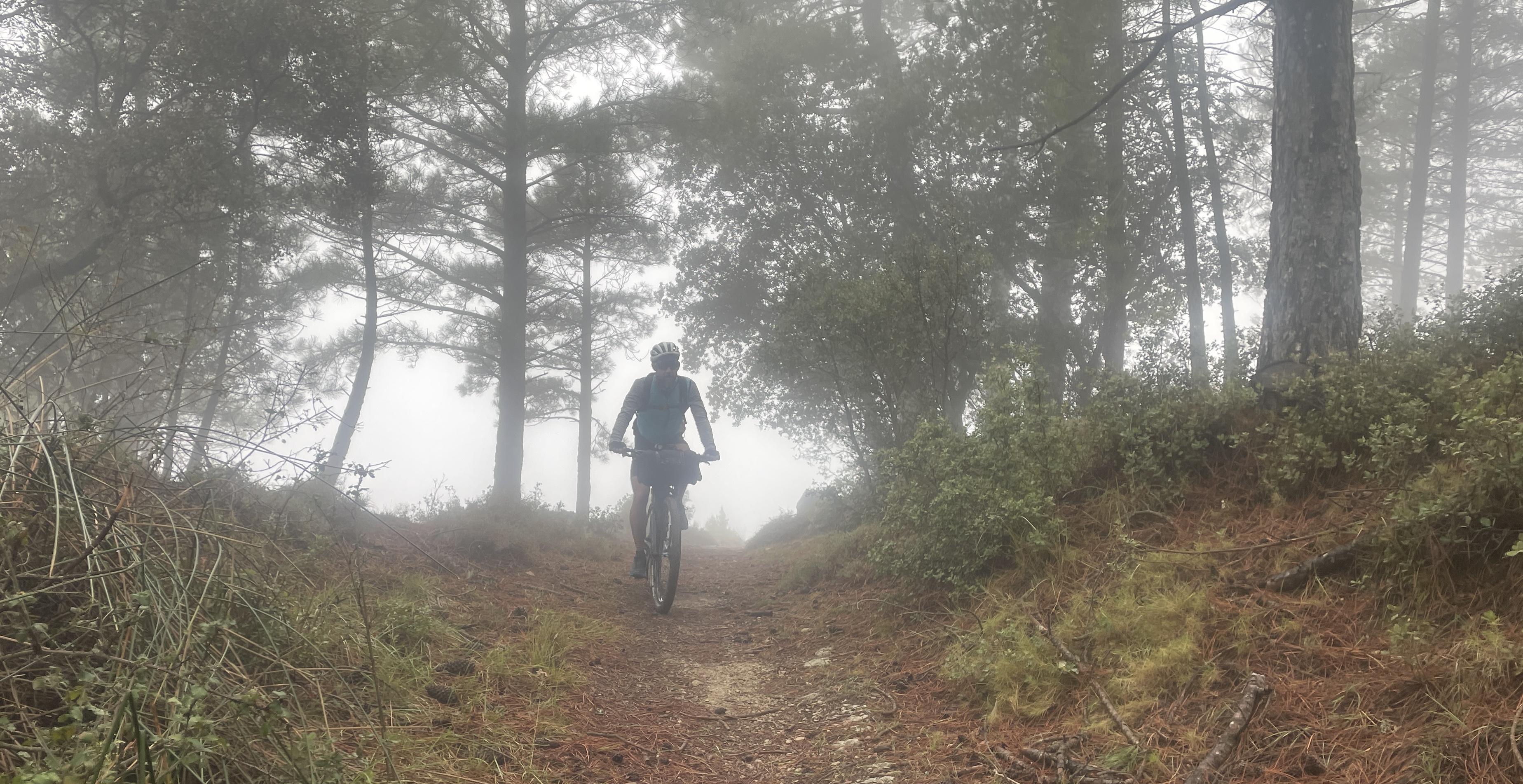
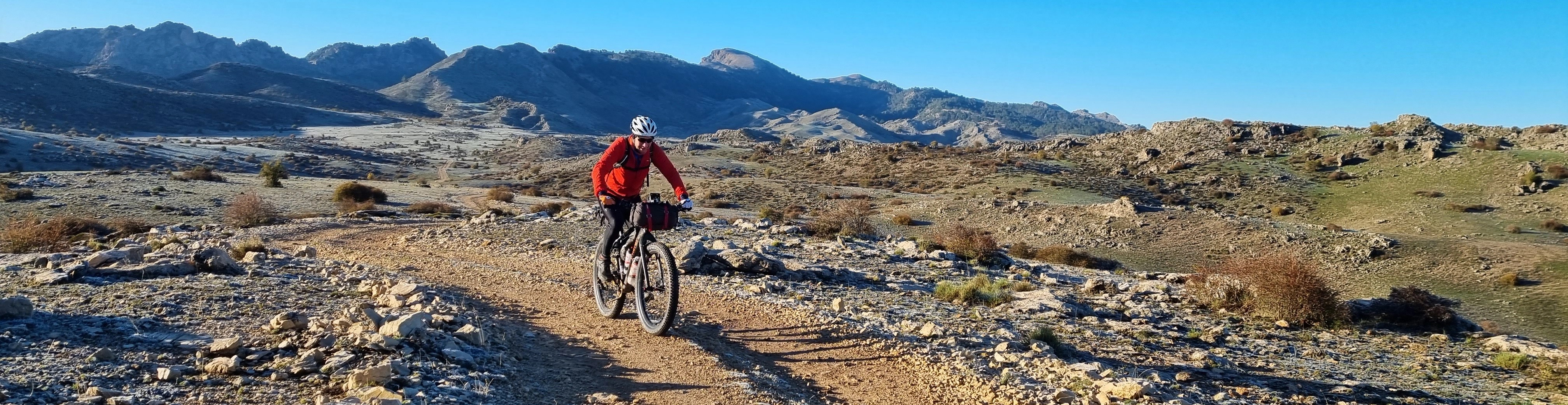
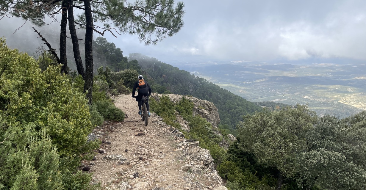
A typical section of the GR247 (this was on the south bound home-run leg)
As mentioned above – the UK and Europe has a lot to offer the bike-packer and while more far-flung excursions always tempt me, such as the Silk Road Route in Kyrgyzstan, or the Tour Divide in the US, or Patagonia …the list goes on..! However I am very conscious of trying to do my ‘little endeavours’ in a sustainable way. To that end, I have not cut out flying altogether (yet), but I am not that keen on doing long-haul stuff, or doing more than a couple of of EU return flights each year, I aim to keep my carbon emissions to less than 10 tonnes/year (the UK average is around 11.5 tonnes/person).
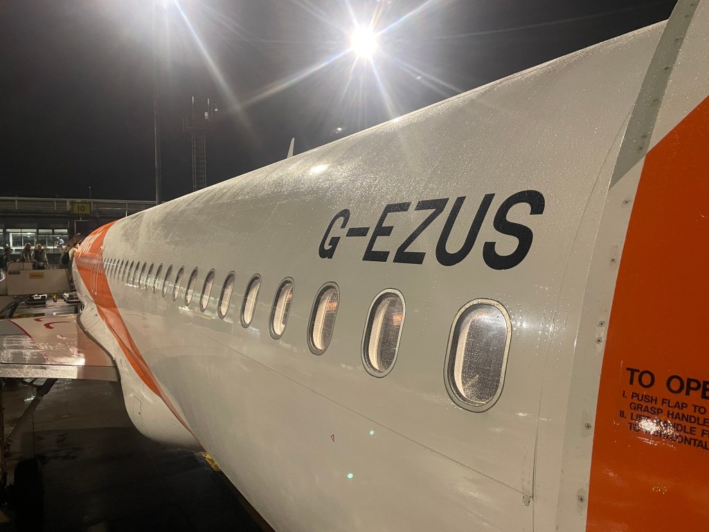
In safe hands on this Easyjet flight!
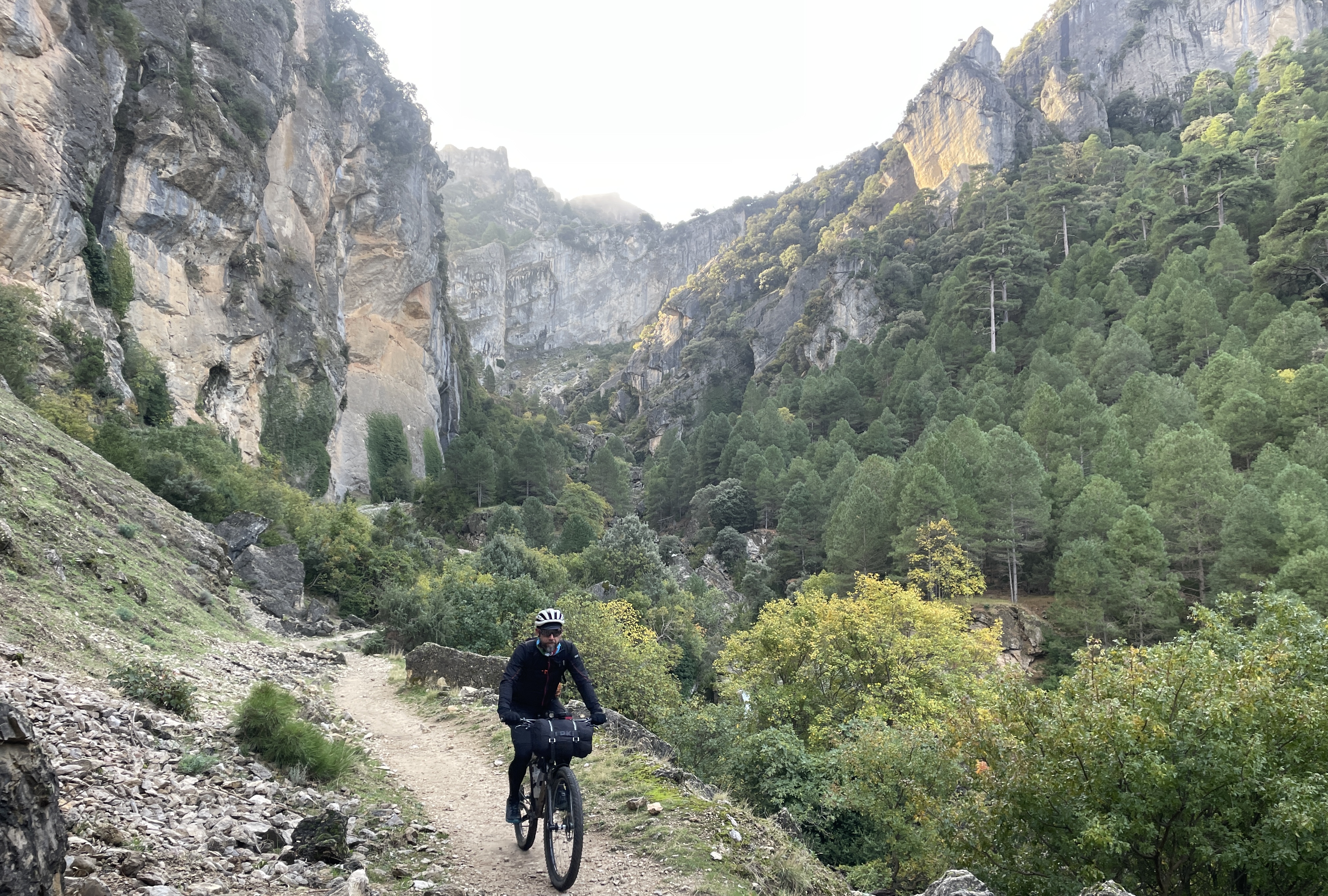
Lets talk about the Bosques del Sur…
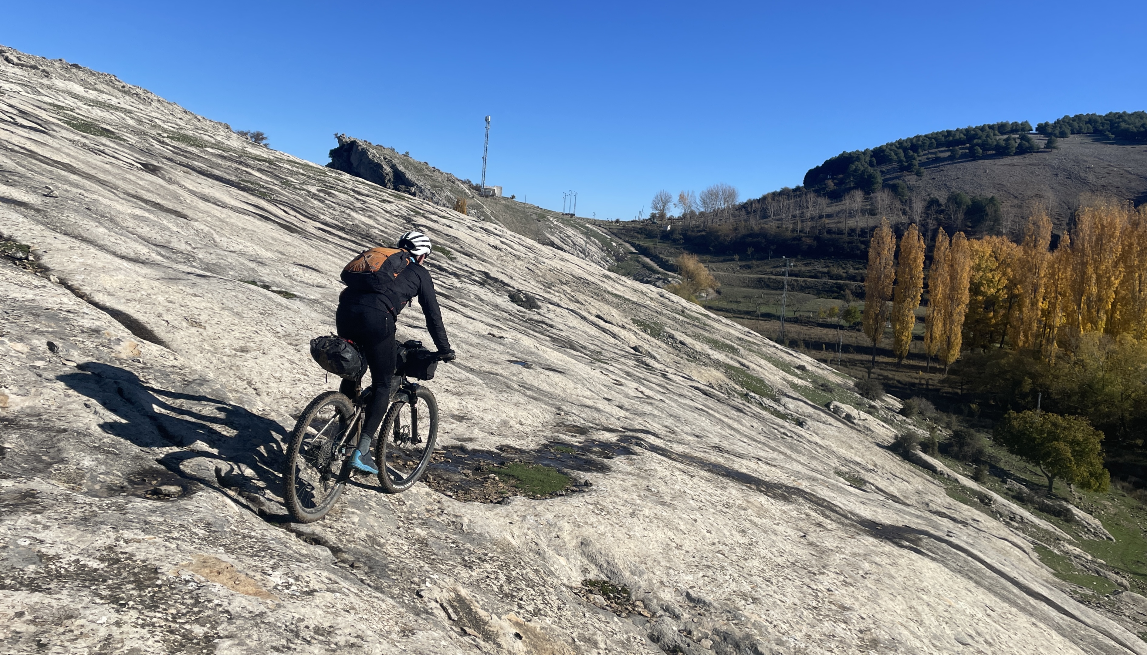
From the two map extracts below, its location in south-east Spain can be identified. It also makes you realise how big Spain actually is! While on the subject of Spain, as a country it has made great progress in the last two to three decades and has a good travel infrastructure, a huge number of protected areas and national parks, also all the small towns and villages retain their key amenities, like shop, bar, bakery, school etc. with thriving communities, also the drivers are respectful and patient – as you head east in Europe this all changes – especially as bicycle rider! As it happened on this ride we only did a handful of kms on surfaced roads and on most of these roads we barely saw a vehicle.
Back to the route..! The normal start for the GR247 is in the north at a town called Siles, however for us arriving to the area from the south the town of Cazorla made more sense, also it is a far better place to base yourself from as it has a lot more going on and more options for accommodation, as well as being a stunning town in its architecture and geographic location.
The Old Town
The GR247 drops into the town from an adjacent village just above called Iruela, the route also exits the town on a steep track that is very sustained climbing to gain a vertical 400m in 4-5km – a bit of a baptism of fire! The outlook forecast for us was mixed, but looked to improve, it was early November, so you can’t expect it to be perfect, as it happens this area of south Spain is the wettest (but still dry by UK standards). After an hour or so of hard grinding our view was taken away from us by the cloud, this was a shame as we missed the spectacular vistas and the cliffs of El Chorro. Due to the late morning start, we had not planned too much distance, 50-70km was a rough target for us.
And so we go into the shroud of cloud.
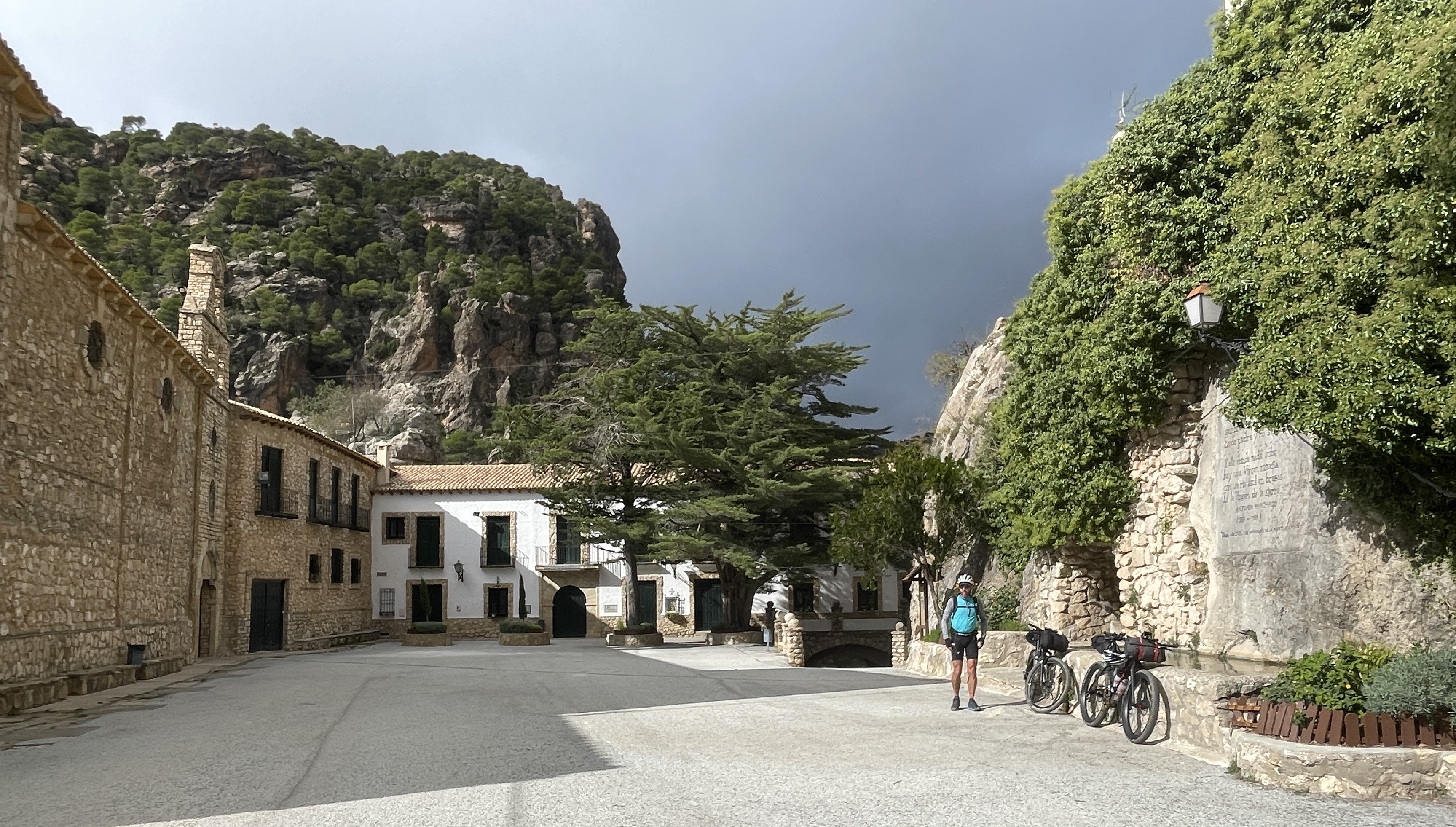
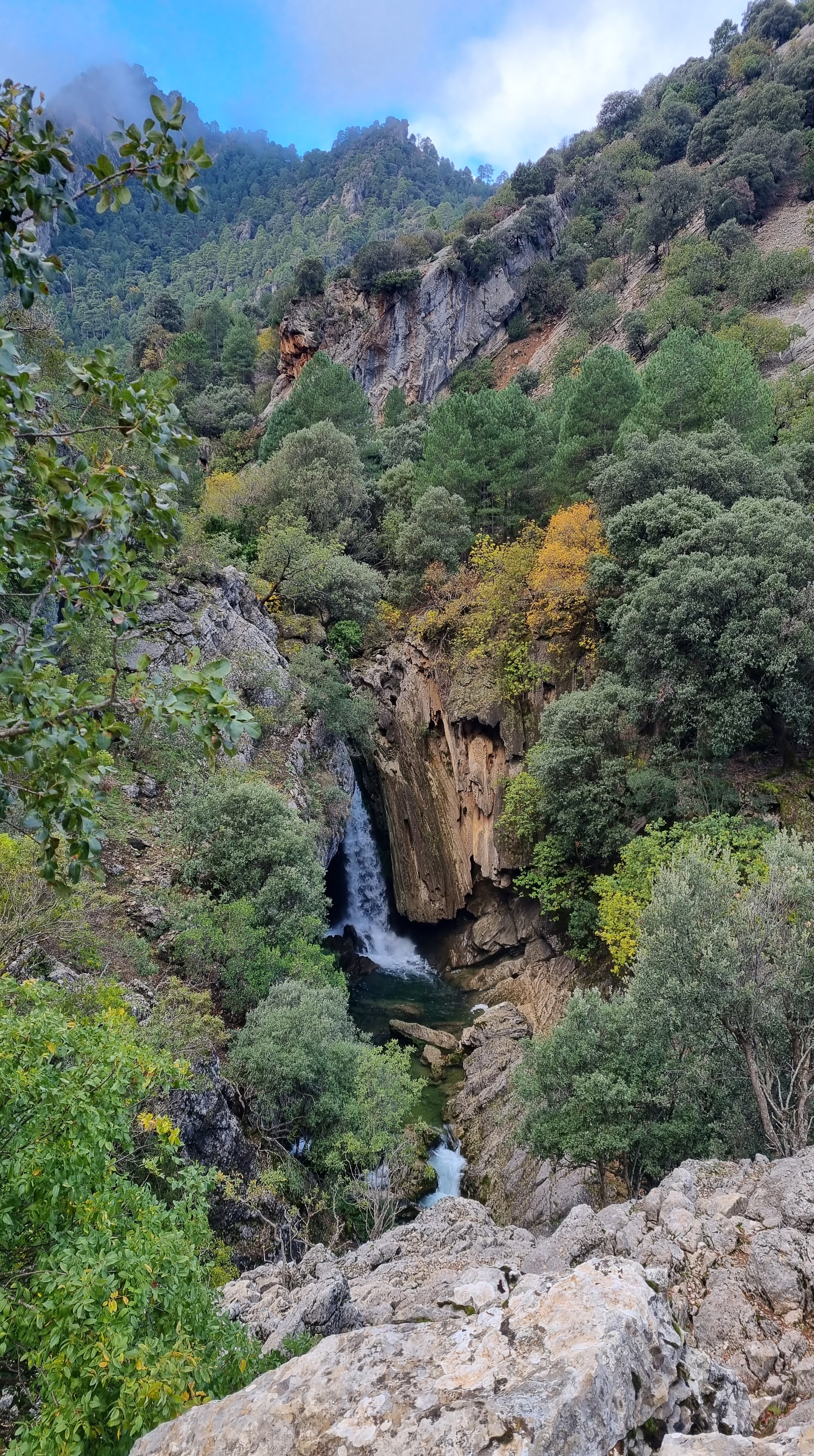
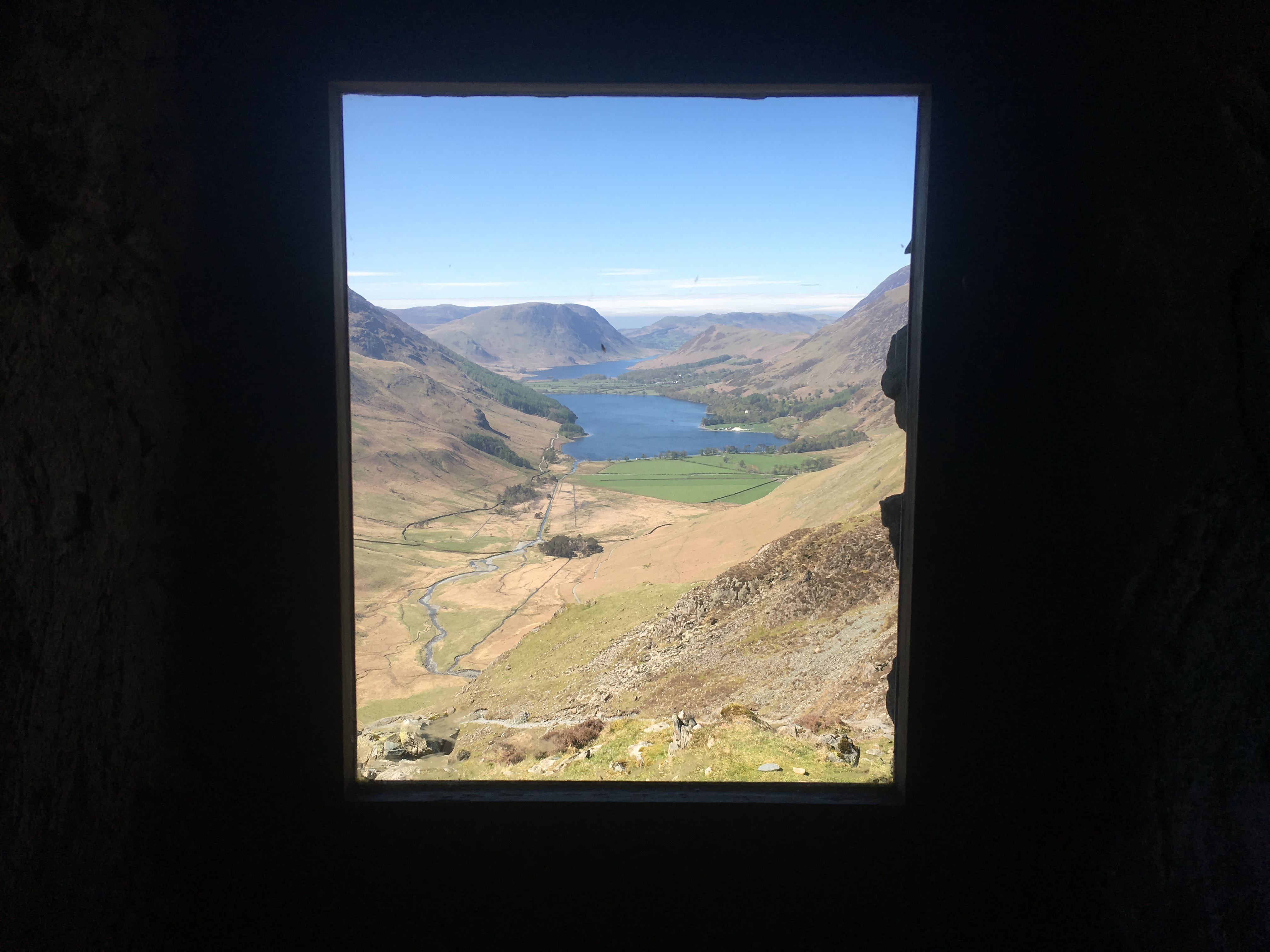
The whole route involves a lot of ascent, but this southern section was relentless, barely a single flat section – you were either in the granny ring grinding away, or hurtling down a stone-spitting descent. The cloud persisted while we we at 900 to 1200m, but we eventually dropped to 700m and arrived at the small medieval village of Tiscar early afternoon and ready for some lunch. Here we found a sun trap in a courtyard of an Abbey and under the lofty castle high above, the warming sun was a pleasure, as was the bread, tomato, cheese and bananas – it was good to eat the food and lighten our bike loads! We were not in a rush to leave and explored both the old castle high, high above and the canyon of hidden waterfalls far, far below. Both these features were well worth the time and effort, we had also started to notice that everything seemed so deserted, even on a Saturday, so few people about and no one on the actual route either – this would continue for the remainder of the trip.
Lunch in the sunny courtyard at Tiscar Abbey
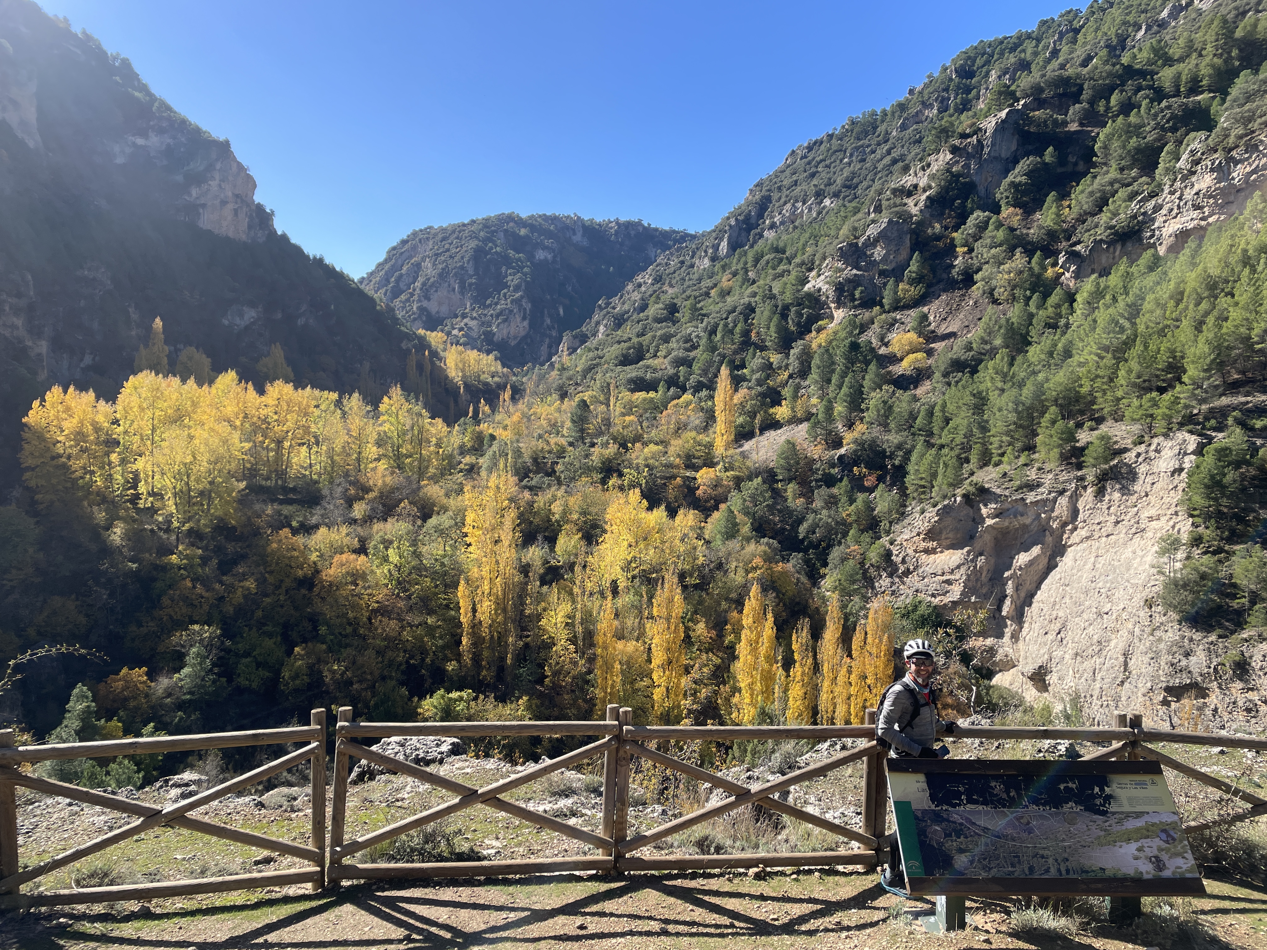
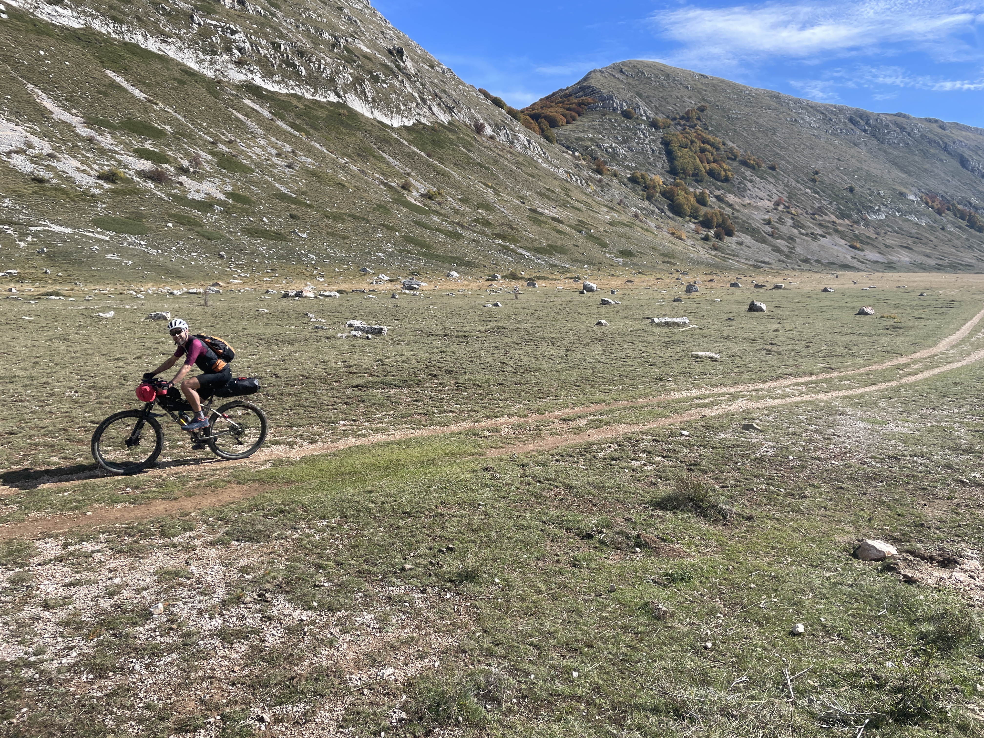
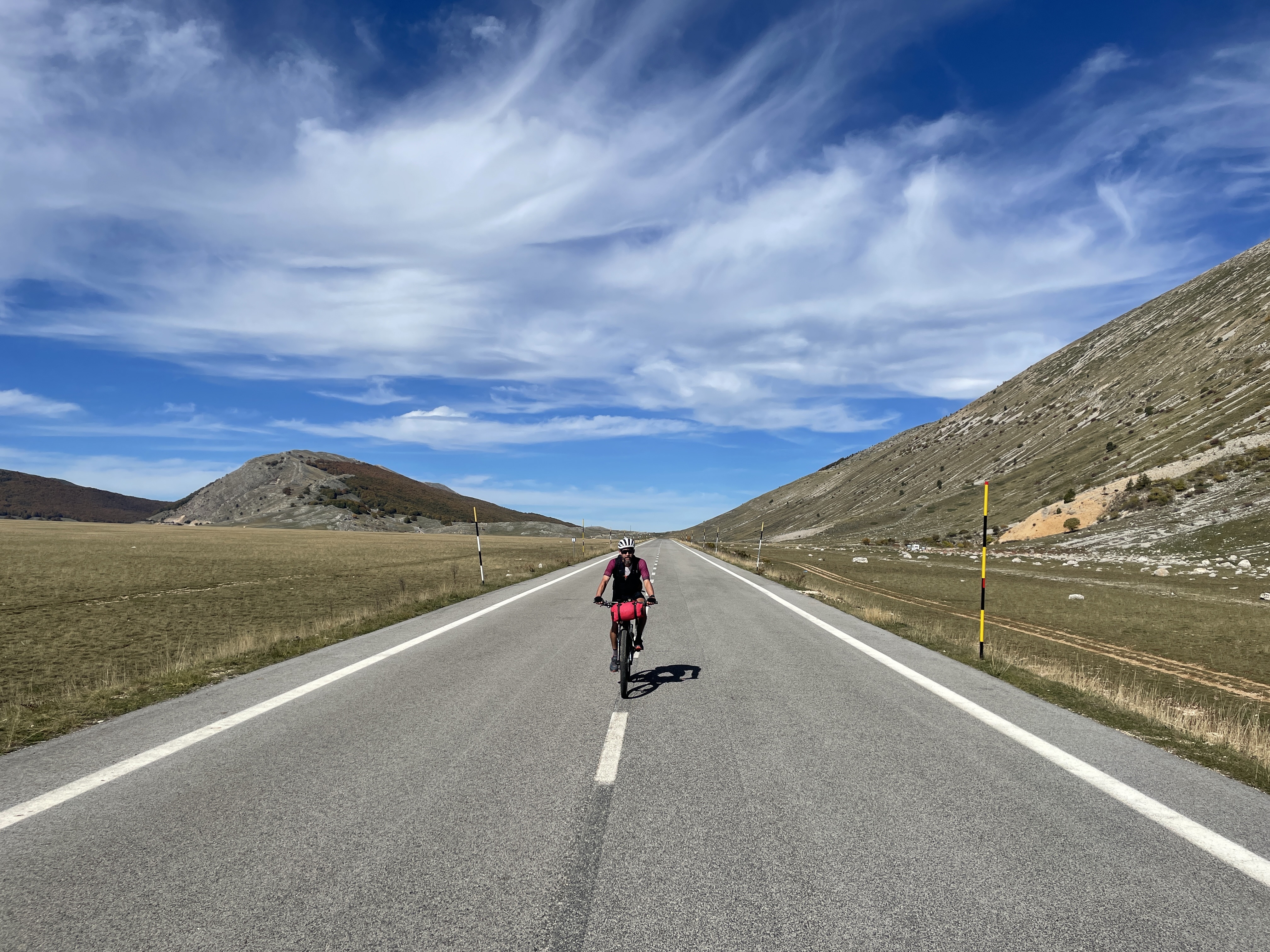
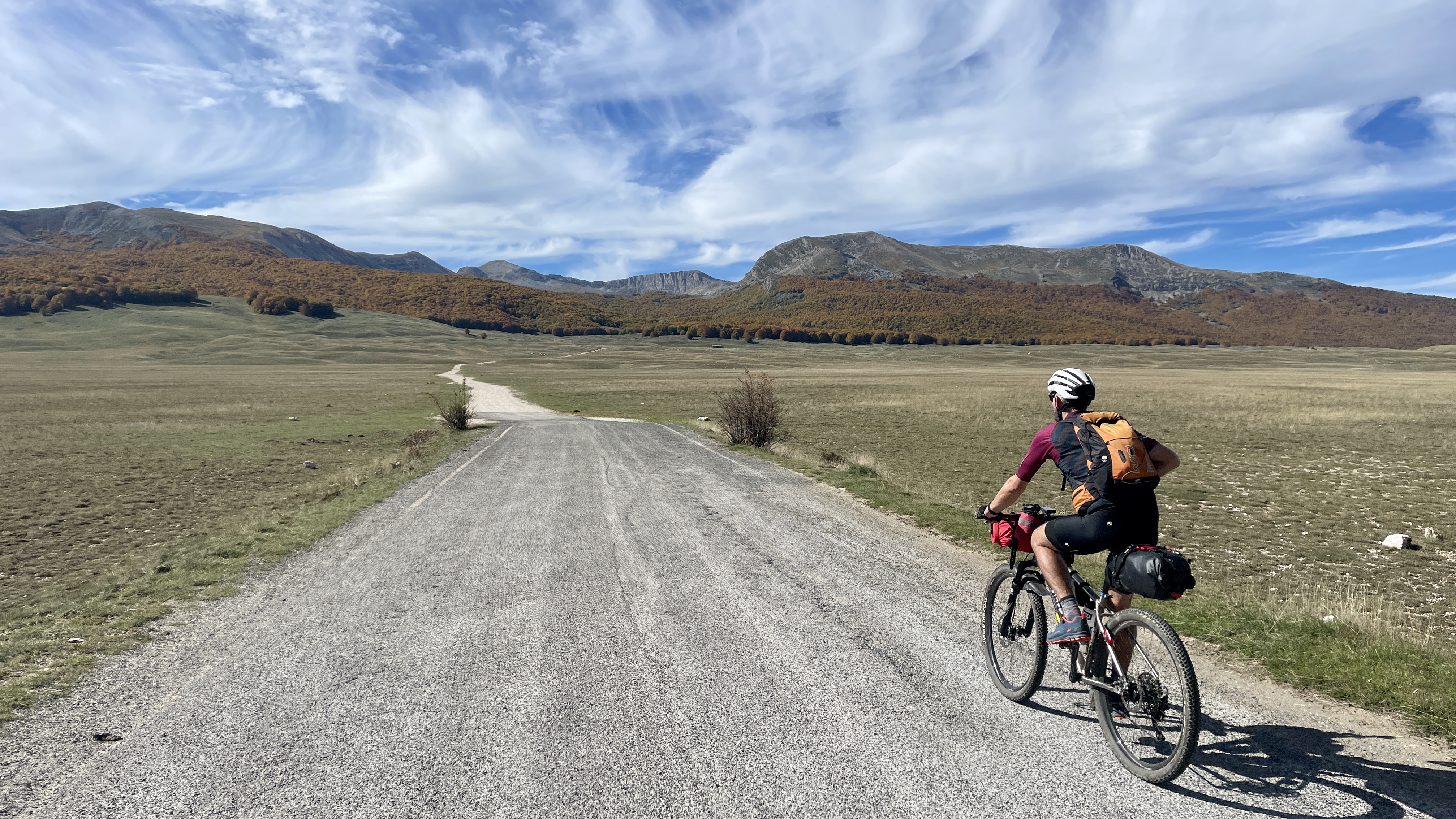
Time to get moving, always at the start of the journey, there is an anxiousness to make progress and not drop behind schedule. In the past we have both been ambitious and often bitten off more than we can chew, so this time we set our goals quite low – around 60-80km per day, that would allow 6 days or so to complete 430km – a typical days riding was from around 9am to 6 pm and it came light around 7:30 and dark around 6:30. It is worth explaining here that ‘our’ GR247 route has been ‘pimped’ somewhat, its usual length is 340km, however we have added in some additional sections – the Barrosa Canyon, the Segura Canyon and the Guadelentin Canyon – you’ll see as this journey unfolds that these are worthwhile and quite bike-able excursions (…well sort-of!).
Tiscar CastleCanyonTiscar Castle (Photo-credit Mark Wildsmith)(Photo-credit Mark Wildsmith)The AbbeyWaterfalls (and a goon!)
As per usual on a ride, the camping or refugios never come up when you need them, we had in mind a small refugio for the night, but it was still some distance away and our plan was to strike camp before darkness. After another endless section of climbs through some very wild terrain, we began the mother of all descents – steep and rocky. It was so good to descend as the temps warmed up, up on high it was single figures, moist and windy – we were keen for a comfortable night on day one…
We learnt that the name translated to ‘refugio with no windows or door’, suffice to say we chose to sleep in our tents that night and just used the refugio for the warm comforting fire, to cook in and then enjoy a beer – a hard earned beer. It had also start to rain, but the woodland felt cosy and warm. By morning our tents had dried and no sign of the evenings rain.
In order to get in sync with our proposed camp/refugio stops, we now had either a short day – 40km or a very long day -120km, doing the later was totally daft, so we came up with another plan to do an additional 25km excursion south, also allowing the opportunity to go to a cafe for coffee and breakfast.
Olives as far as the eye can see (photocredit Mark Wildsmith).
If you don’t find keep looking – the village we had headed to looked like it had 3-4 cafe/bars, it was a Sunday so we knew there may be some closures, but the three in the centre were all shut, everything was shut and they was even some ‘tumbleweed’ rolling down the street. We headed out in the other direction and found the forth, it looked shut, but actually was open, it had some people in it and did a super coffee and omelette sandwich, this got the morning off to a good start, also the weather was sunny. Back on the dirt tracks we pedalled through a few kms of olive plantations – probably the main crop farmed in Andalucia, they stretched as far as the eye could see – another great example of mono-cultures, introduced by humans and maximising every bit of land possible.
A splash of Autumnal colours – deep in the Bosques del Sur.
We were now heading north on the eastern leg of the route, being presented with ever changing landscapes, occasionally passing a deserted building or two.
These buildings were apparently cleared of their occupants in the 1950-60s to allow the area to be used for hunting, thankfully the hunting is now more limited, but it is sad to see these lost communities and you will pass many of these on the journey.
The Bosques del Sur offers a broad range of woodlands and some of it is akin to Scotland, also due to the high rainfall that this area receives it is quite vegetated and damp looking – we even found Apple trees, not to mention a good range of fungi.
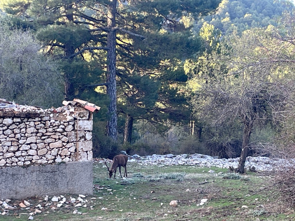
Regugio Fuete AceroLocal Deer
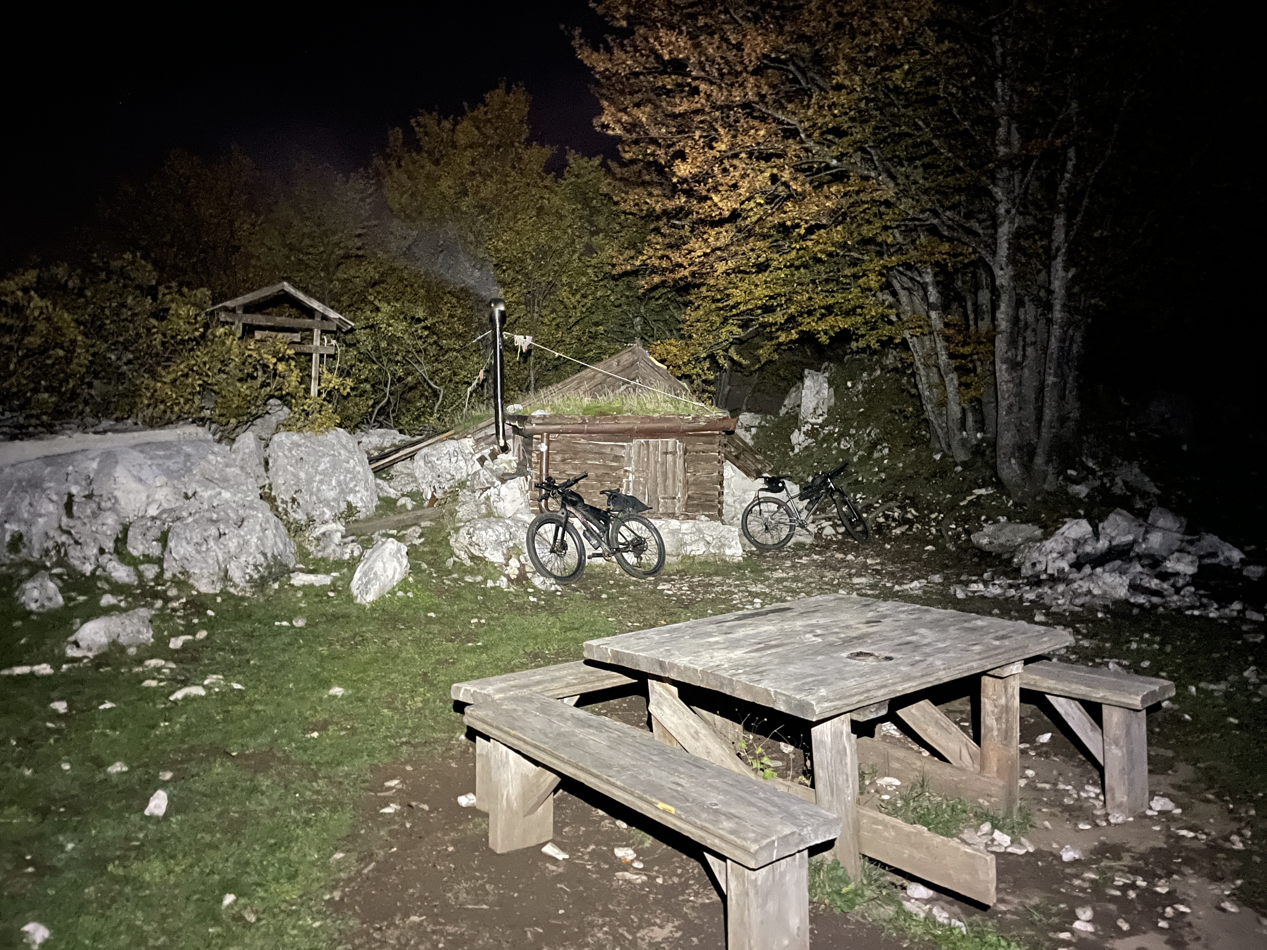
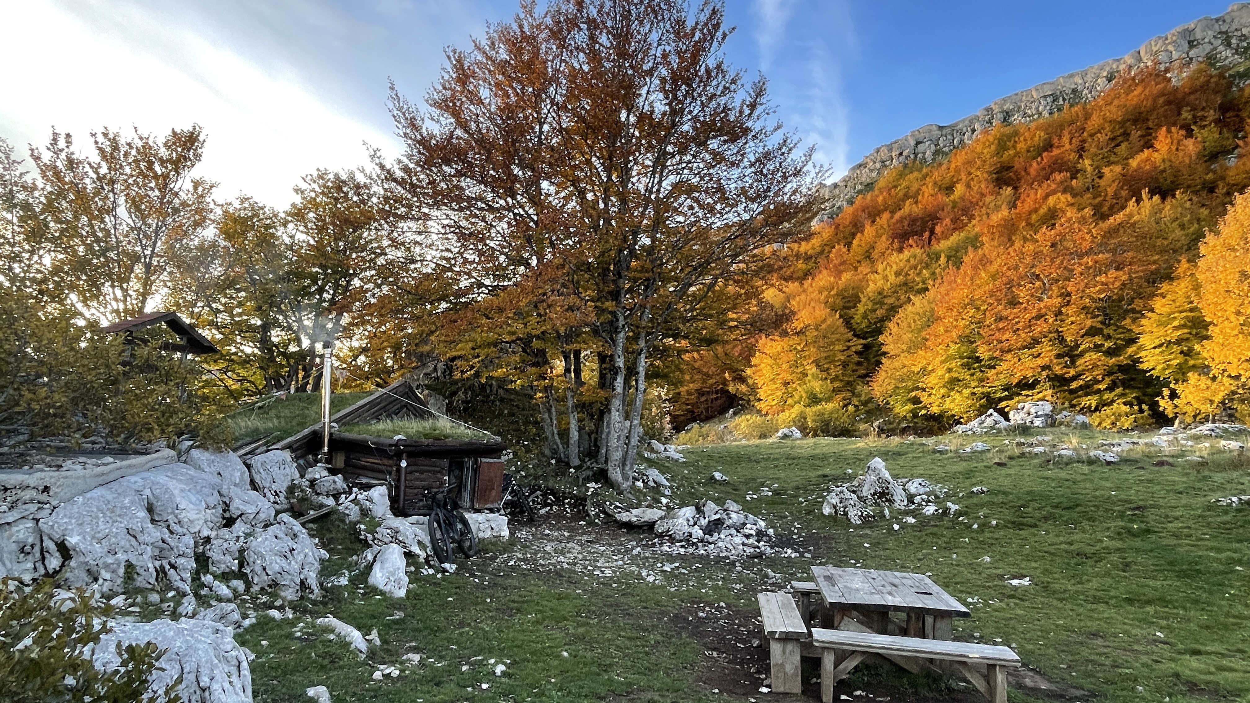
Regugio Fuete Acero was the first of the official park refugios that we stayed in. All the refugios are pretty basic, but functional and always clean, designed to sleep up to 10 persons, but 6 comfortably. We would use a number of this on this tour, out of the four we stopped in two had other guests staying, it made for a good evening here the tales of others travels and escapades. This particular stop we met a Slovakian couple who were bike-packing with their doggos – in fact the doggos had done more bike-packing than any average bike-packer having travelled from Alaska to Patagonia – Incredible! As well as the lovely social, we were buzzing about the day ahead, as we had our first deviation which was the mighty Barrosa Canyon.
The pictures will now tell the story of the next part…
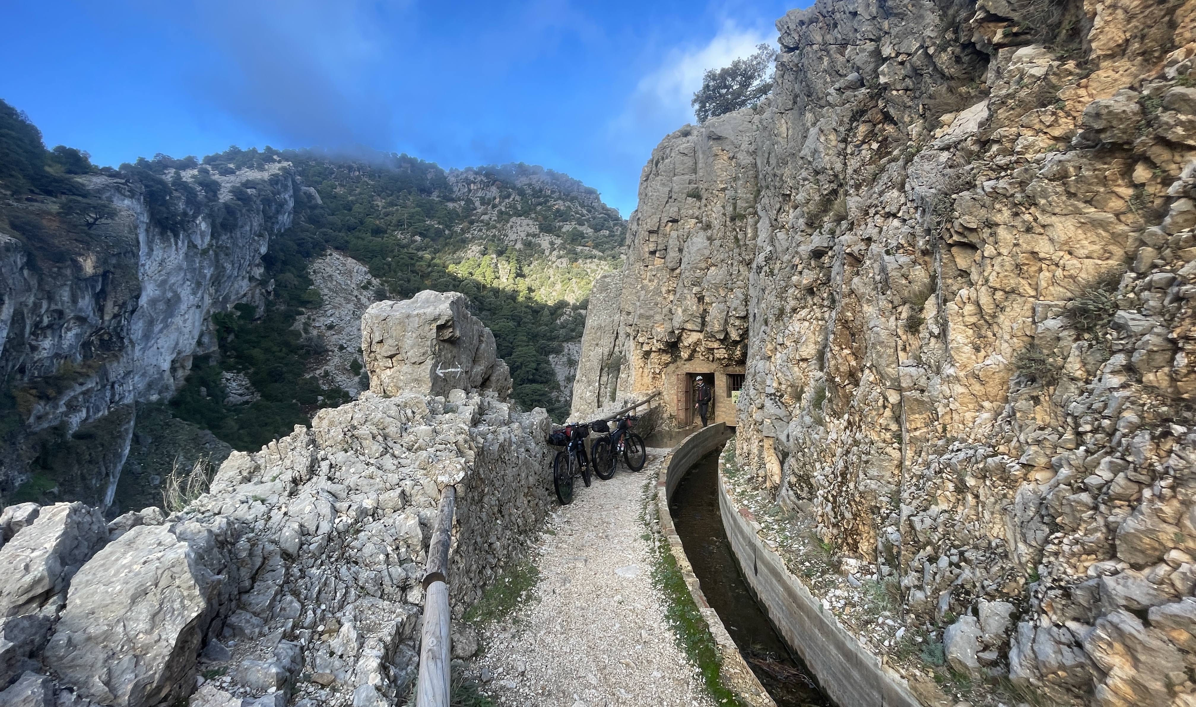
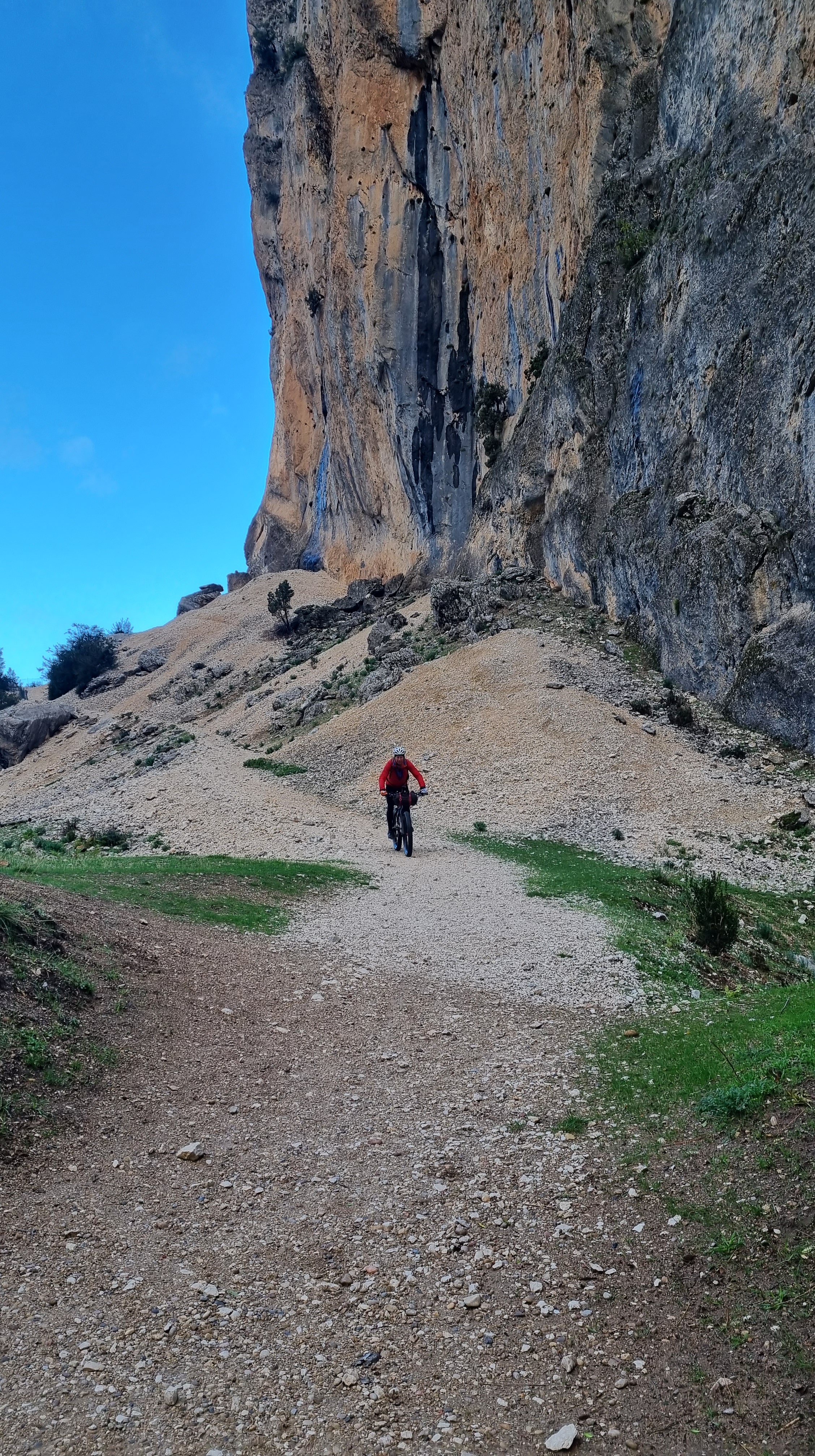
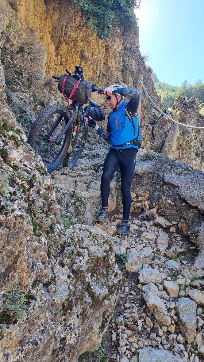
Laguna di Validezores – Located at the top of the Arroya BarrosaThe portal to the canyon – some funky tunnels that you ride through, stick your wheels in the channel and off you go!500m later and out you pop!This is were the ridding gets interesting..!Photocredit Mark WildsmithA tip for this section is to be on it early, it can get busy particularly at weekends.Several spectacular waterfalls.Photocredit Mark WildsmithNear the end of the ‘hard stuff’ – survived it!
The Barrosa has to be one of my all time favourite canyons, so pretty, interesting – and rideable! We had dropped about 900m from the point of entry, whilst we had a bit of flat (ish) to come we would be soon having to pay back all this fun with a 1200m plus climb to get us back to the plateau, however next priority was a cafe for breakfast and a shop to restock our supplies – the village of Coto would supply this …in theory..!
The reality was not to be – it was a Monday and the three cafe/bars were all closed, however there was a shop (like in almost all the villages) and it was open – so we blitzed it for cakes, nuts and other supplies.
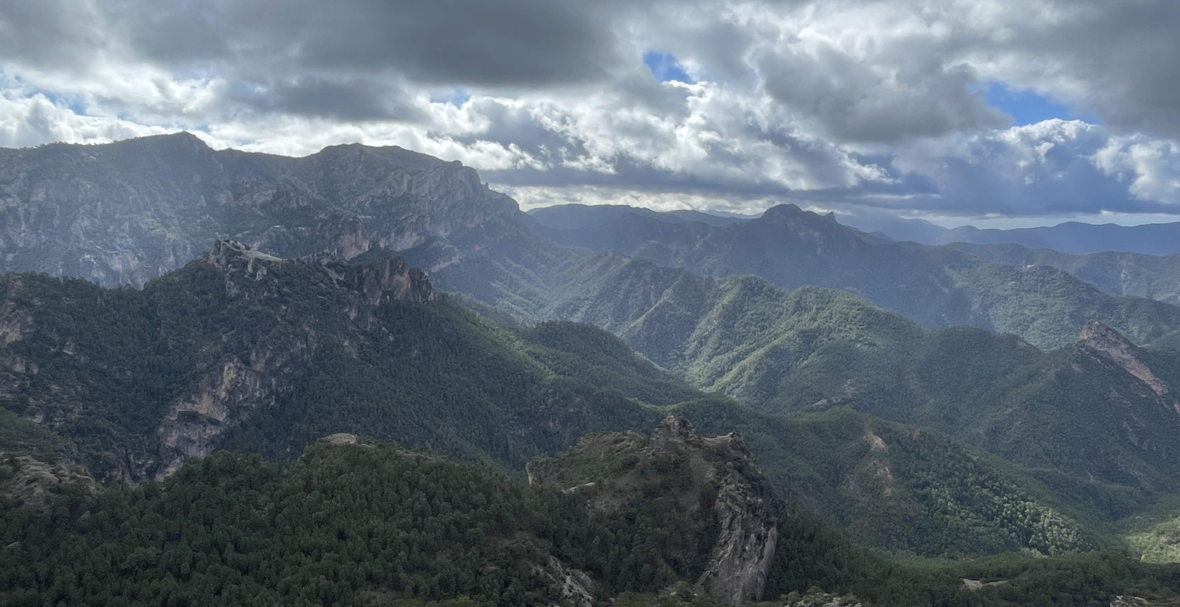
A Panorama of the Sierra CazorlaThe Ghost Village of Los Centenares
The climb back up took most of the afternoon to complete, however this included a detour to the village pictured – one building out of the whole village remains habitable (although no one present on this occasion). The lunch stop here was quiet and cool and it felt like there was a ‘presence’, seeing all these old homes, once a thriving, but basic community …and not really all that long ago.
We filled our bottles and launched into a short section of Hike-a-Bike (this was a short-cut on the map, reality was it probably took us a while longer, but it was a hoot). The dirt road had given way to single track heaven!
Dry, dusty paths.Rocky narrow climbs.At the top, batteries drained and needing a rapid recharge!The sun shines, but we are at 1800m and there is a chill in the air- looking West – to the mountains of the return leg (Photocredit Mark Wildsmith).Plateau presented some easy miles. We had not past a sole since leaving the village of Coto.
The freedom that bike-packing affords you – Cruisin’ down the open trails, carefree and content. These easier sections allows you to explore the views and yet another interesting landscape that we find ourselves in.
Rambla Seca with Gilles and Mark and a frosty start!
We met a crazy French man, he was on his way from his home in Lyon to Senegal – a real character, a free spirit, a font of all biking knowledge and a jolly good Monsieur to spend a night in the hut with – we could have done with some more beers or a bottle of wine. Gilles rated Spain very highly for the bike-packing traveller and like the others we met had some fascinating and inspiring travel stories.
Our next section would be 40km across the high plateau to the village of Pontones for a late breakfast.
A crisp and clear morning – basically we had all our kit on!This was one of ‘those’ mornings. The track winds its way into the far distance (Photocredit Mark Wildsmith)This would have also made a good stop – ironically the route yesterday took us within 3km of it!When Vultures surround you try not to die.Some ‘sketchy’ slabs on the way into Pontones.
The village of Pontones, marks the end of the Sierra Cazorla and the start of the Sierra Segura. There is a resurgence ‘eye’ here, but sadly it was dry, and given the recent rain it was surprising not to see the blue water – like a tear. Our excitement was soon restored and instead we had a huge slab to cycle over. More importantly Pontones would provide breakfast, coffee and ongoing supplies.
And yet another canyon we find ourselves in.
Big drop to the right! (Photocredit Mark Wildsmith)
Entering the Sierra Segura, the mountains had a slightly different feel, perhaps more deeply forested and not quite so craggy and dramatic. From a riding perspective, we noticed we were back on the narrow ‘Camino’ paths and these add to the fun and interest. As you pass the most northerly refugio – Era del Fustal, which is on the roadside you head into dark forest and start to begin a descending journey into the town of Siles, this is the traditional starting point of the GR247. We choose a BnB here as we fancied a clean up and comfy sleep as well as a nice meal. We also had a mechanical to sort – a broken rear spoke on Mark’s bike, fortunately due to the clever hub design, the cassette pulls off – no tools, magic!.
Siles – the official start for the GR247 and the northern most point on the route.
While we had a lovely BnB, Siles didn’t deliver much in the way of bars or eating establishments, however it was a Tuesday and that seems to be one of ‘closed’ days along with Mondays and Wednesdays! …at least off season. On the plus side we found another of those well stocked tiny supermarkets and stocked up with more supplies – our next destination was Segura.
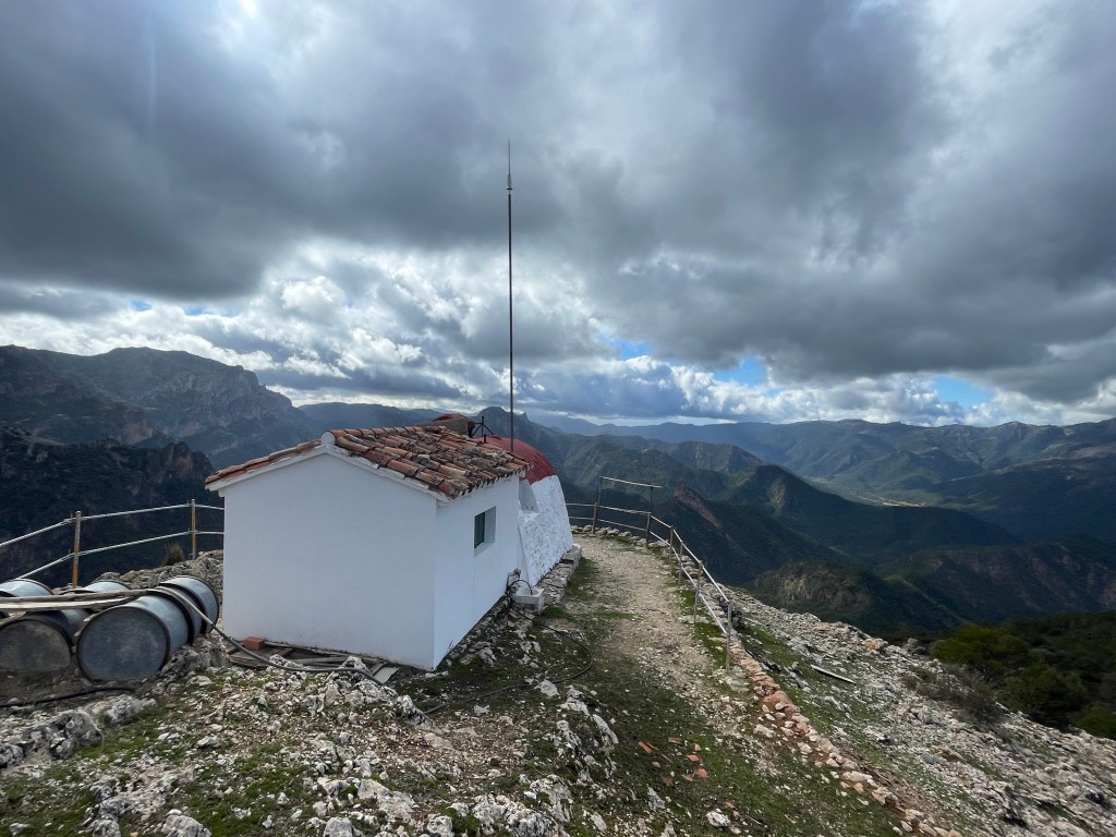
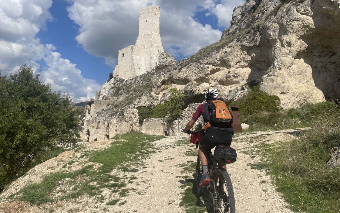
Segura Castle – Well worth the short but steep detour (Photocredit Mark Wildsmith)
I should mention that the scenery from Siles, while pleasant and forested, is not so jaw-dropping like the earlier ride sections. However… the quality of the single track trails compensate, some impeccable and engaging riding as your contour round the terrain on the old camino’s.
The village of Segura soon meets the eye, sitting way high-up, crowned by a big block of a castle; the hill up to it is a bit of a killer, if your legs are strong ‘n’ fresh then its mostly rideable, however if your feeling the fatigue, it’s a push (but with a view). Segura does not offer much in the way of supplies, or cafes (at least not in November), but the castle was open from 16:00 and we spent a good hour exploring it – all to ourselves. As mentioned earlier everywhere round here was so quiet.
Another day and another sweet little refugio! (El Campillo)
Post the Segura Castle our planned accommodation (above) was about 20km, it should have been around 1:30hr, but due to the descent and then an even bigger ascent, coupled with technical trial it was more like 2:30hr, needless to say we arrived well after dark, but hey it was good to see the starry sky! Like all the others, this refugio was clean and functional, also at 1500m it afforded some warmth, though it was only 9-10 deg inside, so still pretty coolish.
We awoke to not such a nice a nice day, not rainy, but low cloud and dull – basically it would be a good Yorkshire day! Our destination was Hornos, at about 28km away it would make a good breakfast stop and should be quick blast down the hill due to the height differential of 700m. We left our refugio, did a short section on road and was then buzzing down another ‘stone-spitting’ single track, with a view of the Tranco Reservoir in the distance – see pics below…
Tranco Reservoir looking seriously depleted.Tranco Barrage – it wasn’t holding back much water on that particular visit.Área recreativa Charco del Aceite
After leaving the old village of Hornos, the route headed around the abandoned shore line, the waters edge being a few hundred metres away, due to the low water level. It was a pleasant change to ride along a meandering track with little in the way of inclines, the scenery was a mix of old groves and forest, still – with no one around, we were however following some quite fresh bike tracks and wondered if it was the Slovakian couple with dogs that we had met a few days earlier..?
Lunch was taken at a lovely picnic site, again we were the ones there – not a single car or person. This location was the lowest section of the whole route at about 550m, we knew therefore a big climb was to come – about 900m and then another of 400-500m – so a tough shift lay ahead!
This section was bizarrely steep – probably 35% …into the clouds and damp.
We had not expected this section to be so brutal (and I had ridden it before, and could not recall the difficulties), the weather also added to the toughness and we realised we had grossly underestimated this section, in fact we had under-estimated the whole day, we knew it would be another late arrival at the planned refugio – to be our last night on the trail. That said – we were not doing particularly long days in the saddle on this tour.
Refugio libre de la Tinada de Serval (Photocredit Mark Wildsmith)Tree Sap – Made great energy gel!(Photocredit Mark Wildsmith)(Photocredit Mark Wildsmith)Trying to get a good coffee fix in the morning was an important part of the business!
The last night in this refugio was a special one, rather than the damp cloud it would have been nice to have a starry sky to enjoy, but a roaring fire made up for it instead, this was one of the few refugios that had fire places. We were expecting to find other folk here, but alas it was just ourselves and given how nice this place was, it was a surprise.
On the home run – as we start the 10km descent into IruelaFlitting between the cliffs and clouds (Photocredit Mark Wildsmith)
We had around 40km to complete the circuit and arrive back in Iruela, we awoke to low cloud, it was a shame as we missed out on one of the finest Andalucian vistas …maybe we come back another year! This next section also afforded some of the finest riding, however it was now tinged with mud instead of dust. Up til now we had stayed pretty clean for the entire journey, ironic that we get a full splatting in the final 20-30km – but its all part of the fun!
Iruela Castle (Photocredit Mark Wildsmith)
At the end of any hard multi-day ride, the memories of the journey remain a bit fragmented, it is usually days/weeks/months after that things start to fall into place. I think we were both ready to finish and enjoy some of the luxuries of ‘normal life’ again. This ride excelled in pre and post ride chill out options, Cazorla has a lot to offer in town and nearby. For the final day we explore the old city of Granada, and that in itself is a city that yielded so much and would be a worthy place to stop for a night or two and soak up the lively buzz and energy, it also looked like ‘foodie’ heaven.
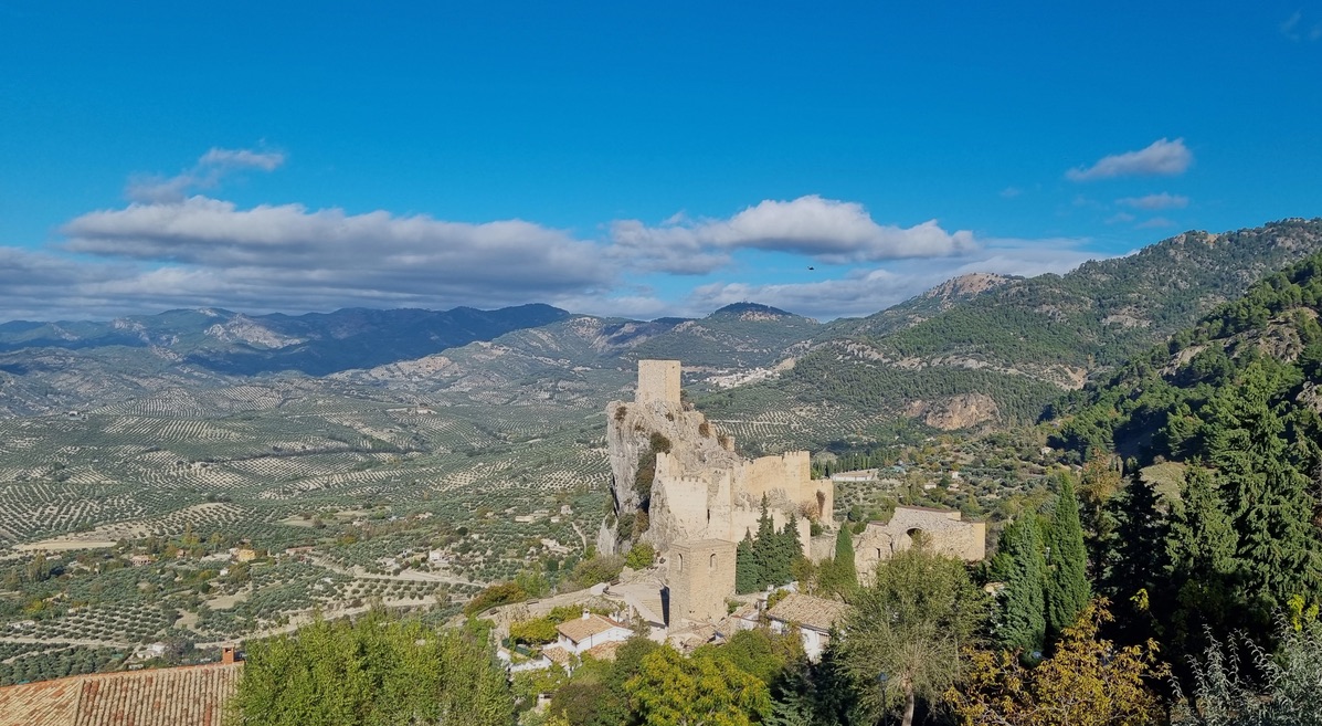
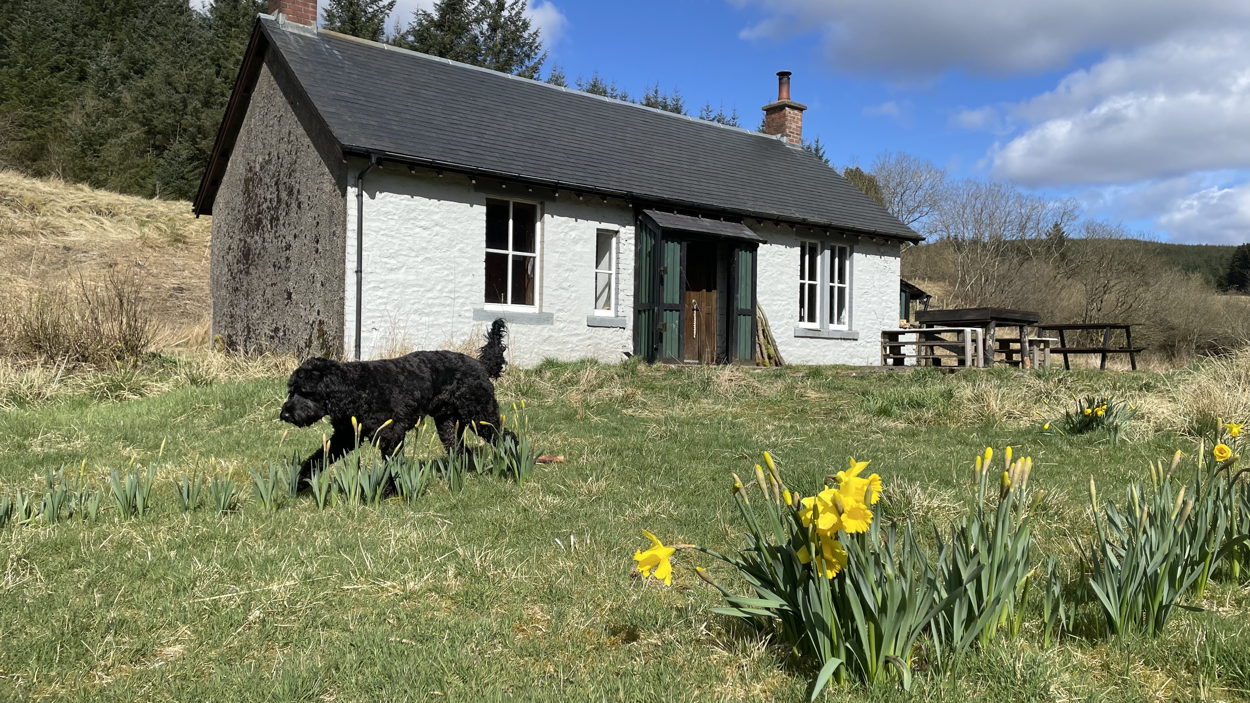
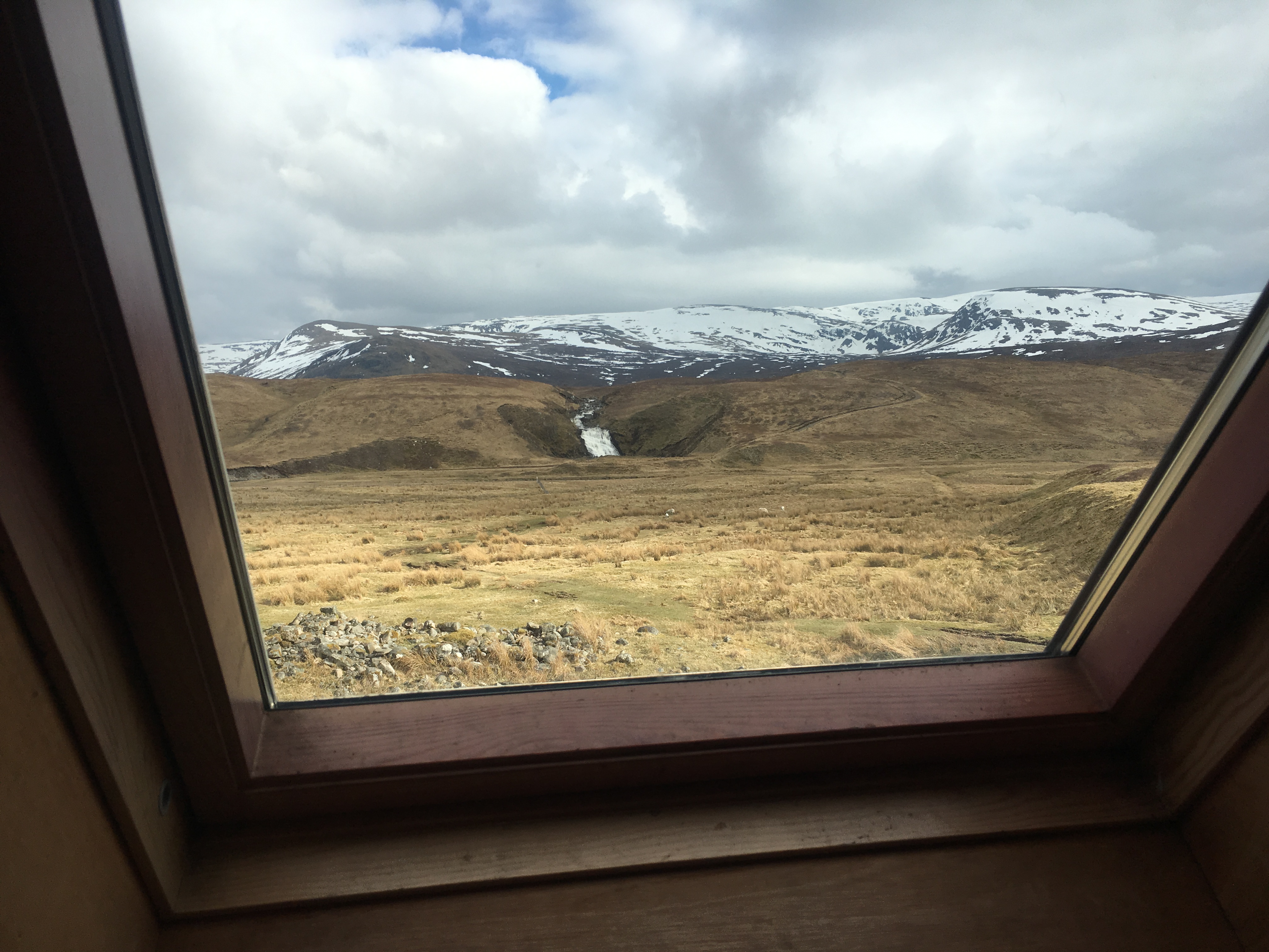
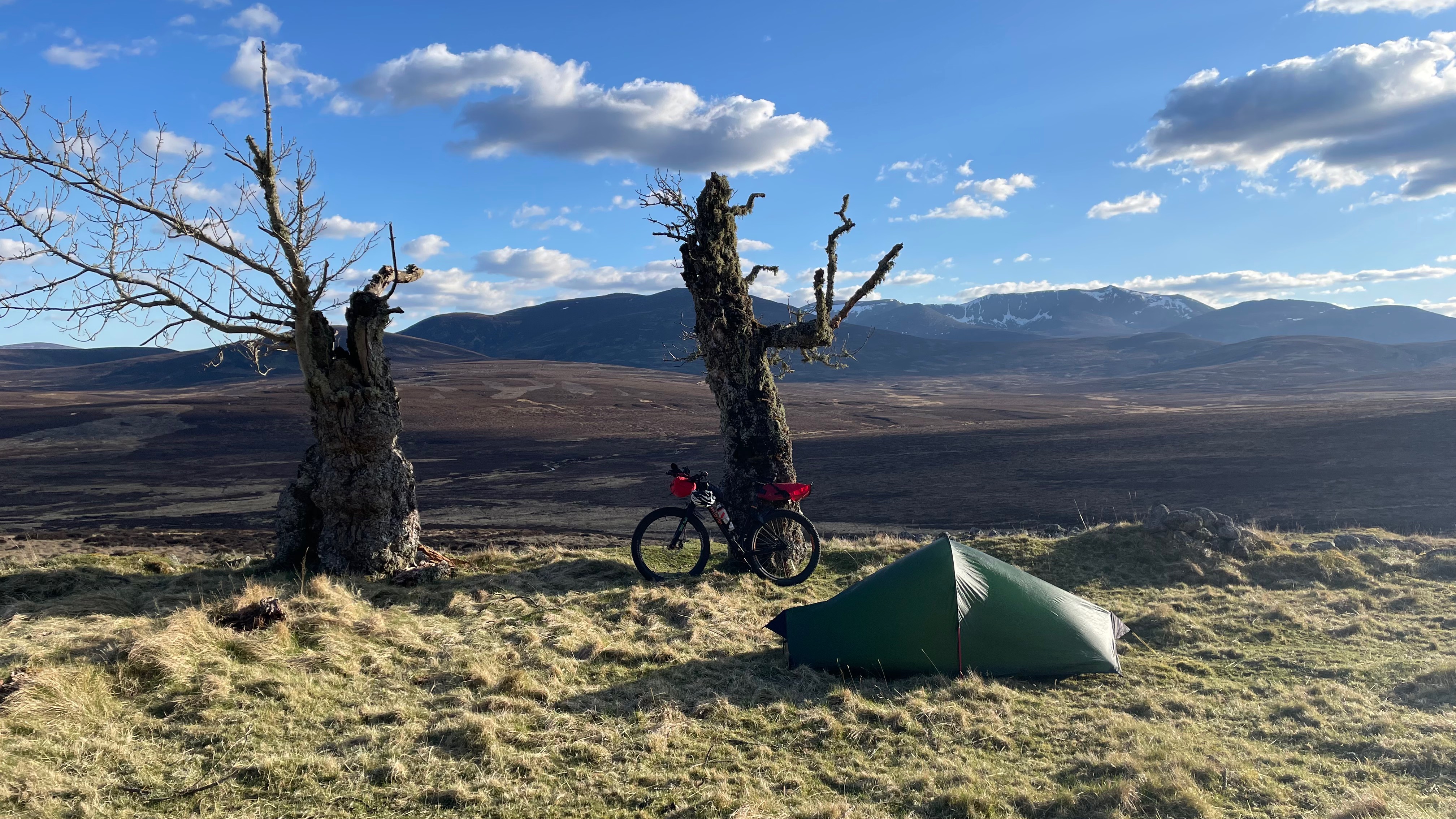
There are still many parts of Scotland that I have not yet passed through and visited by bike, and one of them was Morayshire. Coming out the back of yet another gruellingly grim UK winter, I was keen to strike track on the bike. As well as the weather, other distractions in life have prevented me from getting out as much as I’d have really liked too, things like work getting busier, mojo dropping off, little doggo that likes many frequent walks …the list could go on – but really I just need to ‘pull my finger out’ and get on with stuff!
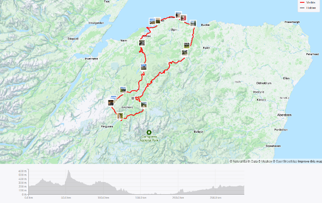
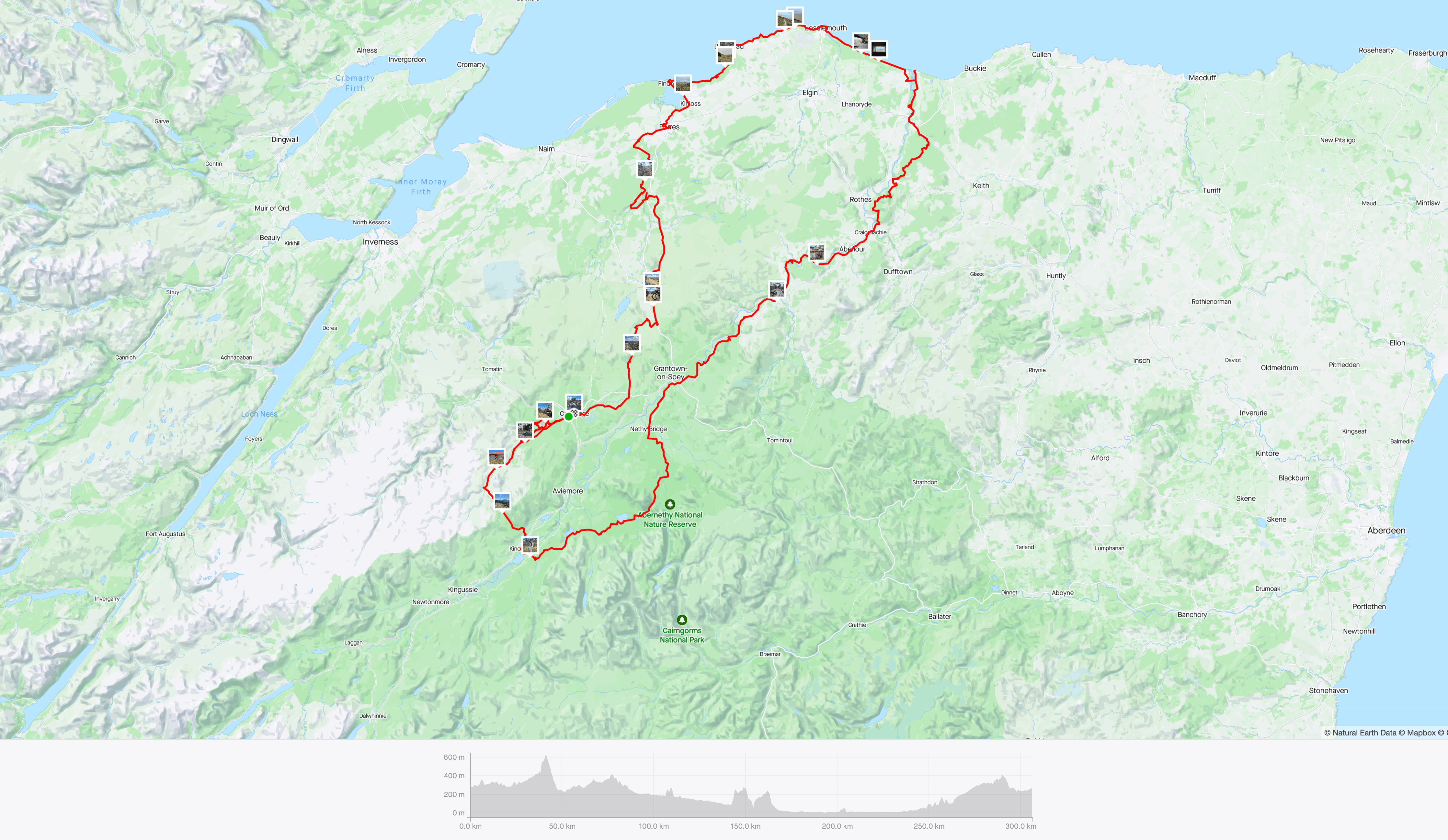
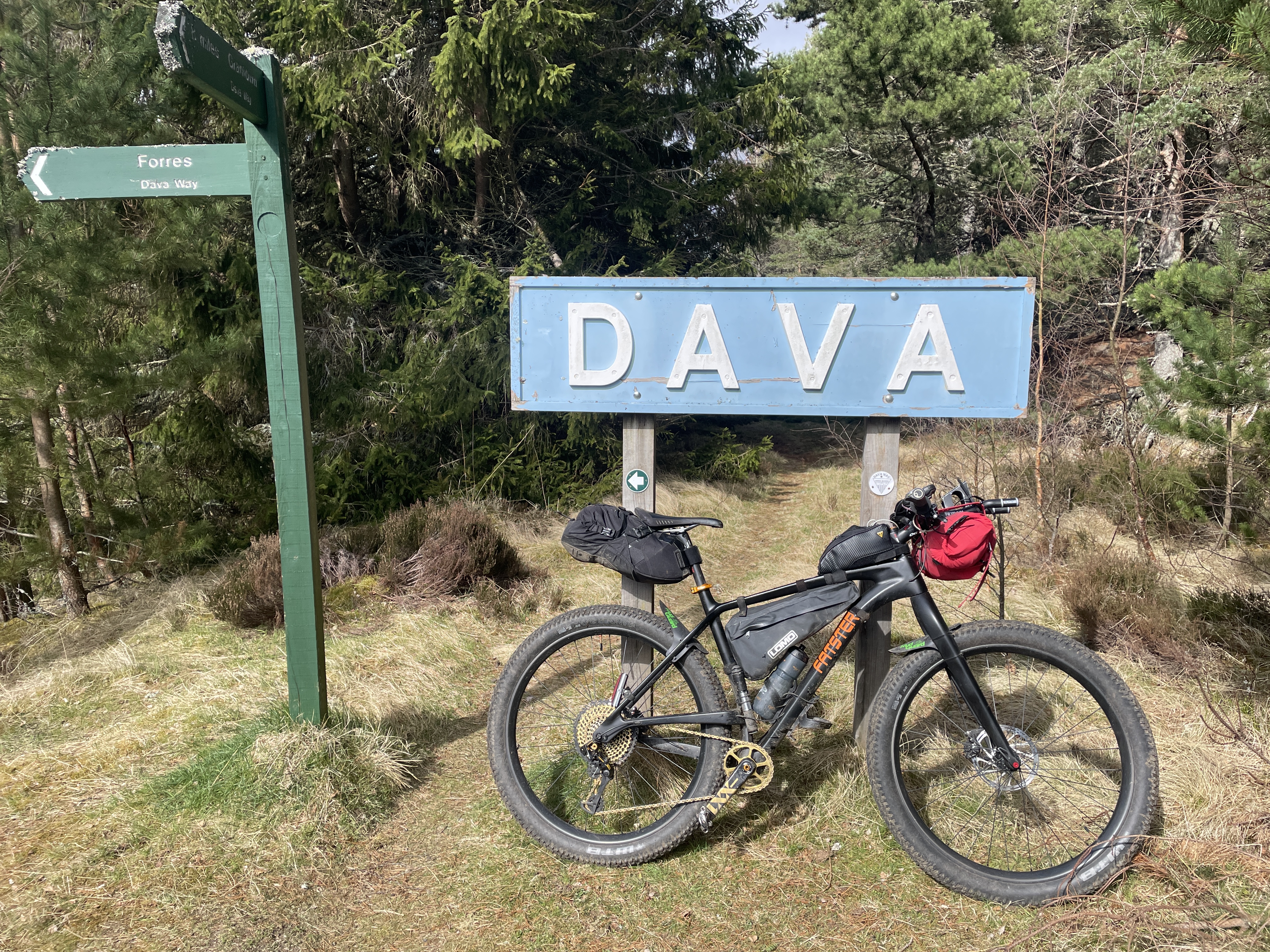
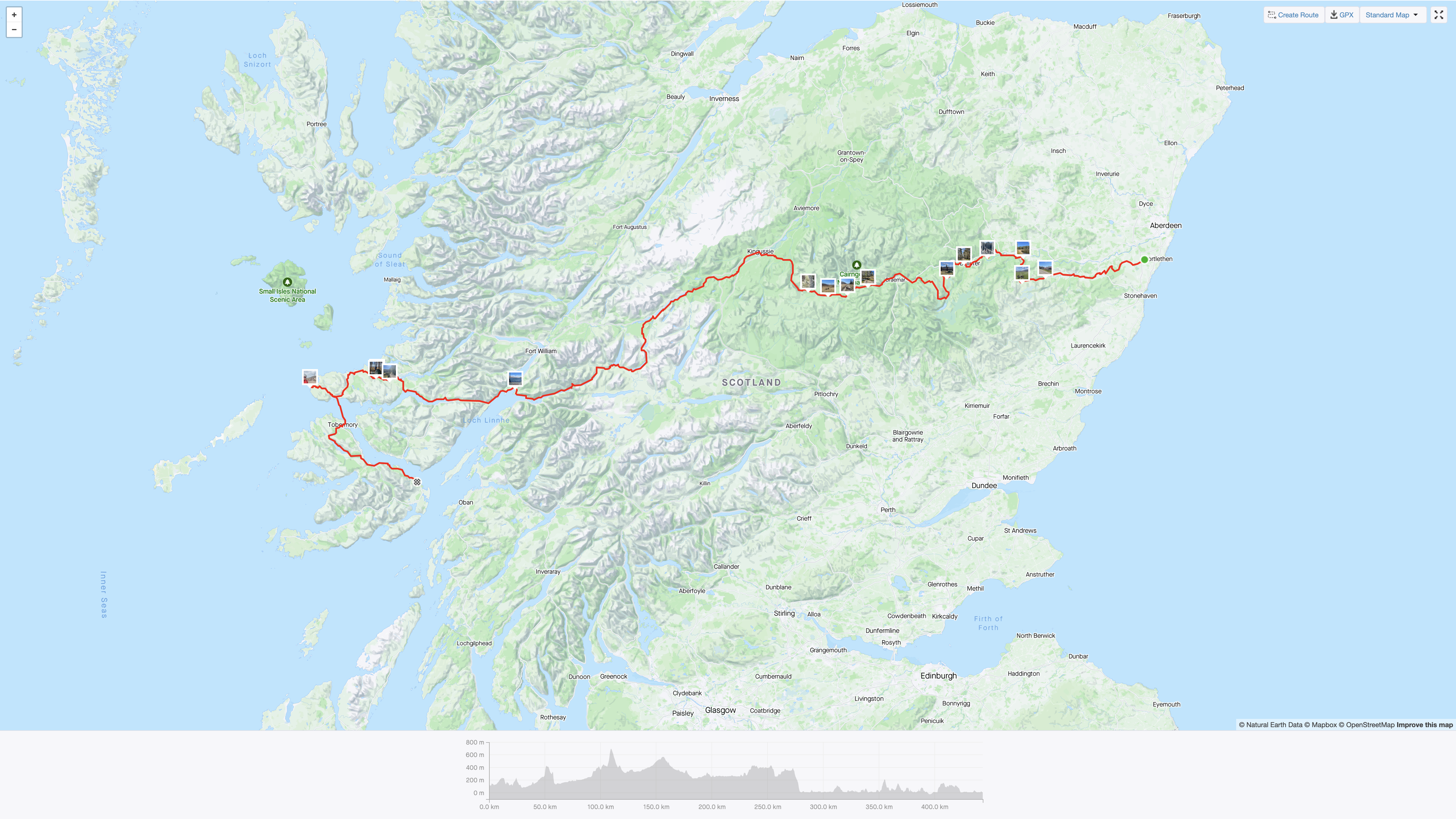
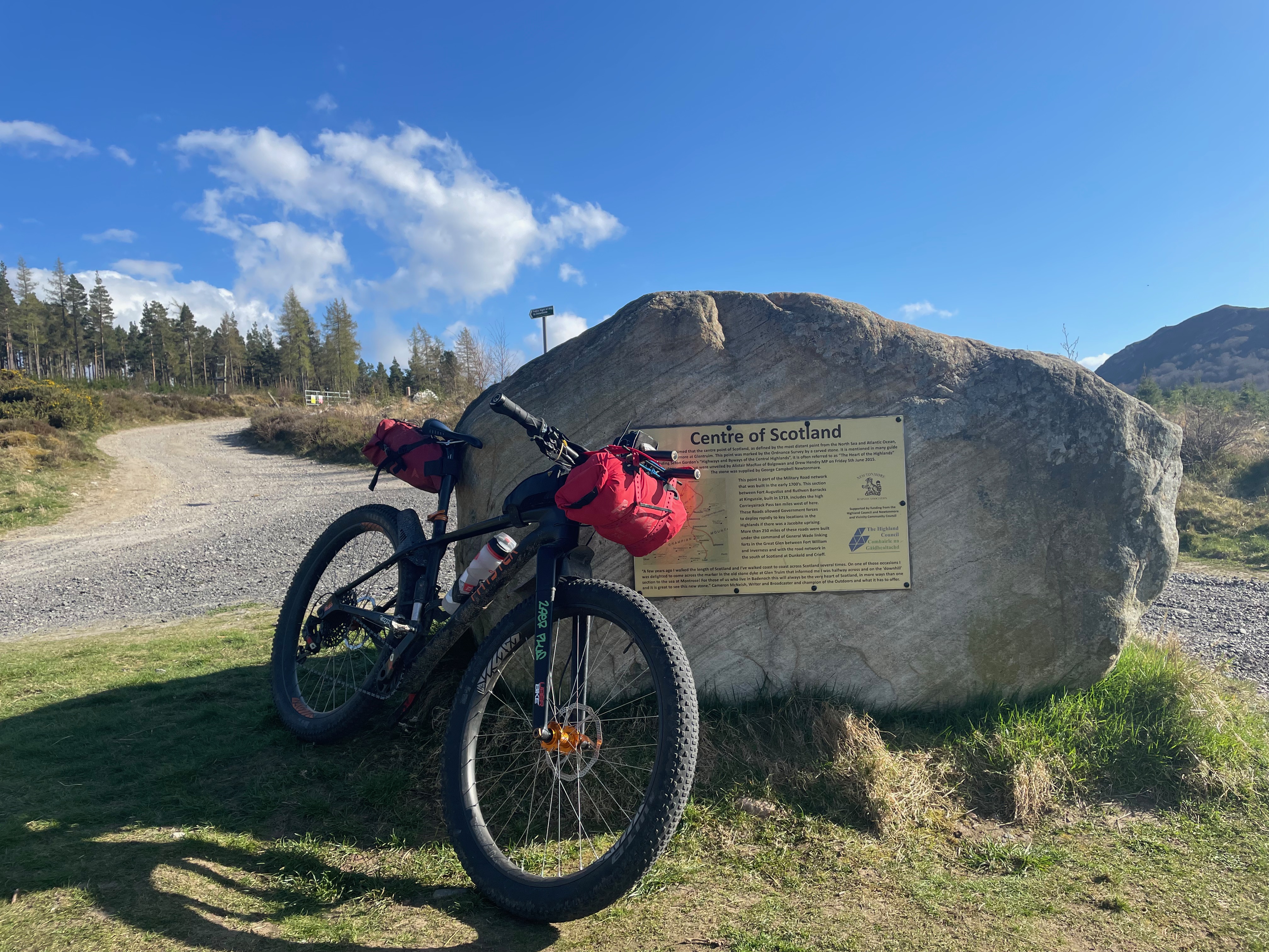
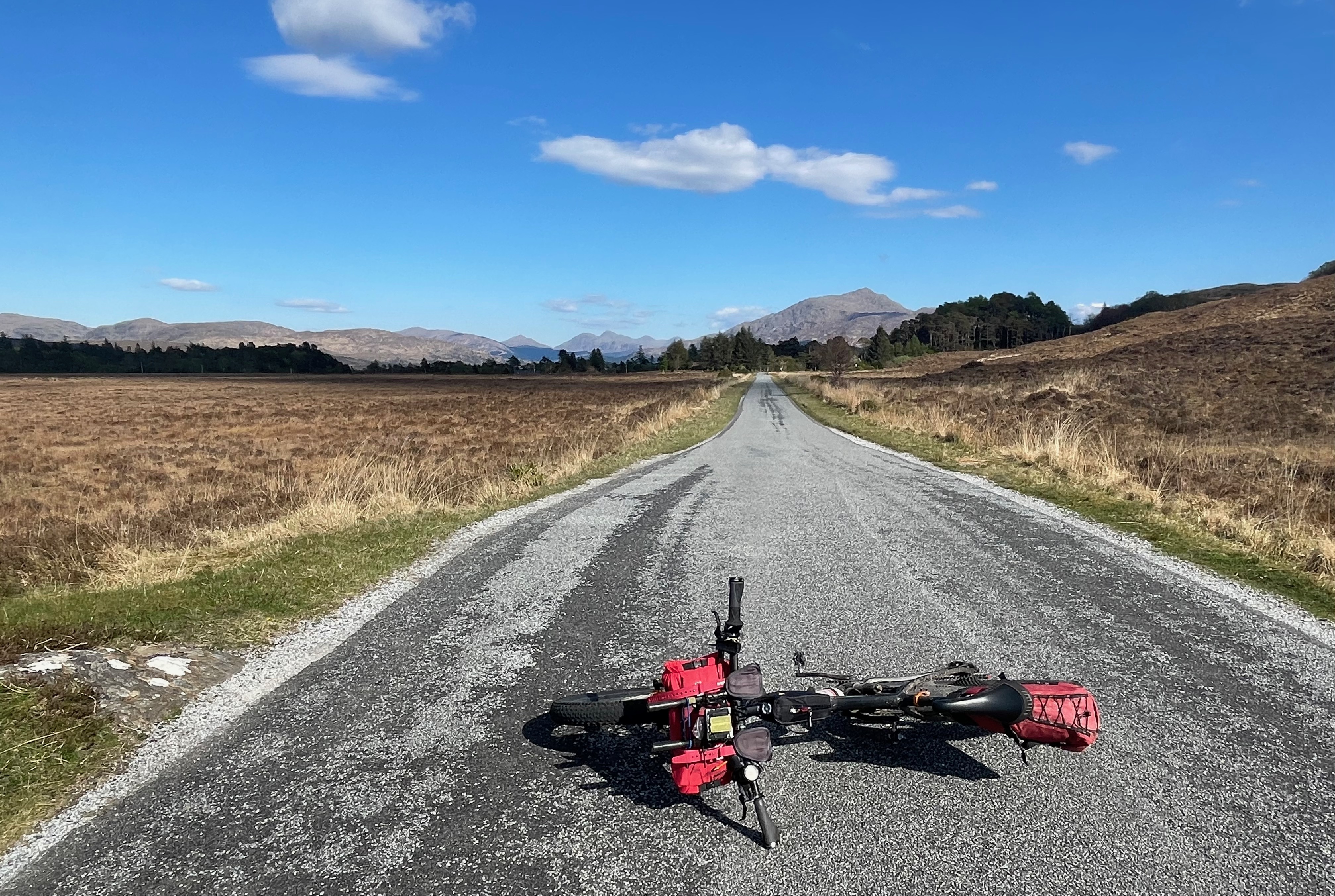
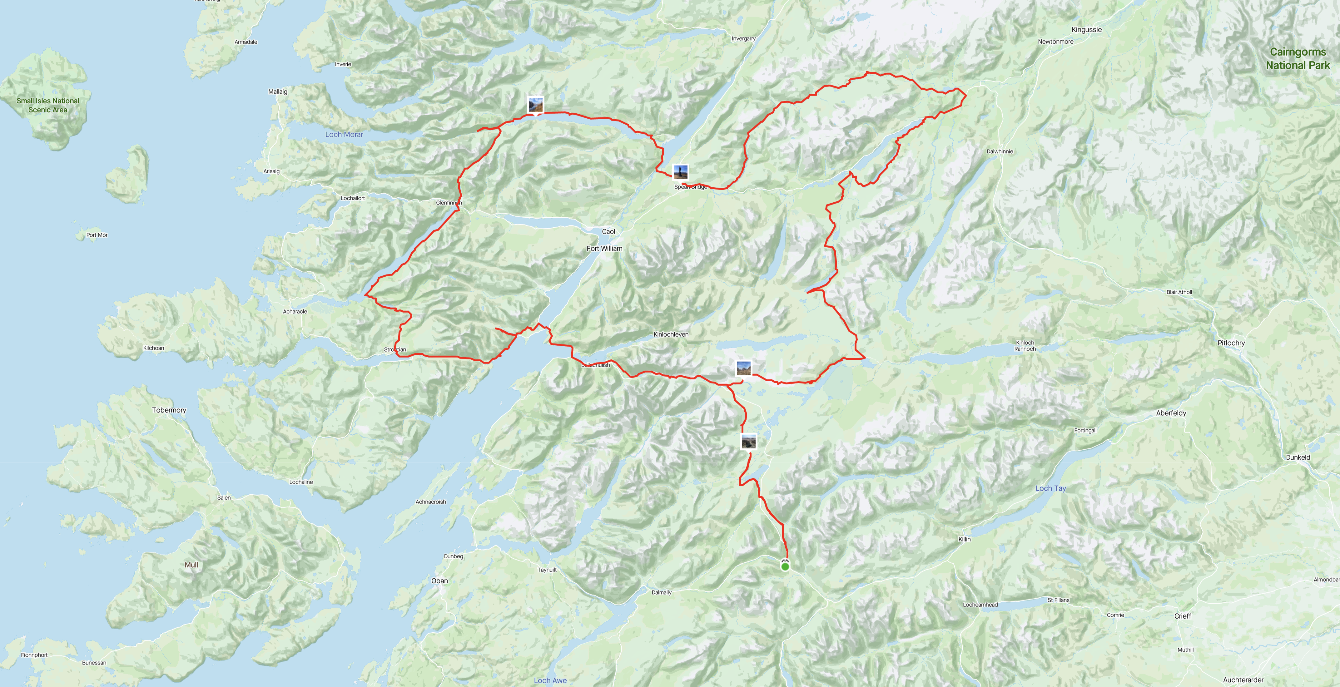
The route for this trip was part of a much bigger route that I had put together during the dark evenings of winter, my original intention had been to include some of the Great Glen to Spean Bridge and then back up Glen Roy and connect to the Spey Way. However I only had 3 1/2 days and I did not want to go to mad on the daily milage (or Km’s – as I now try to work metric), as it was early April, the daylight was only just past halfway and the temps still cool, hence a 100km/day is a reasonable amount, allowing for stops and camping chillout – which I now enjoy (and need!). The route is pictured above and it started in the village of Carrbridge, just 10km north of the bustling Aviemore, both these places are on the train line.
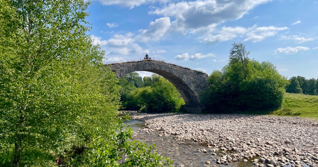
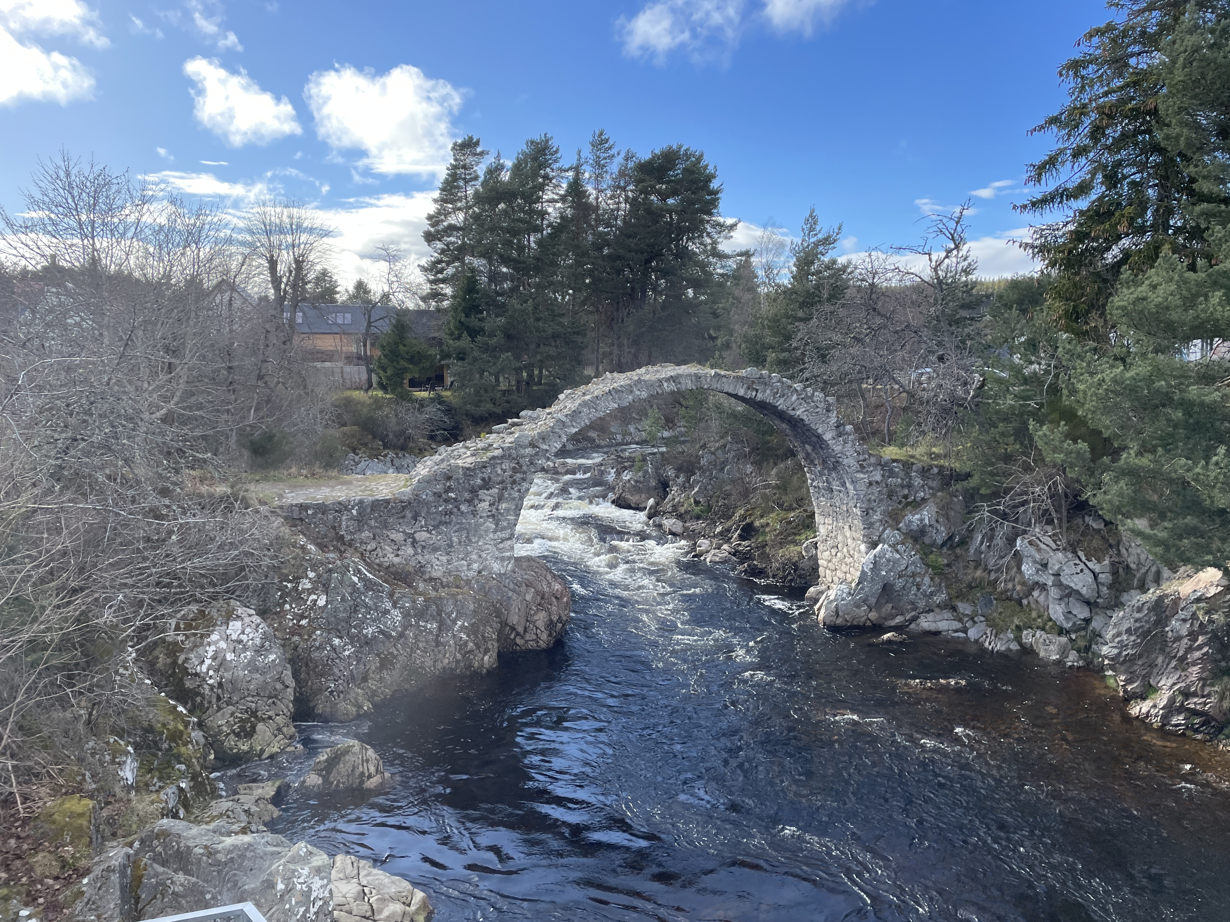
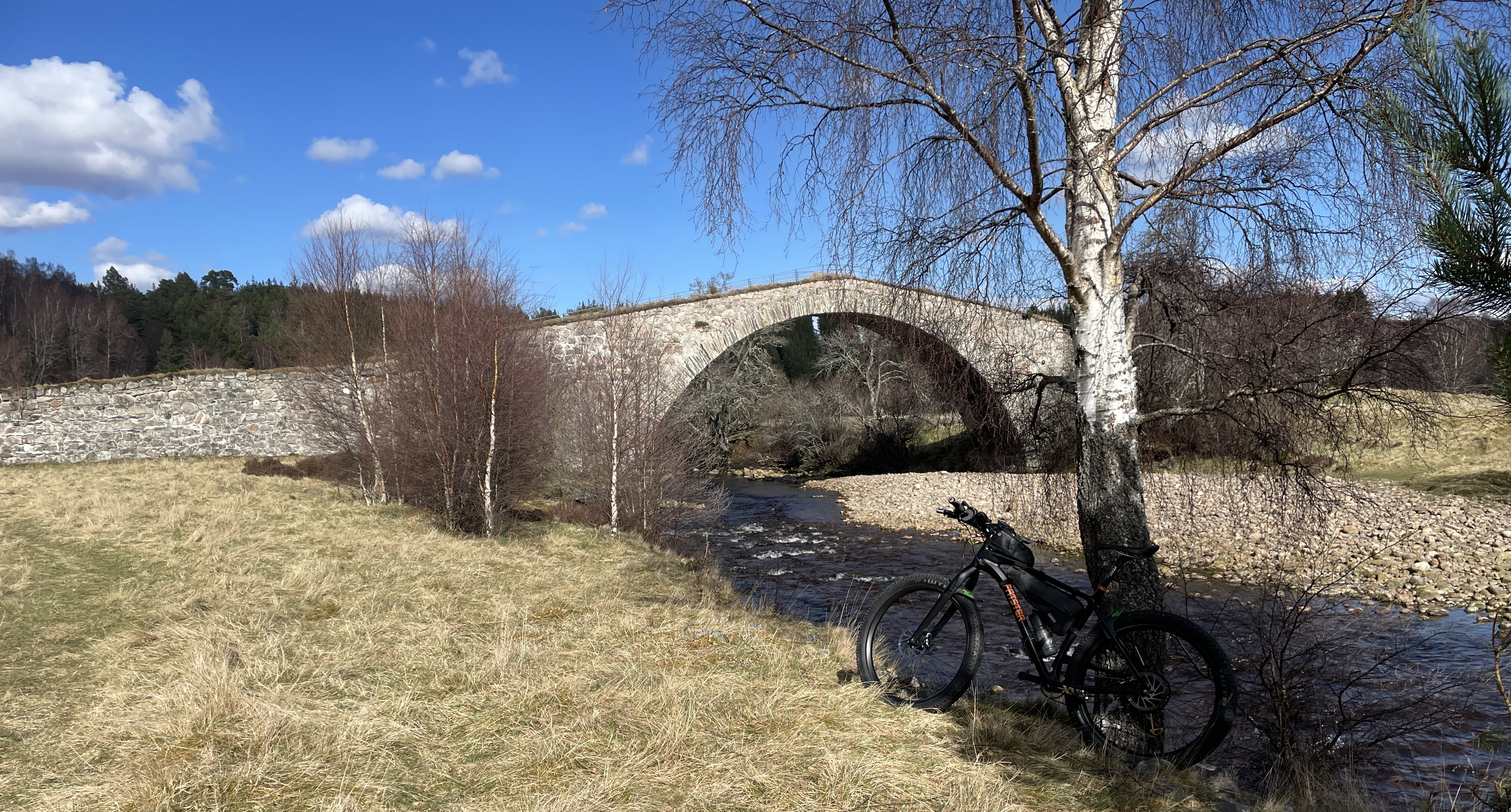
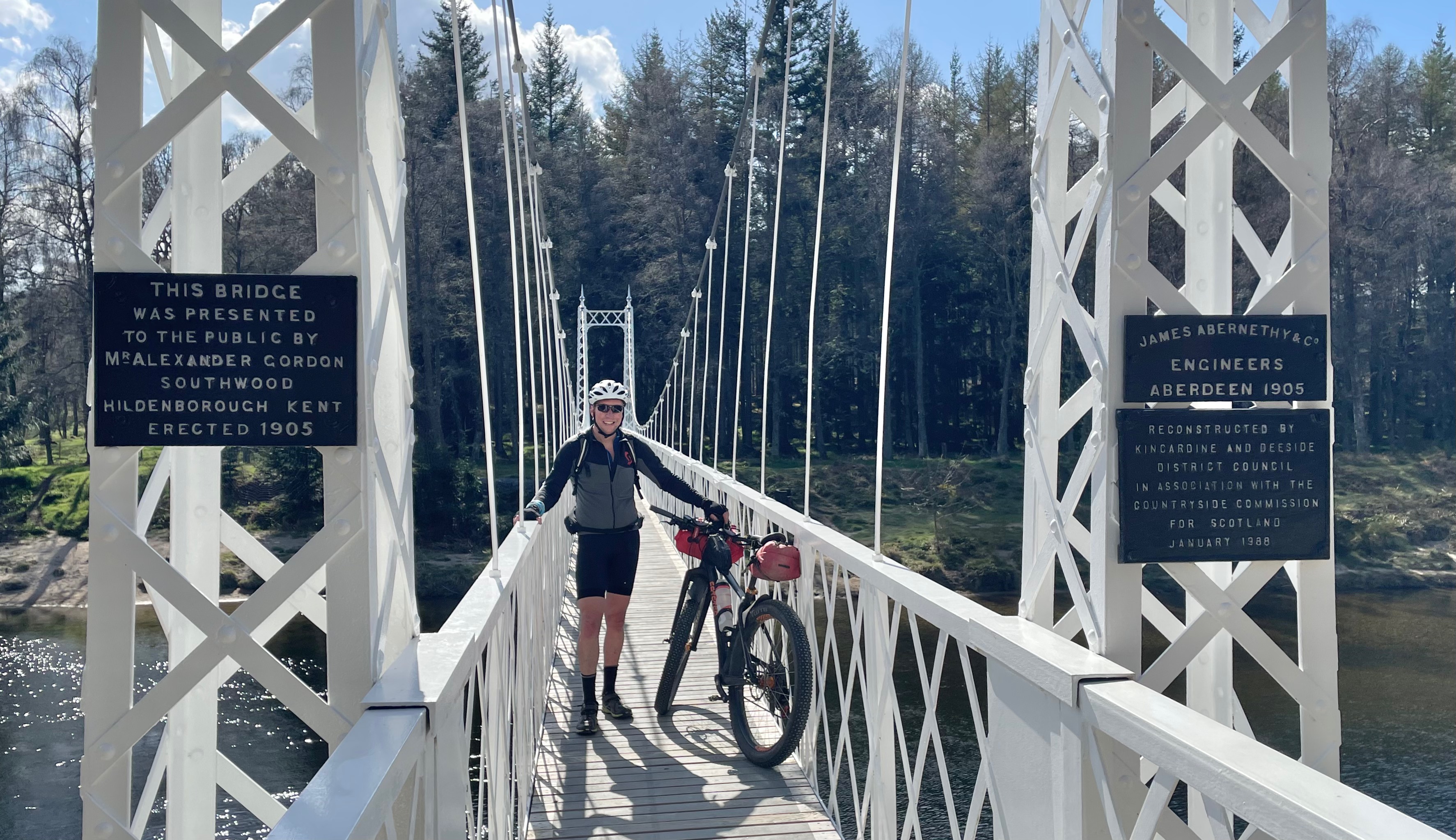
And another wonderful bridge – Sluggan Bridge (part of General Wades route)
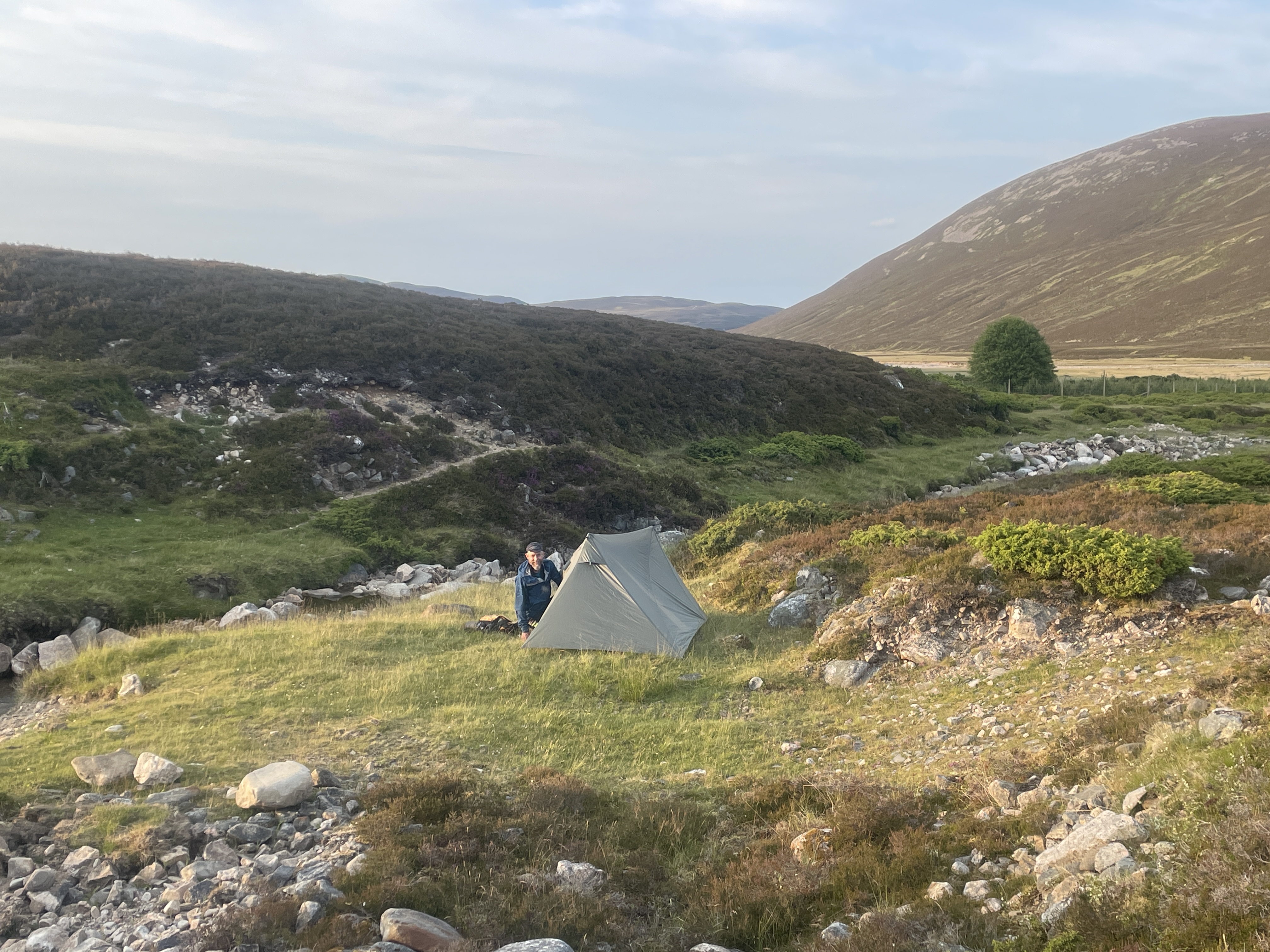
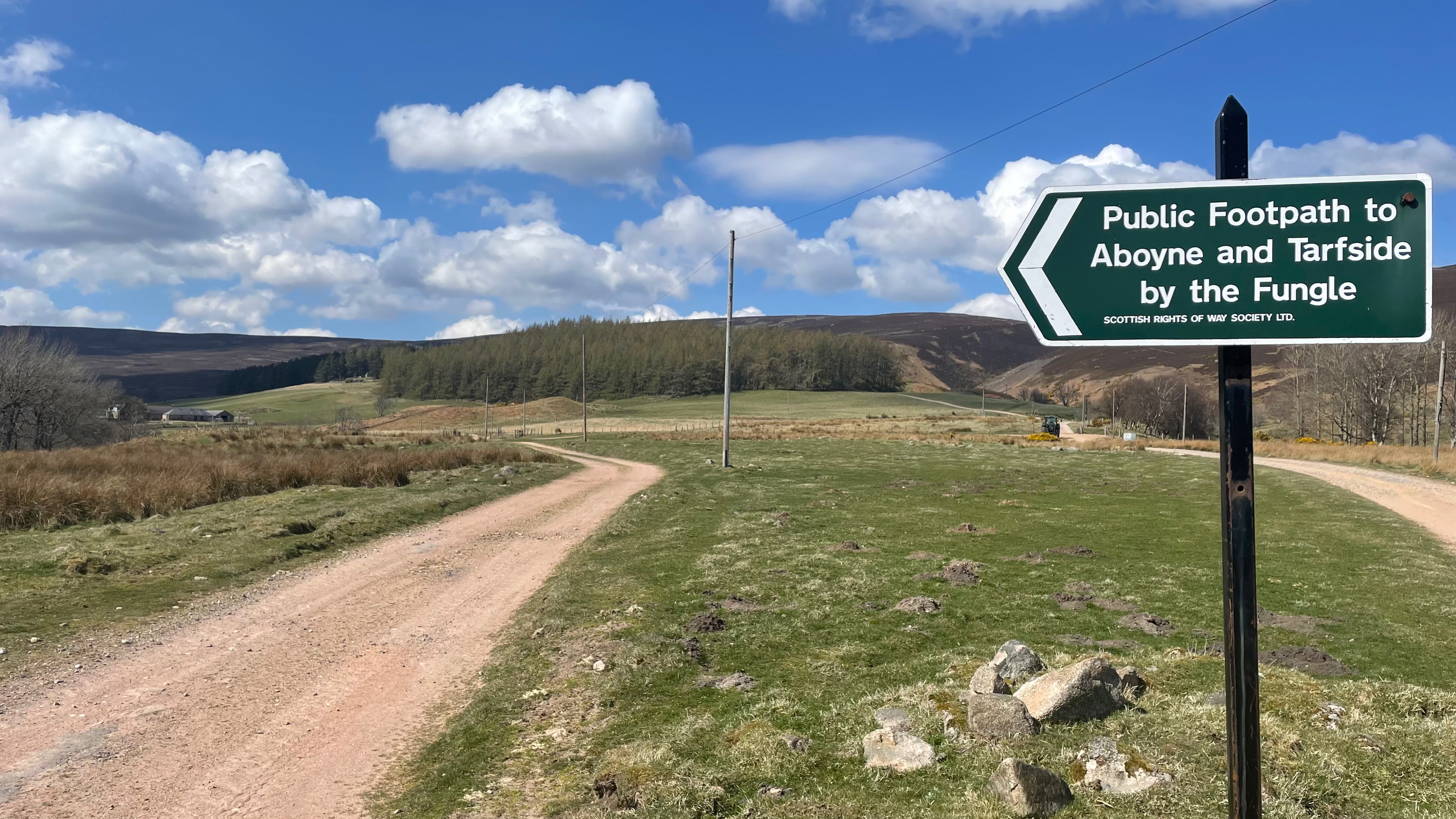
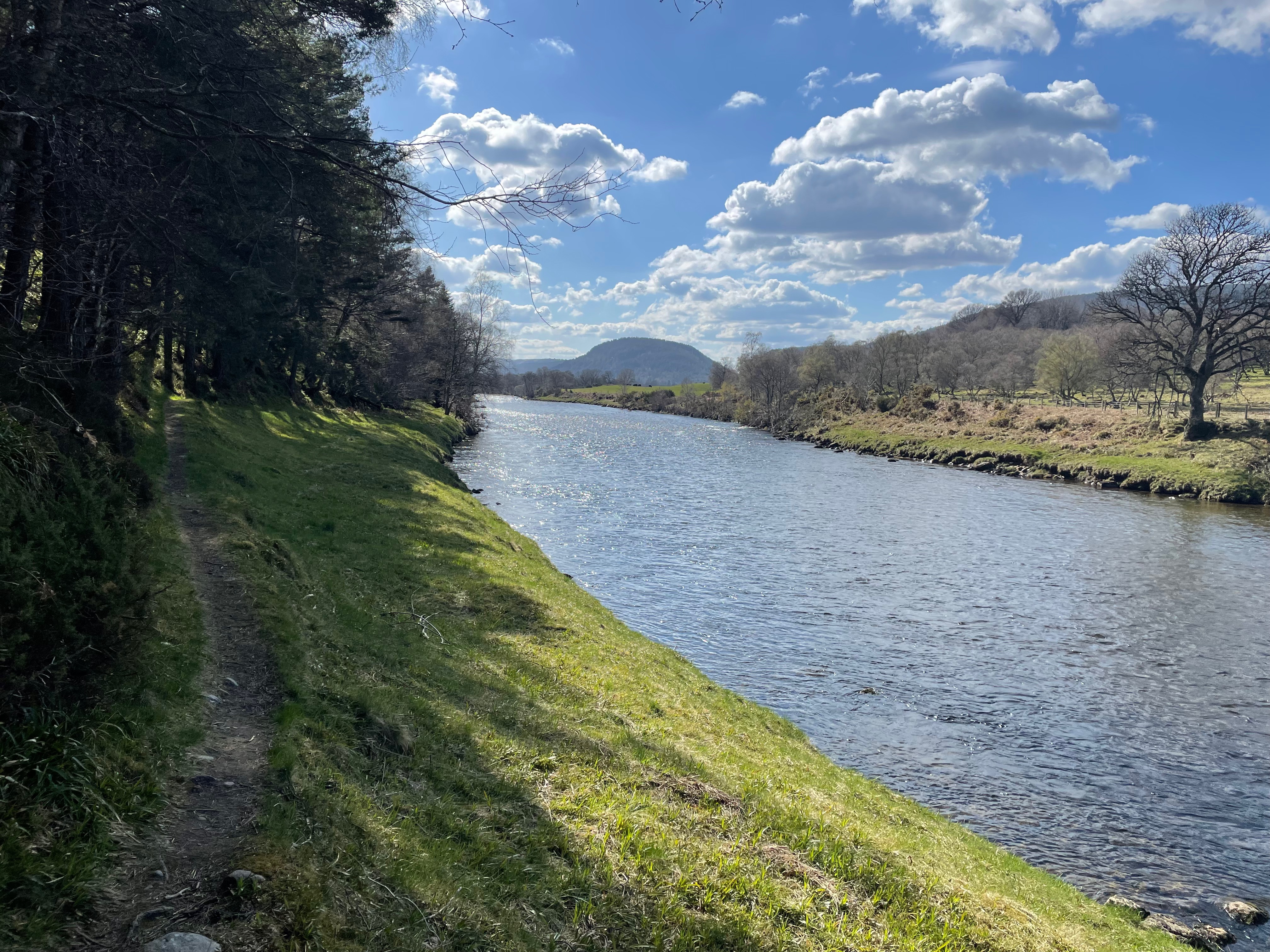
The route heads out of Carrbridge, past the Cemetery through some lovely forest that skirts the village and then heads up the River Dulnain.
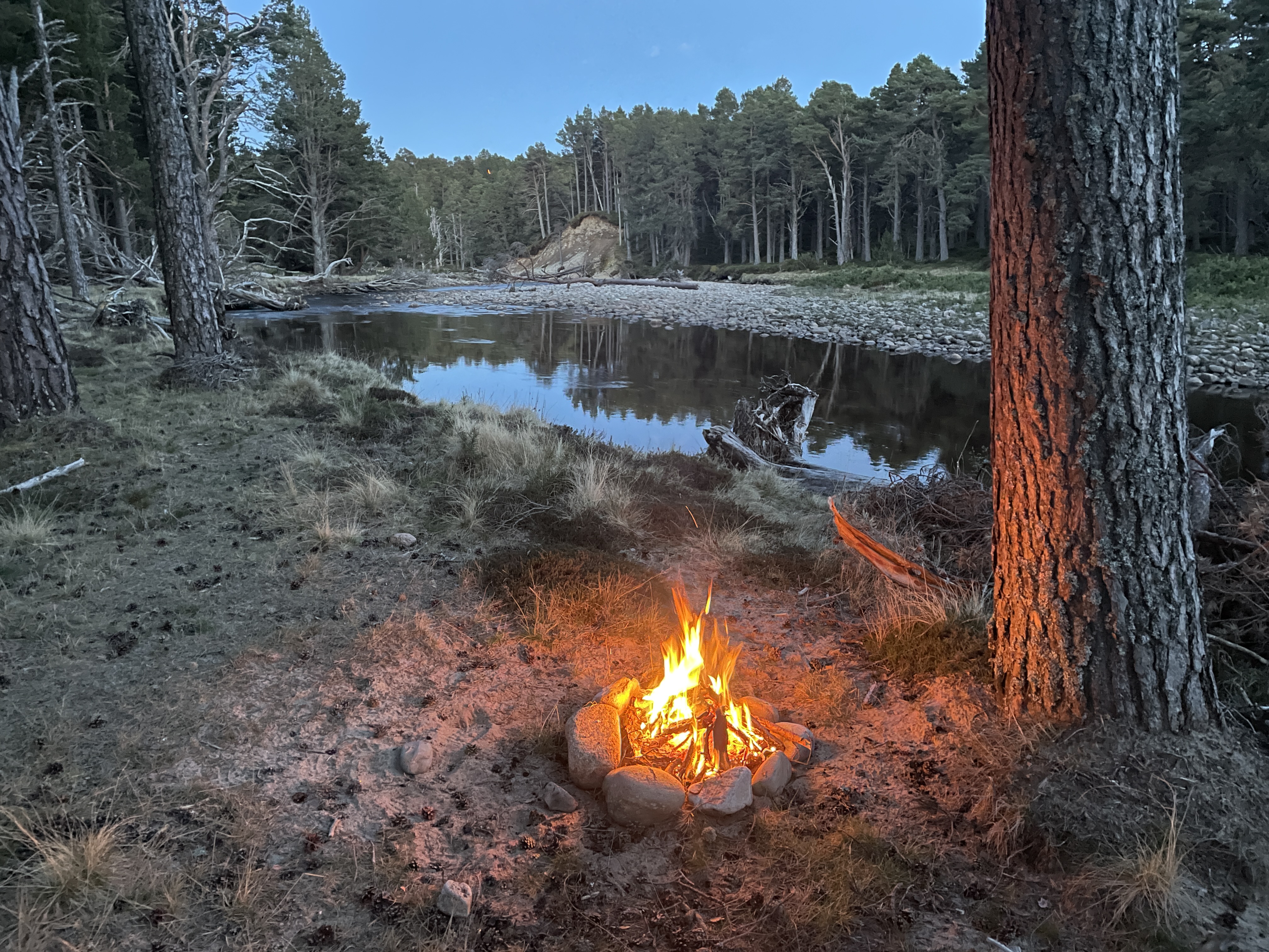
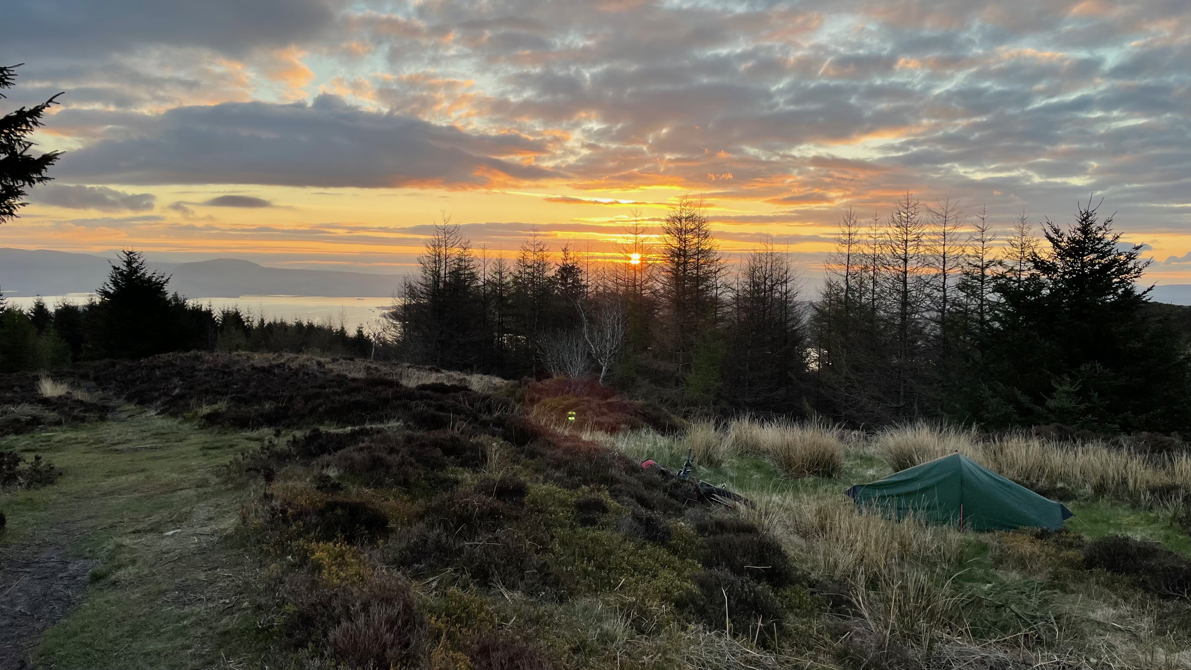
Small Campfire, which was tidied and dispersed the morning after (Leave no Trace)Camping Spot Night 1 – In a lovely stand of trees next to the river.
The trees afford a little extra warmth and help keep the frost off, that was present across the Glen at sunrise. Spring time is a lovely time to venture out, as well as the birdlife and emergence of flowers and new buds, there are little to no insects – apart from the dreaded ‘Tick’, that is increasing prevalent in the UK now – and even in winter time! So be cautious, especially around bovine and deer frequented areas!
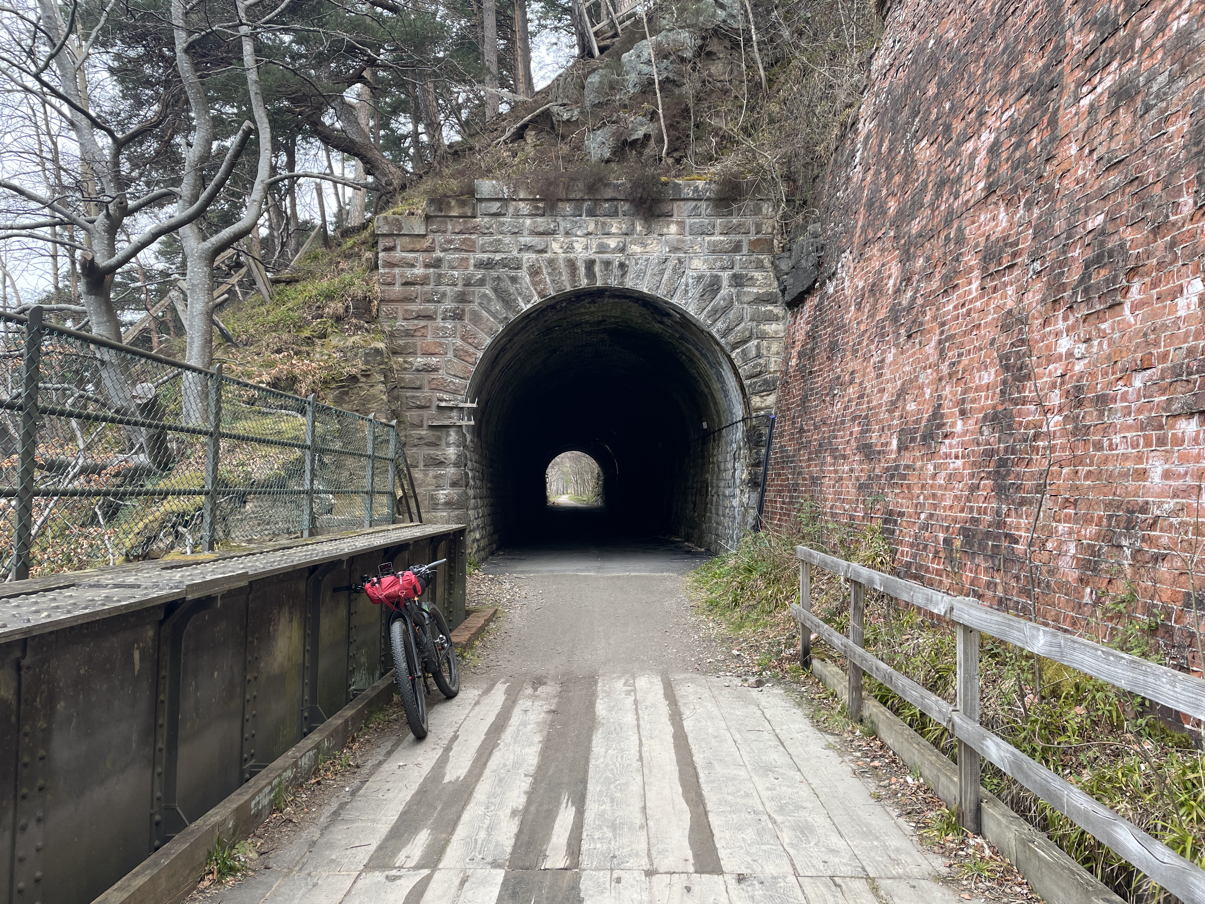
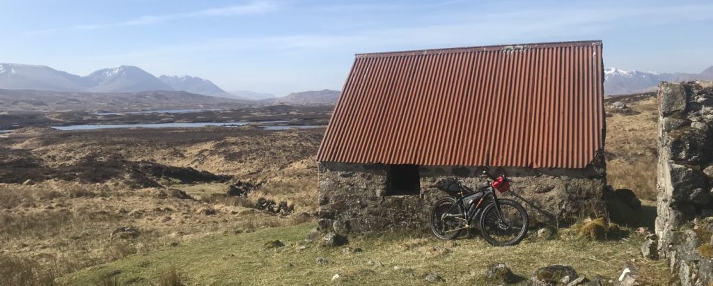
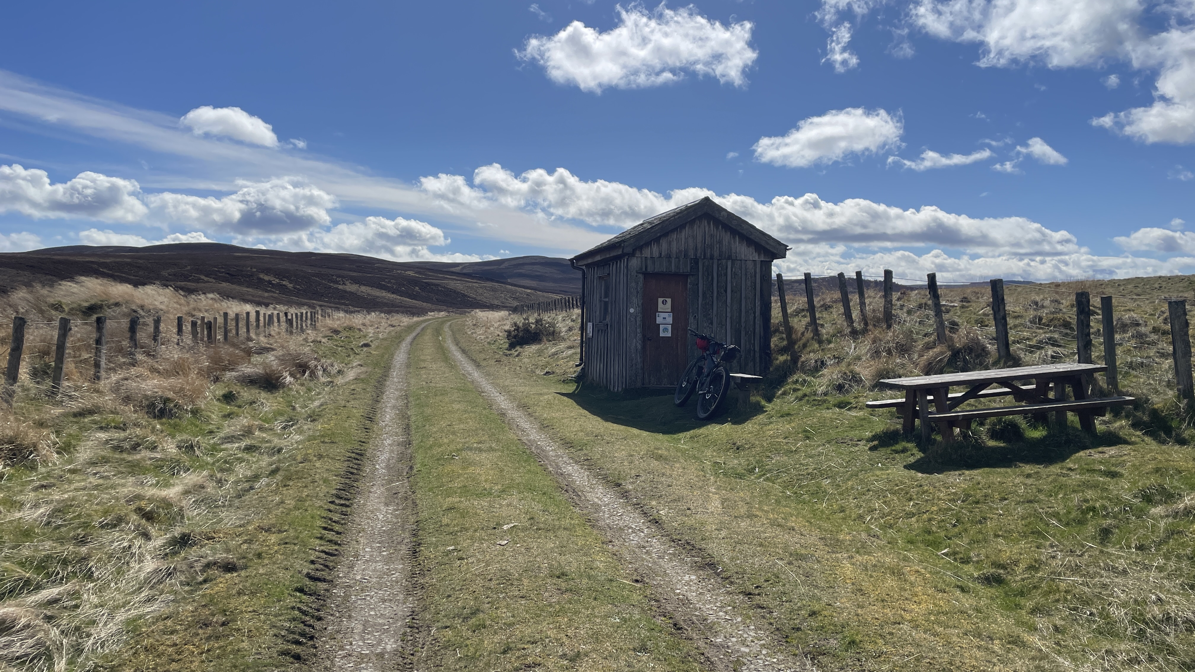
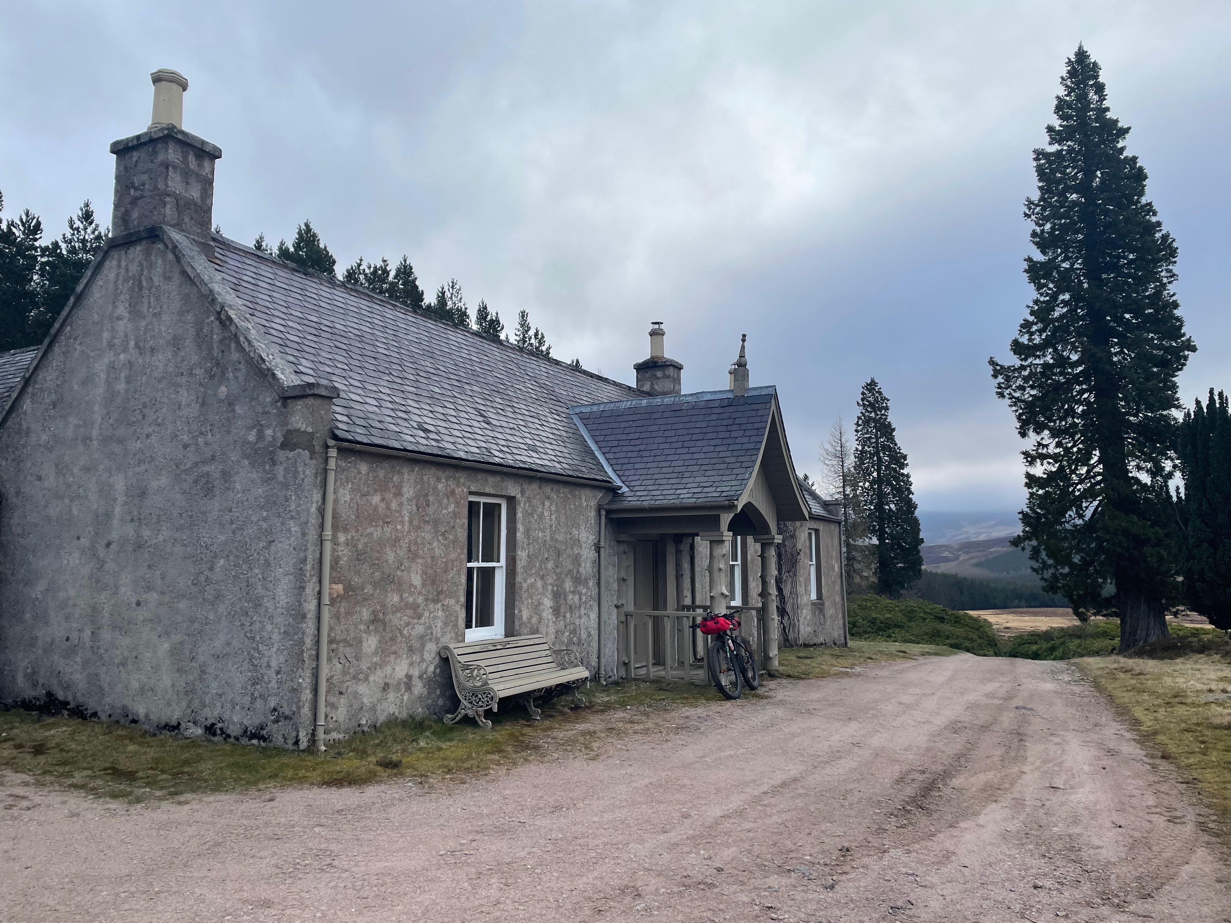
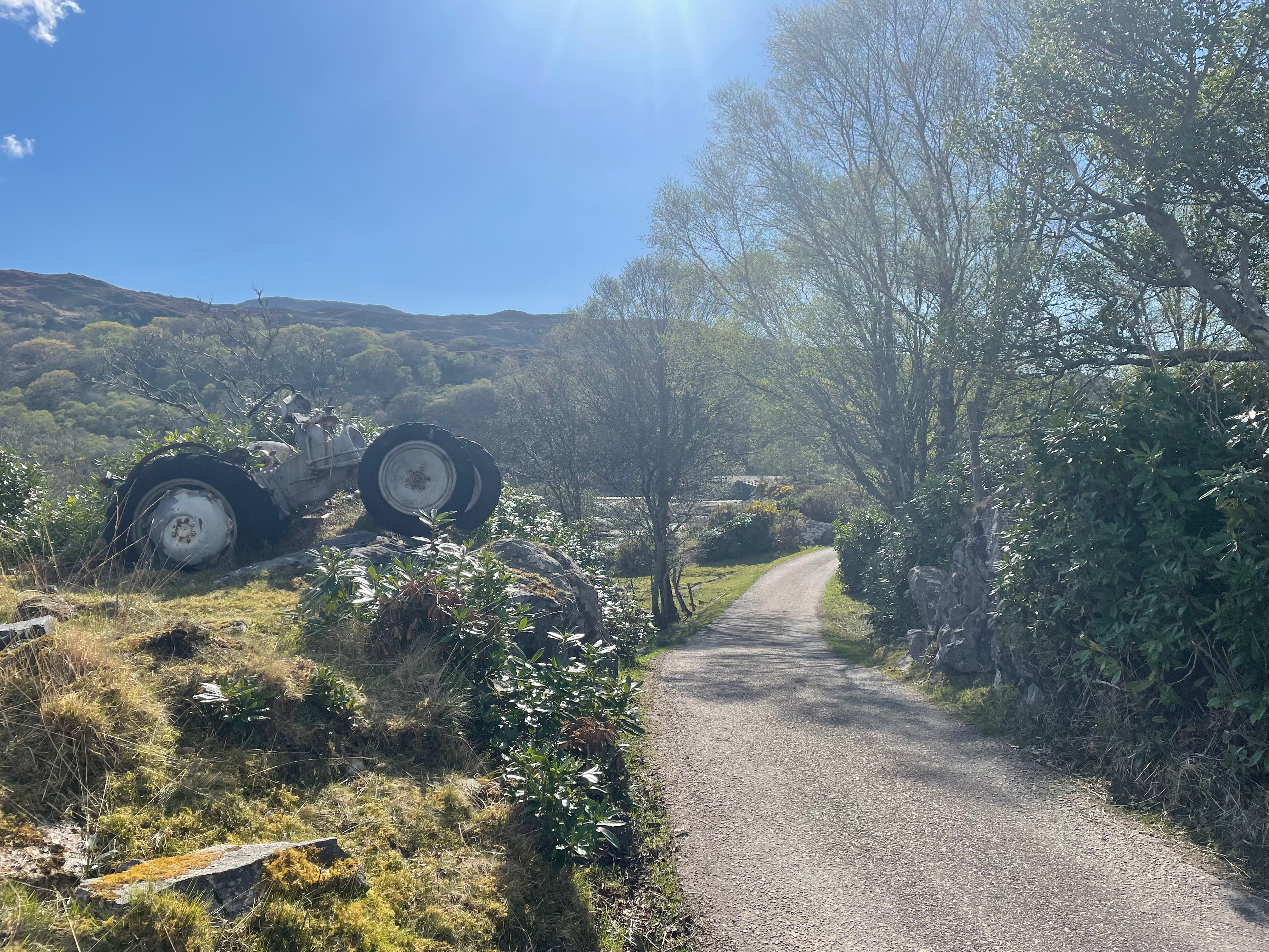
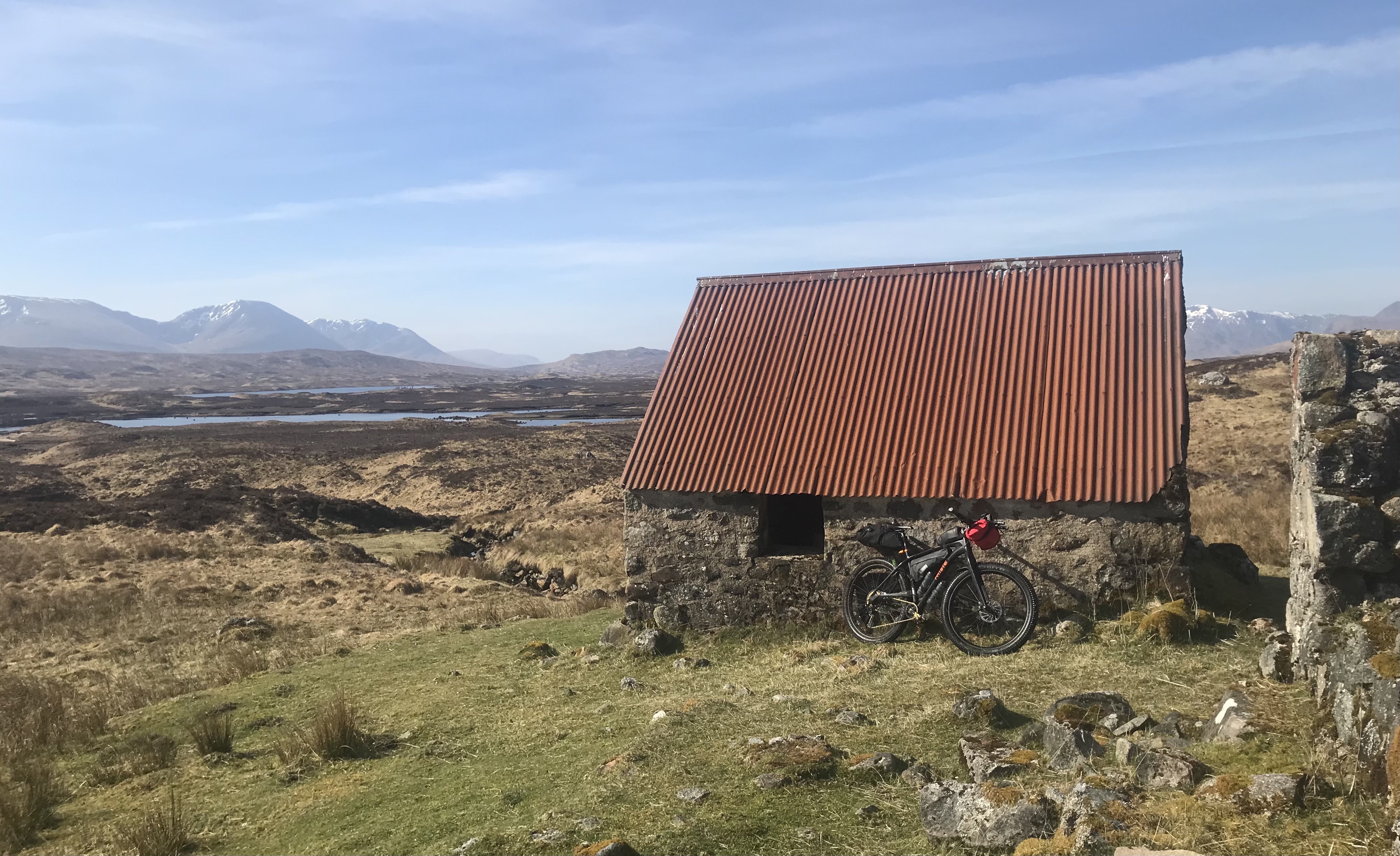
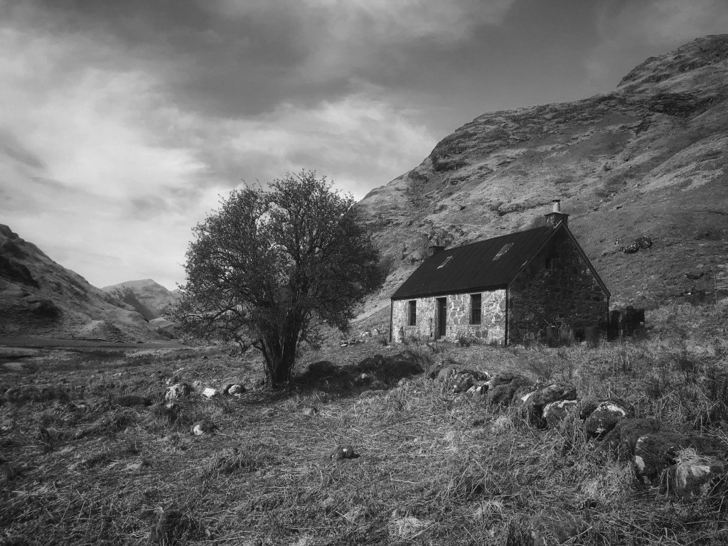
A non-MBA Bothy passed enroute.
Its pleasing to see a Glen that still has many stands of Caladonian trees in and a road that soon ends, helping preserve the wild feel and keep it quiet. The Dulnain opens up eventually where the famous Burma Road comes in, over from Aviemore. You are now in Golden Eagle country! Fortunatlly I met a local chap at Sluggan Bridge and he pre-armed me with the knowledge to keep eyes peeled and suggested I ‘loiter’ at the bothy a while as they are often seen soaring high on a good day. I was lucky and glimpsed one, too far away for a picture, but so please to see one and I enjoyed a coffee!
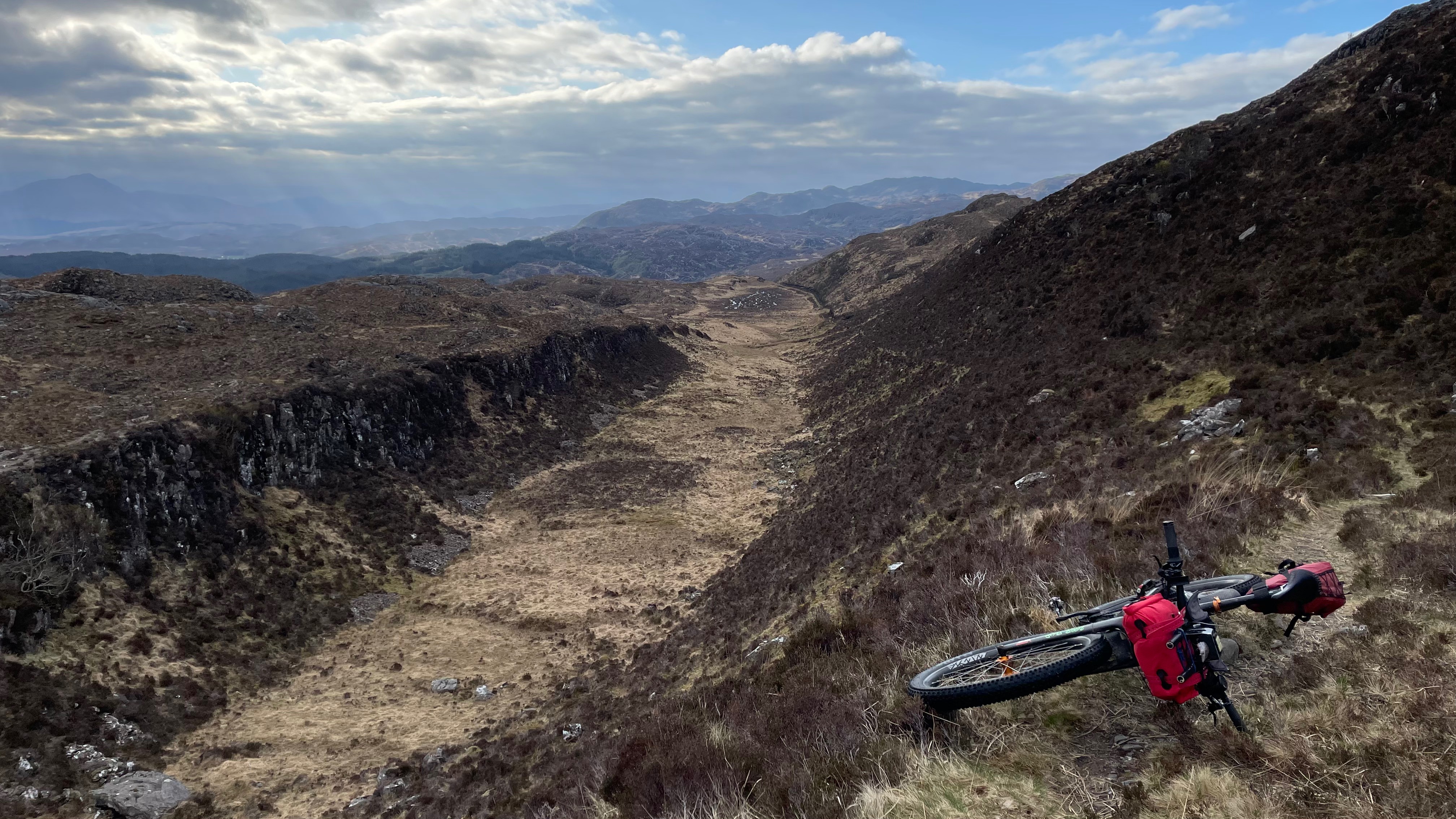
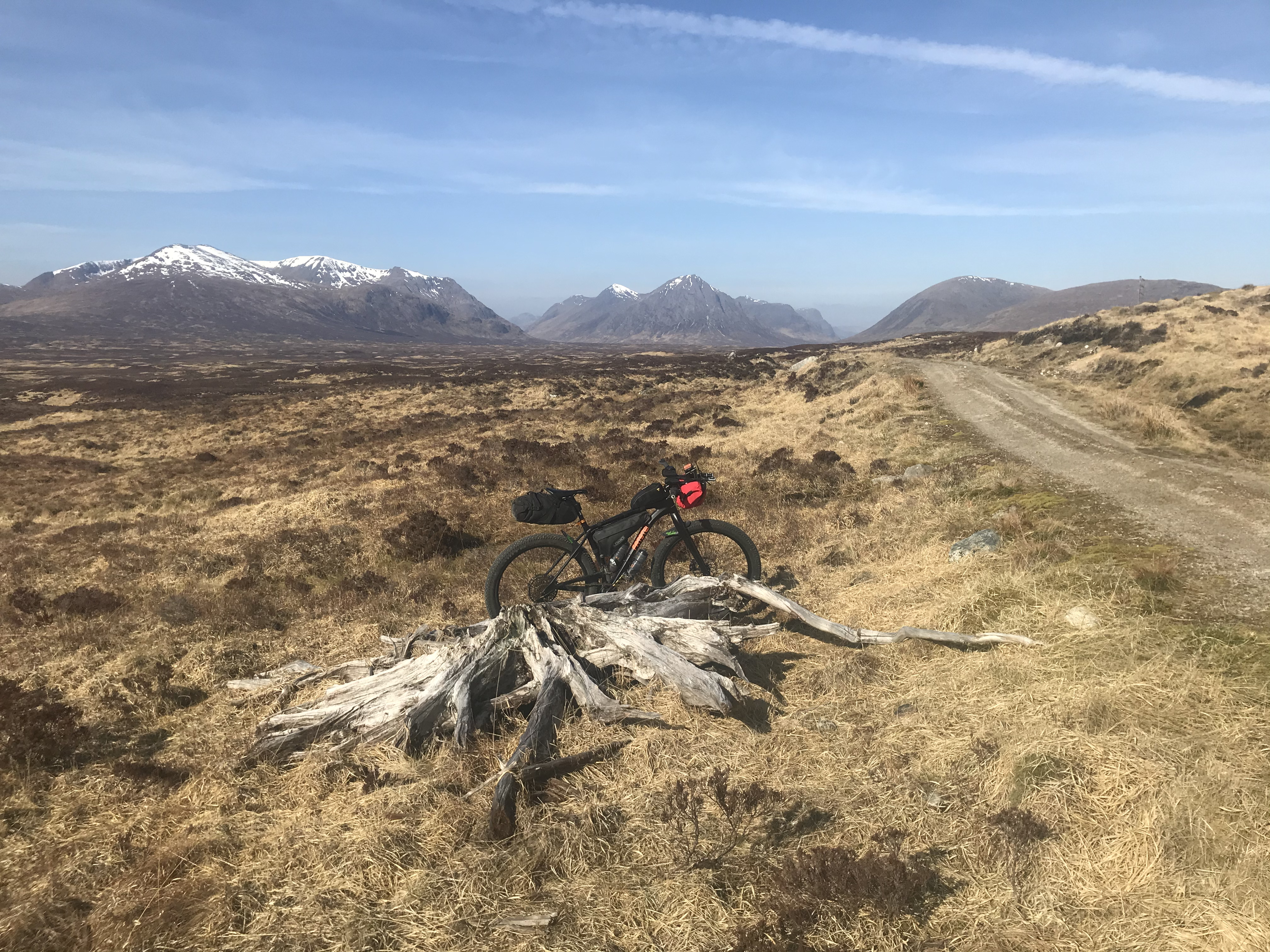
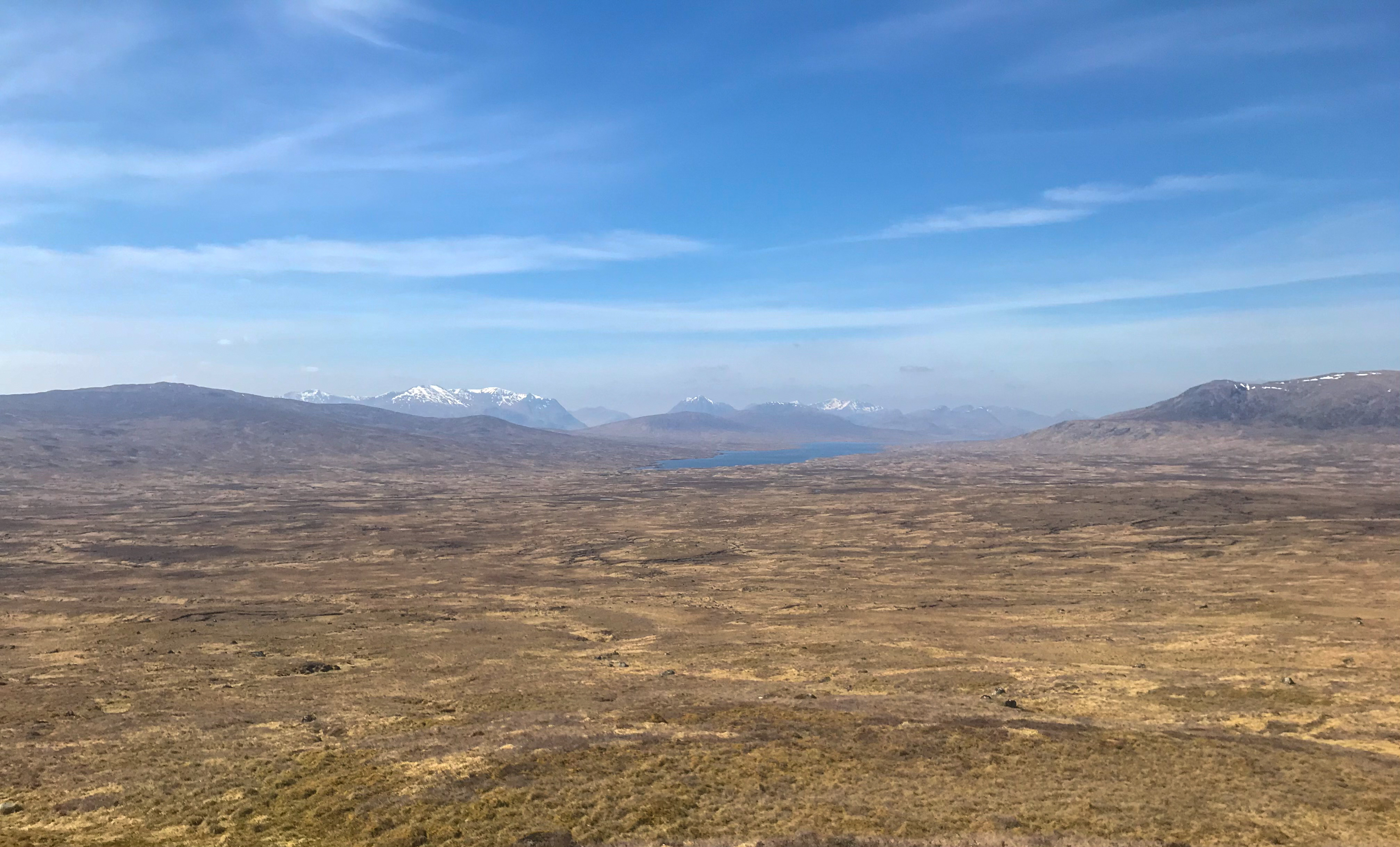
The tracks in the Dulnain at this point stop, however progress further up can still be made following un-marked sheep trods across the pasture land this leads to another track intersection, left back to Alvie Estate and Forest, or right into the desolate Monadhliath Mountains, my route went left – back to civilisation!
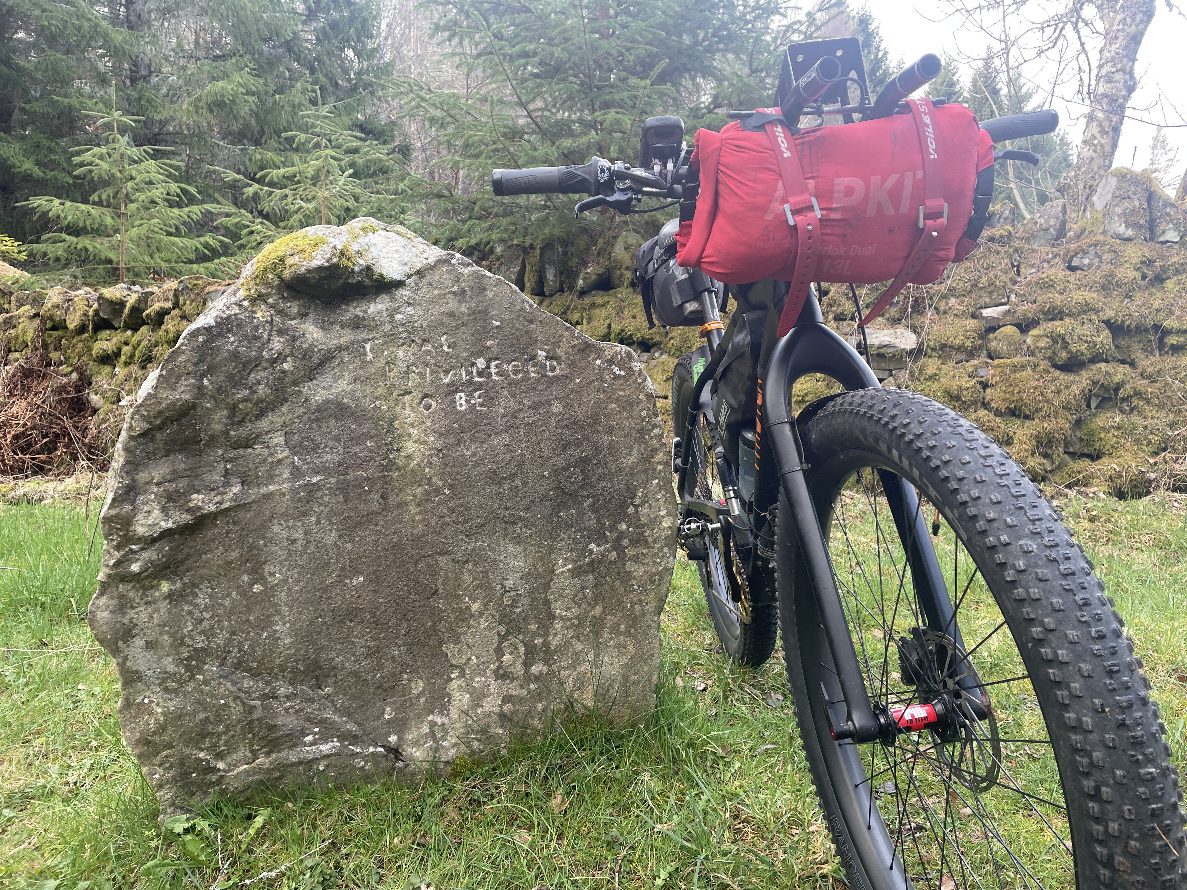
One of the lovely ‘Frank Bruce’ sculptures.
The Alvie estate has a lot to offer the rider and some single tracks can be found here, or just stick to the main dirt roads. Soon you pass the main lodge and then go under the A9, which works well, the route at this points picks up some of Spey Way, but goes up it to Kincraig and then on into the Rothiemurchus Forest, before it enters the forest at Feshiebridge, the Frank Bruce Sculpture park is well worth a visit and a good lunch spot. I like the stone pictured – it makes me feel thankful for just being able to do this sort of stuff!
Wide – Open – Spaces
The Rothiemurchus provides almost endless route options, but I head past Loch an Eilien and then on to Loch Morlich, via the ‘Cairngorm Footbridge’, these next trails are delightful and often quite popular on a sunny day, after Morlich, the Abernethy Forest comes next via Ryovan – an interesting Glen and a handy wee bothy at the top of it!
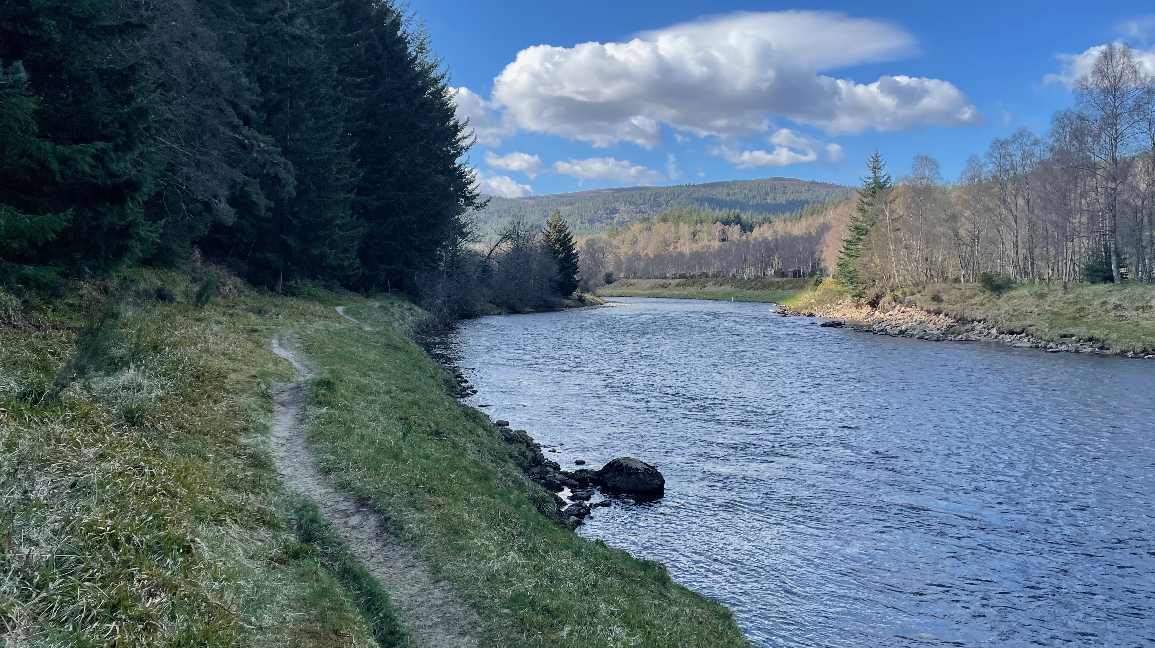
Spey Way – well groomed trails (many along the old disused rail route) that follow the mighty River Spey all the way to where it meets the sea.
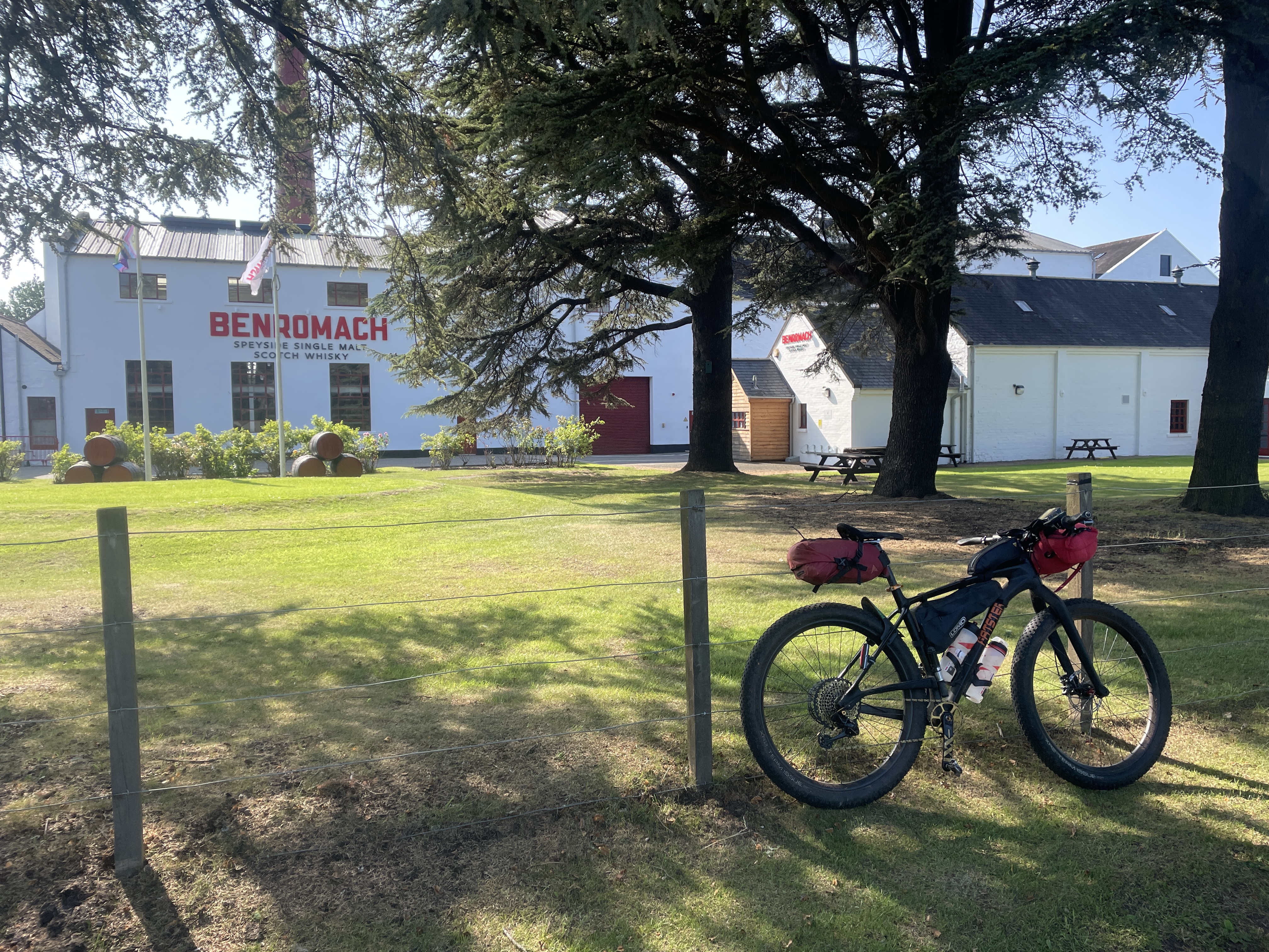
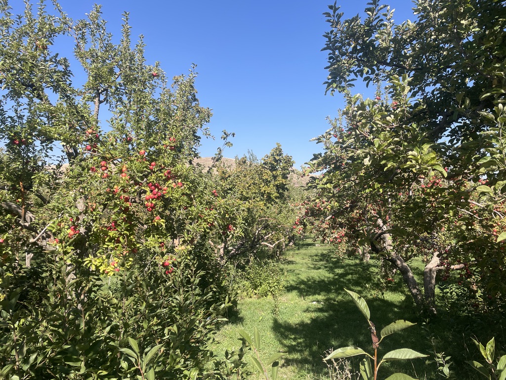
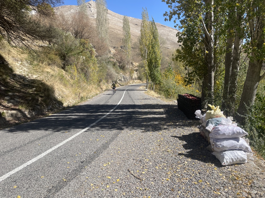
Again the Abernethy provides some interesting diversions, not least an Osprey Centre, but many other hidden gems too. After the forest the landscape opens up as you reach the mighty Spey, here the route becomes a mixture of surfaces, however much of it passes along the old Spey rail track and makes for easy progress. Whilst in yet another different landscape the scenery is mesmerising and you are afforded a a choice of Whisky Distilleries, passing these (even when closed) is super as the sweet smell of the malt radiates.
Two of the several bridges that cross the river here and below
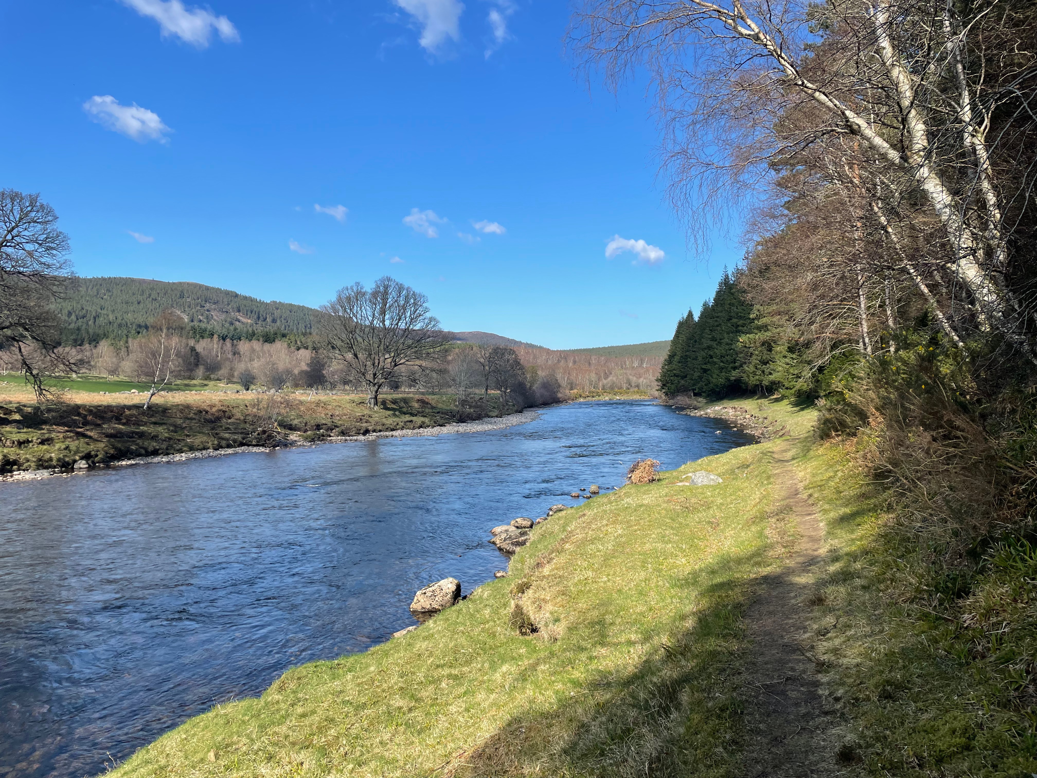
As you head downstream the landscape softens and becomes less rugged and less mountainous.
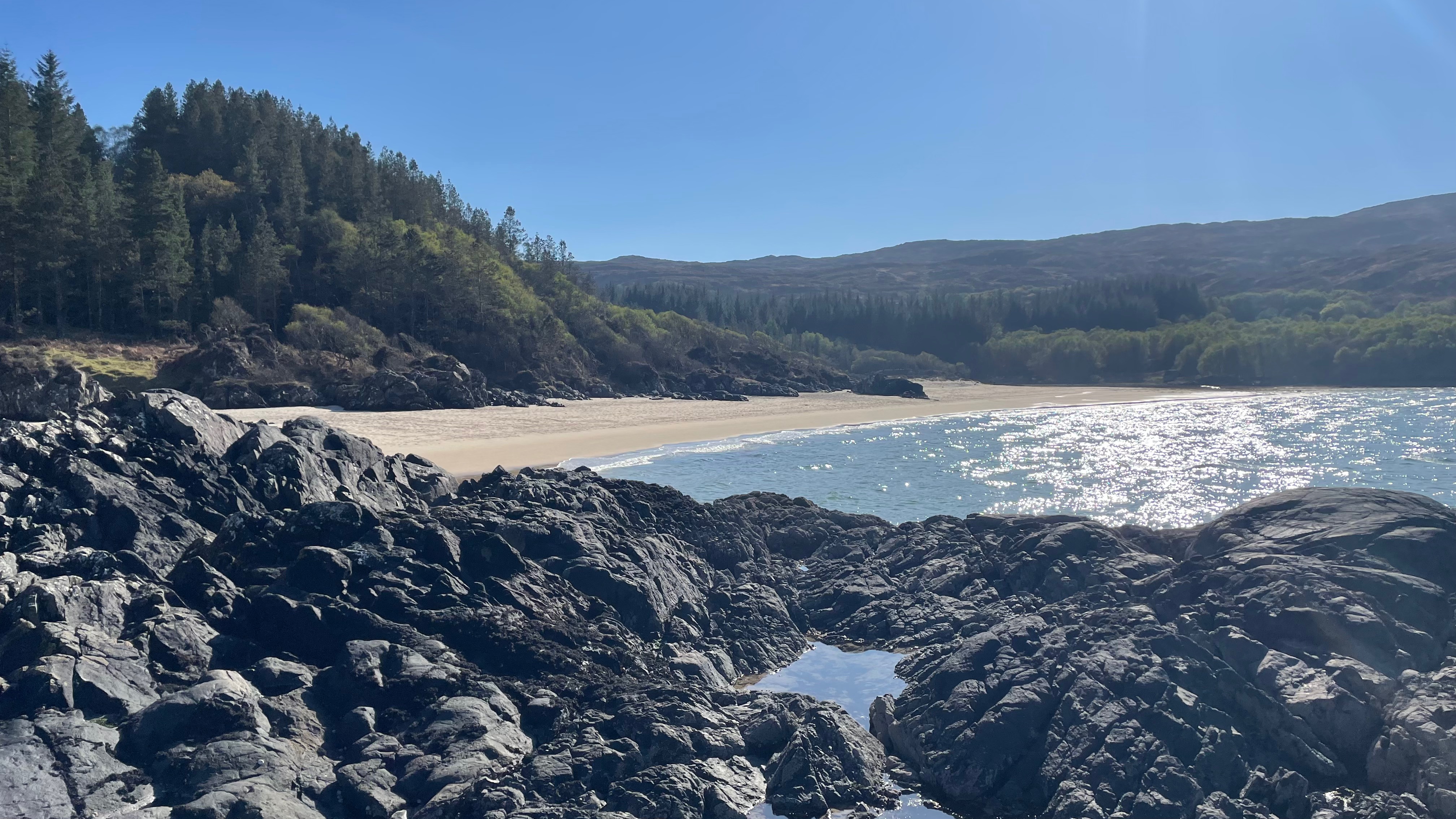
Soon the great river reaches the coast, Spey Bay – here you’ll find pebbles, people and a small cafe and Dolphin Centre.
Picture a land of clear rivers and ancient forests. A place with seals and dolphins in the bay and red squirrels in the trees, Kites and Buzzards in the sky, where historical towns dot the map and centuries-old distilleries produce world-class whisky. Somewhere to stop, look, listen, and rest a while. You’d think such a region would be heaving with tourists, but despite being a wedge of prime-grade Scottish countryside – with the Moray Firth to the north and the Cairngorms to the south – the Moray Speyside area often gets skipped over. My advice is to stop a while and explore.
Riding or Hiking, or however you make the journey, you have serious rewards in store. As well as its celebrated whisky, it has a stunner of a coastline, lined with mile upon mile of pale sandy beaches, backed by rich pine forest, surging cliffs and characterful little fishing villages, while the mighty River Spey is an attraction in its own right, flowing and frothing its way from the mountains to the coast, where it empties into wild Spey Bay.
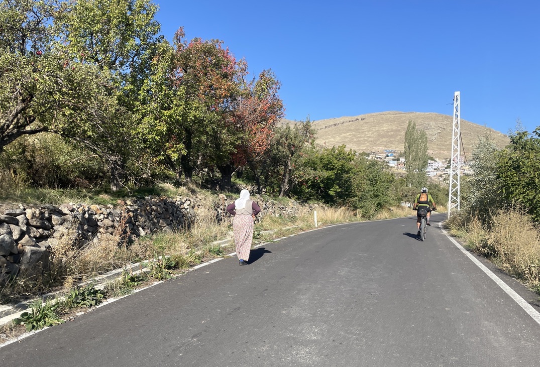
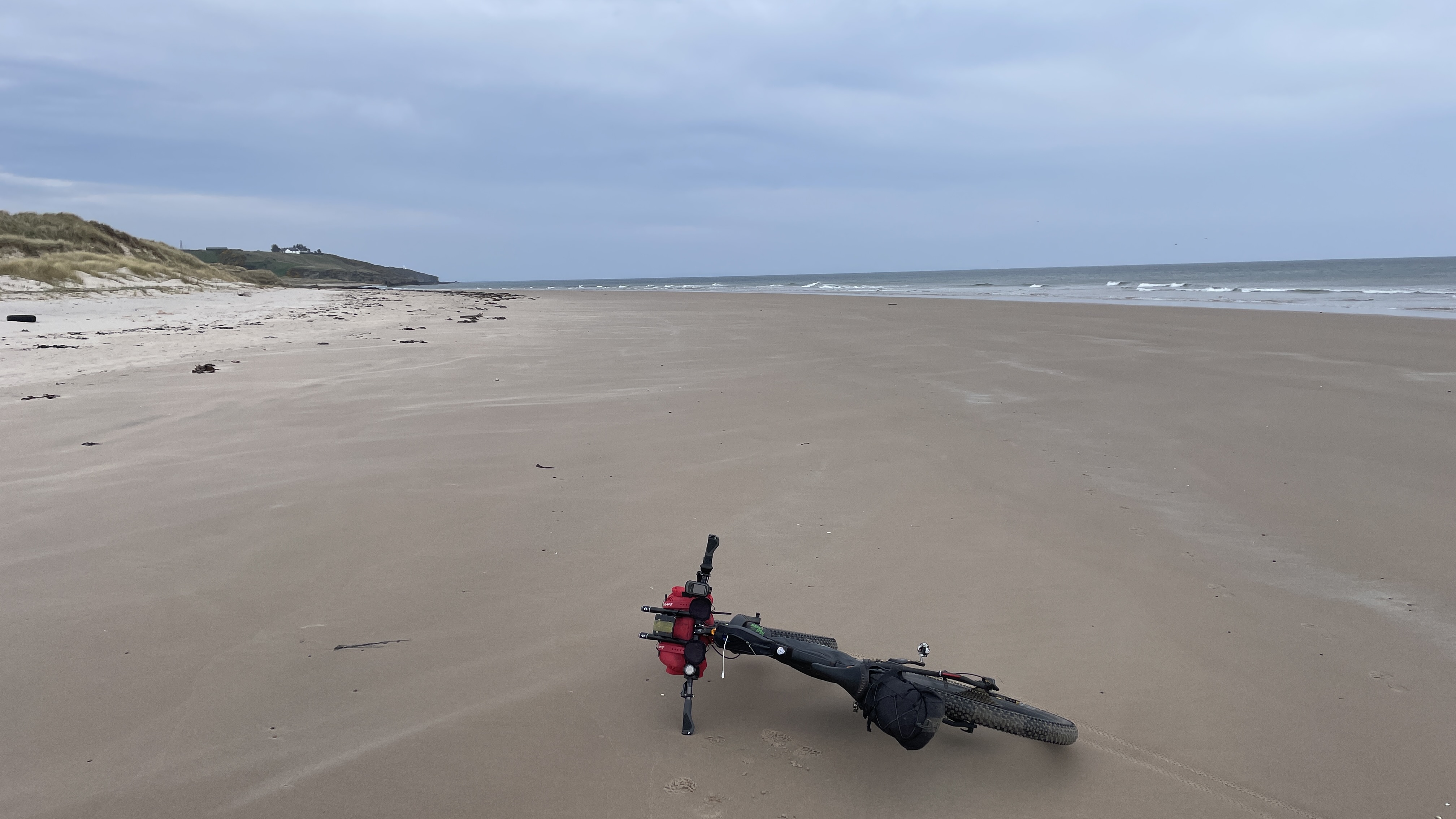
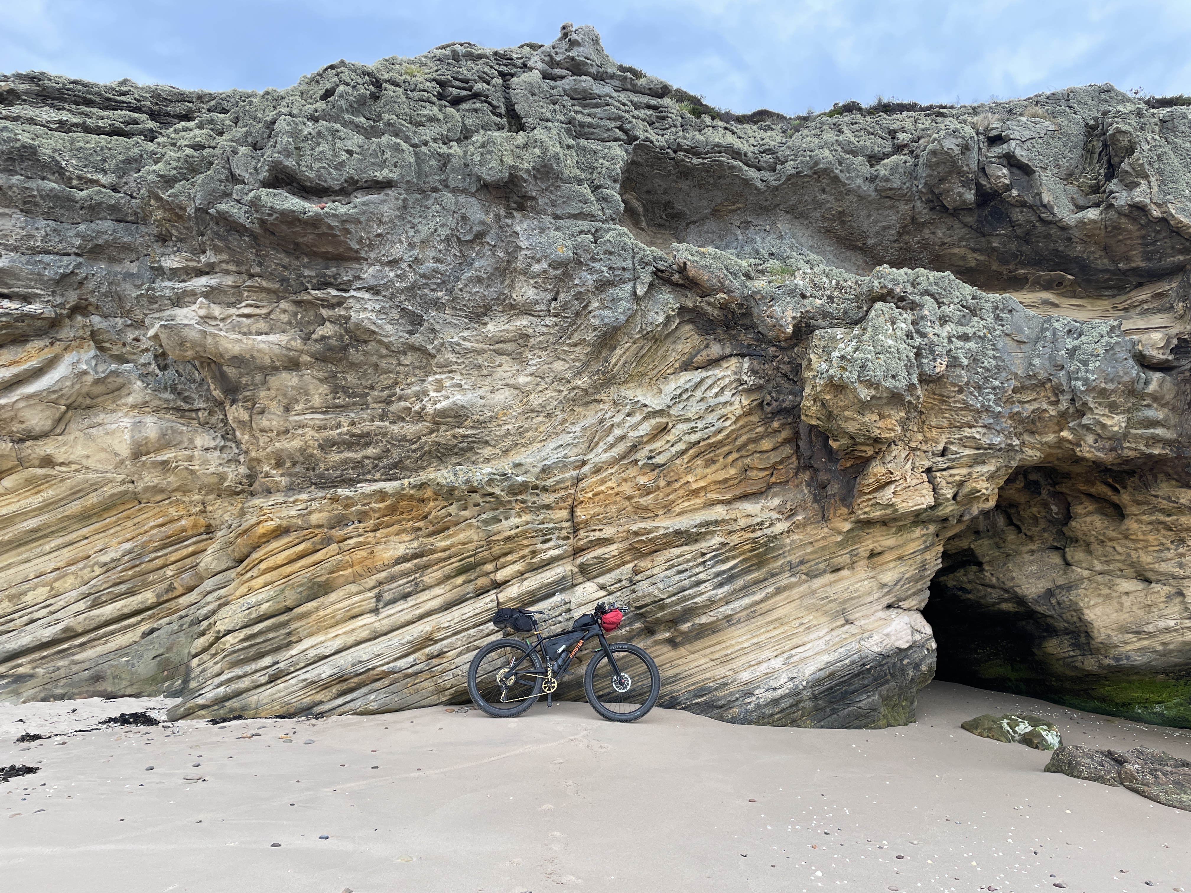
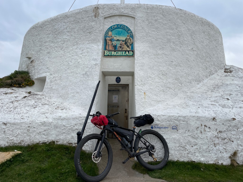
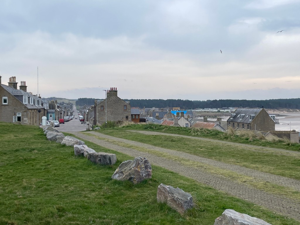
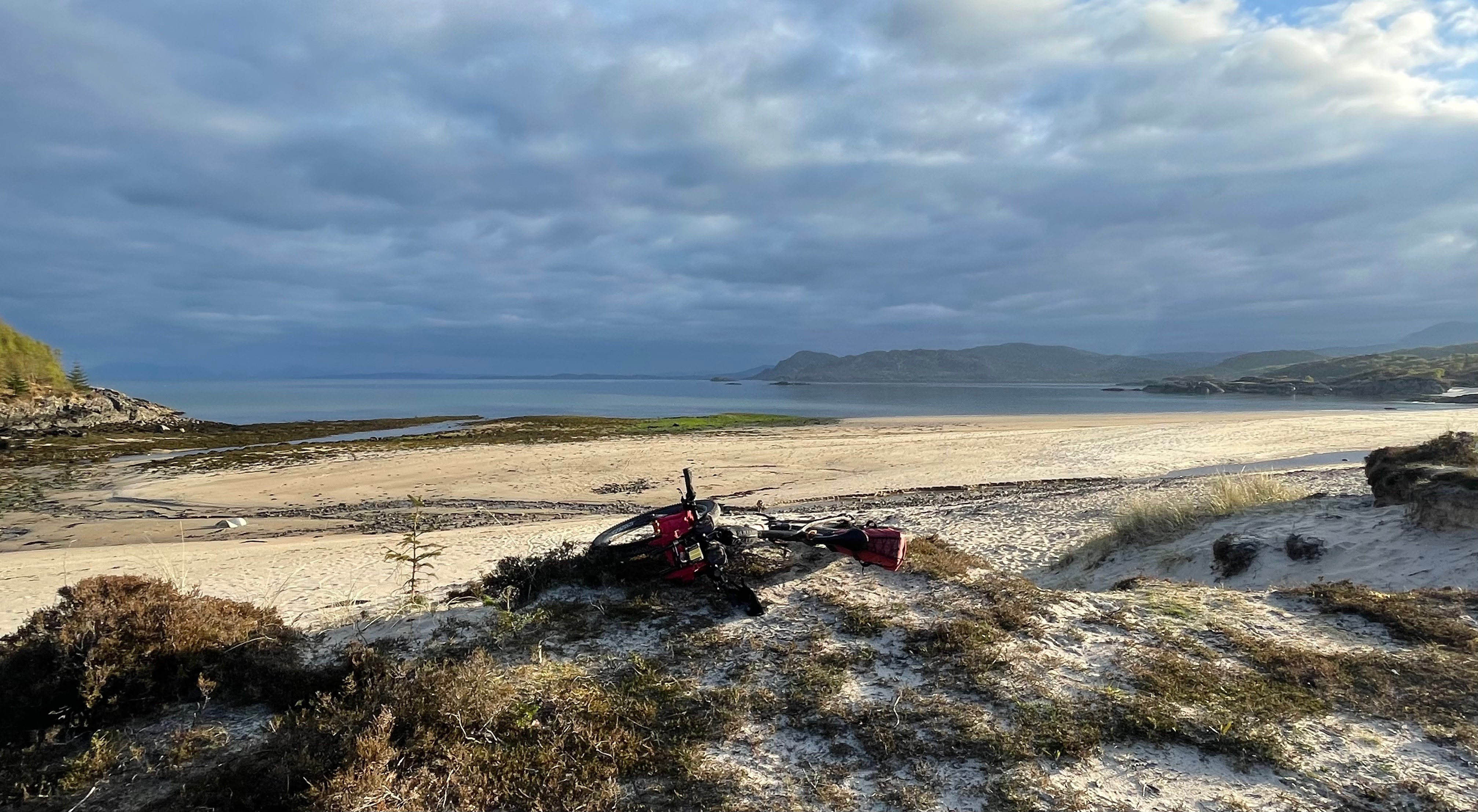
The Spey Way LDP intersects with the Moray Coastal Trail at Spey Bay and you have a choice here to do an out-n-back and head east o Cullen / Buckie, or head west over the big bridge (pictured above) and take the wild shore line, with hardly a person around. The first main town is Lossiemouth, then on the Burghead – each of these places has a variety of attractions and a range of facilities from shops, to BnBs and Pubs (plenty of ice-cream shops too!).
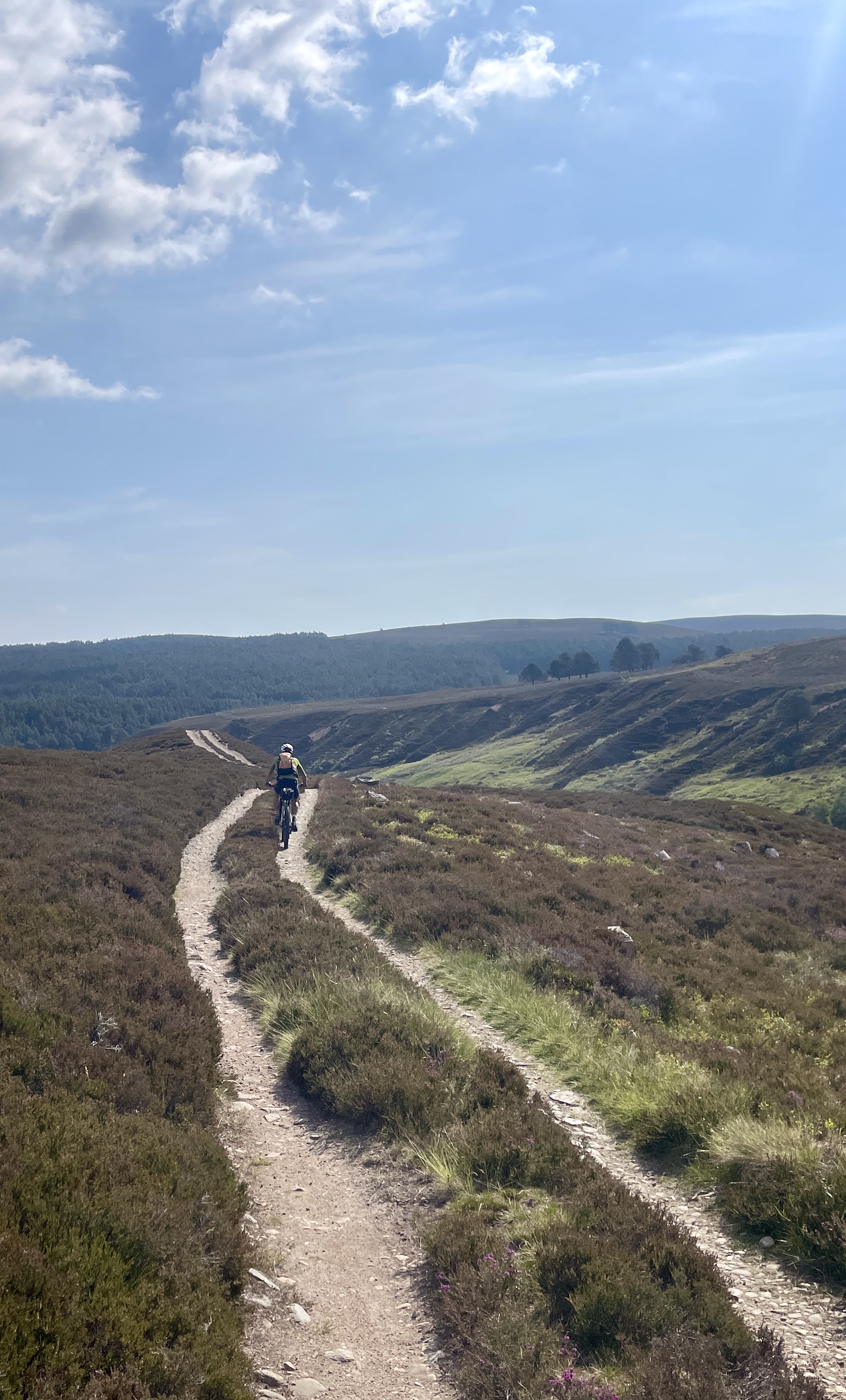
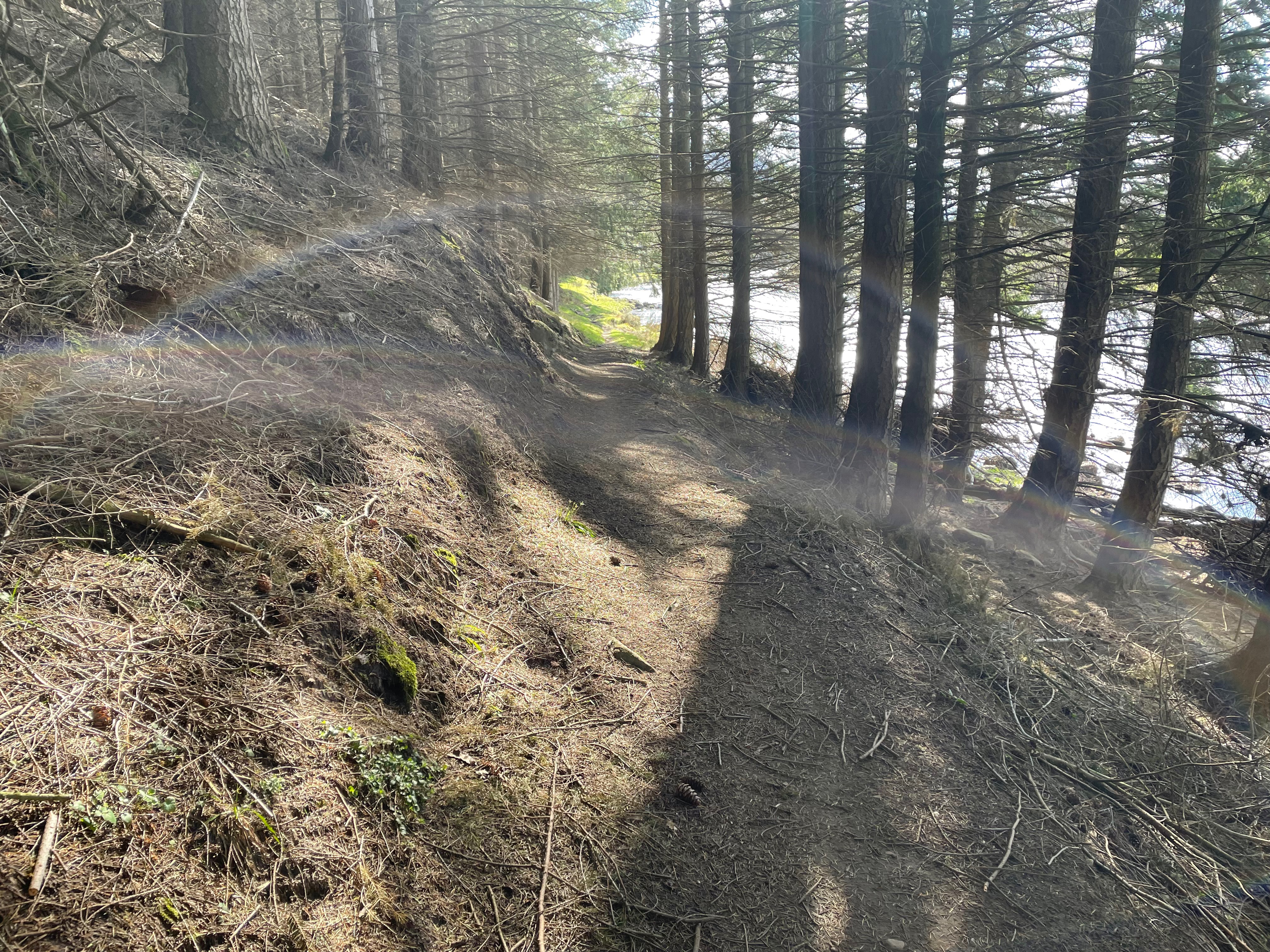
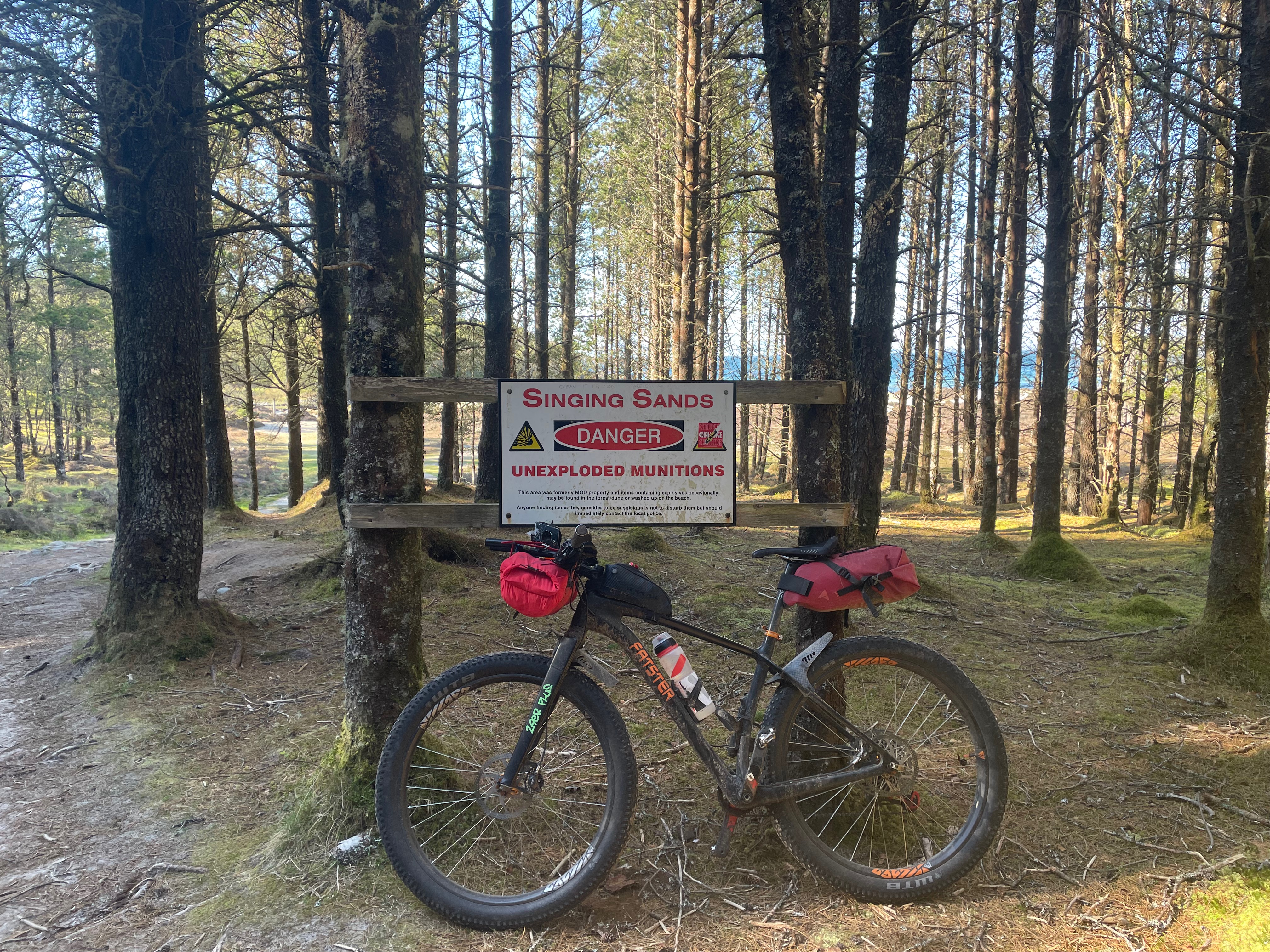
Roseisle Forest and the Burma Road that leads you into it, here you’ll get lost on miles of single-track, over the old dunes that are now planted out with pines, interspersed are nice grassy patches – the most ideal camp-spots, also pleasing to see very little mess or litter!
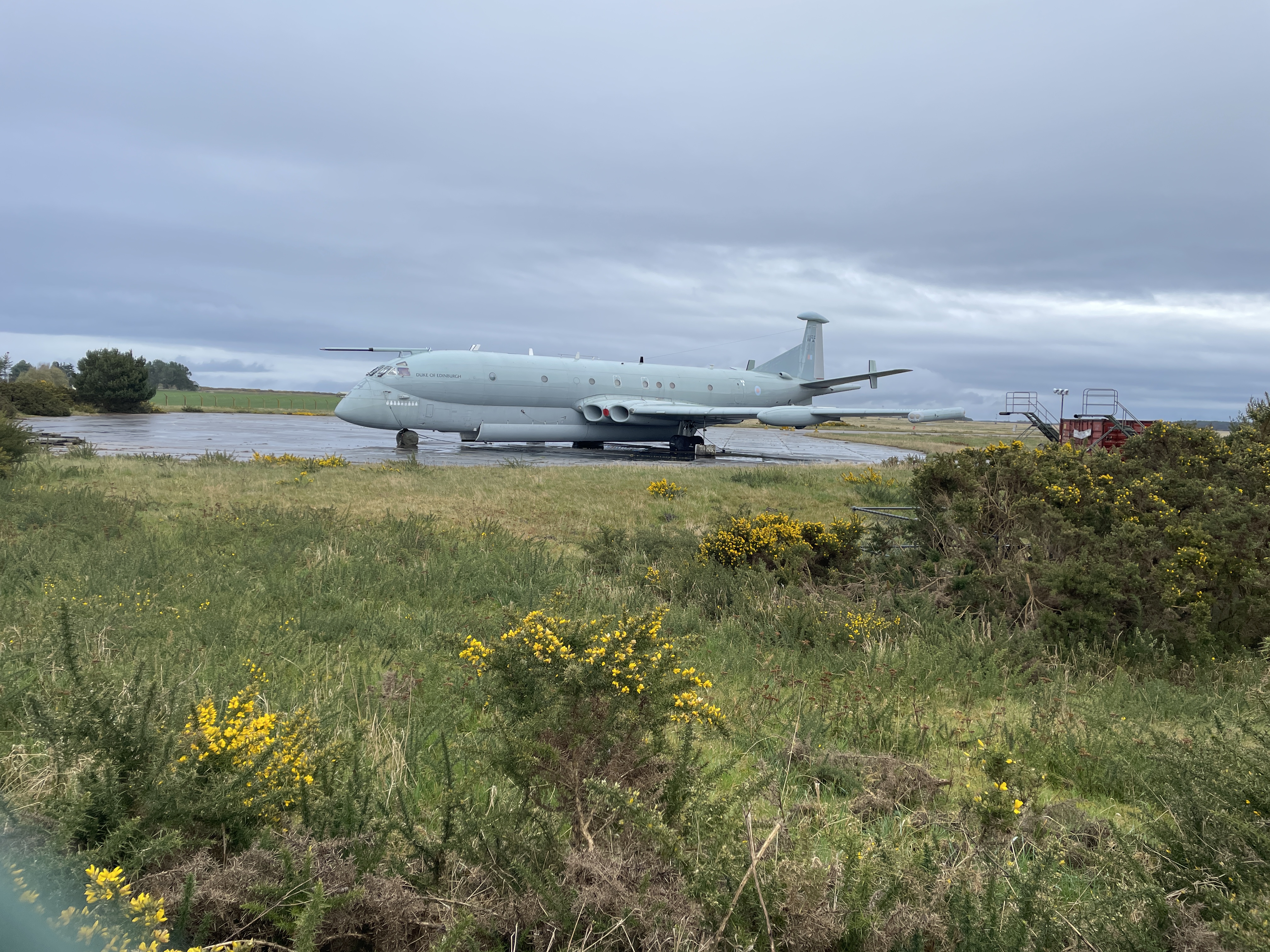
At the small village of Findhorn, near to Kinloss Airfield (pictured above with its Nimrod MR2), you tun inland towards Forres, so as to either pass the Findhorn and continue into another even bigger forrest – Cuilbin, or as I did follow the River Findhorn, up through Forrests and Gorges to meet the Dava Way.
The Dava Way – yet another disused rail route, but all is not lost as it is re-purposed for bikes or hikes, this line cuts inland towards Grantown and climbs up to high and exposed ground (expect headwinds – a small saviour is the halfway hut, it will treat you to some shelter!)
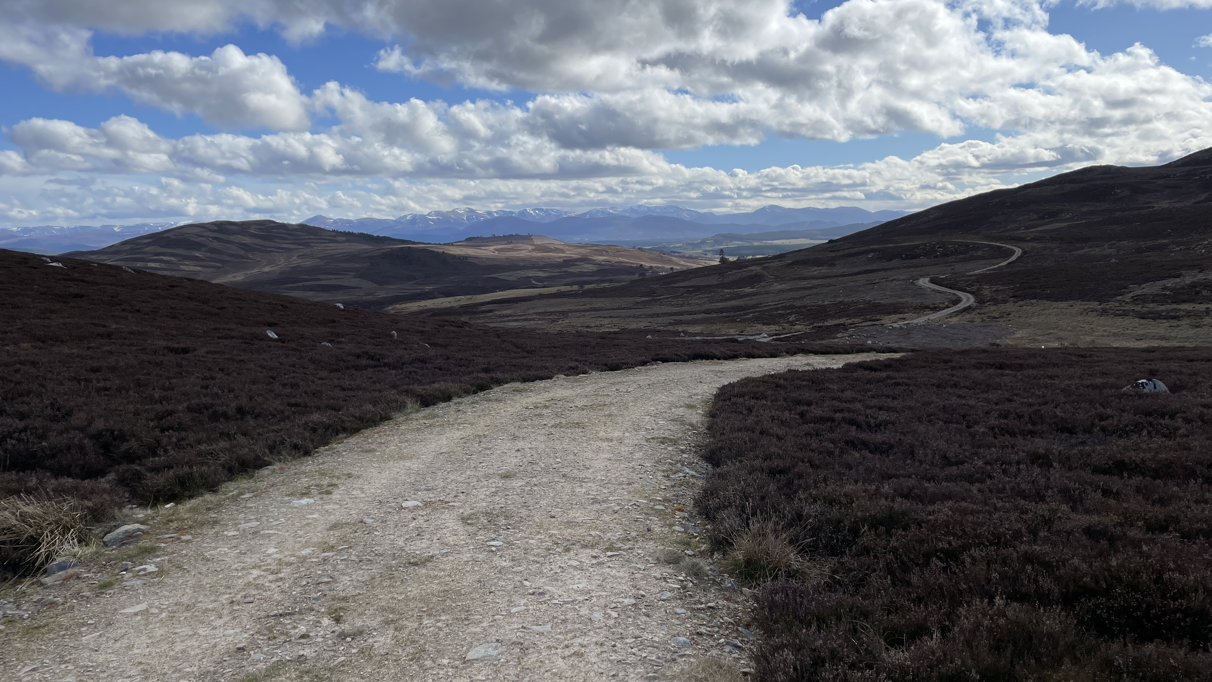
Before reaching Grantown, my route struck off to the west and on to some empty heather moorland, on a selection of beaters tracks towards Dulnain.
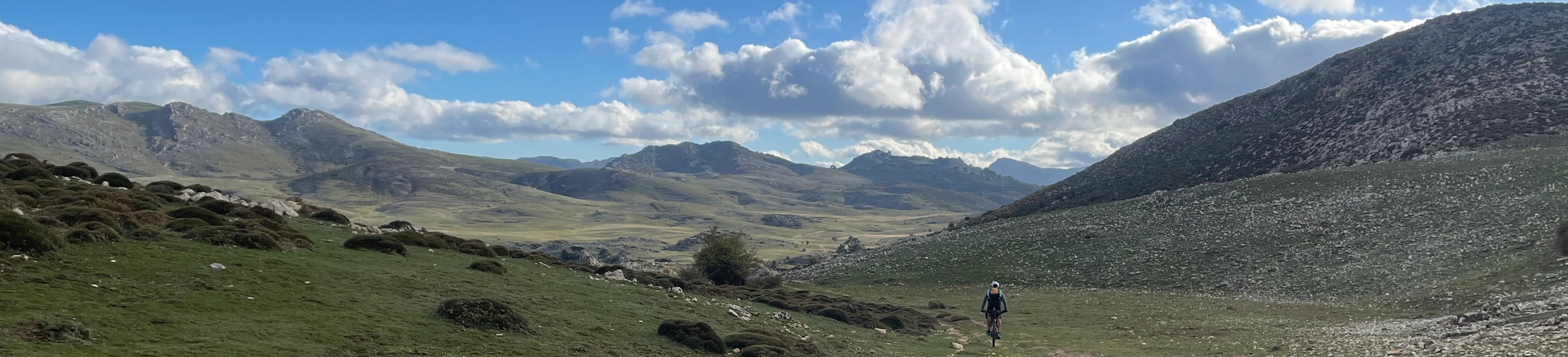
Mesmerising and Far-Reaching views to die-for!
Easy riding back to Spey Valley and then onto Carrbridge – thus closing the loop and finishing this fine journey. A journey of contrasts, constant surprises and beauty, fun pedalling!
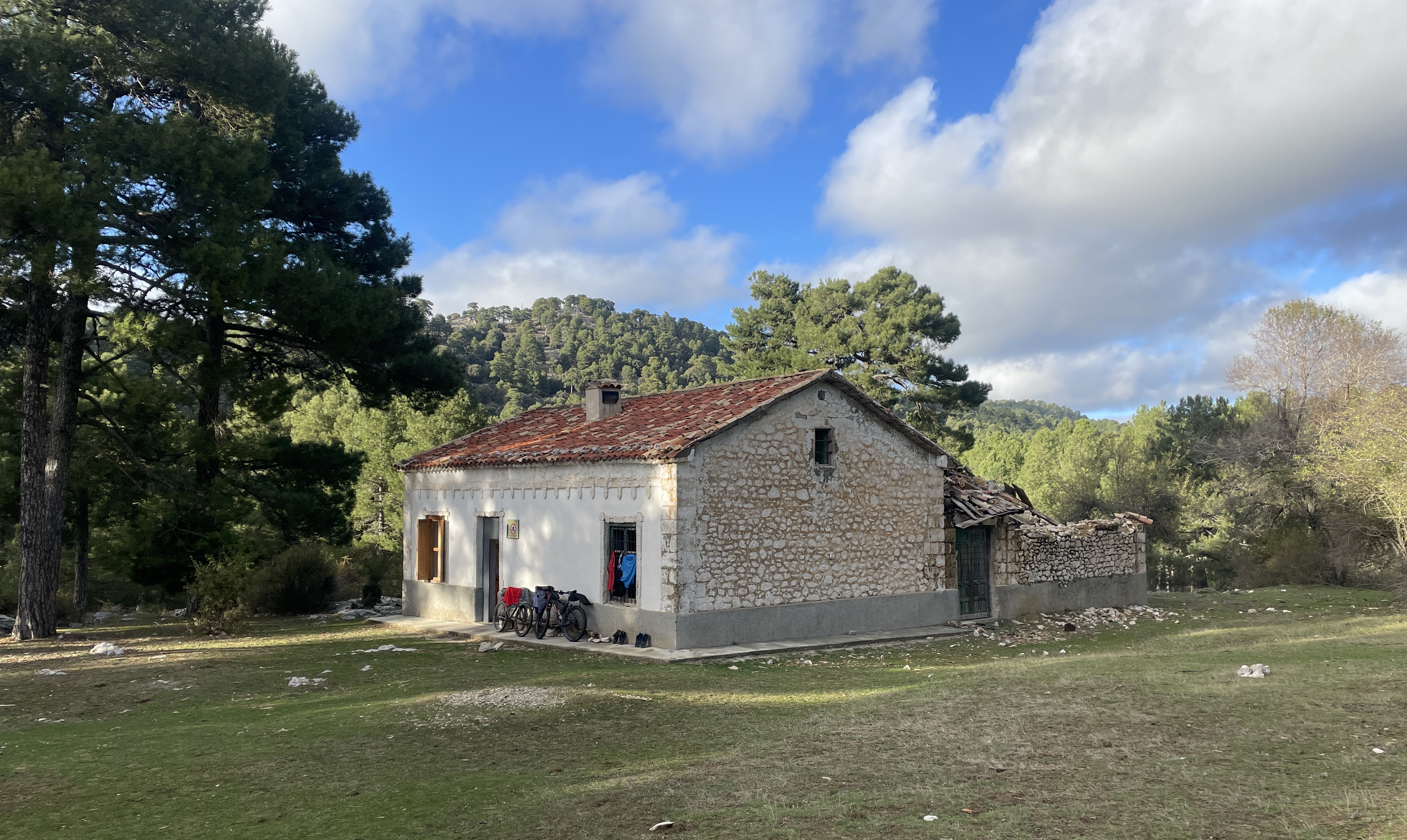
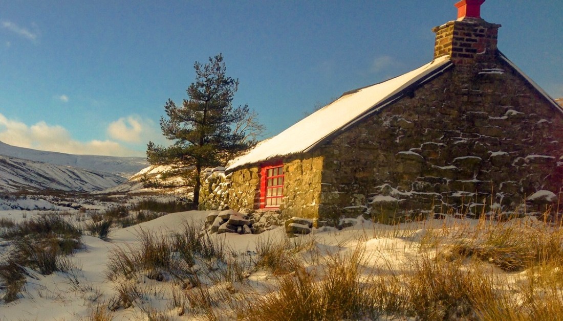
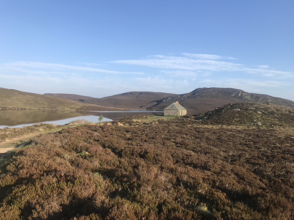
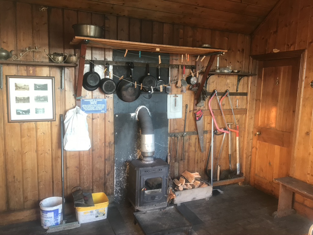
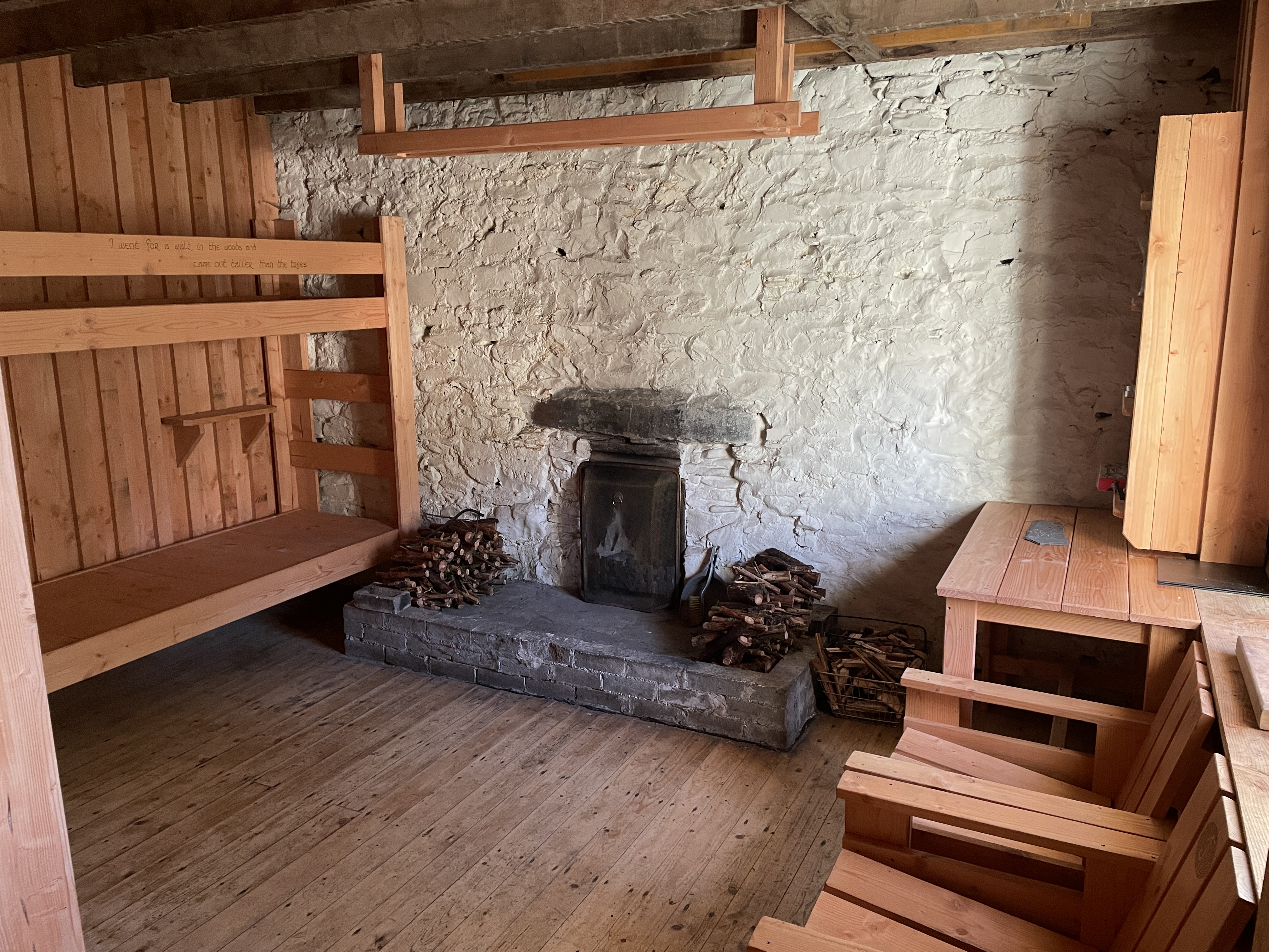
It may come of no surprise to the reader on here that I have a fascination and love of bothy’s. Not everyone is familiar with the term ‘bothy’, so i’ll provide a brief explanation:
‘It is a mountain shelter that is open for people to stop over for a night, or take refuge in poor weather, or just visit for a picnic or lunch. There is much more to the bothy than this, as they are all individual and have rich histories, both from the peasant farmers and shepherds that use to live in them with their families generations ago, to the mountaineers that have used them on epic and pioneering winter climbs. They are a wonderful asset to have in the UKs wilderness areas and a night in one can enhance any visit to the mountains, as well as the chance to have a great social encounter with other likeminded mountain visitors, of whom you may of never met before, nor meet again – but often those stories told and memories will never be forgotten’.
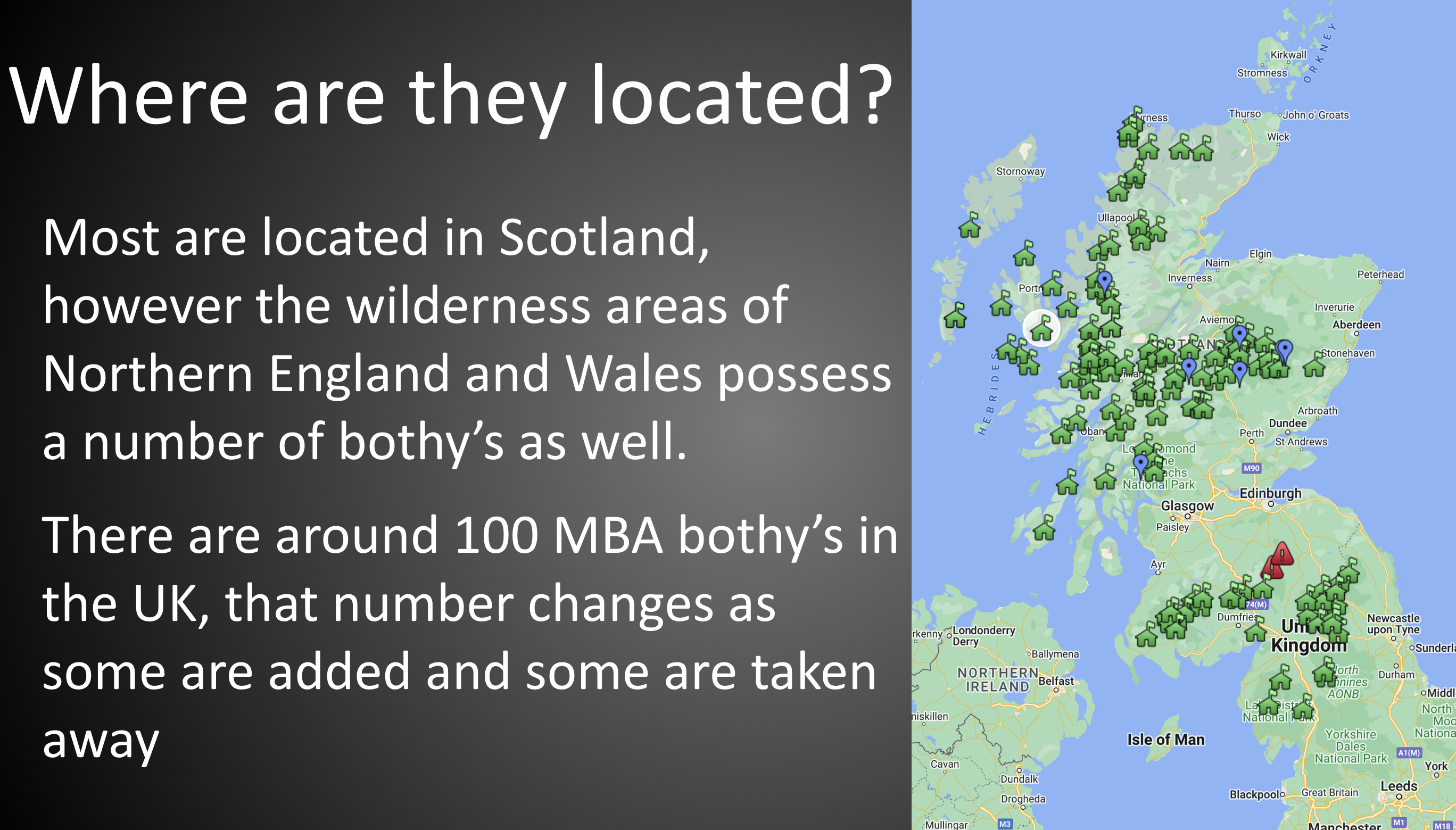
In no particular order I have included a range of bothy’s from locations all over the UK. Later on I will include a few of my favourite foreign ones – usually termed ‘refugio’, sometime just ‘hut’ or ‘hytte’ in Scandinavia.
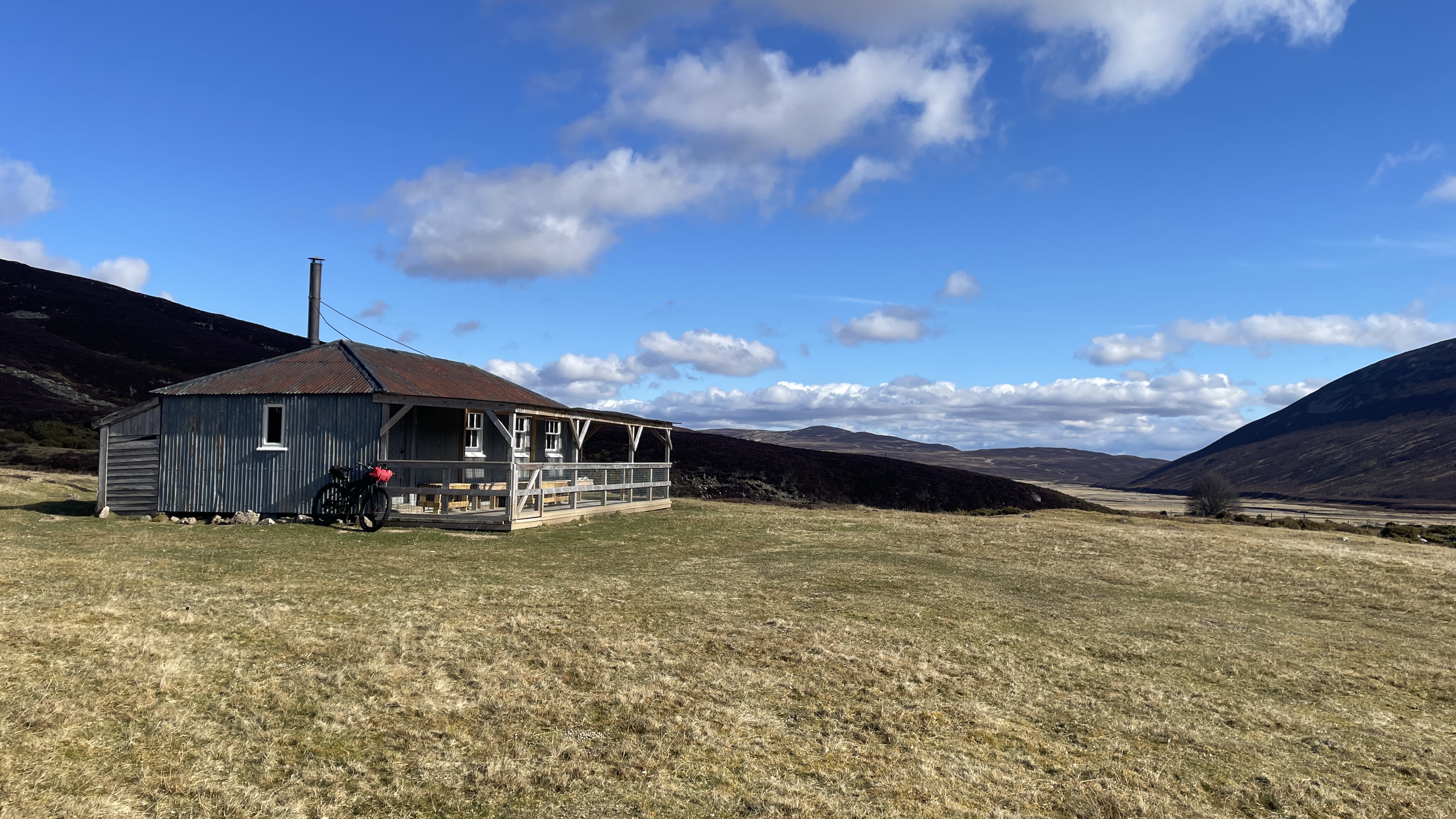
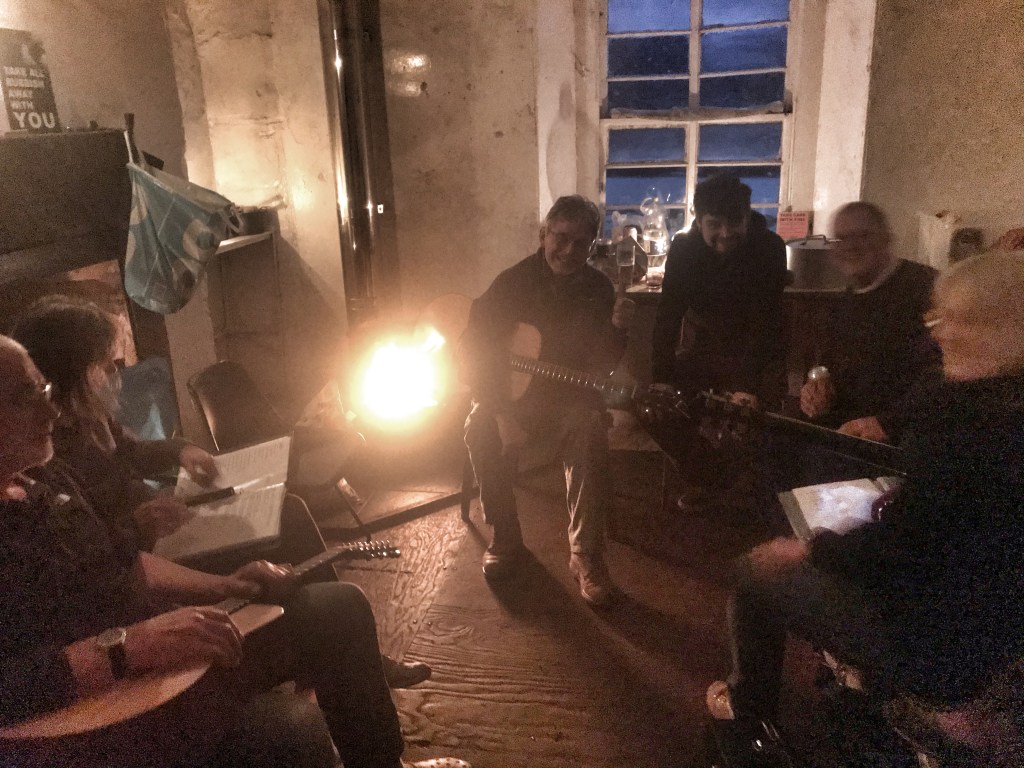
First up is the lovely Greensykes Bothy in the Southern Scotland area. I am now the Maintenance Organiser (or MO for short), who helps maintain, tidy and generally keep an eye on Greensykes. Each MBA bothy has an MO, or quite often two MO’s. Info and advice can be found via MBA webpage link: https://www.mountainbothies.org.uk/ If you start you use these places I recommend you to join, for £25 per year you get a quarterly news letter and the money from subscriptions is well spent on maintaining, improving and adding new bothies.
Here’s my ‘potted’ Greensykes story…
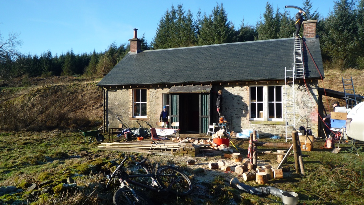
Greensykes Workparty – Jan 2017
I guess it all started in 2016, when I caught site in the Bothy Newsletter of a Workparty support request, at the time a chap called Mike Parker was at the helm, so I emailed him and asked if I could join and possibly bring my two teenage lads along – he was very accommodating and welcomed us along, this workparty in action is shown above – there was a lot going on, with thirteen helpers in all. It was in January and we had been blessed by the winter weather gods! It all started there…
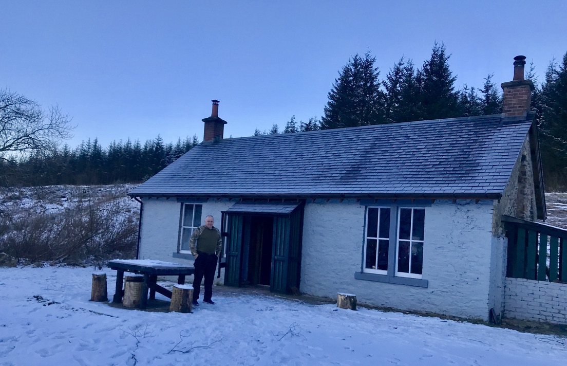
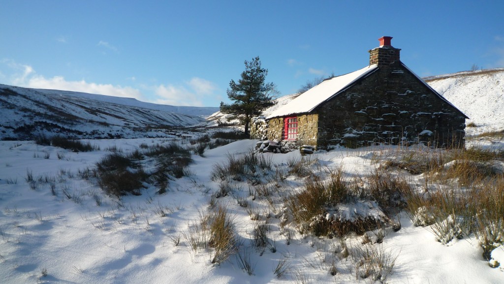
The ‘snowy’ one! (Jan ’18)
I have since visited Greensykes on many occasions, in all seasons, usually on the bike, sometime alone and sometimes with friends and sometimes with family. On one occasion, I can’t quite remember, but pretty sure it was winter pre-pandemic – so lets say January 2018. There was a lot of snow lying in Megdale and my ride in, up the dale got gradually harder, to the point at the sheep pens just before the forest boundary I decided to abandon the bike and continue on foot for the last km. I was following two sets of foot prints, so I knew that there would likely be other guests at the bothy. My assumption was correct as the smell of smoke drifted down from the bothy – a most welcoming smell to a weary and cold cyclist, even more welcoming was the greeting from the guests, they were as surprised as myself and it was the aforementioned Mike Parker that greeted me, he then offered me dinner and then plied me with some beers and whisky.
The previous ‘MO’ -Mike.
On my travels I find this happens all too often, usually with complete strangers, small acts of kindness and sometimes like this ‘quite big’ acts of kindness! I always pass on this gratitude in my own way when I meet others.
The evening went on until late and I recall uttering the words at some point – ‘I could fancy doing this MO role’.
Mike held me to this! A year or so later he asked me if I could take on the role, after some short thoughts and checks with the domestic management, I agreed to it. I would nominally begin in Jan 2020, with a ‘handover’ of tasks from the master. Meanwhile Mike was not leaving as he went on to fulfil a more demanding role within the Mountain Bothy Association (MBA), as the Area Organiser for Southern Scotland.
So that’s were it all started …and then the Pandemic hit, so for the best part of 18 months the bothy’s were closed, except for critical maintenance.
WinterSpringSummer
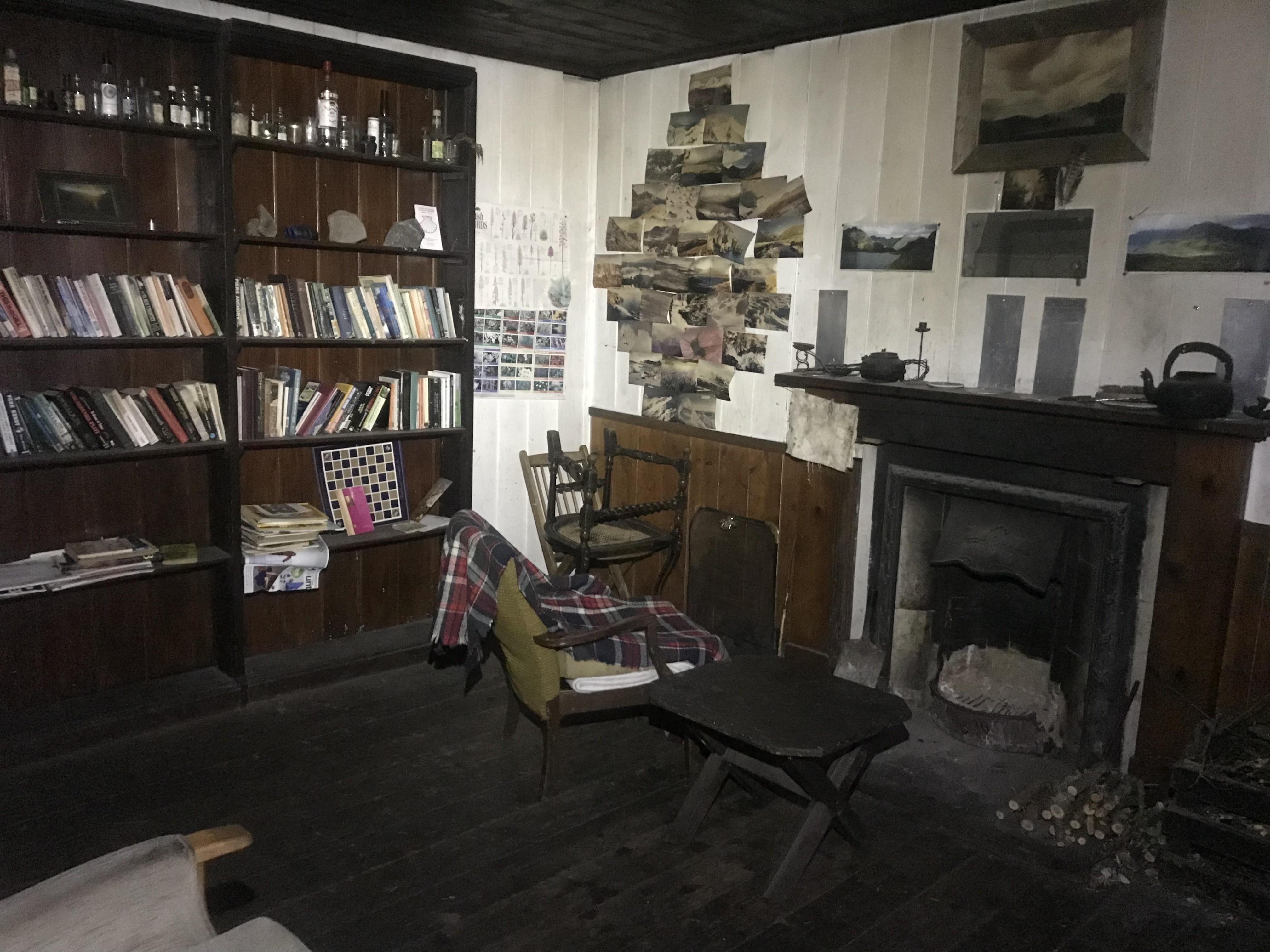
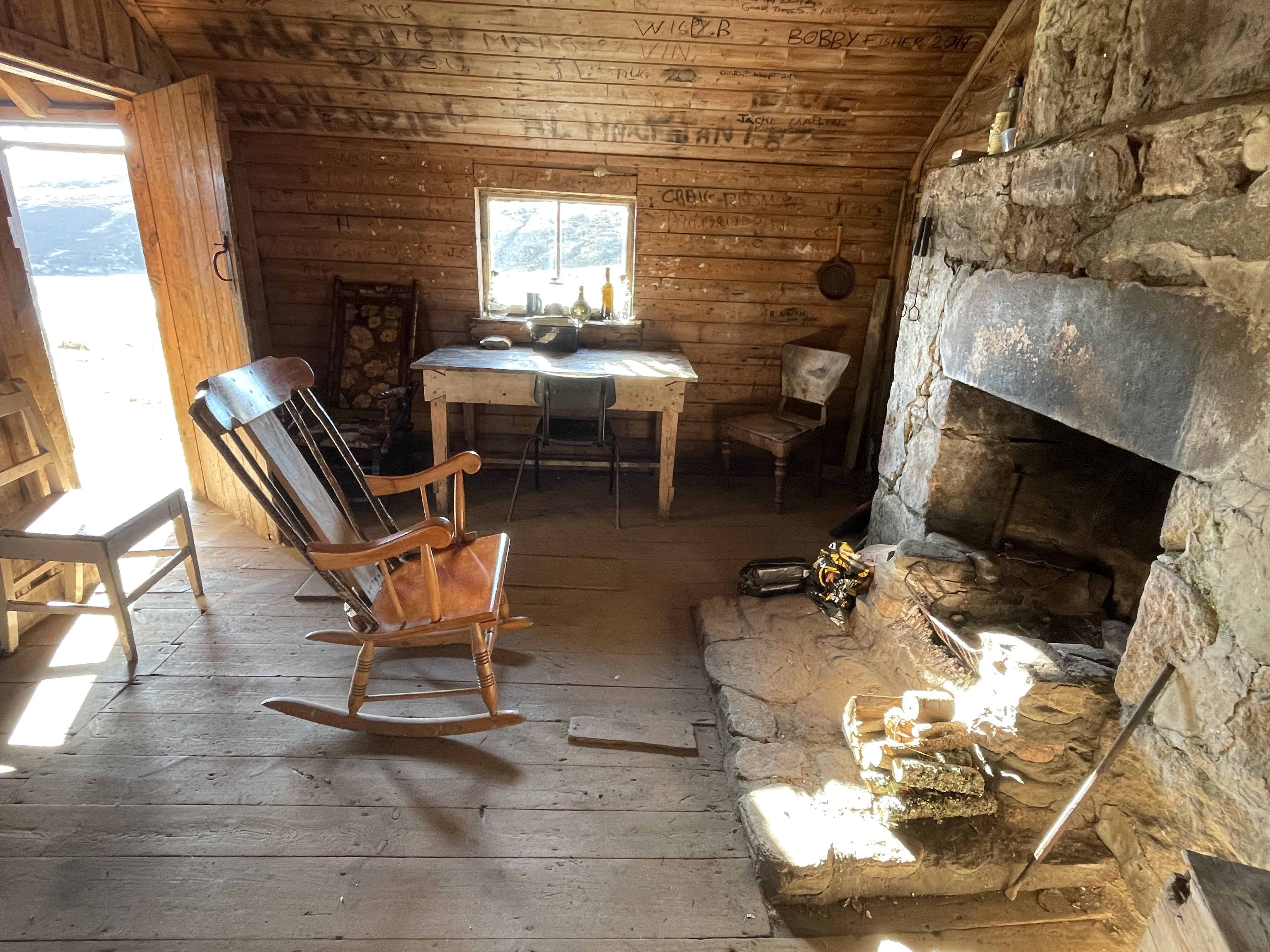
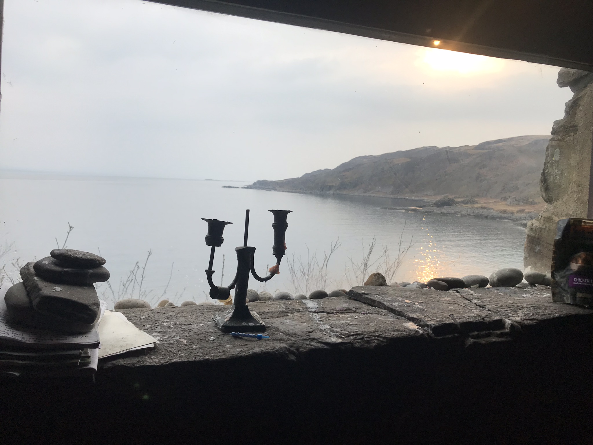
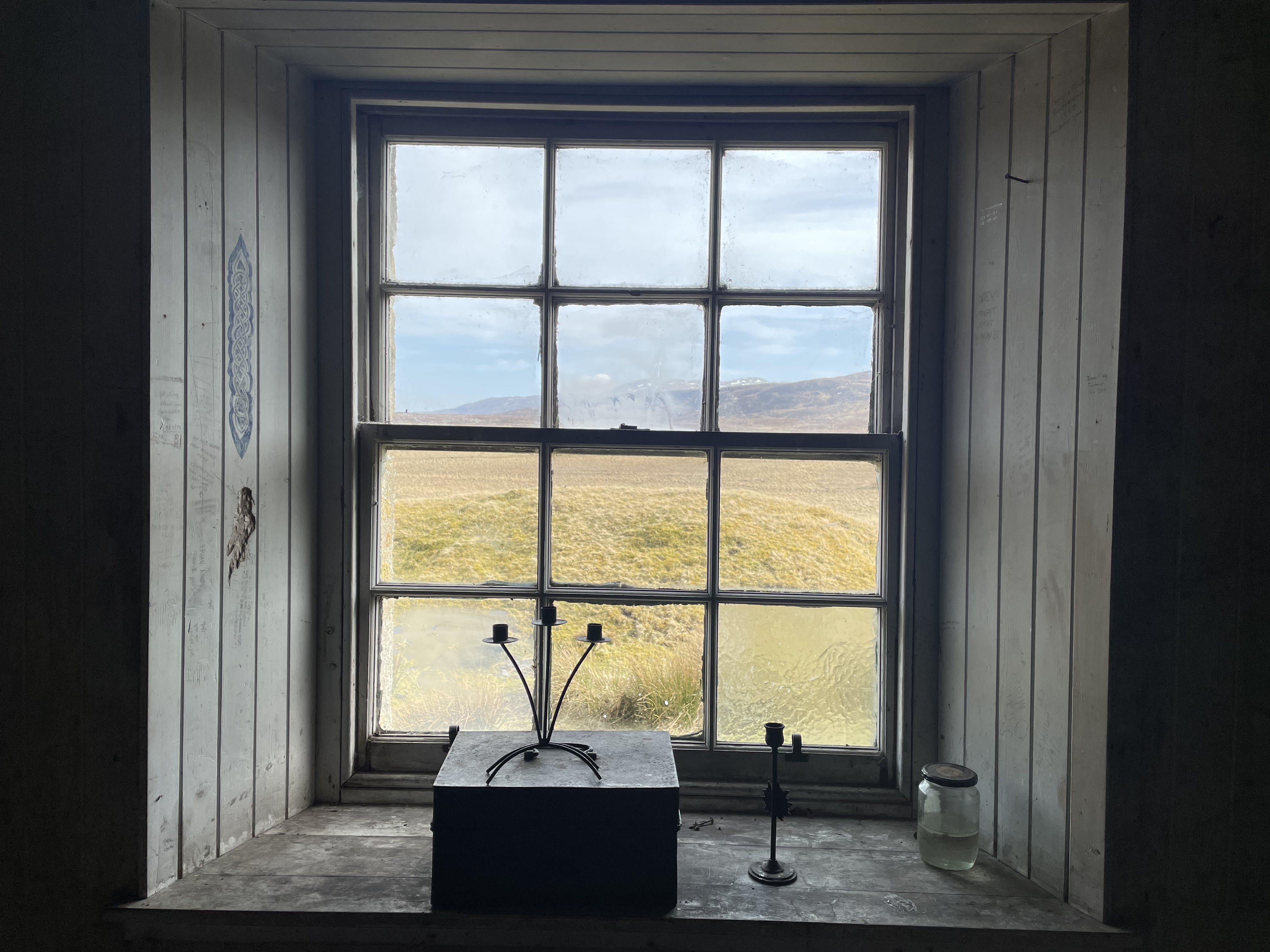
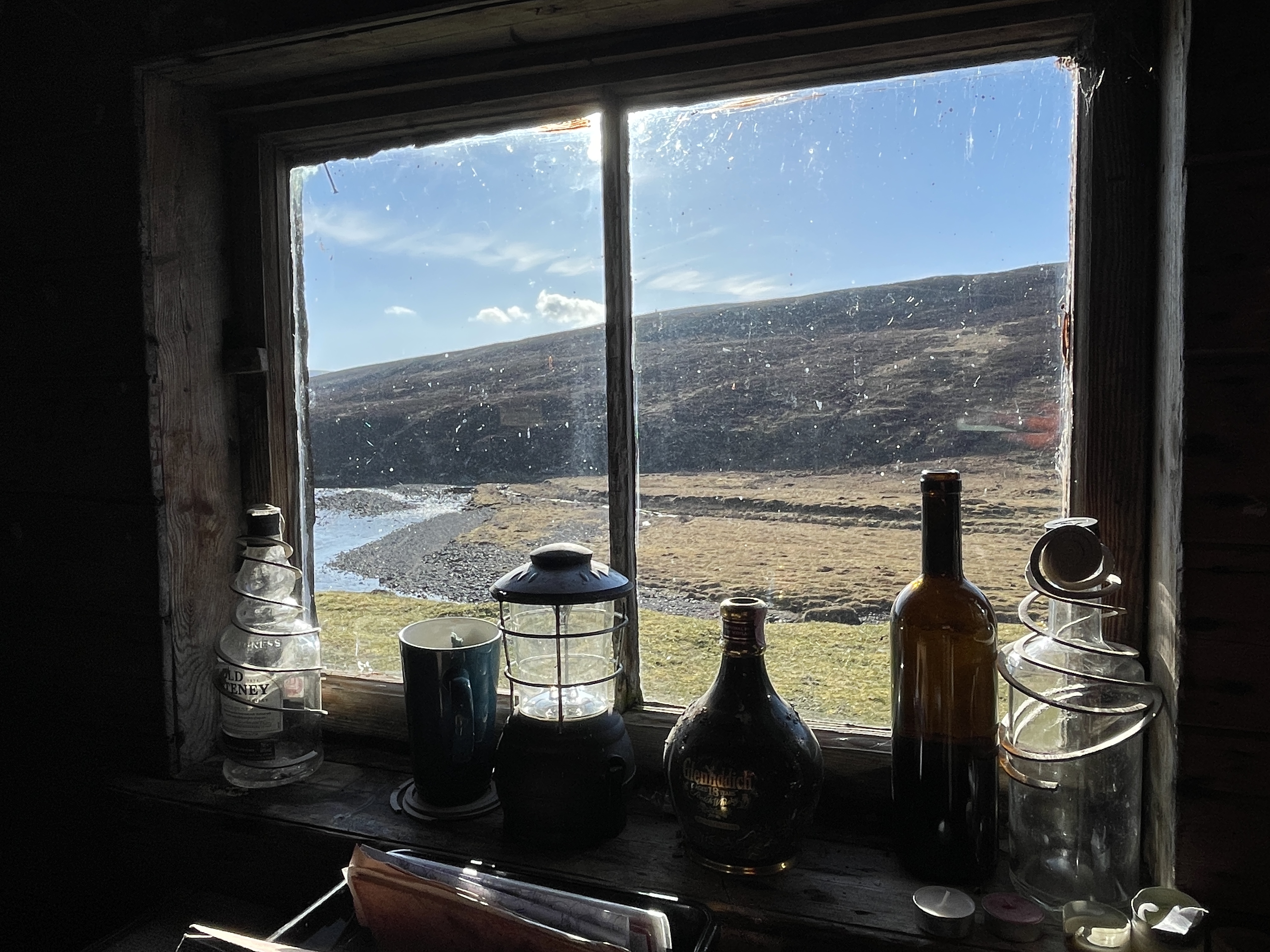
Some of the more unusual, interesting ones, quite often my favourites as they are tricky to locate…
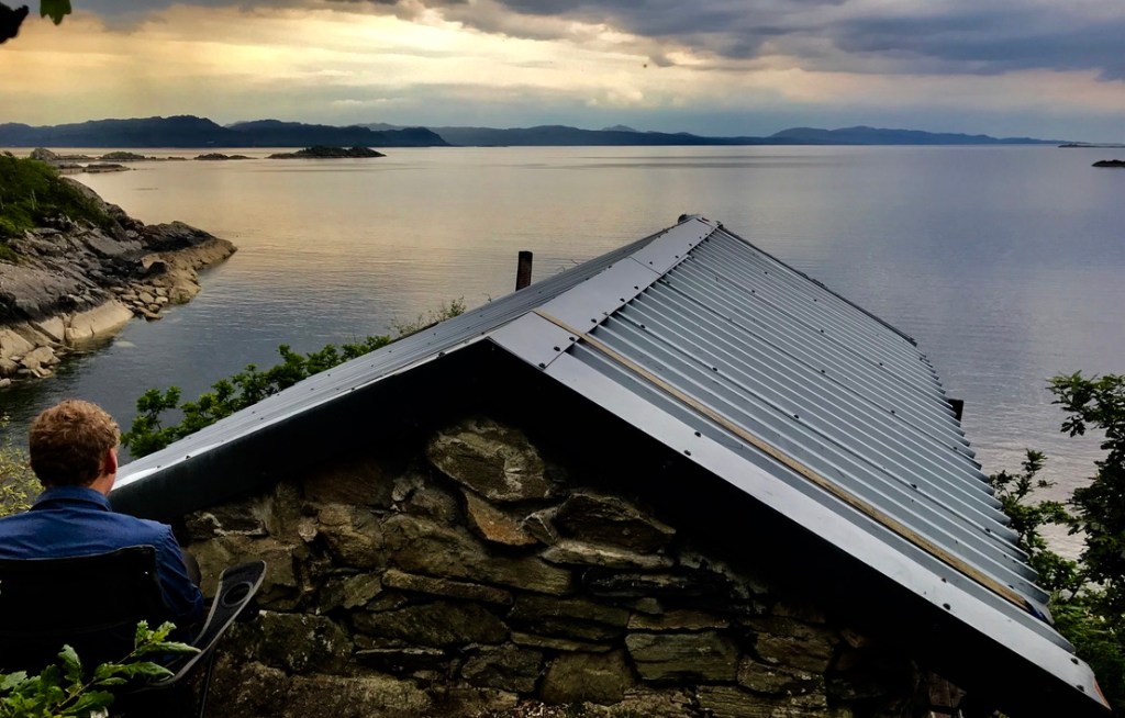
Not all the bothy’s in the UK are managed by the MBA, there are others, usually owned by the estate, sometimes managed by the estate, or sometimes just managed by ‘friends’. These places are not publicised, they are certainly not ‘secret’ either, you just have to do your own research to find them, or quite often there whereabouts may be shared during a night in a bothy with other like minded folk. This keeps them special! They are located across the country – Wales, England and Scotland. I am not sure what is on offer in Ireland..? (something to have a think about…?)
A few of my favourite non-MBA bothy are pictured below. I am happy to share their locations, but it will have to be done with you over a whisky, in a bothy and sat in front of a toasty-warm fire!
I also have many more to find, some that I know about already and others that I will find on the way – both by riding by them, or finding out about them during the ‘bothy nights’.
The interiors… these have a wide range of styles and decor, from the quaint to the curious, to the well presented, some have little or nothing and some can be down right rancid – no photo’s of these one’s I’m afraid.
…and it is so nice seeing bothy’s like these ones being well respected – clean, tidy and a small wood-pile for the next visitors.
Some Bothy views to die for…
Bothy Artwork …or is it graffiti?
I can not locate my other bothy ‘artwork’ pictures – when found I will be sure to include them.
So what does Europe have in its wilderness places?
There are many countries that I have not visited in Europe, however in the ones that I have, I have found huts and refugio’s that serve a similar purpose and usually have a small group of people or friends to help maintain them and keep them special. In no particular order..
ItalyItalySpainSpainSpainSloveniaMontenegro
This post is still a little ‘Work in Progress’ – I will add and update it as more discoveries are made.
If Carlsberg did Bike-Packing Rides… this would surely be it!
This time two weeks ago it was my 53rd birthday and I vividly recall the pain and the pleasure of struggling with my loaded bike up a rocky track in the dark trying to get to Refugio La Vecchia.
La Vecchia – Fairy Tale hut tucked away in the mountains
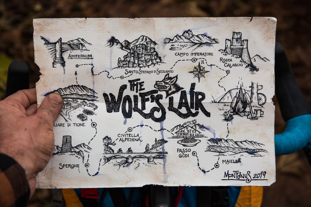
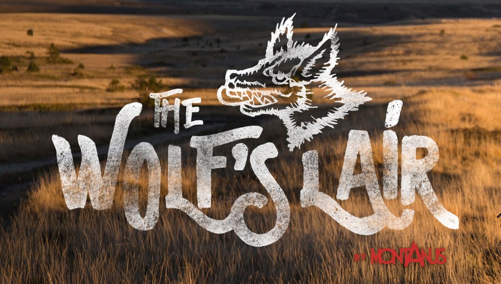
Three years has passed since my last foreign bike-packing trip – back in September 2019, after that last trip my ride buddy – Mark Wildsmith and I had set eyes on this bike-packing film called the ‘Wolf’s Lair’ [link]. It was 10 minutes of jaw-dropping wonderness, beautifully and imaginatively filmed by the Italian duo behind ‘Montanus’, it inspired us and we wanted to experience these wild landscapes that we had not associated with Italy. Then in early 2020 the world changed and along with it came travel restrictions and everything else, so during these difficult, restricted times I adapted and started to explore and re-explore the beautiful areas that we have here in the United Kingdom – and although we may take it for granted we are lucky to have such a varied and beautiful little country. Eventually however the curiosity to travel further afield was beckoning and the lure to experience different cultures, landscapes, weather, food and all that, prompted us to make the decision to go to Appennini Centrale and ‘do’ the Wolfs Lair – and we loved it all!
The Route of the ‘Pimped’ Wolf’s Lair
We chose to go in Autumn, mainly as it was cooler and we knew that the autumn colours would be in full splendour.
Chapel on Monte Tranquilo
After the chaos of summertime travel through the airports, things had quietened by early October and we had a pain free flight to Fiumicino – the main airport for Roma, which lies by the coast.
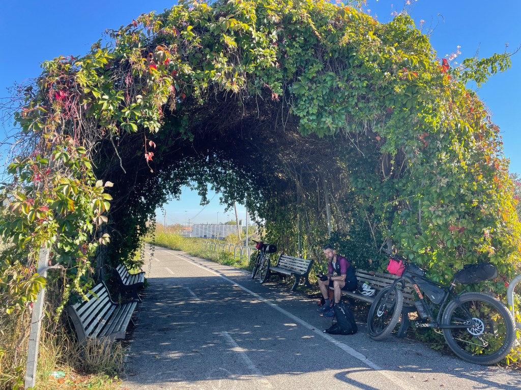
Fiumicino and the Canal that links the River Tiber to the Sea
This is where our cycling adventure would begin, we had a B&B for the first and last night near to the airport and in the town of Fiumicino, which made a nice and interesting place to start and finish, we did not realise it, but it is famed for its fresh fish and its numerous fish restaurant’s (the B&B also let us store our bike-boxes, which was kind of them helpful, as bike logistics can be a pain!). Here we found that the Italians like to eat and food in Italy is generally of a very high quality and more often than not cooked using local produce.
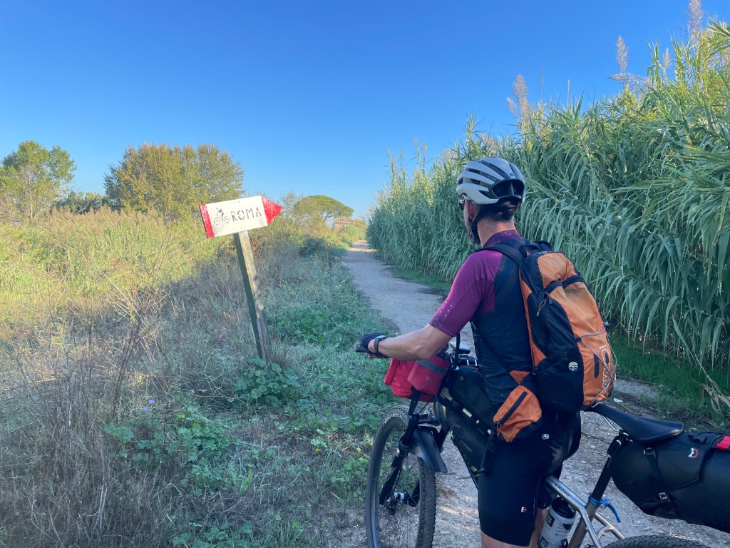
The Off-road route into RomaRoma this way…!
Our plan to get to the central mountains, was to cycle the 40km into Roma, then do some swift city sight-seeing – Vatican City, Spanish Steps, Colosseum and a few other ‘pop-up’ places along the way.
As it happened there was pretty good cycle route all the way into the city centre, most of it avoiding the roads and this was a really pleasant surprise as we were both dreading the Italian traffic and their driving skills. The cycle route enters the city in the most innocuous way using the flood channel of the River Tiber which is set well down from the rest of the city, the river itself was a surprisingly fast flowing and at times a violent white water river and not what you would usually associate within a city centre and certainly not one to fall into either! It was along the river that I recalled the mini’s of the film the Italian Job using this as their escape route!
Mark was navigating (on the nav, as we say!) and the route from the river took us quickly to the Vatican City, even at the relatively early hour (10:30) it was a chaos of tourists and while it was good to see this important landmark, we were pleased to soon leave it – we now had to head across the city to the Termini Station, here we would get a regional train to Avezzano in the mountains. From our brief experience trains in Italy seem to work well for bikes, the regional ones have a large area for up to 6 bikes and the trains are all electric and pretty comfortable and a lot cheaper than the UK. It would take us around 2 hours to do the 120km journey, through many tunnels and viaducts rising up to around 700m.
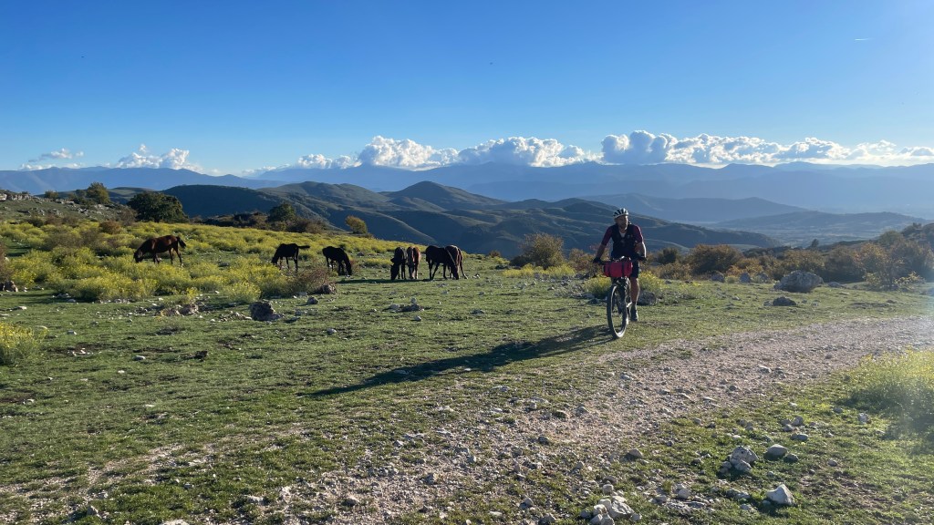
The town of Avezzano is on the edge of an unusual plain, which was covered with water and was Italia’s biggest lake, drained in the 1700’s and now a fertile industrial scale growing area, from above the landscape looks like a patch-work quilt made up of thousands of rectangular fields, we would later cycle through this landscape, but for now we had to go the other way and climb into the mountains. By this time it was mid-afternoon and we had what seemed a straightforward and do-able 50km and 1400m cycle along a mix of road and tracks. It soon got hard work with loose and rounded gravel and we soon realised we were not properly ride fit as we had been in the past, partly due to us both having done a lack of the ‘long stuff’ and in Marks case recovering from his Covid of the previous month, still it was a joy to be in the mountains – freedom and seven days of adventure ahead!
La Vecchia by night
The night time soon arrived, the temperature dropped and we still had around 10km to go, we had climbed up to 1600m by now and were above the warmth of the trees and forests and the double track had turned into a vague rough path. We had both hoped on this trip to do some riding at night, as it in itself is an exciting experience, but we had not planned on doing it on night one – at this point sticking to the vague footpath was a challenge and whilst it would make for a great descent, it was a tough ride and push up. Despite the hardship our excitement levels were high, as we had a small stampede of Red Deer pass ahead of us and we instantly thought that Wolves would be in close pursuit, but not so – phew!
The mountain top eventually levelled and we started to drop over the far side, by now the night view was far reaching and the sight of many distant little mountain villages cloaked in their orange street lights, all under a blanket of stars was quite something. However, by this stage we were both pretty exhausted and hungry, we longed for the cosiness of the Refugio, thank fully after a scramble through some rocks and trees we could see it emerge and it looked to be unoccupied, which was good as it was tiny. This Refugio was not on the Wolf’s Lair route, this was a ‘POI’, that I had found on the map and I can’t recall if it was through Google or the wonderful navigation tool of Komoot, either way we knew that it was ‘gem’ and it was like a little fairy tale grotto all built into some rocks and hidden on the mountain side, 1900m up – a place well worth visiting! Anyway it was my birthday and it was time for a beer… which we had lugged up and worked up a thirst. Despite wanting the beer, the hard toil had made me feel a little nauseous and it took an hour before I felt ready to drink it, which meant it could chill down nicely – I can still taste that one, so hard earned! Inside the hut the old stove was soon lit and we had food being cooked up. It may not have been a wild party, but it was a pretty special place to spend my birthday and a great location to start our travels.
…and the view from it the morning after – stunning and in no rush to leave!Birthday Boy – not a bad place to start the first day of 53 – feeling as excited as a child! [Photo credit Mark Wildsmith]
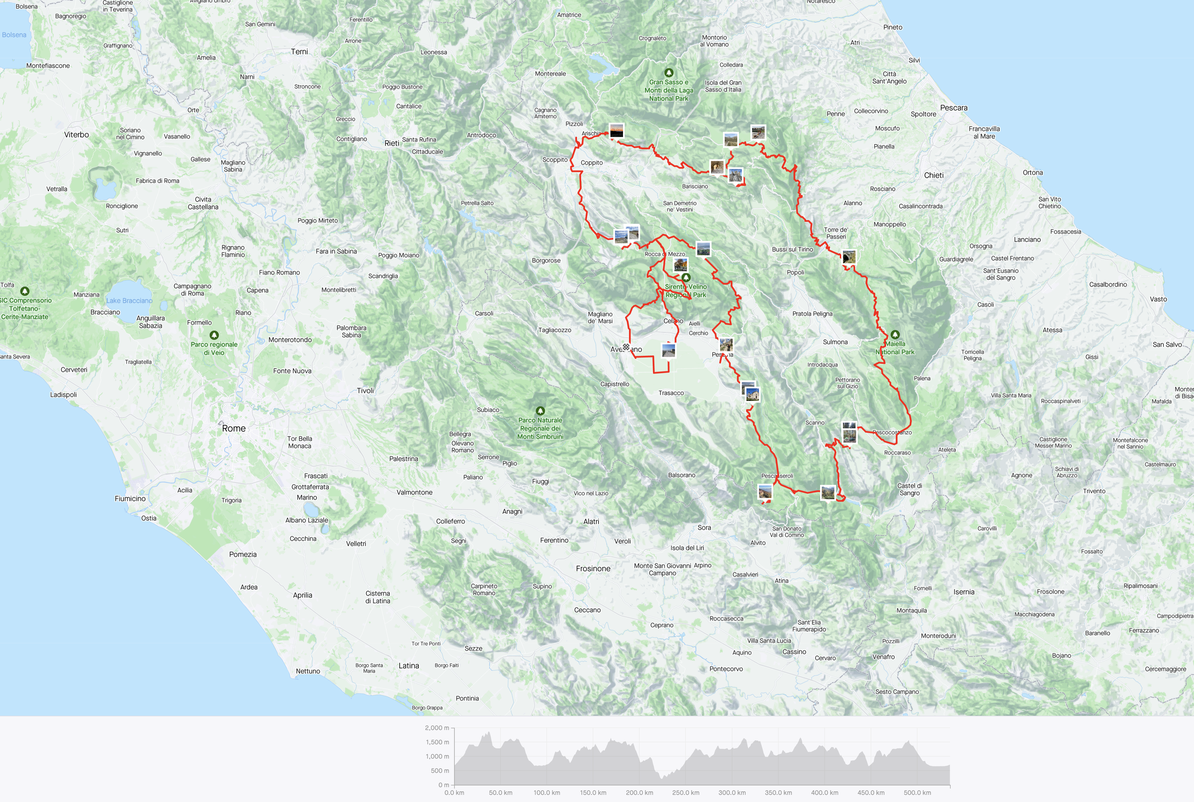
So to the Wolf’s Lair route itself, in its normal form it is around 400km and 9000m vertical, however I had found a few other POIs, that we extended the route for, this was through playing with Komoot, a ride planning an navigation tool – from my initial experiences of it, I would recommend it, our extended route took the distance up to 550km/12000m, which meant a rough average of 80-90km per day. Not a massive amount, given previous rides, but enough for us not to feel time pressured, which had happened in the past. The route is in the very rural and mountainous region contained within the Abruzzo province and links up four national parks; La Aquila and Avezzano are the main centres, however there are numerous small towns and villages enroute, this generally made it pretty easy getting supplies, but it is worth bearing in mind that most shops are closed on Sundays, however there are also numerous bars and cafes to get food and drink from.
The actual landscape, was quite unusual – Limestone Karst, as such we saw very few streams, rivers or lakes and quite often were riding in these ‘sink-hole’ type features. It was really hard to get the lay of the land, and it made it even more interesting.
For the main Wolf’s Lair journey I will let the pictures tell most of the story and add some brief words when needed…
Day 1 – After descending from the Refugio we pass through a 1.4km tunnel to nowhere in particular, only one car passed us by.This was on the other side of the long tunnel – a portal into another dimension.Old farm tracks – some dust and some stone.Empty roads – just the odd farmer and the odd Fiat.Typical scenes on Day 1 – The Beech Forests surrounding the plains, good cover for the predators!Soon in the Gran Sasso NP, after passing through the not-so exciting bits around L’Aquila.Day 2 – The historic old village of Santo Stefano do Sessanio. Opportunity for tent drying (a lot of condensation) and a picnic breakfast. [Photo credit Mark Wildsmith]Rocca Calascio – Ruined, historic and beautiful.The same castle from a different angle – it was hard to leave this place!The beauty continued inside. Paintings by a local artist.A closer view of the Corno Grande, the highest mountain in Central Italy at 2912m, it was here that we briefly met two other Italian ‘old boys’ on E-Bikes and they kindly named all the peaks for us and I’m sure that they had climbed them all!Obtaining Drinking Water was never difficult, even if it was shared with the ‘locals’. [Photo credit Mark Wildsmith]The unusual ‘dry river’.Down the Canyon (this was an off-piste deviation and we had no idea where we would exit it). [Photo credit Mark Wildsmith]Even more unexpected, after exiting the dry river we came across a DIY-BBQ ‘Ristoro Giuliani’ – having missed the last village, we were a couple of hours overdue for lunch – lamb kebab, toast cheese and a big beer did the trick. [Photo credit Mark Wildsmith]Another of those ‘infinity roads’ to nowhere. [Photo credit Mark Wildsmith]After the ‘Piano’ (Plain) we plunged deep into the forest, we spent most of the end of day 2 descending through these. End of Day 2 – a long shift (07:00 to 19:00) and we decide to strike for the comfort of a B&B while in a small town – the scene above is typical of many of these towns and villages. This was a pretty overwhelming day, quite hard to take in all the amazing places that we had ridden through.Day 3 – The first surprise – a huge concrete viaduct built in the sixties – an impressive feat of engineering, now used for bungee at the weekends.More forest…Forest Camp – these worked well as they stayed warm and dry and also an abundant supply of fire wood. The fire pit was covered the morning after – leavenotrace!
Day 4 – A Slideshow to walk through, after leaving the forest camp we descend on drovers roads, taking in an old ‘ish’ ski-station and a characterful restaurant and its friendly dog and amazing croissants (a word about the Italian croissants, they are bigger and crispier than their French cousins and usually have a filling of custard, or chocolate – great with a double expresso!). We head into the Abruzzo NP, its also a Sunday and like North Yorkshire it is full of motorbikes ripping up the tarmac. After the previous couple of tough days we plan a slightly shorter one and decide to head up Monte Tranquilo.
Day 5 – For some reason, maybe it being a Monday..? we both felt a bit disengaged and struggled to get going – even despite two expressos and two filled croissants each (which only cost 8E total!). We quietly chugged along and soon left the Abruzzo NP, it felt like we had passed through it all too quickly and the next section, despite being pretty good cycling, did not seem so great. However we did pass some strange ‘ghost villages’ and interesting landmarks, there was also some threatening weather, so far in the trip it had all be dry and sunny. We had a few spots of rain late PM and we could tell as we moved between valley systems that some heavy rain had passed through. We had earlier stocked up at a supermarket and were now keen to camp. Its worth mentioning and it happens all the time when bike-packing – you always seem to see the perfect camp spots at the wrong time of day. It was going dark quickly, the mist was down and it was dripping wet everywhere. To make things worse our route took us through a small steep sided canyon, quite vegetated and totally unappealing to camp within, persevering, we eventually climbed out of it and reached a Fontaine and a picnic area, rather luckily we found a cosy and dry camp spot under some beech trees also with a fire pit (the ‘trail gods’ helping us again!) – it felt good to finish this day and a beer was needed. I think the ride fatigue had caught up with us and taken the edge off things and a good sleep would sort things hopefully…
Day 6 – This was to be our last day in the mountains proper, it sort of felt sad to be leaving them, however as usual on this ride more surprises were in store… First up was another ghost village of Pagliare di Tione, this was an eerie place as the early morning mists swirled, we had not had breakfast so we brewed up here – dozens of old houses, all empty and some in better states than others, some locked and some unlocked. It felt like we were being watched and there was a presence of something (cows..?) The coffee and bread and cheese perked us up and it would be another 20kms or so and we would be at our start point / finish point of Rocca di Mezzo. However before we got there we had to negotiate the sticky mud that we had heard of… Our bikes had stayed quite clean up till this point – hopefully we would find a tap and wash area in the next village (and as it happened we did – it was good to de-gunge things).
I have not mentioned the other redeeming feature of this ride and this was… there were no gates, well not quite true, we had five or six rickety wire-gates to pass through, that was all in 550km of riding. The landscapes had very few fences and walls, it added to the rural feel. Why in the UK is our agriculture, estates and forestry so obsessed with fencing everything up..?
Celano Castle.
The last night of our ride would see us reach the town of Celano, very much dominated by its huge castle. This is a must see and along with all the other historic sites that we saw along the way, it added to the extra special feel of this trip. Everyday along this ride there was a surprise of some sort, usually it would be seeing the landscape dramatically change, or the sighting of a wild animal or bird, while we did not see a Golden Eagle or a Brown Bear we did glimpse a small pack of Grey Wolves and we could hear their cry’s and barking. I hope that the wildlife and its apex predators continue to grow and roam afar; the national parks and protected areas are doing all they can to protect these species, however where the wild animals meet the areas with more humans, or areas not protected they are at threat. A fine balance exists…
As a cyclist it is not the wild animals that usually pose a threat to us, more the farmers dogs and on past rides we have had some scary close calls, in Abruzzo most of the dogs seemed pretty chilled, we only had a couple of dog chase incidents and thankfully we got away in time…
The plain, once the bed of Italy’s greatest lake (and another infinity road to nowhere).
The last day of the ride in the mountains and we get to cross the great plateau, to go from Celano to Avezzano (train here to Fiumicino, via Roma), this flat route mainly consisted of minor dusty straight-line roads and 90deg corners, fun at first, but soon starting to look all the same and very boring after doing 25km of it, also the totally disrespectful truck drivers who just blasted past and chocking us in dust. Another recollection from along here – I know the meat industry is pretty grim, but here the industrial veg farming was not so hot either – looking dirty and scruffy! On that note Mark managed quite well getting veggie options, some places better than others, I also made a conscious effort to take the veggie option, but sometimes this was lost in translation, or I was just craving something meaty! However the fish was very good and it was a nice treat to have the fresh fish on offer back down in Fiumicino.
[artwork / photo credit – Montanus]
As a wrap-up — I thank Italy and its lovely people for providing such a great adventure, I thank Montanus and Bikepacking.com for the superb route and information, I thank Mark for being awesome company…
– and I thank my wife and my family (and my little dog) for letting me go – these adventures help keep me alive and reset all those critical checks and balances.
Wolf’s Lair – done the full circle and back in Rocca di Mezza [photo credit – Mark Wildsmith].
…I did not mention the bikes… both our trusty steads performed so well. We both had punctures that self sealed and that was it really, maybe a few new creaks..! For me I was riding a larger framed Fatster, and while a little less agile maybe, it was super comfy and well suited to all the surfaces. While on bikes, I would definitely recommend an Mtb for this ride, while a Gravel Bike will do it, having fun on the descents and not having to worry about smashing your rims, out-weighed the potential extra gain in speed that a Gravel Bike may have on the smoother surfaces.
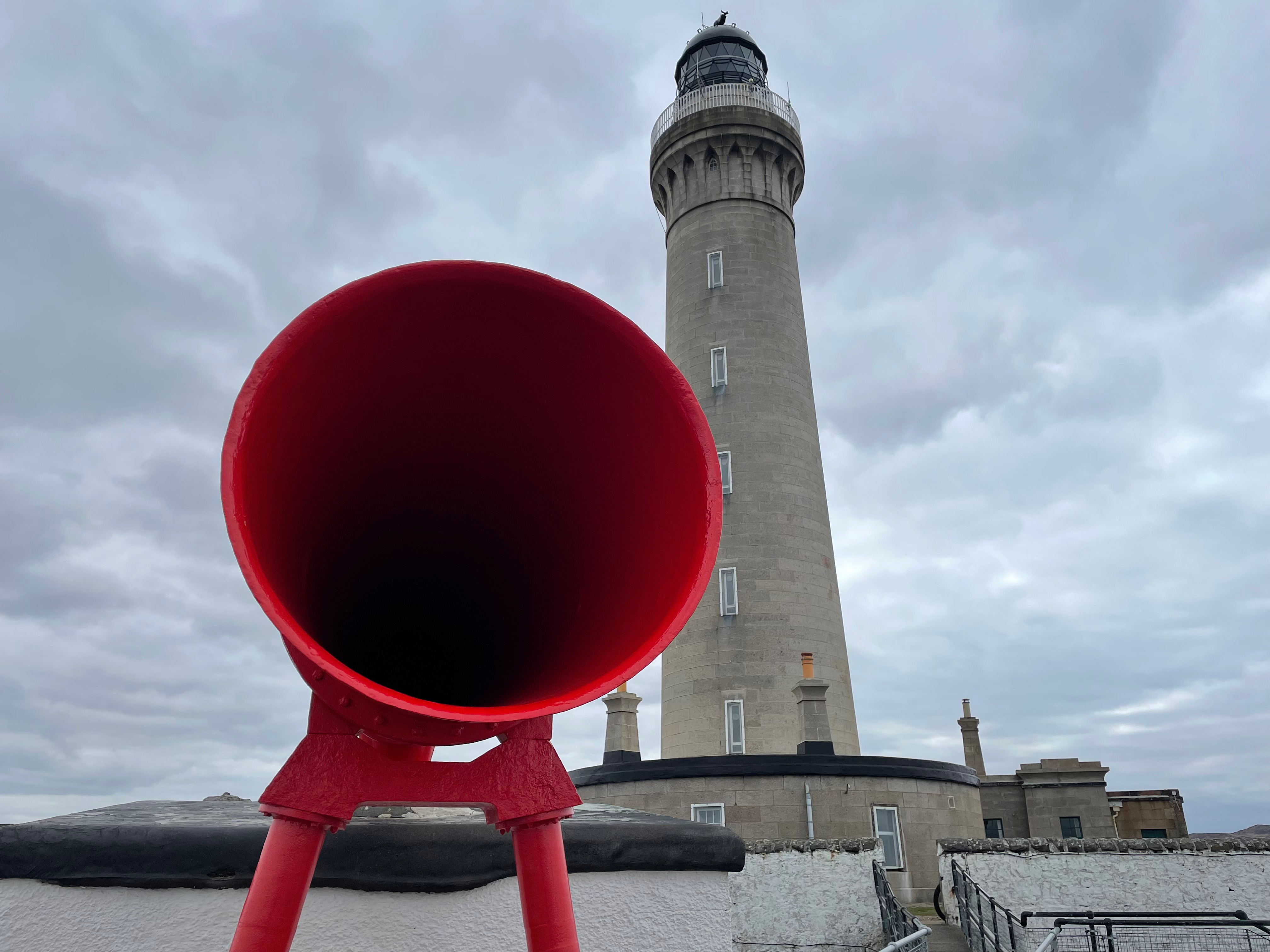
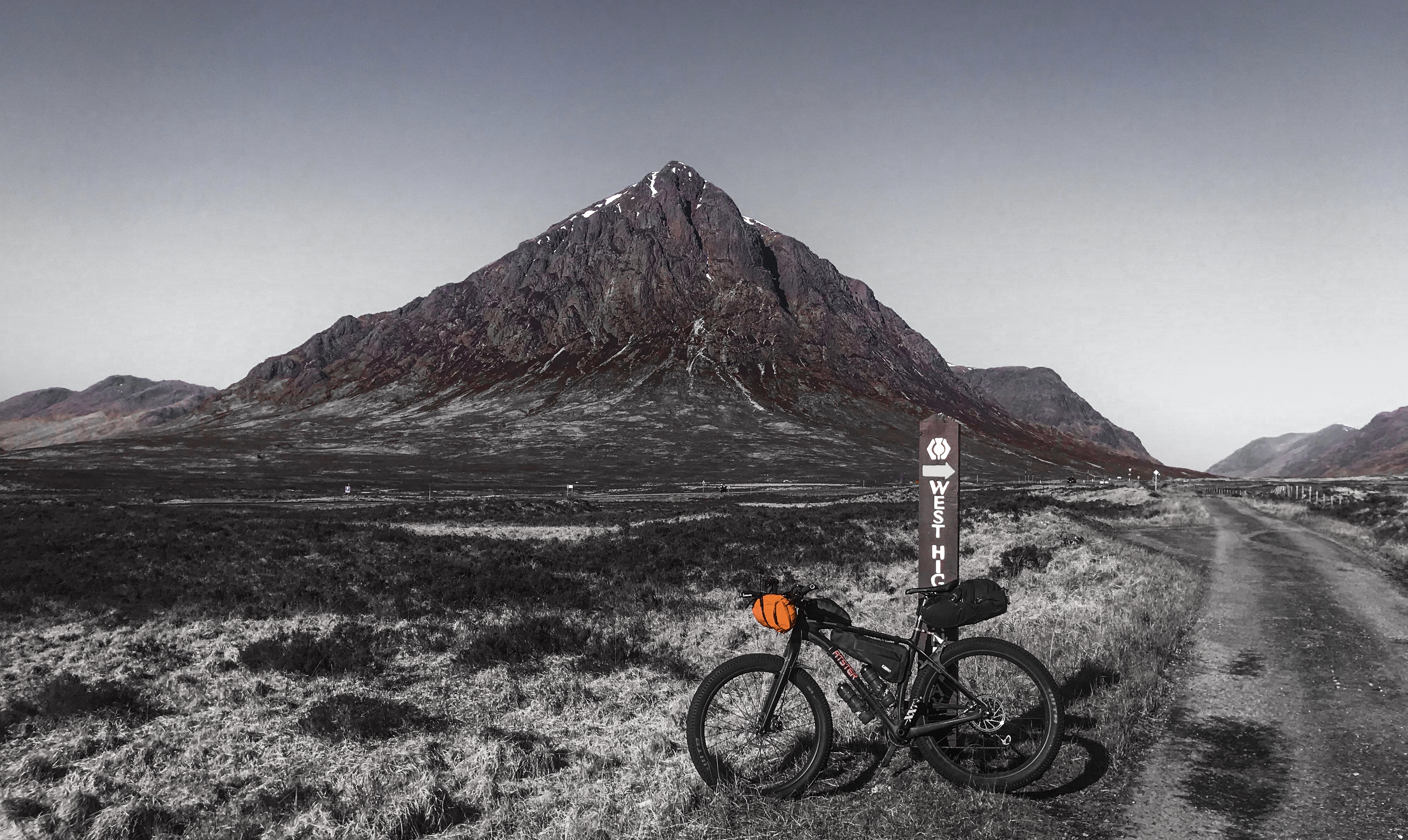
Note: The Komoot route is slightly different to the one shown above (start from Aberdeen Lighthouse has been added, also an extra bit through the oak woods at Strontian has been included, and the section across Isle of Mull removed, so it now finishes at Ardnamurchan Lighthouse – making it 407km / 4500m.) 4-5 Days riding would be a good time to aim for, there are several bothy’s on or near to the route and good camp spots come up.
I have been enjoying a bit of a re-focus recently, I’m always hungry for doing miles in new places, pushing hard whilst going steady if that makes sense..? While I’m at it, immersing myself in the environment as much as possible, quite often just having a 5 minute stop now and then, to soak up the view, the sounds and the smells – appreciating ‘the moment’ if you like!
Since the covid restrictions and since having covid myself, I seem to of had a physical and mental shift and this has made me feel much less competitive, both within me and with others – I’m kind of happy to ‘chug’ along!
This Trans-Scotland ride, wasn’t over-planned or scrutinised, I just had a few places that I wished to visit, or pass through…
From North Sea to Atlantic, doing a coast-to-coast crossing always makes for a magnificent journey. Crossing the Scottish Highlands by Mountain Bike has to be one of the best Bike-Packing journeys that I have done. Like most Scottish trips the weather can be the deciding factor and for this journey, the Weather Gods were with me, there is no finer place to be than Scotland when it is bathed in the spring time sunshine.
Seeing the landscapes changes as I made slow but sure progress west was really noticeable, from the soft green east to wild barren west. The mountain bike is the best tool for the job as you can get access to all the hidden away places, which I just love finding.
My ride is told in the pictures below. If anyone would like the GPX then just drop me a message.
Day 1 – Dee Valley – Forests, Lochs and Glens
Day 2 – Out of the Dee Watershed and into the Centre of Scotland
Day 3 – A Taste of the West
Day 4 – The Atlantic and the Point of Ardnamurchan
A rather belated write-up. The last year has been busy with non-cycling work, mainly a house restoration, so cycling and sport has been pushed to the wayside for a little while – normal service should resume in 2022! This journey was made at the end May and was one of my all-time favourites. The route is available on ‘All-Trails’ and ‘Komoot‘, or just message me for the GPX.
Aberdeen to Glasgow – Offroad
It all started on the train.
Travel by train, sometimes you love it, some times you hate it. Taking bikes on trains in the UK is never that straightforward, with all the regional rail franchises all offering some thing different. On the plus side Scotrail seem to have grasped the bike-on-trains issue the best and now offer more bike spaces and are sometimes a more flexible to the pre-booking rule. This for me is the issue, all too often you book your ticket by the App then have to make a separate call to reserve the bike space, which is not always available – so the conclusion is rail travel with a bike is often hit and miss and frustrating, particularly if you are not able to plan well in advance.
But anyway back in June I was wanting a ‘mountains detox’ and had planned to travel to Glasgow and start a bike-packing route called the ‘Badger Divide’, which is a pretty do-able 3-4 day affair to Inverness.
The trains had other plans for me (and my bike).
At Oxenholme the Glasgow train was double booked and they offered me a later train, rather than wait I asked if I could swap to the Edinburgh train 10 minutes later – yes – no problem. All was good on the train! However I soon realised Edinburgh didn’t offer the quick access to the Highlands that Glasgow’s position does, so I then looked at continuing on to Perth or even Aberdeen. Aberdeen looked appealing as I had not been there before on bike and I was aware of the ‘Deeside Way’ route that heads up into the Cairngorm. So Aberdeen it was.
Where I would head after that would be decided on the fly along the route – I like travelling this way, my goal destination would be Glasgow in 4 days time – Perfect!
Misty morning along the river bank path, early on day 1.
How the weather can change between destinations, on arrival at Aberdeen, by now well past 11pm it was cold and foggy, an east coast ‘Harr’ was in force, ten degrees cooler than were I boarded the train and a thick damp fog.
My plan was to exit the city environs then look for a suitable camp spot just off the path somewhere. Within an hour a good little spot presented itself and I was soon tucked up. I was up early as my pitch was not as ideal as it could have been – sloping! I hate camping on a slope, you constantly roll off your mat and can’t get comfy. At Banachory I was able to get a coffee and some breakfast and enjoyed it along the riverside watching the morning mist slowly lift. It was here that I worked out the next part of the route. As nice as the Deeside way was, it wasn’t particularly challenging and I was aware of another ‘saved’ route that I wished to make use of – Trans-Scotland-Mtb, I decided to vaguely follow this until Blair Atholl – about 150km away. It would take me up into the hills and use some of the old drovers roads, with exciting names like ‘The Fungle Road’.
Fungle Road and Mount Keen in the distance.
Lunch was taken by the burn in the wild Glen Tanar, famous for its rare Capercaillie, but it was a different bird that was making its presence known today – the infamous Cuckoo – a constant backdrop of birdsong.
Lunch is a Noodle Soup by the Water of Tanar
Soon after rising out of the Glen, the trails stretched dry and dusty into the far distance. It was along one of these while quietly pedalling up a long hill, that another bike-packer came up along side me and made jump out of my skin. The face was familiar and so was the voice and it was an old riding buddy who I used to bump into on the HT550 rides – Philip! It was great to see him and we shared the journey for a while on to Lochnagar and then he talked me into continuing my ride a bit further than I’d intended to and stay at the remote and idilic Faindoran Bothy – deep in the Cairngorms. So on we went, the sprightly Phil and not so sprightly me!
Chance Encounters
The journey onto Faindoran was lovely, but was hard going on what were by now tired legs. Expecting to find it empty, it most certainly was not, as there was an Eastern Cairngorm Group Work-Party there. As the repair work stopped, the musical instruments started to come out. It turned into a great night, with a range of music and singing like I’ve never heard before – so much talent, I felt privileged and humbled to be there (having no musical talent of my own), not to mention the food and whisky that they plied us with…
Bothy Nights at their Best!
I have stopped over at Faindoran Bothy twice and both times woken the day after with a hangover!
The remote Faindoran Bothy – camping next to it.Cairngorm Single-tracks you cant beat them..!
The ride up to the ‘Fords of Avon’ was a techie single-track, not an ideal starter while nursing a groggy head, but the scenery was just stunning and I was feeling so alive!
…all too soon there was ‘the’ river crossing, it was high as the snow was melting, made trickier still, as I took off my shoes so as to keep them dry.
It is worth noting that this point in the route could be a ‘gamechanger’ if the river is higher still as it would not be safe to cross and the options are limited to either back tracking or heading north on more tricky path towards Ryovan and then around the Cairngorm massif.
A hiker crossing the notorious and bouldery River Avon
The exit route from this central and isolated point was to head south on good paths, down into Glen Derry and then on to Glen Tilt, some 60km south. The paths are well made and almost all rideable and are a great joy to descend.
Lone Twisted Pines in Upper Glen DerryA soon too be ‘MBA’ Bothy, sometimes known as the Red House.Brynack Lodge – An Old Ruined Military Camp.
Fast gravel trails enable a quick exit of Glen Derry to connect with the long (circa 25km) Glen Tilt. Soon the double track gives way to more twisty single track and this gets exciting and engaging as you start the steep sided descent into the main Glen. This is what I relish on these long journeys – the ever changing terrain and landscapes. At the bottom of the Glen is the village of Blair Atholl and an opportunity to re-stock or get a meal – the first civilisation for over 100km!
A mix of Bridges in Killiecrankie Gorge.
After a food and rest-up at Blair I used a mix of the NCN route and footpaths, the hidden highlight here was the lovely twisty path down the Killiecrankie Gorge, almost under the railway and A9. I would leave the road again at Kinnaird to begin the climb up to Loch Skiach, which would be my destination for the day, as there is an old fishing hut that is used as a bothy.
Loch Skiach and the bothy (non-MBA).
What a stunning location, the bothy itself was a little ‘ropey’ inside and need a good dose of TLC, however feeling a bit beaten and lazy I opted to stop in it rather than camp besides it. It was a pleasant place, to freshen in the Loch and then enjoy dinner watching the sunset, also with a beer that I’d picked up in Blair – Perfect end to a perfect day!
Looking at the map that evening and planning day 3, my objective was to try to reach Loch Lomond, it was almost impossible to gauge the distance, or time it would take, but I knew that it would be a ‘big day’, around 130km perhaps, the town of Creiff would be the first town to aim for, getting there using as much ‘off-road’ as possible.
Techie descent into Glen AlmondMorning mist burning off in Glen Almond
I decided not to divert into Crieff town centre as I had got a noodle lunch to enjoy… So I pushed on through and decided to find a spot in Glen Artney some 20km further. The riding was really varied and interesting and all along trails that were new to me – always a bonus!
Queens Forest POIsExiting the QE Forest and over the pass to Loch Lomond.Acres of purple and acres of blue – and a brake melting decent!
The constantly changing vistas – especially the bealach where the view of Loch Lomond and the Arrochar Alps great you. However hunger was beckoning and a camping spot was needed, I hoped that the Loch Shore would provide a small patch of grass for me… and it did.
A sweet camp.
Day 4 required a bit of an earlier start as I was booked on to a train from Glasgow at 11am. Early starts mid-summer are not such a pain as it starts to become light at 4am, the other bonus is that I would be down the WHW path before all the punters are up and on it!
The man-made environs of Glasgow – The Kelvin Way links city to the hills.
So back into the city, the Central Station being my final destination for this ride. The whole journey really blew me away – the chance encounters with old friends, bothy nights, the flora and fauna, the ever changing landscapes and vistas and the riding itself so many interesting and exciting trails. I’ll definitely do this ride again!
Thank you Avanti-Trains for cocking up my original travel plans and allowing this one to unfurl. And thank you to the ever present cuckoo for serenading my journey all along the way.
Since the Dales Divide Race in August last year, my time has been spent on a house move project, and like all house projects, it has been more work and taken longer than expected. Its been nice to go back to doing DIY, as I am a practical person and like making things – which is just as well! The down-side to this is that I have put all riding and outdoors stuff on the back-burner. I had originally set my sights on around six months to get the bulk of the work finished, and as it happened this would time nicely with England coming out of the latest lock-down restrictions and our freedom of movement for exercise would be increased from just our local areas.
After no visit to the Highlands in 2020, I was realising that I was well overdue – for me being in wilderness areas helps reset my ‘checks and balances’, I do like being cosy and warm at home, but I really love the minimalist, exposure and challenge of being ‘ out there with nature’ .
Going across Rannoch from Blackmount to the Station (Good gravel trails to start, then bogies for 4 km..!)
I had decided not to partake in the 2021 Dales Divide, I was just not ‘bike-fit’, too busy and not in the right ‘head-space’ to bury myself in a race, that said I was longing for a more sedate explore somewhere – ideally the Highlands, as it had been almost two years since I had last visited them. The discovery and visiting new places and seeing nature is an important element of any ride for me …perhaps an ageing thing…! but you get less caught up in the competitive/challenge element and more taken by the moments and experiences you get.
Scotland as a nation was lagging the rest of the country in lifting restrictions, so it meant hanging on until late April time, meanwhile for pretty well the whole of the month so far there had not been a drop of rain and every day was a ‘blue-sky’ day – I was hoping it would hold and it did.
Different modes of accommodation…
I had many routes and trails in my head that I wanted to do, but I only had 3 days, also the Highland Rail service was still on reduced timings, so I elected South Highlands and base myself from the well known (HT550) Tyndrum village. I would do some new trails across Rannoch Moor and I had a couple of other POIs that I hoped to pass.
The Route – 355km / 5250m
After crossing Rannoch from Blackmount, I thought the cafe at the station may be open for take-away coffee and cake, however there was not a soul around, the empty station is pictured above. This set the form for the next couple of days – empty landscapes and empty places – even the Monument at Glenfinnian only had a handful of cars there.
The vast emptiness of Rannoch Moor
From Rannoch there is a great little track over to the next habitation – ‘think ‘2 houses, a hostel and a station – Corrour. I had recollections of visiting this area some 30 years ago on an Outward Bound expedition, but visiting it again reminded me of the beauty and isolation of this place. Loch Ossain provided an ideal lunch spot, at the end of this ?loch is the impressive Corrour Shooting Lodge – They will happily hire it out to you …for £25,000 for a weekend – cheap thrills!
From Corrour I headed east towards the next magnificent estate – Ardverike, see castle above – famed for its Monarch of the Glen series. Again more stunning lochs passed, even saw a Golden Eagle here and paused for five minutes to watch it. A highlight of my ride!
Lochan na Earba
Passing Laggan, my route would now veer and head west, towards the stunning and unique Glen Roy, my overnight destination was Luib Connel, a bothy, to camp besides (see tent pic above). This has to be one of my favourite Highland bothies and it was pleasing to see it fairing-up okay.
Heading towards Melgarve – a large herd of big reds!
The story of Glen Roy goes back 12,000 years to the last min ice-age when the Highlands and parts of northern Europe were under the grip of an ice sheet and when this started to recede it left a vast lake, the shore lines of which are visible around the sides of the Glen and are known as parallel roads – see an OS 1:50k map…
Glen Roy drops out at near to Spean Bridge, usually a tourist stop for the lovely Commando Monument, as well as this a chance for me to call in at the shop for a drink and some fruit
Commando Memorial and snow capped Nevis Range beyond
After passing the POI above I had planned to visit a non-MBE bothy near Fort Augustus, meaning a bit of a detour, I elected to ‘pass’ on this and take the little road down Loch Arkaig, then over unknown trail to Glenfinnan. Pictured at the top, the loch was mirror flat, not a ripple I saw from its start to finish. At the end of the loch I would take a small detour to inspect the Glenpean Bothy, and like the last one was all clean and tidy – always pleasing to see, nothing more upsetting than seeing a lovely bothy not being cared for or used with the respect it deserves!
Sometimes there is no trail…
After the bothy excursion a small line on the map connected Glen Pean to Glenfinnan, however the line on the map was not present on the ground, apart from a faint trod, that came and went, there would now be a 500m 4km climb to the Bealach, a push-up I can deal with, but I was hoping for it to be ‘more’ rideable on the other side…? 2 hours of toiling and I reached the high point – ‘I won’t be doing that one again!’
My aim for the day was to be around the Sunart/Argdour area at the south of Loch Sheil, so that I could be within easy striking distance of the Corran ferry, to get me back down Glen Coe early the following morning. However, finding a camp when you need one, sometimes never happens, especially when you are in a ‘fussy’ mood, looking for that pristine spot! First attempt was in an old Oak Forrest, however I had to abandon camp as it was infested with ticks – nobodies friend and worse than the midge! Luckily it was still too early in the season for the midge, which was an added draw to the visit. A midge can ruin a camp full stop! Th
Evening Sunset with the sky on fireReady to go after de-camping
Unzipping the tent I was greeted to another crisp morning. I decided to skip porridge and just have coffee, as a breakfast opportunity should be present as I head back south through Glen Coe. An ideal route, should have very little ‘trunk road’ sections, mainly as they are unpleasant when busy and usually a little scary with the close, noisy fast moving traffic. Glencoe is hard to avoid and it would really benefit from have the few trail sections that there are, all linked together to make a safe ‘through’ route for cyclists …maybe one day it will happen! I was too early for the shop in Glencoe, but had enough to get by until Tyndrum, some 50km south.
The most majestic mountain – Buachaille Etive Mor
The West Highland Way would take my back from Kingshouse hotel to Tyndrum. It is the final leg for the HT550 and I had painful memories of it, however today, feeling far less beaten-up, it was a pleasure to ride it.
Although my ride-thirst is quenched, I suspect that the addiction will draw me back next month. In between this there is the Dales Divide Race, which I am doing the Dotwatcher.com media updates for – hoping I enjoy doing it and not miss riding it too much! Also nice to feel that we have our ‘wild’ places to visit again after being constrained by lock-down.