 Getting Hooked…
Last year (and that was 2017) I set out about extending my long range bike-pack rides into the borders area of southern Scotland as a new region to explore. It was an area that I for one had passed through many times before when heading to the bigger mountains in the north and it is probably the same case for many others… My first foray was a 3 day expedition from Carlisle to Edinburgh, where I was going to meet the family and go to my cousins wedding – what classier way to arrive than as a dirty hobo bike-packer and make your mark! On this journey I stepped on to the SUW near the Lowther Hills and headed east for many miles. It was a lovely wild trail and what I had done of it had captivated my attention to do more…
The first attempt…
Roll on a couple of weeks and the May time weather was still holding out, also I had been given the offer of a lift from Portpatrick back home. I started to prepare a plan and my kit. I also tried to do some research on the whole route. There was not a huge amount of information, particularly for the Mtber, I did find some interesting descriptions though and this excerpt is worth a mention:
At 212 miles or 341km, the Southern Upland Way is Scotland’s longest official Long Distance Path. Southern Scotland is all too often overlooked by visitors simply seeing it as an area needing to be crossed in order to get from the Scottish Border to the “interesting” parts of the country. Anyone walking all, or even some, of the Southern Upland Way will realise that this too often overlooked part of the country offers plenty of variety, interest and challenge in its own right.
And it is worth holding onto that word “challenge” for a moment. Given the widespread lack of knowledge about southern Scotland, it comes as a surprise to most people to find that the Southern Upland Way is Scotland’s most challenging Long Distance Path. In part this is because it passes through some of the least inhabited and most remote areas of countryside in the United Kingdom; in part it is because it cuts across the grain of the country, involving a series of climbs and descents and a highest point of 725m or 2,378ft; and in part it is because the lengths of individual stages can be very long, up to 27 miles or possibly longer, depending on how you divide the walk.
All of this makes the normal warnings about fitness and equipment levels, and need to be able to read a map and use a compass, especially important. The Southern Upland Way itself is well waymarked. But if you stray from it – always a possibility, especially on upland stretches in poor visibility – you are likely to find yourself, literally, on your own, without any signposting, and possibly a very long way from help. Oh, and quite possibly without a mobile phone signal as well, so “phoning a friend” is often not an option.
Interesting…!
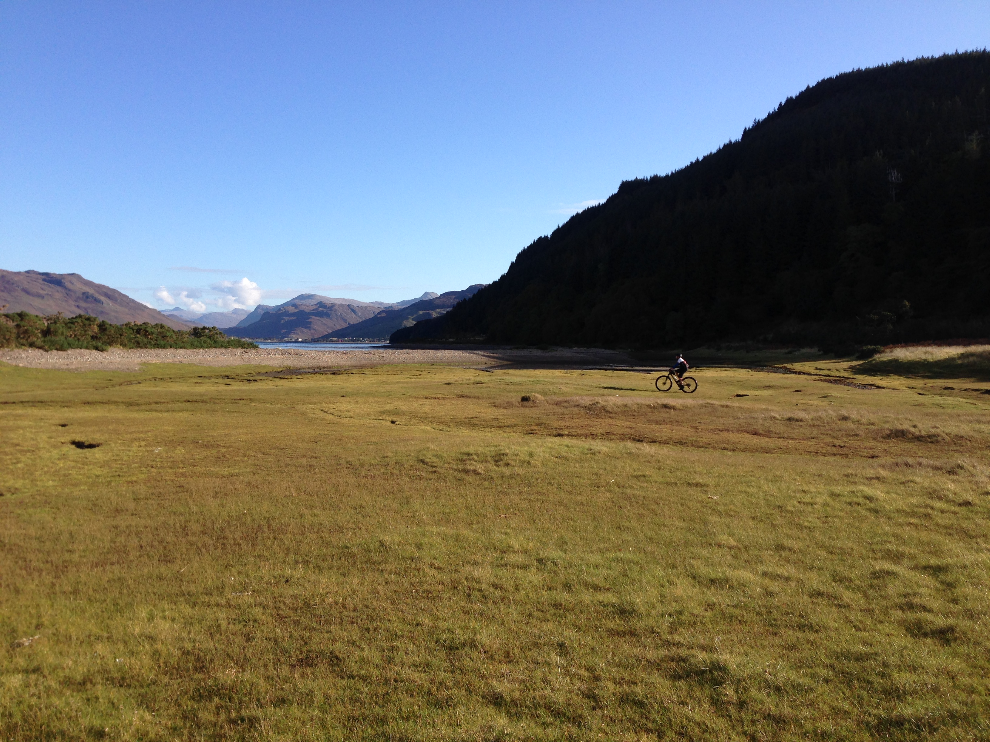
The plan was to get a Thursday PM train to Dunbar, just south of Edinburgh and then cycle to Cockburnspath – a little village, still with a shop and some public toilets, but no pub and little in the way of accommodation, so a bivvy it was – but where…? There is always somewhere to bivvy! I remember it being a cold bivvy (I had a very old sleeping bag, which I was going to bin as I didn’t want to ride with it …perhaps a mistake, see later on…). When I set out at 6am there was a spot of frost on the trail. The weather was good, the trials were quite dry and I had a bit of an easterly tail wind, all this made the journey quite pleasant. My kit was pretty minimal and most of the weight was in my food. I had expected it to take me around 32 hours to complete. I got to the half way point in about 14hrs, which supported my belief in my estimated time. What I had not estimated for was what came next; the tough trail sections in the western half, like crossing the Lowther Hills, then Benbrack, these were really slow going sections and all my flow was lost.
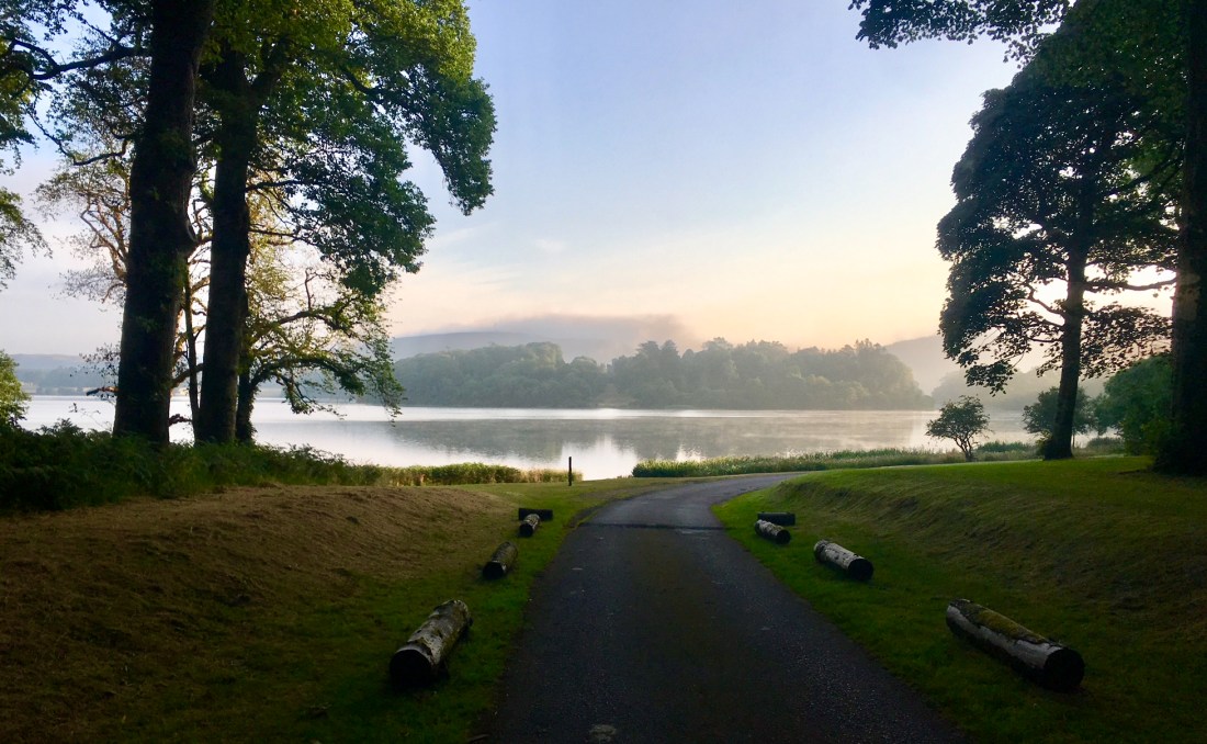
 St Mary’s Loch.
I eventually reached Glen Trool at around 11am after 29 hours of riding, I still had around 45 miles to go. I needed food, coffee, more coffee and a bit of a rest and the café in Glen Trool provided this. While in the café I worked out that the next section could be taking 7-8hrs. Also I was having to manage with a bike problem – the saddle had snapped in the middle and had lost all its support. During the ‘rest’ I had decided that it was better to finish the attempt along NCN roads to Portpatrick. There-by doing a good C2C, but not completing the full SUW. A felt happy and disappointed at the same time, but was not overly fussed as I had had a great ride.
I got to Portpatrick in just under 3 hours from where I had decided to bail and I had a lift home from my brother waiting, I did not really want to abuse his hospitality and to keep him waiting for hours, as he was not there just for me.
Roll on a year and some success…
2018 and gosh how it has turned into the best summer ever – it just keeps on giving! You just can’t ignore these lovely dry trial conditions. When it is warm and dry riding both day and night is a pleasure and so is bivvying. So roll the year on to early July and after the best part of 3 months of non-stop dry weather, my brother Ben mentioned he was heading to the North East and Borders area to see family and do some walking and could offer me a lift home from the finish at Cockburnspath, up near Edinburgh. Given the opportunity of another nice long adventure ride, it did not take long to convince myself that it was a good thing to do, especially given the firm terrain and reasonable looking forecast. So domestic clearances were sought and sorted – yet more brownie points to earn! Then the logistics of getting to Porpatrick had to be worked – luckily a train from my home village to Stranraer would get be there in a pretty respectable 6.30hrs, not the easiest corner of the country to get to…

River Tweed Crossing
Learning from last time, I knew that a West to East crossing made much more sense. The west half is super tough, yet it does yield some good riding, but it has to be worked at and the rate of progress is quite slow due to this tricky terrain. Once you pass under the M74 the route characteristic change to more flowing and faster trails and far less gates!
The SUW is a tremendous bike-pack journey taking an iconic route across the wilds of Southern Scotland, yet hardly anyone does it… [see reasons above] The West Highland Way has a hundred walkers for every one walker on the SUW! With a little investment the west section could be made much better for bikes – lets hope they can do something…? I met one other bike-packer – Chris Johnstone doing the whole route, or most of it and then just three other end-to-end walkers, that’s all.
Like last time I went for a non-stop crossing, however this time I did take a sleeping bag as I needed it to bivvy in at the start. I also had a 2hr sleep in some nice woods near to Moffat after 20 hours of riding. This rest was more to give my backside a break, with the all the heat and some extra padded Assos shorts I seemed to be sweatier that usual and sweat is so bad for inducing the chaff syndrome! The rest and some sodocrem really helped.
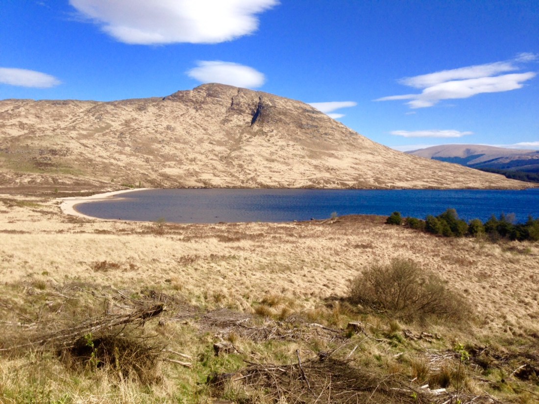
Near White Laggan.
This time I did not buzz off-route and stuck to the full way-marked SUW finishing at Cockburnspath at in 38.34. I had re-supply stops using the shops in St Johns, Sanquar, then going through the night and re-stocking at Galasheils and Lauder.
Again the Fatster bike performed perfectly and its lack of weight made for an easier job on all the stile and gate lifts and the fat tyres helped it roll over the grass sections. More memories to last a life-time!
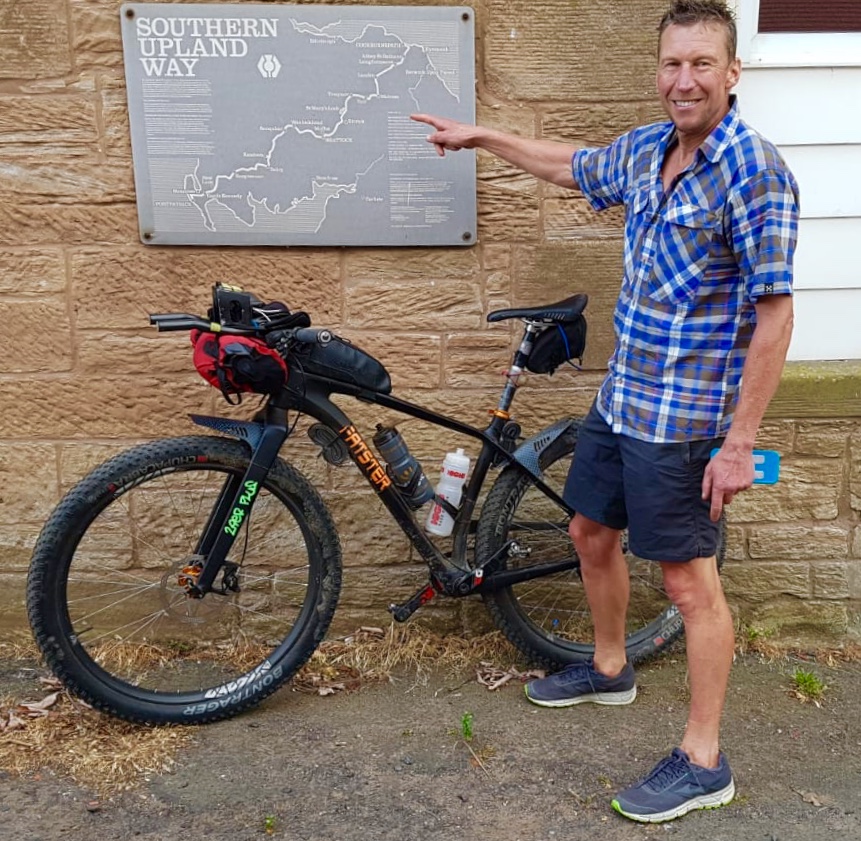 Cockburnspath – the end.
